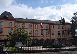
Hautes-Pyrénées is a department in the region of Occitania, southwestern France. The department is bordered by Pyrénées-Atlantiques to the west, Gers to the north, Haute-Garonne to the east, as well by the Spanish province of Huesca in the autonomous community of Aragon to the south. In 2019, its population was 229,567; its prefecture is Tarbes. It is named after the Pyrenees mountain range.
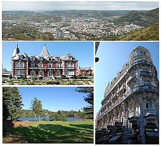
Lourdes is a market town situated in the Pyrenees. It is part of the Hautes-Pyrénées department in the Occitanie region in southwestern France. Prior to the mid-19th century, the town was best known for its Château fort, a fortified castle that rises up from a rocky escarpment at its center.

Barèges is a commune in the Hautes-Pyrénées department, administrative region of Occitania, southwestern France. It is situated in the valley of the Bastan on the former Route nationale 618 on the western side of the Col du Tourmalet.

The Gave de Pau is a river of south-western France. It takes its name from the city of Pau, through which it flows. The river is 181.3 kilometres (112.7 mi) long, and although its source is considered to be on the Cirque de Gavarnie in the Pyrenees mountains waters feed it from the slopes of Monte Perdido in Spain. From the Lago Helado on the slopes of Perdido water works through a cave system to emerge from the Resurgence Brulle via the Grotte Devaux on the French side of the border. The Gave de Pau joins the Gave d'Oloron in Peyrehorade to form the about 9-kilometre (6 mi) long Gaves réunis, which is a left tributary of the Adour. The Gaves réunis is often considered to be part of the Gave de Pau.

Luz-Saint-Sauveur is a commune in the Hautes-Pyrénées department in the Occitania region of south-western France. It lies on the river Bastan, a tributary of the Gave de Pau. Locals simply call it Luz, the city took its current name from Luz-Saint-Sauveur on April 9, 1962. Its inhabitants are called Luzéens and Luzéennes in French. The town features locations of historical heritage such as the church of Saint-André, also known as "Les Templiers", the Château Sainte-Marie or the spa district. Protected by mountains to the east, west and south, and separated from the plain to the north by the Pierrefitte gorge, Luz-Saint-Sauveur is somewhat geographically isolated though it is only a 1⁄2 hour drive from Lourdes.

The arrondissement of Argelès-Gazost is an arrondissement of France in the Hautes-Pyrénées department in the Occitanie region. It has 87 communes. Its population is 38,002 (2016), and its area is 1,300.2 km2 (502.0 sq mi).

TER Midi Pyrénées was the regional rail network serving the Midi-Pyrénées region in southwest France. The centre of the network was Toulouse-Matabiau station. In 2017 it was merged into the new TER Occitanie.

The Route nationale 9, or RN 9, is a route nationale in France between Moulins and the border with Spain across 591 kilometres.
The Route nationale 4 is a trunk road (nationale) in France between Paris and the frontier with Germany.

The Route nationale 20 (N20) is a trunk road (nationale) between Paris and the frontier with Spain heading south through the heart of France and passing through the Cathedral City of Orléans and Toulouse. The road forks at Col de Puymorens with one branch being the Route nationale 22 which leads to Andorra. In winter, avalanches sometimes close the road.
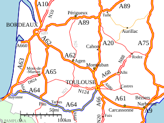
The A64 autoroute is a motorway in southwestern France. It is also called the La Pyrénéenne and numbered the European route E80. It is a toll road for part of its length.

The A89 autoroute is an autoroute in central France. It is known as the La Transeuropéenne. It connects Bordeaux and Lyon via Clermont-Ferrand. Its total length is 544 km (338 mi).

Adé is a commune in the Hautes-Pyrénées department in southwestern France.

Pierrefitte-Nestalas is a commune in the Hautes-Pyrénées department in south-western France.

Ayros-Arbouix is a commune in the Hautes-Pyrénées department in the Occitanie region of south-western France.

Beaucens is a commune in the Hautes-Pyrénées department in the Occitanie region of south-western France.
Route nationale 618 or RN 618 was a French national road linking Saint-Jean-de-Luz to Argelès-sur-Mer. En route it crossed many of the famous passes in the Pyrenees, immortalized by the Tour de France; hence its name was the "Route of the Pyrénées". In 1970, the road was down-graded and is now the RD 918 from Saint-Jean-de-Luz to Arreau and the RD 618 from Arreau to Argelès Plage.

The Lavedan, or occasionally vallées des Gaves, denotes a mountainous natural region of France, located at the heart of the Pyrénées, and forms a group of valleys upstream of Lourdes.

The Pic du Jer is a summit in the Hautes-Pyrénées.
The 2014 Tour de France was the 101st edition of the race, one of cycling's Grand Tours. It featured 22 cycling teams. The Tour started in Yorkshire, England on 5 July and finished on the Champs-Élysées in Paris on 27 July.
