Royal Palm Ranches, Florida | |
---|---|
Coordinates: 26°2′28″N80°16′31″W / 26.04111°N 80.27528°W Coordinates: 26°2′28″N80°16′31″W / 26.04111°N 80.27528°W | |
Country | |
State | |
County | Broward |
Area | |
• Total | 0.3 sq mi (0.8 km2) |
• Land | 0.3 sq mi (0.8 km2) |
• Water | 0.0 sq mi (0.0 km2) |
Population (2000) | |
• Total | 294 |
• Density | 1,008.5/sq mi (389.4/km2) |
Time zone | UTC-5 (Eastern (EST)) |
• Summer (DST) | UTC-4 (EDT) |
FIPS code | 12-62142 [1] |
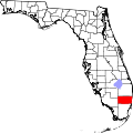
Royal Palm Ranches is a former census-designated place (CDP) in Broward County, Florida, United States. The population was 294 at the 2000 census. It now serves as a community of Cooper City, Florida.
Royal Palm Ranches is located at 26°2′28″N80°16′31″W / 26.04111°N 80.27528°W (26.041240, -80.275242). [2]
According to the United States Census Bureau, the CDP has a total area of 0.8 km2 (0.3 mi2), all land.
As of the census [1] of 2000, there were 294 people, 92 households, and 81 families residing in the CDP. The population density was 391.4/km2 (1,008.5/mi2). There were 98 housing units at an average density of 130.5/km2 (336.2/mi2). The racial makeup of the CDP was 88.44% White (78.2% were Non-Hispanic,) [3] 0.68% African American, 4.08% Asian, 3.40% from other races, and 3.40% from two or more races. Hispanic or Latino of any race were 14.29% of the population.
There were 92 households, out of which 41.3% had children under the age of 18 living with them, 75.0% were married couples living together, 7.6% had a female householder with no husband present, and 10.9% were non-families. 8.7% of all households were made up of individuals, and none had someone living alone who was 65 years of age or older. The average household size was 3.20 and the average family size was 3.39.
In the CDP, the population was spread out, with 28.2% under the age of 18, 5.8% from 18 to 24, 26.5% from 25 to 44, 31.3% from 45 to 64, and 8.2% who were 65 years of age or older. The median age was 42 years. For every 100 females, there were 107.0 males. For every 100 females age 18 and over, there were 108.9 males.
The median income for a household in the CDP was $125,000, and the median income for a family was $152,329. Males had a median income of $78,641 versus $42,321 for females. The per capita income for the CDP was $39,274. None of the population or families were below the poverty line.
As of 2000, English as a first language was spoken by 100% of the population. [4]
Carver Ranches was a census-designated place (CDP) in Broward County, Florida, United States. The population was 4,299 at the 2000 census.
Green Meadow was a census-designated place (CDP) in Broward County, Florida, United States. The population was 1,875 at the 2000 census. It was incorporated into the town of Southwest Ranches, Florida in 2000.
Hillsboro Ranches was a census-designated place (CDP) in Broward County, Florida, United States in 2000. The population was 47 at the 2000 census. Hillsboro Ranches was not designated a CDP in the 2010 census. As of 2018, Hillsboro Ranches remains an unincorporated neighborhood, part of the Broward Municipal Services District, Northern County.
Ivanhoe Estates was a census-designated place (CDP) in Broward County, Florida, United States. The population was 279 at the 2000 census. It's now a neighborhood incorporated into Davie, Florida in 2000.
Oak Point was a census-designated place (CDP) in Broward County, Florida, United States. The population was 145 at the 2000 census. It now serves as a Hollywood, Florida neighborhood known for its wealthy residents and beautiful large homes. It is more commonly referred to as Arapahoe.
Palm Aire, Florida was an unincorporated census-designated place in Broward County, Florida consisting of residential property, commercial businesses, and four golf courses. Palm Aire describes both Palm Aire Village, a collection of single-family houses, and Palm Aire Country Club, a 5,000-acre (20 km2) property with condominiums, villas, estate homes, and four golf courses. It is now part of the cities of Fort Lauderdale and Pompano Beach.
Rolling Oaks was a census-designated place (CDP) in Broward County, Florida, United States. The population was 1,291 at the 2000 census. It was incorporated into the town of Southwest Ranches, Florida in 2000, and is now a neighborhood.
Sunshine Ranches is a former census-designated place (CDP) in Broward County, Florida, United States. The population was 1,704 at the 2000 census. It was incorporated into the town of Southwest Ranches, Florida in 2000, and now serves as a neighborhood.
Palm Springs North is a census-designated place (CDP) in Miami-Dade County, Florida, United States. The population was 5,253 at the 2010 census.
Westwood Lakes is a census-designated place (CDP) in Miami-Dade County, Florida, United States. The population was 11,838 at the 2010 census.
Belle Glade Camp was a census-designated place (CDP) in Palm Beach County, Florida, United States. The population was 1,141 at the 2000 census.
Dunes Road is a former census-designated place (CDP) in Palm Beach County, Florida, United States. The population was 391 at the 2000 census.
Fremd Village-Padgett Island was a census-designated place (CDP) in Palm Beach County, Florida, United States. The population was 2,264 at the 2000 census.
Juno Ridge is a census-designated place (CDP) in Palm Beach County, Florida, United States. The population was 742 at the 2000 census.
Lake Harbor is a census-designated place (CDP) in Palm Beach County, Florida, United States. The population was 195 at the 2000 census. It located along the southern banks of Lake Okeechobee, at the beginning of the Miami Canal. John Stretch Park is also located alongside the north end of Lake Harbor and the lake.
Lakeside Green was a census-designated place (CDP) in Palm Beach County, Florida, United States. The population was 3,311 at the 2000 census.
Royal Palm Estates is a census-designated place (CDP) in Palm Beach County, Florida, United States. The population was 3,583 at the 2000 census.
Schall Circle is a census-designated place (CDP) in Palm Beach County, Florida, United States. The population was 965 at the 2000 census.
Stacy Street is a street and surrounding census-designated place (CDP) in Palm Beach County, Florida, United States. The population was 958 at the 2000 census, which misspelled it Stacey Street.
Whisper Walk was a census-designated place (CDP) located in an unincorporated area northwest of Boca Raton in Palm Beach County, Florida, United States. The population was 5,135 at the 2000 census. While it is not in the city of Boca Raton, Boca Raton is its postal address, and the community is frequently classified under its umbrella term.