Royalton, Indiana

Last updated

Royalton, Indiana
Map of Indiana highlighting Boone County.svg
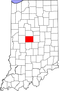
Boone County's location in Indiana
Location map of Boone County, Indiana.svg
Red pog.svg
Royalton
Location in Boone County
Coordinates: 39°55′37″N86°20′18″W / 39.92694°N 86.33833°W / 39.92694; -86.33833
Country United States
State Indiana
County Boone
Township Eagle
Elevation
[1]
919 ft (280 m)
Time zone UTC-5 (Eastern (EST))
  Summer (DST) UTC-4 (EDT)
ZIP code
46077
FIPS code 18-66258 [2]
GNIS feature ID 442375

Royalton is an unincorporated community in Eagle Township, Boone County, in the U.S. state of Indiana. [3]

Contents

History

A post office was established at Royalton (but was called Rodmans until 1838 [4] ) in 1832, and remained in operation until it was discontinued in 1903. [5]

Geography and Location

Royalton is located at 39°55′37″N86°20′18″W / 39.92694°N 86.33833°W / 39.92694; -86.33833 . Royalton is located along Indianapolis Rd approximately 0.7 miles northwest of Marion County. The town is made up of three main streets - Royal Avenue, Circle Drive, and Harmon Avenue.

References

  1. "US Board on Geographic Names". United States Geological Survey. October 25, 2007. Retrieved January 31, 2008.
  2. "U.S. Census website". United States Census Bureau . Retrieved January 31, 2008.
  3. "Royalton, Indiana". Geographic Names Information System . United States Geological Survey . Retrieved March 6, 2020.
  4. Baker, Ronald L. (October 1995). From Needmore to Prosperity: Hoosier Place Names in Folklore and History . Indiana University Press. p.  287. ISBN   978-0-253-32866-3. A post office called Rodmans...
  5. "Boone County". Jim Forte Postal History. Retrieved August 26, 2014.