
Khalilabad is a city and a municipal board in Sant Kabir Nagar district in the Indian state of Uttar Pradesh. It is the district headquarters of Sant Kabir Nagar district.
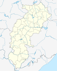
Manendragarh is a city of the Koriya district that is a part of the state of Chhattisgarh. The city housing the taluk headquarters along with few important district head offices is sited near the Chhattishgarh-Madhya Pradesh state border.
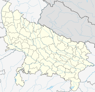
Bindki is a city, sub-district and a municipality in Fatehpur district in the state of Uttar Pradesh, India.
Chirgaon is a town and a municipal board in Jhansi district in the Indian state of Uttar Pradesh, India.
Dhanaura is a city and a municipal board in Amroha district in the state of Uttar Pradesh, India. Dhanaura is also known as Mandi Dhanaura, its native name.
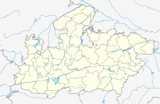
Ghansor is a small census town in Seoni district in the state of Madhya Pradesh,. It serves the headquarters for Janpad panchayat Ghansor. It hosts a Railway station which comes in South Eastern Central Railways zone connecting Jabalpur and Balaghat. It has a government Community Health centre and has robust government education centre with a network of schools and colleges both Private and Public .It is well connected with bus services from Lakhnadon Seoni Jabalpur Mandla. It's weather conditions are- The lowest temperature is -4°c at winter night at 3:00 am in the year 2018. The highest temperature is 52°c at 3.00 pm n 2016 in summer season
Pharenda, or Anandnagar, is a small city in the Maharajganj district of the province of Uttar Pradesh in northern India. It is located approximately 44 kilometres north of Gorakhpur near the border with Nepal. District of Pharenda is Maharajganj. This is situated on the Buddhist Circuit which is built from Sarnath to Lumbini. It lies on NH-24 and near NH 29. It is about 45 km from Gorakhpur, 40 km from Siddharthnagar, 30 km from Maharajganj and 55 km from Sonauli Indo-Nepal Border. This place is named after Seth Anandram Jaypuriya. There is closed sugar Mill which was started in about 1935 and closed in 1995. Near Anand Nagar there is a temple is Durga devi mandir, popularly known as Lehara Devi mandir.
Gola Gokaran Nath or Gola is a small city/town, municipal board, thana and tehsil in Lakhimpur Kheri district in the Indian state of Uttar Pradesh.
Haidergarh is a town and a nagar panchayat in the Barabanki district in the Indian state of Uttar Pradesh.
Khadda is a town, a Nagar panchayat and a Tehsil in Kushinagar district in the Indian state of Uttar Pradesh. It is situated approximately 8 km from the border of Bihar and 18 km from the India-Nepal border.
Kora Jahanabad is a town in Fatehpur district and in Indian state of Uttar Pradesh. It is located on Kora Road, about 6 km east of Jahanabad, about 43 km south of Kanpur, 78 km west by northwest of Fatehpur, and 480 km southeast of Delhi. Local people also call it "Jahanabad".
Maudaha is a city and a Municipal Board in Hamirpur district in the Indian state of Uttar Pradesh.The district participated in the elections of 1937 which were conducted under the Government of India Act of 1935, in order to organize activities of the Congress in the district Jawaharlal Nehru and Abul Kalam Azad visited Maudaha in 1937. With the outbreak of the Second World War in 1939, however, the Congress ministries resigned on the issue of India's forced participation in it. Agriculture is the main occupation of the people.
Obra is a town, Tehsil and Assembly constituency of Uttar Pradesh which is recently upgraded from the stature of Nagar Panchayat in Sonebhadra district in the Indian state of Uttar Pradesh. Obra is located 137 km from Varanasi at the Banks of Renu & Sone River with population of 46,574 As per 2011 India Census. State-owned UPRVUNL and UPJVUNL have a coal-fired thermal power plant and a hydro electric power plant here, respectively. The before mentioned industries are the major source of employment either directly or indirectly. Recreational places in Obra include Jawahar Bal Udayan, Ambedkar Stadium, Lord Shiva's temple, Sone river banks, parsoi and kharatiya villages etc. Restructuring of government residential colony is ongoing as new power plants are being constructed.
Sarila is a town, a former princely state and a nagar panchayat in Hamirpur district in the northern Indian state of Uttar Pradesh.
Saurikh is a nagar panchayat in Kannauj district in the Indian state of Uttar Pradesh. Its old name was Sau-Rishi.It is located near main industrial and educational hub of Dibiyapur which is around at a distance of 55 km from the town.
Ahirauli Baghel is an Indian village located on the border of Bihar and Uttar Pradesh. Ahirauli Baghel comes under Bankata Block of Deoria District, Uttar Pradesh. It belongs to Gorakhpur Division. It is located 47 KM towards East from District head quarters Deoria. It distance is 374 KM from State capital Lucknow. Bhojpuri and Hindi is the primary language spoken in this village.
Dilari (डिलारी) is a village in Moradabad district and subdistrict in the Indian state of Uttar Pradesh. It is about 18 km from Moradabad. Dilari is famous for its production and manufacturing of sugar cane and peppermint oil .It is also famous for the production of Mango, Wheat and Rice.This village have roots in history since 1734. There are many documents to prove that Dilari was settled in 1734 by Thakur Bhagwant Singh.
Itaura is a village in Jalaun district in the Indian state of Uttar Pradesh. This is a twin village and it includes Akbarpur and Itora.
Rithuakhor is a village and gram panchayat in Sahjanwa tehsil in Gorakhpur district in the Indian state of Uttar Pradesh.

Barhan is a town in Etmadpur tehsil, Agra district, Uttar Pradesh, India, located at 30 km from main Agra city. Mostly populated by kushwaha, Jain, Jadaun, Gautam community. Notable families of Kulshreshtha clan has contributed in development of Barhan.


 India
India