Saint-Paul-d'Oueil

Last updated • 1 min readFrom Wikipedia, The Free Encyclopedia

Saint-Paul-d'Oueil
SaintPaulDOueil.jpg
A general view of Saint-Paul-d'Oueil
Location of Saint-Paul-d'Oueil
Saint-Paul-d'Oueil
France location map-Regions and departements-2016.svg
Red pog.svg
Saint-Paul-d'Oueil
Languedoc-Roussillon-Midi-Pyrenees region location map.svg
Red pog.svg
Saint-Paul-d'Oueil
Coordinates: 42°49′36″N0°33′07″E / 42.8267°N 0.5519°E / 42.8267; 0.5519
Country France
Region Occitania
Department Haute-Garonne
Arrondissement Saint-Gaudens
Canton Bagnères-de-Luchon
Government
  Mayor (20202026) Jean-Luc Redonnet [1]
Area
1
7.46 km2 (2.88 sq mi)
Population
 (2021) [2]
38
  Density5.1/km2 (13/sq mi)
Time zone UTC+01:00 (CET)
  Summer (DST) UTC+02:00 (CEST)
INSEE/Postal code
31508 /31110
Elevation1,031–1,988 m (3,383–6,522 ft)
(avg. 1,100 m or 3,600 ft)
1 French Land Register data, which excludes lakes, ponds, glaciers > 1 km2 (0.386 sq mi or 247 acres) and river estuaries.

Saint-Paul-d'Oueil (French pronunciation: [sɛ̃pɔldwɛj] ; Gascon : Sent Pau d'Oelh) is a commune in the Haute-Garonne department in southwestern France.

Contents

Geography

Climate

Saint-Paul-d'Oueil has an oceanic climate (Köppen climate classification Cfb). The average annual temperature in Saint-Paul-d'Oueil is 9.8 °C (49.6 °F). The average annual rainfall is 989.6 mm (38.96 in) with May as the wettest month. The temperatures are highest on average in August, at around 17.0 °C (62.6 °F), and lowest in January, at around 3.2 °C (37.8 °F). The highest temperature ever recorded in Saint-Paul-d'Oueil was 37.5 °C (99.5 °F) on 18 August 2012; the coldest temperature ever recorded was −16.6 °C (2.1 °F) on 8 February 2012.

Climate data for Saint-Paul-d'Oueil (1981−2010 normals, extremes 1999−2020)
MonthJanFebMarAprMayJunJulAugSepOctNovDecYear
Record high °C (°F)21.8
(71.2)
24.5
(76.1)
24.2
(75.6)
26.5
(79.7)
31.2
(88.2)
36.4
(97.5)
36.0
(96.8)
37.5
(99.5)
34.7
(94.5)
28.8
(83.8)
25.1
(77.2)
23.0
(73.4)
37.5
(99.5)
Mean daily maximum °C (°F)7.7
(45.9)
8.3
(46.9)
11.7
(53.1)
13.2
(55.8)
16.8
(62.2)
21.3
(70.3)
22.5
(72.5)
22.7
(72.9)
19.9
(67.8)
16.8
(62.2)
10.3
(50.5)
7.8
(46.0)
15.0
(59.0)
Daily mean °C (°F)3.2
(37.8)
3.4
(38.1)
6.2
(43.2)
7.9
(46.2)
11.5
(52.7)
15.5
(59.9)
16.9
(62.4)
17.0
(62.6)
14.2
(57.6)
11.5
(52.7)
5.8
(42.4)
3.5
(38.3)
9.8
(49.6)
Mean daily minimum °C (°F)−1.3
(29.7)
−1.6
(29.1)
0.7
(33.3)
2.6
(36.7)
6.2
(43.2)
9.8
(49.6)
11.2
(52.2)
11.3
(52.3)
8.5
(47.3)
6.2
(43.2)
1.2
(34.2)
−0.9
(30.4)
4.5
(40.1)
Record low °C (°F)−13.9
(7.0)
−16.6
(2.1)
−12.0
(10.4)
−6.1
(21.0)
−3.9
(25.0)
0.6
(33.1)
3.6
(38.5)
4.7
(40.5)
−0.6
(30.9)
−6.0
(21.2)
−10.5
(13.1)
−11.5
(11.3)
−16.6
(2.1)
Average precipitation mm (inches)95.7
(3.77)
58.6
(2.31)
81.3
(3.20)
104.8
(4.13)
115.0
(4.53)
82.1
(3.23)
76.7
(3.02)
64.2
(2.53)
63.7
(2.51)
68.6
(2.70)
105.3
(4.15)
73.6
(2.90)
989.6
(38.96)
Average precipitation days (≥ 1.0 mm)9.88.210.412.512.710.99.210.08.310.311.29.5122.9
Source: Météo-France [3]

Population

Historical population
YearPop.±%
196267    
196844−34.3%
197542−4.5%
198230−28.6%
199044+46.7%
199949+11.4%
200853+8.2%

Sights

The Château de Saint-Paul-d'Oueil is a 16th-century castle which is listed as a historic site by the French Ministry of Culture. [4]

See also

Related Research Articles

<span class="mw-page-title-main">Saint-Félix-Lauragais</span> Commune in Occitania, France

Saint-Félix-Lauragais is a commune in the Haute-Garonne department in southwestern France.

<span class="mw-page-title-main">Saint-Véran</span> Commune in Provence-Alpes-Côte dAzur, France

Saint-Véran is a commune in the Hautes-Alpes department in southeastern France in the Queyras Regional Natural Park. It is a member of Les Plus Beaux Villages de France Association.

<span class="mw-page-title-main">Labarthe-Rivière</span> Commune in Occitania, France

Labarthe-Rivière is a commune in the Haute-Garonne department in southwestern France.

<span class="mw-page-title-main">Revel, Haute-Garonne</span> Commune in Occitania, France

Revel is a commune in the Haute-Garonne department in southwestern France.

<span class="mw-page-title-main">Melgven</span> Commune in Brittany, France

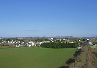
Melgven is a commune in the Finistère department of Brittany in northwestern France.

<span class="mw-page-title-main">Saint-Ségal</span> Commune in Brittany, France

Saint-Ségal is a commune in the Finistère department of Brittany in north-western France.

<span class="mw-page-title-main">Plouisy</span> Commune in Brittany, France

Plouisy is a commune in the Côtes-d'Armor department of Brittany in north-western France. Plouisy is 407 kilometres from Paris.

<span class="mw-page-title-main">Saint-Firmin, Hautes-Alpes</span> Commune in Provence-Alpes-Côte dAzur, France

Saint-Firmin is a commune in the Hautes-Alpes department in southeastern France.

<span class="mw-page-title-main">Sisco, Haute-Corse</span> Commune in Corsica, France

Sisco is a commune in the Haute-Corse department of France on the island of Corsica. It takes its name from the Ruisseau de Sisco, which flows through the commune and enters the Tyrrhenian Sea in the village of Sisco.

<span class="mw-page-title-main">Villar-Loubière</span> Commune in Provence-Alpes-Côte dAzur, France

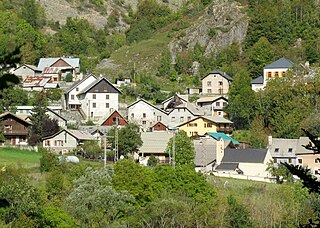
Villar-Loubière is a commune in the Hautes-Alpes department in southeastern France.

<span class="mw-page-title-main">Clarac, Haute-Garonne</span> Commune in Occitania, France

Clarac is a commune in the Haute-Garonne department in southwestern France.

<span class="mw-page-title-main">Palaminy</span> Commune in Occitania, France

Palaminy is a commune in the Haute-Garonne department in southwestern France.

<span class="mw-page-title-main">Ségreville</span> Commune in Occitania, France

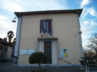
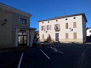
Ségreville is a commune in the Haute-Garonne department in southwestern France.

<span class="mw-page-title-main">Villematier</span> Commune in Occitania, France

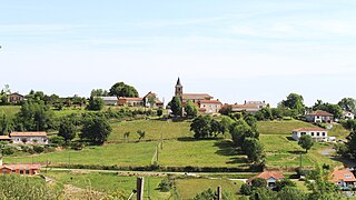
Villematier is a commune in the Haute-Garonne department in southwestern France.

<span class="mw-page-title-main">Campistrous</span> Commune in Occitania, France

Campistrous is a commune in the Hautes-Pyrénées department in south-western France.

<span class="mw-page-title-main">Castelvieilh</span> Commune in Occitania, France

Castelvieilh is a commune in the Hautes-Pyrénées department in south-western France.

<span class="mw-page-title-main">Le Pouget</span> Commune in Occitania, France

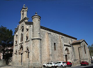
Le Pouget is a commune in the Hérault department in the Occitanie region in southern France. It contains the Gallardet dolmen.

Lomné is a commune in the Hautes-Pyrénées department in south-western France.

<span class="mw-page-title-main">Saint-Michel-de-Maurienne</span> Commune in Auvergne-Rhône-Alpes, France

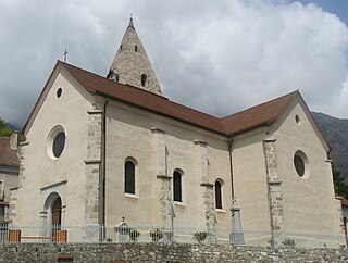
Saint-Michel-de-Maurienne is a commune in the Savoie department in the Auvergne-Rhône-Alpes region in south-eastern France.

<span class="mw-page-title-main">Val Buëch-Méouge</span> Commune in Provence-Alpes-Côte dAzur, France

Val Buëch-Méouge is a commune in the Hautes-Alpes department of southeastern France. The municipality was established on 1 January 2016 and consists of the former communes of Ribiers, Châteauneuf-de-Chabre and Antonaves.

References

  1. "Répertoire national des élus: les maires". data.gouv.fr, Plateforme ouverte des données publiques françaises (in French). 9 August 2021.
  2. "Populations légales 2021" (in French). The National Institute of Statistics and Economic Studies. 28 December 2023.
  3. "Fiche Climatologique Statistiques 1981-2010 et records" (PDF). Météo-France . Retrieved 21 August 2022.
  4. Base Mérimée : Château , Ministère français de la Culture. (in French)