"},"adm_district_jur":{"wt":""},"adm_district_jur_ref":{"wt":""},"adm_inhabloc_jur":{"wt":"[[city of federal subject significance|town of okrug significance]] of Salekhard"},"adm_inhabloc_jur_ref":{"wt":""},"adm_citydistrict_jur":{"wt":""},"adm_citydistrict_type":{"wt":""},"adm_citydistrict_jur_ref":{"wt":""},"adm_selsoviet_jur":{"wt":""},"adm_selsoviet_type":{"wt":""},"adm_selsoviet_jur_ref":{"wt":""},"capital_of":{"wt":""},"capital_of_ref":{"wt":""},"adm_ctr_of1":{"wt":"Yamalo-Nenets Autonomous Okrug"},"adm_ctr_of1_ref":{"wt":""},"adm_ctr_of2":{"wt":"town of okrug significance of Salekhard"},"adm_ctr_of2_ref":{"wt":""},"adm_ctr_of3":{"wt":""},"adm_ctr_of3_ref":{"wt":""},"inhabloc_cat":{"wt":"Town"},"inhabloc_cat_ref":{"wt":""},"inhabloc_type":{"wt":""},"inhabloc_type_ref":{"wt":""},"mun_district_jur":{"wt":""},"mun_district_jur_ref":{"wt":""},"urban_okrug_jur":{"wt":"Salekhard Urban Okrug"},"urban_okrug_jur_ref":{"wt":""},"urban_settlement_jur":{"wt":""},"urban_settlement_jur_ref":{"wt":""},"rural_settlement_jur":{"wt":""},"rural_settlement_jur_ref":{"wt":""},"inter_settlement_territory":{"wt":""},"inter_settlement_territory_ref":{"wt":""},"mun_admctr_of1":{"wt":"Salekhard Urban Okrug"},"mun_admctr_of1_ref":{"wt":""},"mun_admctr_of2":{"wt":""},"mun_admctr_of2_ref":{"wt":""},"leader_title":{"wt":"Mayor"},"leader_title_ref":{"wt":""},"leader_name":{"wt":"Alexey Titovsky"},"leader_name_ref":{"wt":""},"representative_body":{"wt":""},"representative_body_ref":{"wt":""},"elevation_m":{"wt":""},"area_km2":{"wt":"84.50"},"area_km2_ref":{"wt":""},"pop_2010census":{"wt":"42544"},"pop_2010census_rank":{"wt":""},"pop_2010census_ref":{"wt":"{{ru-pop-ref|2010Census}}"},"pop_latest":{"wt":"49 214"},"pop_latest_date":{"wt":"2018"},"pop_latest_ref":{"wt":""},"population_demonym":{"wt":""},"time_zone_ref":{"wt":""},"established_date":{"wt":"1595"},"established_title":{"wt":""},"established_date_ref":{"wt":""},"current_cat_date":{"wt":"1938"},"current_cat_date_ref":{"wt":""},"abolished_date":{"wt":""},"abolished_date_ref":{"wt":""},"postal_codes":{"wt":"629000"},"postal_codes_ref":{"wt":""},"dialing_codes":{"wt":"34922"},"dialing_codes_ref":{"wt":"[http://www.btk-online.ru/phcode/1358.html Телефонные коды городов] (in Russian). Retrieved 2010-09-24."},"website":{"wt":"http://www.salekhard.org/"},"date":{"wt":"May 2019"}},"i":0}}]}" id="mwBQ">Town in Yamalo-Nenets Autonomous Okrug, Russia
Salekhard Салехард | |
---|---|
![]() Polar circle monument in Salekhard | |
Coordinates: 66°32′N66°36′E / 66.533°N 66.600°E | |
Country | Russia |
Federal subject | Yamalo-Nenets Autonomous Okrug [1] |
Founded | 1595 |
Town status since | 1938 |
Government | |
• Mayor | Alexey Titovsky |
Area | |
• Total | 84.50 km2 (32.63 sq mi) |
Elevation | 15 m (49 ft) |
Population | |
• Total | 42,544 |
• Estimate (2018) | 49 214 |
• Density | 500/km2 (1,300/sq mi) |
• Subordinated to | town of okrug significance of Salekhard [1] |
• Capital of | Yamalo-Nenets Autonomous Okrug, [1] town of okrug significance of Salekhard [1] |
• Urban okrug | Salekhard Urban Okrug [3] |
• Capital of | Salekhard Urban Okrug [3] |
Time zone | UTC+5 (MSK+2 ![]() |
Postal code(s) [5] | 629000 |
Dialing code(s) | +7 34922 [6] |
OKTMO ID | 71951000001 |
Website | www |
Salekhard (Russian : Салеха́рд [səlʲɪˈxart] ; Khanty: Пуӆңават, Pułñawat; Nenets : Саляʼ харад, Saljaꜧ harad, formerly Obdorsk) is a town and the administrative centre of Yamalo-Nenets Autonomous Okrug, Russia. The town lies on the Arctic Circle, with the town centre being about 1 kilometer (0.62 mi) south and suburbs stretching to the north of the circle. The population is 47,910 (2021 Census) [7] .
The settlement of Obdorsk (Обдорск) was founded in 1595, in the place of a Khanty settlement called Polnovat-Vozh (Полноват-вож), by Russian settlers after the conquest of Siberia.[ citation needed ] It was situated on the Ob River, and its name supposedly derives from that. The land around Obdorsk was referred to as Obdorsky krai, or Obdoriya.
The town was often used as a place of exile during the Tsarist and Soviet periods. Among notable people who spent time here were the Doukhobor spiritual leader Pyotr Verigin and Leon Trotsky. The town and nearby area contained three Soviet camps where approximately 6,500 prisoners were held, arrested for their belief in God. [8] At the port of Salekhard, approximately 1,500 prisoners were used as slave labor, loading and unloading goods at the dock, or mining metal ore. About 5,000 prisoners in two camps near Salekhard were forced to polish diamonds mined from Mir mine.[ citation needed ]
The nearest railway station is at Labytnangi on the opposite side of the river Ob. From 1949 to 1953, the Salekhard-Igarka Railway project made an unsuccessful attempt to extend the line to Igarka, claiming the lives of thousands of Gulag prisoners. [9] The section of railway from Salekhard to Nadym was completed and remained in use for some time in the Soviet era, although it was later abandoned. It is currently[ when? ] being rebuilt, along with a long-awaited bridge across the Ob between Labytnangi and Salekhard.[ citation needed ]
Salekhard was the host city for the 2006 Arctic Council Ministerial Meeting in October 2006. [10]
In April 2014, Rostelecom, a Russian Internet service provider, completed the final stretch of the Nadym-Salekhard optical Internet line, which stretches for almost 3,500 kilometres (2,200 mi). [11]
In the Summer of 2016, temperatures as high as 95 °F (35 °C) thawed anthrax-infected corpses that had been frozen since the soviet era near Salekhard, causing anthrax spores to infect reindeer herds and herders. [12]
Within the framework of administrative divisions, it is, together with one rural locality, incorporated as the town of okrug significance of Salekhard—an administrative unit with the status equal to that of the districts. [1] As a municipal division, the town of okrug significance of Salekhard is incorporated as Salekhard Urban Okrug. [3]
As of 2021, the ethnic composition of Salekhard was: [13]
Year | Pop. | ±% |
---|---|---|
1897 | 1,249 | — |
1926 | 1,872 | +49.9% |
1939 | 12,764 | +581.8% |
1959 | 16,567 | +29.8% |
1970 | 21,929 | +32.4% |
1979 | 24,935 | +13.7% |
1989 | 32,334 | +29.7% |
2002 | 36,827 | +13.9% |
2010 | 42,544 | +15.5% |
2021 | 47,910 | +12.6% |
Source: Census data |
Yamal Airlines has its head office in Salekhard. [14] Most of residents are employed in reindeer herding, fishing and the services sector. [15]
By 2015, about 3 kilometres (1.9 miles) from the airport, near the Arctic Circle, authorities plan to build a large polar resort "Center of the Arctic tourism".[ citation needed ]
Salekhard is located in the Ob river valley and is an important river port of the Russian Far North. The unfinished Salekhard–Igarka Railway was set to provide a rail connection between the Ob river port of Salekhard and the Yenisei river port of Igarka. Currently, the nearest railway is at Labytnangi, 20 kilometres (12 mi) northwest on the opposite side of the river Ob. The project Northern Latitudinal Railway will provide Salekhard access to Russian railway and will further connect Salekhard to the Konosha–Vorkuta railway and other parts of European Russia. [16] The Salekhard Bridge project, a combined railway-road bridge over Ob river, is the main component of Northern Latitudinal Railway that will connect Labytnangi and Salekhard is to be constructed with the cost of 60 billion rubles. [17] Nadym–Salekhard road, a 344 km long road, was inaugurated in December 2020 to the 90th anniversary of the Yamalo-Nenets Autonomous Okrug, [18] it will facilate the construction of a railway between the two cities and connects the eastern and western parts of Yamal Okrug. [19] [20] For 9–10 months each year, the Ob river is frozen and cars and trucks can drive across the river ice. In the summer a ferry operates, however during the floating of ice, generally shortly before the start and shortly after the end of summer, Salekhard is effectively isolated from the outside world, regarding freight. During these periods, only helicopters are able to reach Salekhard in case of emergency. Native people, mainly the Nenets and Khanty people, always build up stocks of food at home, in the shops, and in the markets during this period, but they still suffer from seasonal inflation. The city is also served by the Salekhard Airport, which is 7 kilometres (4.3 mi) north of the main city.
Salekhard has a subarctic climate (Köppen climate classification Dfc) with short, mild summers and severely cold winters. Precipitation is moderate, and is significantly greater in summer than in winter.
Climate data for Salekhard (1991–2020, extremes 1882–present) | |||||||||||||
---|---|---|---|---|---|---|---|---|---|---|---|---|---|
Month | Jan | Feb | Mar | Apr | May | Jun | Jul | Aug | Sep | Oct | Nov | Dec | Year |
Record high °C (°F) | 3.5 (38.3) | 3.3 (37.9) | 7.3 (45.1) | 15.5 (59.9) | 28.4 (83.1) | 31.6 (88.9) | 32.9 (91.2) | 30.4 (86.7) | 24.8 (76.6) | 18.2 (64.8) | 7.0 (44.6) | 4.1 (39.4) | 32.9 (91.2) |
Mean daily maximum °C (°F) | −18.8 (−1.8) | −17.7 (0.1) | −9.2 (15.4) | −2.3 (27.9) | 4.7 (40.5) | 15.2 (59.4) | 20.0 (68.0) | 15.9 (60.6) | 9.3 (48.7) | 0.2 (32.4) | −10.5 (13.1) | −15.6 (3.9) | −0.7 (30.7) |
Daily mean °C (°F) | −23.1 (−9.6) | −22 (−8) | −14.2 (6.4) | −7.3 (18.9) | 0.4 (32.7) | 10.3 (50.5) | 15.0 (59.0) | 11.6 (52.9) | 5.7 (42.3) | −2.7 (27.1) | −14.5 (5.9) | −19.9 (−3.8) | −5.1 (22.8) |
Mean daily minimum °C (°F) | −27.7 (−17.9) | −26.6 (−15.9) | −19.3 (−2.7) | −12.1 (10.2) | −3.5 (25.7) | 5.8 (42.4) | 9.9 (49.8) | 7.3 (45.1) | 2.4 (36.3) | −5.8 (21.6) | −18.9 (−2.0) | −24.3 (−11.7) | −9.4 (15.1) |
Record low °C (°F) | −51.9 (−61.4) | −53.7 (−64.7) | −47.4 (−53.3) | −38.7 (−37.7) | −30.8 (−23.4) | −11 (12) | −1 (30) | −5.5 (22.1) | −10 (14) | −35.7 (−32.3) | −47.1 (−52.8) | −51.5 (−60.7) | −53.7 (−64.7) |
Average precipitation mm (inches) | 24 (0.9) | 21 (0.8) | 23 (0.9) | 28 (1.1) | 44 (1.7) | 57 (2.2) | 61 (2.4) | 67 (2.6) | 46 (1.8) | 48 (1.9) | 31 (1.2) | 26 (1.0) | 476 (18.7) |
Average extreme snow depth cm (inches) | 36 (14) | 40 (16) | 45 (18) | 36 (14) | 17 (6.7) | 0 (0) | 0 (0) | 0 (0) | 0 (0) | 5 (2.0) | 20 (7.9) | 30 (12) | 45 (18) |
Average rainy days | 0 | 0 | 1 | 3 | 10 | 17 | 18 | 20 | 20 | 9 | 1 | 0 | 99 |
Average snowy days | 26 | 25 | 23 | 18 | 17 | 4 | 0.03 | 0.2 | 5 | 21 | 25 | 27 | 191 |
Average relative humidity (%) | 83 | 82 | 81 | 78 | 77 | 70 | 72 | 79 | 82 | 86 | 85 | 83 | 80 |
Mean monthly sunshine hours | 4 | 48 | 135 | 209 | 233 | 270 | 307 | 185 | 96 | 57 | 18 | 0 | 1,562 |
Source 1: Pogoda.ru.net [21] | |||||||||||||
Source 2: NOAA (sun only, 1961-1990) [22] |
Salekhard is twinned with:
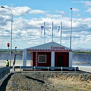
The Yamalo-Nenets Autonomous Okrug or Yamalia is a federal subject of Russia and an autonomous okrug of Tyumen Oblast. Its administrative center is the town of Salekhard, and its largest city is Novy Urengoy. The 2021 Russian Census recorded its population as 510,490.
Nadym is a town in Yamalo-Nenets Autonomous Okrug, Russia, located on the river Nadym. The population has fluctuated over time: 46,611 (2010 Census); 45,943 (2002 Census); 52,586 (1989 Soviet census).
Noyabrsk is the second largest city in Yamalo-Nenets Autonomous Okrug, Russia, located in the middle of the West Siberian oil fields, on the Tyumen–Novy Urengoy railway about 300 kilometers (190 mi) north of Surgut. Population: 110,620 (2010 Census).
Novy Urengoy is a city in Yamalo-Nenets Autonomous Okrug, Russia. Population: 107,251 (2021 Census); 104,107 (2010 Census); 94,456 (2002 Census); 93,235 (1989 Soviet census). It is the largest city in the autonomous okrug.
Tarko-Sale is a town and the administrative center of Purovsky District in Yamalo-Nenets Autonomous Okrug, Russia. It is located on the Pyakupur River near its confluence with the Ayvasedapur river, 560 kilometers (350 mi) southeast of Salekhard the administrative center of the autonomous okrug. The population of Tarko-Sale was 20,398 (2010 Census); 18,517 (2002 Census); 17,400 (1989 Soviet census).
Muravlenko is a town in Yamalo-Nenets Autonomous Okrug, Russia, located 480 kilometers (300 mi) southeast of Salekhard. Population: 33,391 (2010 Census); 35,926 (2002 Census).
Labytnangi is a town in Yamalo-Nenets Autonomous Okrug, Russia, located on the left bank of the Ob River, 20 kilometers (12 mi) northwest of Salekhard. Population: 26,936 (2010 Census); 27,304 (2002 Census); 31,501 (1989 Soviet census).
Gubkinsky is a town in Yamalo-Nenets Autonomous Okrug, Russia, located on the left bank of the Pyakupur River, south of Salekhard. Population: 23,335 (2010 Census); 20,407 ; 9,676.
Nadymsky District is an administrative and municipal district (raion), one of the seven in Yamalo-Nenets Autonomous Okrug of Tyumen Oblast, Russia. It is located in the central and southern parts of the autonomous okrug. The area of the district is 103,960 square kilometers (40,140 sq mi). Its administrative center is the town of Nadym. Population: 19,919 ; 23,470 (2002 Census); 29,772 (1989 Soviet census).
Gubkinsky Urban Okrug is the name of several municipal formations in Russia:
Krasnoselkupsky District is an administrative and municipal district (raion), one of the seven in Yamalo-Nenets Autonomous Okrug of Tyumen Oblast, Russia. It is located in the southeast of the autonomous okrug. The area of the district is 106,270 square kilometers (41,030 sq mi). Its administrative center is the rural locality of Krasnoselkup. Population: 6,204 ; 6,384 (2002 Census); 7,940 (1989 Soviet census). The population of Krasnoselkup accounts for 64.1% of the district's total population.
Priuralsky District is an administrative and municipal district (raion), one of the seven in Yamalo-Nenets Autonomous Okrug of Tyumen Oblast, Russia. It is located in the west of the autonomous okrug. The area of the district is 64,150 square kilometers (24,770 sq mi). Its administrative center is the rural locality of Aksarka. Population: 14,995 ; 7,680 (2002 Census); 6,616 (1989 Soviet census). The population of Aksarka accounts for 20.9% of the district's total population.
Purovsky District is an administrative and municipal district (raion), one of the seven in Yamalo-Nenets Autonomous Okrug of Tyumen Oblast, Russia. It is located in the center and south of the autonomous okrug. The area of the district is 108,400 square kilometers (41,900 sq mi). Its administrative center is the town of Tarko-Sale. Population: 51,280 ; 47,667 (2002 Census); 56,049 (1989 Soviet census). The population of Tarko-Sale accounts for 39.8% of the district's total population.
Shuryshkarsky District is an administrative and municipal district (raion), one of the seven in Yamalo-Nenets Autonomous Okrug of Tyumen Oblast, Russia. It is located in the southwest of the autonomous okrug. The area of the district is 54,016 square kilometers (20,856 sq mi). Its administrative center is the rural locality of Muzhi. Population: 9,814 ; 9,559 (2002 Census); 9,001 (1989 Soviet census). The population of Muzhi accounts for 36.8% of the district's total population.
Tazovsky District is an administrative and municipal district (raion), one of the seven in Yamalo-Nenets Autonomous Okrug of Tyumen Oblast, Russia. Its administrative center is the rural locality of Tazovsky.
Yamalsky District is an administrative and municipal district (raion), one of the seven in Yamalo-Nenets Autonomous Okrug of Tyumen Oblast, Russia. It is located in the north and northwest of the autonomous okrug. The area of the district is 117,410 square kilometers (45,330 sq mi). Its administrative center is the rural locality of Yar-Sale. Population: 16,310 ; 14,918 (2002 Census); 15,029 (1989 Soviet census). The population of Yar-Sale accounts for 39.8% of the district's total population.
Zapolyarny Urban Settlement is the name of several municipal formations in Russia.
The Anthem of the Yamalo-Nenets Autonomous Okrug is one of the national symbols of Yamalo-Nenets Autonomous Okrug, a federal subject of Russia, along with its flag and coat of arms. The Russian lyrics of the anthem were written by Lyudmila Khodunova, and the anthem's music was composed by Yuri Yunkerov, both in 2010. It was officially adopted on 17 November 2010.
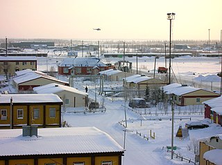
Yar-Sale is a rural locality in Russia located east of Salekhard near the Gulf of Ob in the northern part of Western Siberia. It is the administrative center of Yamalsky District, one of seven in Yamalo-Nenets Autonomous Okrug of Tyumen Oblast.
Aksarka is a rural locality and the administrative center of Priuralsky District of Yamalo-Nenets Autonomous Okrug, Russia. Population: 3,133 (2010 Census); 2,569 (2002 Census); 2,365 (1989 Soviet census).