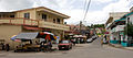
San Ignacio and Santa Elena are towns in western Belize. San Ignacio serves as the cultural-economic hub of Cayo District.[2] It got its start from mahogany and chicle production during British colonisation. Over time it attracted people from the surrounding areas, which led to the diverse population of the town today. San Ignacio is the second largest settlement in Cayo District after the capital, Belmopan.[3]
The town was originally named El Cayo by the Spanish. On 19 October 1904, El Cayo was officially declared a town by the government of British Honduras.[4] In the past a creek ran between the Macal and the Mopan rivers one mile outside of San Ignacio going toward Benque Viejo. This creek then fulfilled the definition of an area of land completely surrounded by water and thus the name Cayo, "island". There was a large wooden bridge across this creek in the late 1940s, but since the creek eventually dried up, the area was filled with limestone gravel and today there remains no evidence of its existence.[citation needed] The demise of the creek, however, took away the distinction for the classification of a 'cayo' from the venerable western town of 'El Cayo' and returned it to a regular land mass.[citation needed]
Geography
San Ignacio is situated on the banks of the Macal River, about 63 miles (101km) west of Belize City and 22 miles (35km) west of the country's capital: Belmopan. The town has an area of approximately 2.5 square miles (6.5km2).[5]
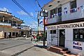
Small park of downtown San Ignacio in front of the police station
Belize independence day celebration
Hawkesworth Bridge
Demographics
The population is largely Mestizo, followed by Kriol, and some Lebanese and Mopan Maya. San Ignacio also boasts a fairly large Chinese population, most of whom emigrated from Guangzhou in waves in the mid-20th century. The Mennonite community of Spanish Lookout is situated a few miles outside San Ignacio. The 2010 census counted 17,878 inhabitants in San Ignacio and Santa Elena, of whom 8,751 are males and 9,127 are females. The total number of households is 4,351 and the average household size is 4.1.[6]
Santa Elena
In recent years San Ignacio has absorbed the formerly separate town of Santa Elena. San Ignacio and its sister-town Santa Elena make up Belize's third largest urban area. The two towns are connected by Belize's only suspension bridge, the one-lane Hawkesworth Bridge across the Macal river, built in 1949 and another one-lane, low-lying wooden bridge at the market and a two lane bridge, the Santa Elena Bridge constructed in 2018. The two are collectively referred to as the "Twin Towns" although San Ignacio has a larger population. As of 2010[update], Santa Elena has a population of 7,389 compared with San Ignacio's population of 10,489.[6]
San Ignacio is currently governed by a town council affiliated with the United Democratic Party (UDP). The mayor is Earl Trapp, also of the UDP. Town council elections are held every three years to elect the mayor and council. Both UDP and People's United Party (PUP) candidates participate in town elections. The next municipal elections are scheduled for the year 2020.
San Ignacio has three main colleges. Sacred Heart College of Catholic denomination is the largest institution, with both a high school and a junior college division, and is one of the largest high schools in Belize. Eden Seventh Day Adventist High School and Saint Ignatius High School (Catholic) are also found here.
Galen University was founded in 2003 and is located at Central Farm, a couple of minutes east of San Ignacio. The University of Belize also has an agricultural campus next to Galen.
Healthcare
The city is served by the San Ignacio Hospital, which is a regional clinic, and the Loma Luz Adventist hospital in Santa Elena. It also has various clinics, doctors and pharmacies scattered around town, and "the only official medical electives program run by Belizians."[7]
Attractions
The area around San Ignacio is one of the most popular parts of the country for tourism. Nearby attractions include the ancient Maya ruins of Caracol, Xunantunich, Cahal Pech, and El Pilar. Notable caves to explore include the Actun Tunichil Muknal cave, which includes skeletons, ceramics, and stoneware, and Barton Creek Cave, which is popular among adventure tourists interested in cave canoeing, as well as Crystal Cave at St. Herman's, also known as Mountain Cow Cave, which is challenging physically as visitors have to descend a 15-foot drop to see stalactites, stalagmites, massive crystal formations, ancient ceremonial fire pits, relics, wall carvings, and actual skeletal remains of Mayan sacrificial victims.
Also popular among adventure travelers are nature reserves such as the Chaa Creek Nature Reserve, and the Mountain Pine Ridge Forest Reserve. A day trip to Mountain Pine Ridge allows visitors to go on several hikes and visit waterfalls, caves, and Maya ruins.
↑Grant, H.E.W. "19, October, 1904". Government of British Honduras. Government Gazette British Honduras. Archived from the original on 2016-11-04. Retrieved 2016-11-02.
This page is based on this Wikipedia article Text is available under the CC BY-SA 4.0 license; additional terms may apply. Images, videos and audio are available under their respective licenses.