Related Research Articles

The San Luis Valley is a region in south-central Colorado with a small portion overlapping into New Mexico. The valley is approximately 122 miles (196 km) long and 74 miles (119 km) wide, extending from the Continental Divide on the northwest rim into New Mexico on the south. It contains 6 counties and portions of 3 others. It is an extensive high-elevation depositional basin of approximately 8,000 square miles (21,000 km2) with an average elevation of 7,664 feet (2,336 m) above sea level. The valley is a section of the Rio Grande Rift and is drained to the south by the Rio Grande, which rises in the San Juan Mountains to the west of the valley and flows south into New Mexico. The San Luis Valley has a cold desert climate but has substantial water resources from the Rio Grande and groundwater.

Chiricahua is a band of Apache Native Americans.

Jornada del Muerto was the name given by the Spanish conquistadors to the Jornada del Muerto desert basin, and the almost waterless 90-mile (140 km) trail across the Jornada beginning north of Las Cruces and ending south of Socorro, New Mexico. The name translates from Spanish as "Dead Man's Journey" or "Route of the Dead Man". The trail was part of the Camino Real de Tierra Adentro which led northward from central colonial New Spain, present-day Mexico, to the farthest reaches of the viceroyalty in northern Nuevo México Province.

Arizona Territory, colloquially referred to as Confederate Arizona, was an organized incorporated territory of the Confederate States of America that existed from August 1, 1861, to May 26, 1865, when the Confederate States Army Trans-Mississippi Department, commanded by General Edmund Kirby Smith, surrendered at Shreveport, Louisiana. However, after the Battle of Glorieta Pass, the Confederates had to retreat from the territory, and by July 1862, effective Confederate control of the territory had ended. Delegates to the secession convention had voted in March 1861 to secede from the New Mexico Territory and the Union, and seek to join the Confederacy. It consisted of the portion of the New Mexico Territory south of the 34th parallel, including parts of the modern states of New Mexico and Arizona. The capital was Mesilla, along the southern border. The breakaway region overlapped Arizona Territory, established by the Union government in February 1863.
Fort Selden was a United States Army post, occupying the area in what is now Radium Springs, New Mexico. The site was long a campground along the El Camino Real de Tierra Adentro. It was the site of a Confederate Army camp in 1861. The U.S. Army established Fort Selden in 1865 for the purpose of protecting westward settlers from Native American raids, but the post fell into disrepair after the American Civil War. It was ultimately abandoned in 1891, due in large part to the decision to expand Fort Bliss and the lack of any expenditures for repair of the facility.

Fort Craig was a U.S. Army fort located along El Camino Real de Tierra Adentro, near Elephant Butte Lake State Park and the Rio Grande in Socorro County, New Mexico.
The Battle of Canada Alamosa as it was known to the Union Army, or Alamosa as it was known to the Confederates, was a skirmish of the American Civil War on the late evening of September 24 and the morning of September 25, 1861. It was one of several small battles that occurred in Confederate Arizona near the border with Union held New Mexico Territory, this one being the largest.
Fort Thorn or Fort Thorne, originally Cantonment Garland, was a settlement and military outpost located on the west bank of the Rio Grande, northwest of present-day Hatch, and west of Salem in Doña Ana County, New Mexico, United States. It was named for 1st Lt. Herman Thorn of the 2nd U.S. Infantry drowned in the Colorado River in 1849. He had previously been an aide to General John Garland, the new commander of the Ninth Military District, that encompassed New Mexico Territory in 1853.

Southern Emigrant Trail, also known as the Gila Trail, the Kearny Trail, Southern Trail and the Butterfield Stage Trail, was a major land route for immigration into California from the eastern United States that followed the Santa Fe Trail to New Mexico during the California Gold Rush. Unlike the more northern routes, pioneer wagons could travel year round, mountain passes not being blocked by snows; however, it had the disadvantage of summer heat and lack of water in the desert regions through which it passed in New Mexico Territory and the Colorado Desert of California. Subsequently, it was a route of travel and commerce between the eastern United States and California. Many herds of cattle and sheep were driven along this route and it was followed by the San Antonio-San Diego Mail Line in 1857–1858 and then the Butterfield Overland Mail from 1858 to 1861.
Mowry City is a ghost town first in Doña Ana County, then Grant County and finally in Luna County, New Mexico, United States, approximately 25 miles (40 km) north of Deming. Originally it was the crossing point of Cooke's Wagon Road on the Mimbres River. Mowry City was formerly the location of Rio Mimbres, a stop on the San Antonio-San Diego Mail Line, and Miembre's River Station, a stagecoach stop on the Butterfield Overland Mail and later stagecoach routes. The town lasted from 1859 until the arrival of the railroad in southern New Mexico in 1881.
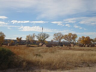
Canada Alamosa an Americanized version of the Spanish Cañada Alamosa, is a term historically applied to five geographical features, all in the same immediate area in southwest Socorro and northwest Sierra Counties, New Mexico. In historical texts the name, Canada Alamosa is applied inter-changeably to the five features, and it is often only the context that distinguishes one feature from the other.
Las Palomas is a census-designated place in Sierra County, New Mexico, United States. Its population was 173 as of the 2010 census. The community is located near Exit 71 of Interstate 25; New Mexico State Road 187 also passes through the community.
Monticello is an unincorporated community located in Sierra County, New Mexico, United States. Monticello is located on Alamosa Creek, 22 miles (35 km) northwest of Truth or Consequences. Monticello has a post office with ZIP code 87939.
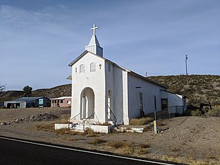
Cuchillo, originally known as Cuchillo Negro, is an unincorporated community in Sierra County, New Mexico, United States. It was named for Apache chieftain Baishan, known by his Spanish name Cuchillo Negro "Black Knife", who was killed in a skirmish with American troops in 1857. The town is located on the north bank of Cuchillo Negro Creek. Cuchillo's name change came after the 1900 Census. It was recorded under its present name in the 1910 Census.
Cañon del Muerto is a canyon, in Sierra County, New Mexico.
Fort McRae was a Union Army post, established in 1863, then a U.S. Army post from 1866 and closed in 1876, in what is now Sierra County, New Mexico. The post was named for Alexander McRae (1829–1862) a slain hero of the 1862 Battle of Valverde.
Canta Recio, was a native New Mexican settlement, now a ghost town in Socorro County, New Mexico, United States. It was located 40 miles south of Socorro, on the west bank of the Rio Grande, south of Milligan Gulch.
Contadero is a ghost town along the east bank of the Rio Grande in Socorro County, New Mexico, United States.
Alamocita, initially called New Alamosa, was a later 19th century native New Mexican frontier settlement along the east bank of the Rio Grande and is now a ghost town in Sierra County, New Mexico, United States.
Zapata, sometimes called Zapato, or San Ignacio is a ghost town in Sierra County, New Mexico, United States. Its site was submerged by the Elephant Butte Reservoir some years after it had been abandoned.
References
- 1 2 3 4 5 6 7 8 9 10 11 12 13 14 15 Wilson, John P., Between the River and the Mountains: A History of Early Settlement in Sierra County, New Mexico, Report #40, John P. Wilson, Las Cruces, New Mexico, August 1985
- ↑ CENSUS YR: 1860 TERRITORY: NM COUNTY: Socorro DIVISION: San Ygnacio de la Alamosa REEL NO: M653-714 PAGE NO: 35; REFERENCE: Enumerated on July 4, 1860. Page #687
- ↑ The Origins of Sierra County:Political and Economic Roots by James B. Sullivan, pp,6-13, SOUTHERN NEW MEXICO HISTORICAL REVIEW, Doña Ana County Historical Society, Volume IX, No.1, Las Cruces, New Mexico January 2002
- Old Territory and Military Department of New Mexico: compiled in the Bureau of Topographical Engineers of the War Dept. chiefly for military purposes. Under the authority of the Secretary of War 1850. Partially revised and corrected to 1867. Engraved by W. H. Dougal., United States Bureau of Topographical Engineers, Washington, D.C., 1867 Uncolored map, published prior to and revised after the Civil War. List of Authorities identifies 19 maps created by explorers of the region published between 1843 and 1858. Shows boundaries, principal travel routes, trails, mail routes, cities and villages, rivers and creeks. Includes list of Principal latitudes & longitudes astronomically determined. Includes notes. This map shows the location of Alamosa along the Rio Grande just before it was abandoned. From davidrumsey.com accessed September 29, 2019.