See also
| | This British Columbia school-related article is a stub. You can help Wikipedia by expanding it. |
| School District 84 Vancouver Island West | |
|---|---|
| Location | |
Gold River Gold River, Tahsis, Zeballos in Vancouver Island Canada | |
| District information | |
| Superintendent | Mr Lawrence Tarasoff |
| Schools | 5 |
| Budget | CA$6.0 million |
| Students and staff | |
| Students | 445 |
| Other information | |
| Website | www |
School District 84 Vancouver Island West is a school district in British Columbia. It covers the northwest corner of Vancouver Island. This includes the major centre of Gold River and the remote communities of Tahsis, Zeballos and Kyuquot.
| School | Location | Grades |
|---|---|---|
| Captain Meares Elem-Secondary School | Tahsis | 1-12 |
| Gold River Secondary School | Gold River | 8-12 |
| Kyuquot Elementary Secondary School | Kyuquot | 1-12 |
| Ray Watkins Elementary School | Gold River | K-7 |
| Zeballos Elem-Secondary School | Zeballos | K-12 |

British Columbia is the westernmost province of Canada. Situated between the Pacific Ocean and the Rocky Mountains, the province has a diverse geography, with rugged landscapes that include rocky coastlines, sandy beaches, forests, lakes, mountains, inland deserts and grassy plains. British Columbia borders the province of Alberta to the east; the territories of Yukon and Northwest Territories to the north; the U.S. states of Washington, Idaho and Montana to the south, and Alaska to the northwest. With an estimated population of over 5.6 million as of 2024, it is Canada's third-most populous province. The capital of British Columbia is Victoria, while the province's largest city is Vancouver. Vancouver and its suburbs together make up the third-largest metropolitan area in Canada, with the 2021 census recording 2.6 million people in Metro Vancouver.

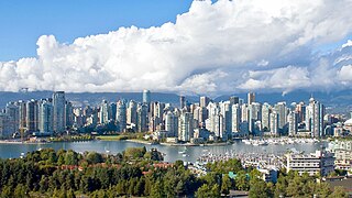
Vancouver is a major city in western Canada, located in the Lower Mainland region of British Columbia. As the most populous city in the province, the 2021 Canadian census recorded 662,248 people in the city, up from 631,486 in 2016. The Metro Vancouver area had a population of 2.6 million in 2021, making it the third-largest metropolitan area in Canada. Greater Vancouver, along with the Fraser Valley, comprises the Lower Mainland with a regional population of over 3 million. Vancouver has the highest population density in Canada, with over 5,700 people per square kilometre, and fourth highest in North America.

Vancouver Island is an island in the northeastern Pacific Ocean and part of the Canadian province of British Columbia. The island is 456 km (283 mi) in length, 100 km (62 mi) in width at its widest point, and 32,100 km2 (12,400 sq mi) in total area, while 31,285 km2 (12,079 sq mi) are of land. The island is the largest by area and the most populous along the west coasts of the Americas.

Richmond is a city in the coastal Lower Mainland region of British Columbia, Canada. Mainly a suburban city, it occupies almost the entirety of Lulu Island, between the two estuarine distributaries of the Fraser River. Encompassing the adjacent Sea Island and several other smaller islands and uninhabited islets to its north and south, the suburb neighbours Vancouver and Burnaby on the Burrard Peninsula to the north, New Westminster and Annacis Island to the east, Delta to the south, and the Strait of Georgia to the west.

West Vancouver is a district municipality in the province of British Columbia, Canada. A member municipality of the Metro Vancouver Regional District, West Vancouver is to the northwest of the city of Vancouver on the northern side of English Bay and the southeast shore of Howe Sound, and is adjoined by the District of North Vancouver to its east. Together with the District of North Vancouver and the City of North Vancouver, it is part of a local regional grouping referred to as the North Shore municipalities, or simply "the North Shore".

Powell River is a city on the northern Sunshine Coast of southwestern British Columbia, Canada. Most of its population lives near the eastern shores of Malaspina Strait, which is part of the larger Georgia Strait between Vancouver Island and the Mainland. With two intervening long, steep-sided fjords inhibiting the construction of a contiguous road connection with Vancouver to the south, geographical surroundings explain Powell River's remoteness as a community, despite relative proximity to Vancouver and other populous areas of the BC Coast. The city is the location of the head office of the qathet Regional District.

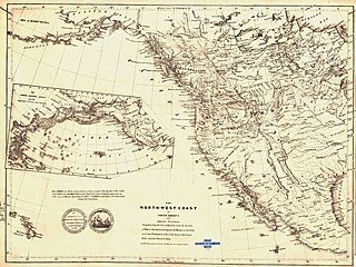
New Caledonia was a fur-trading district of the Hudson's Bay Company that comprised the territory of the north-central portions of present-day British Columbia, Canada. Though not a British colony, New Caledonia was part of the British claim to North America. Its administrative centre was Fort St. James. The rest of what is now mainland British Columbia was called the Columbia Department by the British, and the Oregon Country by the Americans. Even before the partition of the Columbia Department by the Oregon Treaty in 1846, New Caledonia was often used to describe anywhere on the mainland not in the Columbia Department, such as Fort Langley in the Fraser Valley.

Quadra Island is a large island off the eastern coast of Vancouver Island, in British Columbia, Canada. It is part of the Discovery Islands, in the Strathcona Regional District.

Sir James Douglas, was a Canadian fur trader and politician who became the first Governor of the Colony of British Columbia. He is often credited as "The Father of British Columbia". He was instrumental to the resettlement of 35 African Americans fleeing a life of racial persecution in San Francisco who arrived in the province aboard the steamship Commodore in what later became known as the Pioneer Committee. In 1863, Douglas was knighted by Queen Victoria for his services to the Crown.
The Cowichan Valley School District, is located in the Cowichan Valley on Vancouver Island, British Columbia, Canada. It consists of numerous elementary, middle, Secondary schools, and alternative schools for programs like adult education.

The British Columbia Coast, popularly referred to as the BC Coast or simply the Coast, is a geographic region of the Canadian province of British Columbia. As the entire western continental coastline of Canada along the Pacific Ocean is in the province, it is synonymous with being the West Coast of Canada.

Alert Bay is a village on Cormorant Island, near the town of Port McNeill on northeast Vancouver Island, in the Regional District of Mount Waddington, British Columbia, Canada.

The Colony of Vancouver Island, officially known as the Island of Vancouver and its Dependencies, was a Crown colony of British North America from 1849 to 1866, after which it was united with the mainland to form the Colony of British Columbia. The united colony joined Canadian Confederation, thus becoming part of Canada, in 1871. The colony comprised Vancouver Island and the Gulf Islands of the Strait of Georgia.

Sea Island is an island in the Fraser River estuary in the city of Richmond, British Columbia. It is located south of the city of Vancouver and north and west of Lulu Island. Sea Island is the home to Vancouver International Airport (YVR), a nature conservation area, and a permanent resident population of 814, most of which live in the neighbourhood of Burkeville. A small part of the island is under the administration of the Musqueam Indian Band.

West Vancouver Schools, also known as WVS or School District 45 West Vancouver, is a school district in British Columbia. It is immediately north of Vancouver and includes the Municipality of West Vancouver, the community of Lions Bay and Bowen Island.
School District 64 Gulf Islands is a school district in British Columbia. It includes the islands off southern Vancouver Island in the Strait of Georgia. This includes Saltspring Island as well as Galiano, Mayne, Saturna, Pender Islands. It also recently went through a reconfiguration causing the outer island kids grade 8 and up to go to Pender for 3 years and then to Saltspring.
School District 72 Campbell River is a school district on Vancouver Island in British Columbia. Centered in Campbell River it includes the more rural communities such as Sayward and the adjacent islands between Vancouver Island and mainland British Columbia such as Quadra and Cortes Island
School District 85 Vancouver Island North is a school district in British Columbia. It is based in the town of Port Hardy. It provides service to the communities northern tip of Vancouver Island including Port McNeill and Woss as well as the adjacent smaller islands such as Alert Bay.

Cortes Island is an island in the Discovery Islands archipelago on the coast of British Columbia, Canada. The island is 25 km (16 mi) long, 13 km (8 mi) wide, and 130 km2 (50 sq mi) in area. It has a population of 1,035 permanent residents. Cortes Island lies within Electoral Area B of the Strathcona Regional District, which provides water and sewage systems, fire protection, land use planning, parks, recreation, and emergency response.