External links
| | This British Columbia school-related article is a stub. You can help Wikipedia by expanding it. |
| School District 75 Mission | |
|---|---|
| Location | |
Mission Mission, Hatzic, Dewdney, McConnell Creek, Dewdney, Nicomen Island, Deroche, Lake Errock in Fraser Valley Canada | |
| District information | |
| Superintendent | Mr Angus Wilson |
| Schools | 17 |
| Budget | CA$59 million |
| Students and staff | |
| Students | 7086 |
| Other information | |
| Website | www |
School District 75 Mission is a school district in the Central Fraser Valley of British Columbia . Centered in Mission, immediately north of Abbotsford, British Columbia, it extends eastward beyond that municipality along the north side of the Fraser River as far as Lake Errock and Deroche.
| School | Location | Grades |
|---|---|---|
| Albert McMahon Elementary School | Mission | K-6 |
| Cherry Hill Elementary School | Mission | K-6 |
| Christine Morrison Elementary School | Mission | K-6 |
| Deroche Elementary School | Deroche | K-6 |
| Dewdney Elementary School | Dewdney | K-6 |
| Edwin S Richards Elementary School | Mission | K-6 |
| Hatzic Elementary School | Mission | K-6 |
| Hatzic Middle School | Mission | 7-9 |
| École Heritage Park Middle School | Mission | 7-9 |
| Hillside Traditional Academy | Mission | K-6 |
| Mission Central Elementary School | Mission | K-6 |
| École Mission Senior Secondary School | Mission | 10-12 |
| Riverside College (Mission, British Columbia) | Mission | Extended Learning |
| Silverdale Elementary School | Mission | K-6 |
| Summit Learning Centre | Mission | K-12 |
| West Heights Elementary School | Mission | K-6 |
| Windebank Elementary School | Mission | K-6 |
| | This British Columbia school-related article is a stub. You can help Wikipedia by expanding it. |

The Lower Mainland is a geographic and cultural region of the mainland coast of British Columbia that generally comprises the regional districts of Metro Vancouver and the Fraser Valley. Home to approximately 3.05 million people as of the 2021 Canadian census, the Lower Mainland contains sixteen of the province's 30 most populous municipalities and approximately 60% of the province's total population.

The Fraser River is the longest river within British Columbia, Canada, rising at Fraser Pass near Blackrock Mountain in the Rocky Mountains and flowing for 1,375 kilometres (854 mi), into the Strait of Georgia just south of the City of Vancouver. The river's annual discharge at its mouth is 112 cubic kilometres (27 cu mi) or 3,550 cubic metres per second (125,000 cu ft/s), and each year it discharges about 20 million tons of sediment into the ocean.
The Fraser Valley is a geographical region in southwestern British Columbia, Canada and northwestern Washington State. It starts just west of Hope in a narrow valley encompassing the Fraser River and ends at the Pacific Ocean stretching from the North Shore Mountains, opposite the city of Vancouver BC, to just south of Bellingham, Washington.

Abbotsford is a city in British Columbia next to the Canada–United States border, Greater Vancouver and the Fraser River. With a census population of 153,569 people (2021), it is the largest municipality in the province outside metropolitan Vancouver. Abbotsford–Mission has the third-highest proportion of visible minorities among census metropolitan areas in Canada, after the Greater Toronto Area and the Greater Vancouver CMA. It is home to Tradex, the University of the Fraser Valley, and Abbotsford International Airport.

Maple Ridge is a city in British Columbia, Canada. It is located in the northeastern section of Greater Vancouver between the Fraser River and the Golden Ears, which is a group of mountain summits which are the southernmost of the Garibaldi Ranges of the Coast Mountains. Maple Ridge's population in 2021 was 90,990. Its downtown core area was once known as Haney.

Chilliwack is a city of about 100,000 people and 261 km2 (100 sq mi) in the Canadian province of British Columbia. It is located about 100 km (62 mi) east of the City of Vancouver in the Fraser Valley. The enumerated population is 93,203 in the city and 113,767 in the greater metropolitan area. It is the second-fastest growing metropolitan area in Canada.

Mission is a city in the Lower Mainland of the province of British Columbia, Canada. It was originally incorporated as a district municipality in 1892, growing to include additional villages and rural areas over the years, adding the original Town of Mission City, long an independent core of the region, in 1969. It is bordered by the city of Abbotsford to the south and the city of Maple Ridge to the west. To the east are the unincorporated areas of Hatzic and Dewdney.
Highway 11, known locally as the Abbotsford–Mission Highway, is a 17 km (11 mi) long at-grade expressway that figuratively cuts the Fraser Valley in half. The highway was first given the '11' designation in 1958, and it originally followed South Fraser Way through Abbotsford, being re-routed onto the four-lane Sumas Way in the mid-1980s. Highway 11 originally entered Mission over the same bridge that carries a spur of the Canadian Pacific Railway across the Fraser River, but it was re-routed onto its own bridge, the Mission Bridge, in 1973.

Hope is a district municipality at the confluence of the Fraser and Coquihalla rivers in the province of British Columbia, Canada. Hope is at the eastern end of both the Fraser Valley and the Lower Mainland region, and is at the southern end of the Fraser Canyon. To the east, over the Cascade Mountains, is the Interior region, beginning with the Similkameen Country on the farther side of the Allison Pass in Manning Park. Located 154 kilometres (96 mi) east of Vancouver, Hope is at the southern terminus of the Coquihalla Highway and the western terminus of the Crowsnest Highway, locally known as the Hope-Princeton, where they merge with the Trans-Canada Highway. Hope is at the eastern terminus of Highway 7. As it lies at the eastern end of the Fraser Valley in the windward Cascade foothills, the town gets very high amounts of rain and cloud cover – particularly throughout the autumn and winter.
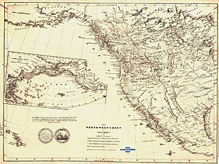
New Caledonia was a fur-trading district of the Hudson's Bay Company that comprised the territory of the north-central portions of present-day British Columbia, Canada. Though not a British colony, New Caledonia was part of the British claim to North America. Its administrative centre was Fort St. James. The rest of what is now mainland British Columbia was called the Columbia Department by the British, and the Oregon Country by the Americans. Even before the partition of the Columbia Department by the Oregon Treaty in 1846, New Caledonia was often used to describe anywhere on the mainland not in the Columbia Department, such as Fort Langley in the Fraser Valley.

Greater Vancouver, also known as Metro Vancouver, is the metropolitan area with its major urban centre being the city of Vancouver, British Columbia, Canada. The term "Greater Vancouver" describes an area that is roughly coterminous with the region governed by the Metro Vancouver Regional District (MVRD), though it predates the 1966 creation of the regional district. It is often used to include areas beyond the boundaries of the regional district but does not generally include wilderness and agricultural areas that are included within the MVRD.

The Fraser Valley Regional District (FVRD) is a regional district in British Columbia, Canada. Its headquarters are in the city of Chilliwack. The FVRD covers an area of 13,361.74 km2 (5,159 sq mi). It was created in 1995 by an amalgamation of the Fraser-Cheam Regional District and Central Fraser Valley Regional District and the portion of the Dewdney-Alouette Regional District from and including the District of Mission eastwards.

The Douglas Ranges are a subrange of the Pacific Ranges of the Coast Mountains of the Canadian province of British Columbia, about 70 km (43 mi) east of downtown Vancouver, north of the Fraser River and between the valleys of Stave and Harrison Lakes. They are approximately 4,900 km2 (1,900 sq mi) in area. Their highest peak is Mount Robertson 2,252 m (7,388 ft), at the northwest limit of the range.

The District of Kent is a district municipality located 116 kilometres (72 mi) east of Vancouver, British Columbia. Part of the Fraser Valley Regional District, Kent consists of several communities, the largest and most well-known being Agassiz—the only town in the municipality—Harrison Mills, Kilby, Mount Woodside, Kent Prairie, Sea Bird Island and Ruby Creek. Included within the municipality's boundaries are several separately-governed Indian reserves, including the Seabird Island First Nation's reserves on and around the island of the same name.
Dewdney, originally named Johnson's Landing from 1884–1892, is an unincorporated community in the Central Fraser Valley of British Columbia, Canada, about 15 km east of the city of Mission. It was incorporated as a district municipality on April 17, 1892, including adjoining areas of Hatzic and Hatzic Island but the anticipated real estate boom on that island didn't pan out and economic damage from the Great Fraser Flood of 1894 led to the municipality's disincorporation on March 12, 1906. Another municipality eastwards, Nicomen, was incorporated in the same year but similarly later disincorporated. Though in the same school district as Mission, it and other adjoining rural areas did not join that municipality when offered. It is now represented as part of Electoral Area 'G' in the regional district government, which currently is the Fraser Valley Regional District.
Matsqui is a former district municipality in British Columbia, Canada. It was incorporated in 1892 and merged with the district municipality of Abbotsford in 1995 to create the new City of Abbotsford. Matsqui used to be the western part of what is now Abbotsford. It had commercial growth in the Clearbrook area which then spilled over to Abbotsford.
The Leq'á:mel First Nation, formerly known as Lakahahmen First Nation, is a First Nations band government whose community and offices are located in the area near Deroche, British Columbia in the Fraser Valley region in Canada, about 12 kilometres east of the District of Mission. They are a member government of the Sto:lo Nation Chiefs Council, which is one of two tribal councils of the Sto:lo.
Hatzic is a historic community in the Central Fraser Valley region of the Lower Mainland of British Columbia, Canada, located on the east side of the City of Mission and including areas beyond the municipal boundary to the east and northeast.
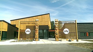
The Matsqui people are a Sto:lo Aboriginal group located in the Central Fraser Valley region of British Columbia, Canada. Their band government is the Matsqui First Nation, a member of the Sto:lo Nation tribal council. The core traditional territory of the Matsqui stretches along the Fraser River from Crescent Island to Sumas Mountain, and southward beyond the Canada-United States border. Today the band administers four reserves and has a population of 225. Their original language is Halq'eméylem.