Schroeder, Minnesota | |
|---|---|
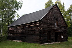 The Schroeder Lumber Company Bunkhouse | |
 Schroeder, Minnesota Location of the community of Schroeder within Schroeder Township, Cook County  Schroeder, Minnesota Schroeder, Minnesota (the United States) | |
| Coordinates: 47°32′40″N90°53′31″W / 47.54444°N 90.89194°W | |
| Country | |
| State | |
| County | Cook |
| Township | Schroeder |
| Elevation | 640 ft (200 m) |
| Time zone | UTC-6 (Central (CST)) |
| • Summer (DST) | UTC-5 (CDT) |
| ZIP codes | 55613 |
| Area code | 218 |
| GNIS feature ID | 658185 [1] |
Schroeder is an unincorporated community in Schroeder Township, Cook County, Minnesota, United States.
Contents
The community is located on the North Shore of Lake Superior. The Cross River flows through the center, or middle of Schroeder.
Schroeder is located 30 miles (48 km) southwest of the city of Grand Marais; and 53 miles (85 km) northeast of the city of Two Harbors.
Minnesota Highway 61 serves as a main route in the community.
Temperance River State Park and the Superior Hiking Trail are both nearby.

