
Not to be confused with Cook, Minnesota in Saint Louis County.
Grand Portage is an unorganized territory in Cook County, Minnesota, on Lake Superior, at the northeast corner of the state near the border with northwestern Ontario. The population was 565 at the 2010 census. The unincorporated community of Grand Portage and the Grand Portage Indian Reservation are both located within Grand Portage Unorganized Territory of Cook County.

The Pigeon River forms part of the Canada–United States border between the state of Minnesota and the province of Ontario, west of Lake Superior. In pre-industrial times the river was a waterway of great importance for transportation and the fur trade.
Minnesota State Highway 61 is a 148.843-mile-long (239.540 km) highway in northeast Minnesota, which runs from a junction with Interstate 35 (I-35) in Duluth at 26th Avenue East, and continues northeast to its northern terminus at the Canadian border near Grand Portage, connecting to Ontario Highway 61 at the Pigeon River Bridge. The route is a scenic highway, following the North Shore of Lake Superior, and is part of the Lake Superior Circle Tour designation that runs through Minnesota, Ontario, Michigan, and Wisconsin.
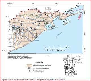
The Grand Portage Indian Reservation is located in Cook County near the tip of Minnesota's Arrowhead Region in the extreme northeast part of the state. The community was considered part of the Lake Superior Band of Chippewa, but is not a party to the treaties that group signed. The reservation was established as part of an 1854 treaty, and the land area is 74.396 sq mi.

The Arrowhead Region is located in the northeastern part of the U.S. state of Minnesota, so called because of its pointed shape. The predominantly rural region encompasses 10,635.26 square miles (27,545.2 km2) of land area and includes Carlton, Cook, Lake and Saint Louis counties. Its population at the 2000 census was 248,425 residents. Aitkin, Itasca, and Koochiching counties are also sometimes considered as part of the region. This would increase the land area to 18,221.97 square miles (47,194.7 km2) and the population to 322,073 residents.

Grand Portage National Monument is a United States National Monument located on the north shore of Lake Superior in northeastern Minnesota that preserves a vital center of fur trade activity and Anishinaabeg Ojibwe heritage. The area became one of the British Empire's four main fur trading centers in North America, along with Fort Niagara, Fort Detroit, and Michilimackinac.
Portage may refer to one of the following.

Grand Portage State Park is a state park at the northeastern tip of Minnesota, USA, on the Canada–United States border. It contains a 120-foot (37 m) waterfall, the tallest in the state, on the Pigeon River. The High Falls and other waterfalls and rapids upstream necessitated a historically important portage on a fur trade route between the Great Lakes and inland Canada. This 8.5-mile (13.7 km) path plus the site of forts on either end are preserved in nearby Grand Portage National Monument. The state park, held by the surrounding Grand Portage Indian Reservation and leased to the state of Minnesota for $1 a year, is the only U.S. state park jointly managed by a state and a Native American band. It is also the only Minnesota state park not owned by the state.

Height of Land Portage is a portage along the historic Boundary Waters route between Canada and the United States. Located at the border of the Canadian province of Ontario and the U.S. state of Minnesota, the path is a relatively easy crossing of the Laurentian Divide separating the watersheds of the Atlantic and Arctic oceans.
Buyck is an unincorporated community in Portage Township, Saint Louis County, Minnesota, United States.
Little Marais is an unincorporated community in Lake County, Minnesota, United States; located on the North Shore of Lake Superior.
Hovland is an unincorporated community in Cook County, Minnesota, United States.
Pigeon Point is an isolated peninsula located at the northeast extremity of Minnesota, in Cook County, Minnesota, United States. To the north of the point lies Pigeon Bay, which shares a shoreline with Canada and to the south is Lake Superior. Pigeon Point is the closest mainland U.S. point to Isle Royale, on the far side of the water boundary between Minnesota and Michigan. The extreme end of the point is owned by the United States Coast Guard while the land up to the point is held by the Grand Portage Indian Reservation. The closest town to the point is Grand Portage, Minnesota which lies thirteen miles to the west. There are no roads that lead to this point and is only accessible by boat.
The Grand Portage State Forest is a state forest located near the community of Hovland in Cook County, in extreme northeastern Minnesota. The forest encloses Judge C. R. Magney State Park, Swamp River Wildlife Management Area, Hovland Woods Scientific and Natural Area, and Spring Beauty Hardwoods Scientific and Natural Area. It borders the Grand Portage Indian Reservation to the east, the Superior National Forest to the west, and Ontario to the north. The forest is named after the Grand Portage, a historic trade route between the Great Lakes and the Northwest.
Mineral Center is an unincorporated community in Cook County, Minnesota, United States; located five miles west of the community of Grand Portage.
Grand Portage is an unincorporated community in Cook County, Minnesota, United States; located on Grand Portage Bay of the North Shore of Lake Superior.
Colvill is an extinct townsite in Cook County, Minnesota, United States.
Pigeon Bay is a body of water that lies between Minnesota, United States and Ontario, Canada and is part of Lake Superior. The international boundary between the two countries lies in the middle of the bay. The name of "Pigeon" Bay was most likely from the prevalence of the passenger pigeon which was common in the US/Canada border region.

The Grand Portage-Pigeon River Border Crossing connects the cities of Grand Portage, Minnesota and Neebing, Ontario. It is the main route between the larger cities of Duluth, MN and Thunder Bay, ON.


