Grand Portage, Minnesota

Last updated

Grand Portage is an unorganized territory in Cook County, Minnesota, United States, on Lake Superior, at the northeastern corner of the state near the border with northwestern Ontario. [1] The population was 565 at the 2010 census. The unincorporated community of Grand Portage and the Grand Portage Indian Reservation are both located within Grand Portage Unorganized Territory of Cook County.

Contents

The adjacent Grand Portage National Monument, designated a National Monument in 1958, lies entirely within the boundaries of the Grand Portage Ojibwe Indian Reservation. The reconstructed depot celebrates fur trade and Ojibwe ways of life. The British North West Company built its inland headquarters at Grand Portage; the post was active until 1802.

Grand Portage is home to passenger ferries that provides access from the community to Isle Royale National Park, meaning Minnesota has access to the U.S. state of Michigan.

Geography

According to the United States Census Bureau, the unorganized territory has a total area of 192.5 sq mi (498.7 km2), of which 74.2 sq mi (192.2 km2) is land and 118.3 sq mi (306.5 km2) (61.46%) is water.

Minnesota State Highway 61 (Old U.S. Highway 61) serves as a main route in the area.

The community of Grand Portage is located 34 miles (55 km) northeast of the city of Grand Marais; and six miles (9.7 km) southwest of the Canada–US border.

Unincorporated communities

The following unincorporated communities are located within Grand Portage Unorganized Territory:

Climate

Grand Portage has a humid continental climate that is prevalent throughout the state. Its version is significantly cooler in summers than more southerly areas and more severe in winters. Precipitation is dominant in summers, but can render some high volumes of snowfall in winter.

Climate data for Grand Portage, Minnesota (1991–2020 normals, extremes 1895–present)
MonthJanFebMarAprMayJunJulAugSepOctNovDecYear
Record high °F (°C)50
(10)
56
(13)
67
(19)
82
(28)
88
(31)
95
(35)
94
(34)
94
(34)
87
(31)
78
(26)
67
(19)
52
(11)
95
(35)
Mean maximum °F (°C)39.3
(4.1)
42.7
(5.9)
53.0
(11.7)
64.6
(18.1)
77.1
(25.1)
82.6
(28.1)
86.3
(30.2)
85.2
(29.6)
79.1
(26.2)
68.5
(20.3)
53.4
(11.9)
41.6
(5.3)
88.7
(31.5)
Mean daily maximum °F (°C)20.3
(−6.5)
24.3
(−4.3)
34.4
(1.3)
45.4
(7.4)
58.1
(14.5)
67.7
(19.8)
73.6
(23.1)
73.0
(22.8)
64.8
(18.2)
51.4
(10.8)
37.5
(3.1)
25.8
(−3.4)
48.0
(8.9)
Daily mean °F (°C)10.5
(−11.9)
13.1
(−10.5)
23.7
(−4.6)
35.8
(2.1)
47.4
(8.6)
56.9
(13.8)
63.0
(17.2)
62.6
(17.0)
54.4
(12.4)
42.4
(5.8)
29.6
(−1.3)
17.5
(−8.1)
38.1
(3.4)
Mean daily minimum °F (°C)0.7
(−17.4)
2.0
(−16.7)
13.0
(−10.6)
26.2
(−3.2)
36.8
(2.7)
46.1
(7.8)
52.3
(11.3)
52.1
(11.2)
44.0
(6.7)
33.3
(0.7)
21.8
(−5.7)
9.2
(−12.7)
28.1
(−2.2)
Mean minimum °F (°C)−21.3
(−29.6)
−17.8
(−27.7)
−9.6
(−23.1)
12.7
(−10.7)
26.7
(−2.9)
35.6
(2.0)
43.6
(6.4)
43.0
(6.1)
31.7
(−0.2)
22.5
(−5.3)
3.7
(−15.7)
−13.8
(−25.4)
−24.3
(−31.3)
Record low °F (°C)−39
(−39)
−48
(−44)
−29
(−34)
−22
(−30)
18
(−8)
25
(−4)
38
(3)
31
(−1)
24
(−4)
10
(−12)
−18
(−28)
−28
(−33)
−48
(−44)
Average precipitation inches (mm)1.35
(34)
1.03
(26)
1.33
(34)
2.79
(71)
3.11
(79)
3.58
(91)
3.42
(87)
3.04
(77)
3.13
(80)
3.40
(86)
2.65
(67)
1.74
(44)
30.57
(776)
Average snowfall inches (cm)12.2
(31)
8.0
(20)
8.0
(20)
7.7
(20)
0.2
(0.51)
0.0
(0.0)
0.0
(0.0)
0.0
(0.0)
0.0
(0.0)
0.5
(1.3)
6.7
(17)
11.9
(30)
55.2
(140)
Average precipitation days (≥ 0.01 in)8.66.26.68.611.311.811.610.211.511.29.29.3116.1
Average snowy days (≥ 0.1 in)8.05.64.32.90.20.00.00.00.00.43.87.933.1
Source: NOAA [2] [3]

History

Beginning in the 17th century Grand Portage became a major center of the fur trade. See Canadian Canoe Routes (early). It was at the point where a major canoe fur trade route of the voyageurs left the great lakes. It was so named because the route began with a huge 9 mile portage. [4] A portage is a place where the canoes and equipment are carried over land. The French established this trade with the Native Americans until the British took it over in the 18th century after the Seven Years' War. The North West Company established the area as its regional headquarters. Soon Grand Portage became one of Britain's four main fur trading posts, along with Niagara, Detroit, and Michilimackinac. [5] Even after the American Revolutionary War and victory by the rebellious colonists, the British continued to operate in the area. Under the Treaty of Paris in 1783, Britain had to cede former territory to the United States, including this area.

Finally with the signing of the Jay Treaty in 1796 defining the northern border between Canada and the US, British traders planned to move from Grand Portage. They wanted to avoid the taxes the US put on their operations, in its effort to encourage American traders instead. In 1802 the traders planned to move north to create a new center, what they called Fort William. In 1803 following the Louisiana Purchase, in which the U.S. acquired the lands to the west of Grand Portage, the British finally moved from Grand Portage to the new post in Canada. [6] The North West Company moved its headquarters northward to what they named Fort William. After British fur traders abandoned the area, it rapidly declined economically until fisheries and logging became popular in the 19th century.

Demographics

As of the census [7] of 2000, there were 557 people, 247 households, and 137 families residing in the unorganized territory. The population density was 7.5 people per square mile (2.9 people/km2). There were 286 housing units at an average density of 3.9 per square mile (1.5/km2). The racial makeup of the unorganized territory was 35.73% White, 57.81% Native American, 0.36% from other races, and 6.10% from two or more races. Hispanic or Latino of any race were 1.97% of the population.

There were 247 households, out of which 31.2% had children under the age of 18 living with them, 32.8% were married couples living together, 14.2% had a female householder with no husband present, and 44.5% were non-families. 32.4% of all households were made up of individuals, and 6.5% had someone living alone who was 65 years of age or older. The average household size was 2.26 and the average family size was 2.82.

In the unorganized territory, the population was spread out, with 27.1% under the age of 18, 8.1% from 18 to 24, 30.5% from 25 to 44, 26.2% from 45 to 64, and 8.1% who were 65 years of age or older. The median age was 36 years. For every 100 females, there were 98.2 males. For every 100 females age 18 and over, there were 95.2 males.

The median income for a household in the unorganized territory was $30,326, and the median income for a family was $31,771. Males had a median income of $26,458 versus $22,232 for females. The per capita income for the unorganized territory was $15,782. About 18.9% of families and 21.7% of the population were below the poverty line, including 28.1% of those under age 18 and 6.3% of those age 65 or over.

See also

Related Research Articles

<span class="mw-page-title-main">Cook County, Minnesota</span> County in Minnesota, United States

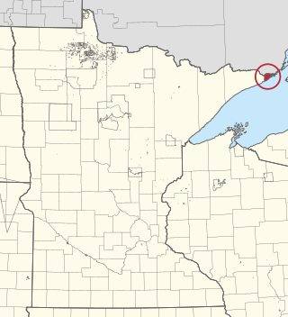
Cook County is the easternmost county in the U.S. state of Minnesota. As of the 2020 census, the population was 5,600, making it Minnesota's seventh-least populous county. Its county seat is Grand Marais. The Grand Portage Indian Reservation is in the county.

Greenwood Township is a township in Saint Louis County, Minnesota, United States. The population was 939 at the 2010 census.

Halden Township is a township in Saint Louis County, Minnesota, United States. The population was 129 at the 2010 census.

Morse Township is a township in Saint Louis County, Minnesota, United States. The population was 1,213 at the 2010 census.

Willow Valley Township is a township in Saint Louis County, Minnesota, United States. The population was 126 at the 2010 census.

<span class="mw-page-title-main">Portage, Wisconsin</span> City in Wisconsin, United States

Portage is a city in and the county seat of Columbia County, Wisconsin, United States. The population was 10,581 at the 2020 census, making it the largest city in Columbia County. The city is part of the Madison Metropolitan Statistical Area.

Lower Red Lake is an unorganized territory in Beltrami County, Minnesota, United States.The territory is located on the Red Lake Indian Reservation, and the town of Red Lake is located in the area. The population of the Lower Red Lake territory was 5,790 at the 2010 census.

Gheen is an unorganized territory in Saint Louis County, Minnesota, United States. The population was 25 at the 2000 census.

Whiteface Reservoir is an unorganized territory in Saint Louis County, Minnesota, United States. The population was 292 at the 2000 census.

<span class="mw-page-title-main">Pigeon River (Minnesota–Ontario)</span> River in Minnesota and Ontario, Canada and United States

The Pigeon River forms part of the Canada–United States border between the state of Minnesota and the province of Ontario, west of Lake Superior. In pre-industrial times, the river was a waterway of great importance for transportation and the fur trade.

<span class="mw-page-title-main">Boundary Waters Canoe Area Wilderness</span> Wilderness area in Minnesota, United States

The Boundary Waters Canoe Area Wilderness comprises 1,090,000 acres (4,400 km2) of pristine forests, glacial lakes, and streams in the Superior National Forest. Located entirely within the U.S. state of Minnesota at the Boundary Waters, the wilderness area is under the administration of the United States Forest Service. Efforts to preserve the primitive landscape began in the 1900s and culminated in the Boundary Waters Canoe Area Wilderness Act of 1978. The area is a popular destination for canoeing, hiking, and fishing, and is the most visited wilderness in the United States.

<span class="mw-page-title-main">Grand Portage Indian Reservation</span>

The Grand Portage Indian Reservation is the Indian reservation of the Grand Portage Band of Minnesota Chippewa Tribe, a federally recognized tribe in Minnesota.

<span class="mw-page-title-main">Grand Portage National Monument</span> United States historic place

Grand Portage National Monument is a United States National Monument located on the north shore of Lake Superior in northeastern Minnesota that preserves a vital center of fur trade activity and Anishinaabeg Ojibwe heritage. The area became one of the British Empire's four main fur trading centers in North America, along with Fort Niagara, Fort Detroit, and Michilimackinac.

<span class="mw-page-title-main">Grand Portage State Park</span> State park in Minnesota, United States

Grand Portage State Park is a state park at the northeastern tip of the U.S. state of Minnesota, on the Canada–United States border. It contains a 120-foot (37 m) waterfall, the tallest in the state, on the Pigeon River. The High Falls and other waterfalls and rapids upstream necessitated a historically important portage on a fur trade route between the Great Lakes and inland Canada. This 8.5-mile (13.7 km) path as well as the sites of historic forts at either end are preserved in nearby Grand Portage National Monument.

<span class="mw-page-title-main">Height of Land Portage</span> Historic site in Minnesota / Thunder Bay District, Ontario

Height of Land Portage is a portage along the historic Boundary Waters route between Canada and the United States. Located at the border of the Canadian province of Ontario and the U.S. state of Minnesota, the path is a relatively easy crossing of the Laurentian Divide separating the Hudson Bay and Great Lakes-St. Lawrence watersheds.

<span class="mw-page-title-main">Grand Portage State Forest</span> State Forest in Cook County, Minnesota

The Grand Portage State Forest is a state forest located near the community of Hovland in Cook County, in extreme northeastern Minnesota. The forest encloses Judge C. R. Magney State Park, Swamp River Wildlife Management Area, Hovland Woods Scientific and Natural Area, and Spring Beauty Hardwoods Scientific and Natural Area. It borders the Grand Portage Indian Reservation to the east, the Superior National Forest to the west, and Ontario to the north. The forest is named after the Grand Portage, a historic trade route between the Great Lakes and the Northwest.

<span class="mw-page-title-main">Canadian canoe routes</span> Canoe routes of early explorers of Canada

This article covers the water based Canadian canoe routes used by early explorers of Canada with special emphasis on the fur trade.
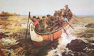
<span class="mw-page-title-main">Voyageurs</span> French Canadians who engaged in the North American fur trade

Voyageurs were 18th and 19th century French Canadians who transported furs by canoe at the peak of the North American fur trade. The emblematic meaning of the term applies to places and times where that transportation was over long distances. The voyageurs' strength and endurance was regarded as legendary. They were celebrated in folklore and music. For reasons of promised celebrity status and wealth, this position was coveted.

Grand Portage is an unincorporated community in Cook County, Minnesota, United States; located on Grand Portage Bay of the North Shore of Lake Superior.

<span class="mw-page-title-main">Portages in North America</span>

Portages in North America usually began as animal tracks and were improved by tramping or blazing. In a few places iron-plated wooden rails were laid to take a handcart. Heavily used routes sometimes evolved into roads when sledges, rollers or oxen were used, as at Methye Portage. Sometimes railways were built. The basic purpose of most canals is to avoid portages.

References

  1. "Grand Portage, Minnesota". Geographic Names Information System . United States Geological Survey, United States Department of the Interior.
  2. "NOWData – NOAA Online Weather Data". National Oceanic and Atmospheric Administration . Retrieved June 23, 2021.
  3. "Summary of Monthly Normals 1991-2020 for Grand Portage, MN". U.S. Climate Normals 2020: U.S. Monthly Climate Normals (1991–2020). National Oceanic and Atmospheric Administration . Retrieved June 23, 2021.
  4. Morse, Eric W. (1969). Fur Trade Canoe Routes of Canada/ Then and Now. Canada National and Historic Parks Branch. p. 75.
  5. "U.S. Census website". United States Census Bureau . Retrieved January 31, 2008.

47°57′50″N89°41′05″W / 47.96389°N 89.68472°W / 47.96389; -89.68472