Scotch Grove, Iowa

Last updated
Scotch Grove, Iowa
Scotch Grove.jpg
USA Iowa location map.svg
Red pog.svg
Scotch Grove
Usa edcp location map.svg
Red pog.svg
Scotch Grove
Coordinates: 42°10′22″N91°06′28″W / 42.17278°N 91.10778°W / 42.17278; -91.10778 Coordinates: 42°10′22″N91°06′28″W / 42.17278°N 91.10778°W / 42.17278; -91.10778
Country United States
State Iowa
County Jones
Elevation
876 ft (267 m)
Time zone UTC-6 (Central (CST))
  Summer (DST) UTC-5 (CDT)
Area code 319
GNIS feature ID461484 [1]
Scotch Grove Historic District
Area22 acres (8.9 ha)
NRHP reference No. 13001137 [2]
Added to NRHPFebruary 5, 2014

Scotch Grove is an unincorporated community in Jones County, Iowa, United States. Scotch Grove is located on Iowa Highway 38, southeast of Monticello and north of Center Junction. The townsite was listed as a historic district on the National Register of Historic Places in 2014. [2]

Contents

History

In 1837, the first settlers came to Scotch Grove. Most of these settlers were from the Red River Settlement, which was located in modern-day Winnipeg, Manitoba. They were sponsored by Lord Selkirk and known as the Selkirk Settlers. They had defended themselves from violent members of NW furtraders who tried to drive them out of the West. They were starved, killed, burned out and terrorized until they finally left. https://www.lordselkirk.ca/ Most families originated from Island of Mull, Scotland travelled to Hudson Bay 1812 and south by water to Lake Winnipeg and to the forks of Red river and Assiniboia River. These settlers were descendants of Scottish farmers who were evicted during the Highland Clearances.

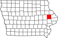
The town of Scotch Grove was laid out in 1872 by James and Charles Applegate, [3] on whose property the Davenport & St. Paul Railroad depot had been built the same year. The community developed as an agriculture-related business center in the heyday of Iowa's agricultural golden age between the 1890s and the 1920s. Unlike most other communities that developed along a railroad, it was never able to grow beyond a rural crossroads community. [4] Scotch Grove's population in 1902 was 28. [5]

The historic district at the time of its nomination consisted of 52 resources, including 41 contributing buildings, three contributing structures, and eight non-contributing buildings. [4] Among the historic buildings there are 19 commercial-related buildings, 15 houses, two railroad-related buildings, three garages and two sheds. The historic structures include a silo and the two roads that form the crossroads. The buildings that are not considered historic are more recent construction.

Notable person

Related Research Articles

<span class="mw-page-title-main">Ida County, Iowa</span> County in Iowa, United States

Ida County is a county located in the U.S. state of Iowa. As of the 2020 census the population was 7,005, making it the state's eighth-least populous county. The county seat is Ida Grove. The county was authorized by the Iowa Legislature in January 1851 as a packet of projected counties in unorganized territory of western Iowa. It was named after Ida Smith, the first child of European immigrants to be born in this region.

<span class="mw-page-title-main">Arborg, Manitoba</span> Town in Manitoba

Arborg is a town located along the Icelandic River in Manitoba. The community is located 103 kilometres north of Winnipeg, at the junction of Manitoba Highways 7 and 68, in the Interlake Region of Manitoba, Canada. The town is surrounded by the Municipality of Bifrost - Riverton and has a population of 1,279 as of the 2021 Canadian census.

<span class="mw-page-title-main">Roderick Dhu Sutherland</span> American politician

Roderick Dhu Sutherland was an American Populist Party politician.

Prices Fork is a small traditionally agricultural census-designated place (CDP), in Montgomery County, Virginia, United States. The population as of the 2010 Census was 1,066. It is located about three miles west of Blacksburg and the campus of Virginia Polytechnic Institute and State University.

<span class="mw-page-title-main">Cathedral of St. John (Winnipeg)</span> Church in Manitoba, Canada

St. John's Cathedral is an Anglican cathedral in Winnipeg, Manitoba, Canada, which is the cathedral church of the Diocese of Rupert's Land. It is located in the Luxton neighbourhood of north-end Winnipeg on Anderson Avenue near Main Street and the Red River. St. John's Cathedral marks the birthplace of the Anglican Church in western Canada.

<span class="mw-page-title-main">Outline of Iowa</span> Overview of and topical guide to Iowa

The following outline is provided as an overview of and topical guide to the U.S. state of Iowa.

<span class="mw-page-title-main">Crescent Warehouse Historic District</span> Historic district in Iowa, United States

The Crescent Warehouse Historic District is a 10.5-acre (4.2 ha) historic district in Downtown Davenport, Iowa, United States. The district is a collection of multi-story brick structures that formerly housed warehouses and factories. Most of the buildings have been converted into loft apartments. The district was listed on the National Register of Historic Places in 2003.

<span class="mw-page-title-main">Byers Station Historic District</span> Historic district in Pennsylvania, United States

Byers Station Historic District is a national historic district located in Upper Uwchlan Township, Chester County, Pennsylvania, United States. The district includes 26 contributing buildings in the crossroads community of Byers Station. The buildings date to the 19th century and include a number of notable Italianate style buildings. Notable buildings include a variety of residences, a factory, a Masonic lodge (1894), and the former Byers Hotel. The community grew around the Byers railroad station, after its opening in 1871, and continued after plumbago (graphite) was discovered in the area in 1875.

<span class="mw-page-title-main">Newton Downtown Historic District (Newton, Iowa)</span> Historic district in Iowa, United States

The Newton Downtown Historic District is a nationally recognized historic district located in Newton, Iowa, United States. It was listed on the National Register of Historic Places in 2014. At the time of its nomination it contained 85 resources, which included 60 contributing buildings, one contributing site, and 24 non-contributing buildings. Jasper County was established by the Iowa Territorial Legislature in 1846, and Newton was incorporated the following year as the county seat. The town grew slowly at first around the Jasper County Courthouse. Businesses largely served the needs of the local farmers as well as the town's residents. The Mississippi and Missouri Railroad, later the Chicago, Rock Island and Pacific Railroad, came to Newton in 1867. This changed the town's economy from agricultural-based to manufacturing, and the central business district expanded outward as the community grew. Several washing machine companies established themselves in Newton, most notably Maytag. The emergence of Maytag as a major corporation in the mid-20th century led to the transformation of the downtown area. Between 1951 and 1952, 18 businesses installed new storefronts, transforming them from their original Victorian appearance to a more modern appearance. The modernization continued into the 1960s.

<span class="mw-page-title-main">Fort Dodge Downtown Historic District</span> Historic district in Iowa, United States

Fort Dodge Downtown Historic District is a nationally recognized historic district located in Fort Dodge, Iowa, United States. It was listed on the National Register of Historic Places in 2010. Additional documentation for the district was approved by the National Park Service on January 4, 2019. At the time of its nomination it contained 177 resources, which included 100 contributing buildings, one contributing site, one contributing structure, five contributing objects, 64 non-contributing buildings, three non-contributing structures, and three non-contributing objects. The district covers the city's central business district, mainly along Central Avenue, but also along the adjoining streets as well. Commercial development in the district began with the city's original plat in 1854 and continued through the opening of the Crossroads Mall in 1964. Webster County Courthouse (1902), First National Bank Building (1908), and the Wahkonsa Hotel (1910) are all located in the district and are individually listed on the National Register.

<span class="mw-page-title-main">Corbett's/Eby's Mill Bridge</span> United States historic place

Corbett's/Eby's Mill Bridge is a historic structure located northeast of Scotch Grove, Iowa, United States. It spans the Maquoketa River for 128 feet (39 m). James S. Applegate established a gristmill near this location in 1858. He was joined by John Corbett, who obtained ownership by 1868 and expanded the operation and added a sawmill. He petitioned the Jones County Board of Supervisors for an iron bridge at this location in 1870. They agreed to pay two-thirds of the construction costs with the final third paid for by local subscriptions. The contract to construct this bridge and a similar span in Monticello was made with Miller, Jamison & Company of Cleveland. Both are single span bowstring truss bridges that were completed in November 1871. This bridge has always been identified with the mill. Samuel Eby acquired it in 1875, and it remained in the family until 1913. The bridge was originally on a loop road that circled behind the mill pond. When County Road X73 was created in 1958 it bypassed the bridge to the south. The bridge has been under private ownership ever since. It was listed on the National Register of Historic Places in 1985.

<span class="mw-page-title-main">Shelburne Village Historic District</span> Historic district in Vermont, United States

The Shelburne Village Historic District encompasses the central portion of the main village of Shelburne, Vermont. Centered on the junction of United States Route 7 with Harbor and Falls Roads, the district's architecture traces the town's history from the 18th to early 20th century. It was listed on the National Register of Historic Places in 1990.

<span class="mw-page-title-main">Cedar Rapids Central Business District Commercial Historic District</span> Historic district in Iowa, United States

The Cedar Rapids Central Business District Commercial Historic District is a nationally recognized historic district located in Cedar Rapids, Iowa, United States. It was listed on the National Register of Historic Places in 2015. At the time of its nomination it consisted of 60 resources, which included 46 contributing buildings, one contributing structure, 12 non-contributing buildings, and one non-contributing structure. Cedar Rapids was platted on the east bank of the Cedar River as Rapids City in 1841, and it was incorporated under the same name in 1849. Kingston was established on the west bank of the river in 1852. The two smaller communities consolidated in 1870 as Cedar Rapids. The streets were laid out parallel and perpendicular to the river, which flowed from the northwest to the southeast. The Chicago, Iowa and Nebraska Railroad was the first to arrive in the community in 1859 and the tracks were laid on Fourth Street on the eastern edge of the central business district. The first bridge across the river was built at Third Avenue in 1871.

<span class="mw-page-title-main">West Side Third Avenue SW Commercial Historic District</span> Historic district in Iowa, United States

The West Side Third Avenue SW Commercial Historic District is a nationally recognized historic district located in Cedar Rapids, Iowa, United States. It was listed on the National Register of Historic Places in 2014. At the time of its nomination it consisted of 10 resources, which included seven contributing buildings and three non-contributing buildings. Cedar Rapids was platted on the east bank of the Cedar River as Rapids City in 1841, and it was incorporated in 1849. Kingston was established on the west bank of the river in 1852, and it was annexed by Cedar Rapids in 1870. The streets were laid out parallel and perpendicular to the river, which flowed from the northwest to the southeast. The Chicago, Iowa & Nebraska Railway, later the Chicago & North Western Railway, was the prominent railroad on the west side of town. The first bridge across the river at Third Avenue was built in 1871. The current bridge was completed in 1912. Prior to a bridge, Rapid City and Kingston were connected by a ferry operated by David W. King, the founder of Kingston.

<span class="mw-page-title-main">Business Part of Olin Historic District</span> Historic district in Iowa, United States

The Business Part of Olin Historic District is a nationally recognized historic district located in Olin, Iowa, United States. It was listed on the National Register of Historic Places in 2014. At the time of its nomination the district consisted of 22 resources, including 18 contributing buildings and four non-contributing buildings. The district takes in the city's central business district.

<span class="mw-page-title-main">Corning Commercial Historic District</span> Historic district in Iowa, United States

The Corning Commercial Historic District is a nationally recognized historic district located in Corning, Iowa, United States. It was listed on the National Register of Historic Places in 2012. At the time of its nomination the district consisted of 78 resources, including 56 contributing buildings, one contributing site, one contributing object, 18 non-contributing buildings, and one non-contributing structure. The district covers most of the central business district. It has a linear layout, with twin main streets, associated with Central Park and the Adams County Courthouse at its uppermost end. This is an unusual town layout and is thought to be the only town in Iowa so configured. The elevation slopes down toward the East Nodaway River, south of the downtown and a light industrial area.

<span class="mw-page-title-main">Waterloo East Commercial Historic District</span> Historic district in Iowa, United States

The Waterloo East Commercial Historic District is a nationally recognized historic district located in Waterloo, Iowa, United States. It was listed on the National Register of Historic Places in 2011. At the time of its nomination the district consisted of 36 resources, including 28 contributing buildings, and eight non-contributing buildings. The city of Waterloo was established in the early 1850s. Its first settlers started developing the west side of the city before crossing the Cedar River and developing east side. The first Black Hawk County Courthouse was built on the east side in 1856 and East Waterloo Township was created two years later. As industry began to develop along the river, and the arrival of the first railroad in 1861, the commercial district on the east side began to grow. Also on the east side of town was the terminus of the streetcar-turned-interurban system. By 1900, the city became one of the primary wholesale and retail centers in northeastern Iowa. In 1911 the Black population increased significantly as workers, primarily from Mississippi, moved into town to work for the Illinois Central Railroad. The following year the saloons in town were closed and bootlegging, gambling, drugs, and prostitution started to increase in the area surrounding the central business district. All of these developed put together created the atmosphere of the downtown commercial district.

<span class="mw-page-title-main">Davenport Downtown Commercial Historic District</span> Historic district in Iowa, United States

The Davenport Downtown Commercial Historic District is a nationally recognized historic district located in the central business district of Davenport, Iowa, United States. It was listed on the National Register of Historic Places in 2020. At the time of its nomination it consisted of 43 resources, which included 33 contributing buildings, one contributing structure, and nine non-contributing buildings. In addition, the district also contains 33 buildings that are individually listed on the National Register. This historic district is bordered by four other districts: the Crescent Warehouse Historic District and the Davenport Motor Row and Industrial Historic District on the east, the Hamburg Historic District to the northwest, and the West Third Street Historic District on the west.

The Coggon Commercial Historic District is a nationally recognized historic district located in Coggon, Iowa, United States. It was listed on the National Register of Historic Places in 2019. At the time of its nomination it consisted of 18 contributing buildings. Coggon's development began in the 1880s after arrival of the railroad in town. Main Street was built perpendicular to the train tracks, which was on the west side of the central business district, so that the businesses had easy access. The east side of Main Street terminated at the Coggon Public School. The street was designed to be wider than normal to accommodate pedestrian and buggy traffic and to showcase the school building. All but three of the contributing buildings in the historic district were built between 1887 and 1912. They are one- and two-story brick structures with storefronts on the main floor. Coggon's economy expanded in the early 20th century during a period of agricultural revitalization. Automobiles started to gain prominence toward the end of this period. The town's first gas station opened in 1910. As people drove more they traveled less by train and passenger service was eventually discontinued in Coggon. Freight service, however, still utilizes the tracks on the west side of town.

<span class="mw-page-title-main">Richard L. and Verda M. Alleman Farm Historic District</span> Historic district in Iowa, United States

The Richard L. and Verda M. Alleman Farm Historic District is a nationally recognized historic district located southeast of Slater in rural Polk County, Iowa, United States. It was listed on the National Register of Historic Places in 2013. At the time of its nomination the district consisted of 18 resources, including nine contributing buildings, one contributing site, one contributing structure, one contributing object, three non-contributing buildings, and three non-contributing structures.

References

  1. "US Board on Geographic Names". United States Geological Survey. 2007-10-25. Retrieved 2008-01-31.
  2. 1 2 "National Register Information System". National Register of Historic Places . National Park Service. July 9, 2010.
  3. Corbit, Robert McClain (1910). History of Jones County, Iowa: Past and Present, Volume 1. S. J. Clarke Publishing Company. p. 595.
  4. 1 2 Jennifer A. Price. Ph.D. "Scotch Grove Historic District" (PDF). National Park Service . Retrieved 2016-11-07.
  5. Cram's Modern Atlas: The New Unrivaled New Census Edition. J. R. Gray & Company. 1902. pp. 203–207.
  6. Sutherland, Roderick Dhu, (1862 - 1915) at Biographical Directory of United States Congress