Seafar

Last updated

Seafar
North Lanarkshire UK location map.svg
Red pog.svg
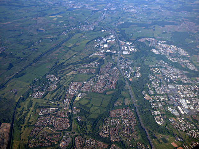
Seafar
Location within North Lanarkshire
OS grid reference NS756748
Council area
Lieutenancy area
Country Scotland
Sovereign state United Kingdom
Post town GLASGOW
Postcode district G67
Dialling code 01236
Police Scotland
Fire Scottish
Ambulance Scottish
EU Parliament Scotland
UK Parliament
Scottish Parliament
List of places
UK
Scotland
55°57′00″N3°59′35″W / 55.950°N 3.993°W / 55.950; -3.993 Coordinates: 55°57′00″N3°59′35″W / 55.950°N 3.993°W / 55.950; -3.993

Seafar is an area of the town of Cumbernauld. The original Seafar sand pit and farm were in the middle of what is now the A8011. [1] Early in the new town's history Seafar was more distinct from Ravenswood and Muirhead than it now is possibly due to the building schedule and signage on paths. [2] Recently Seafar is more dominant, perhaps because neither Ravenswood nor Muirhead appear on road signs. [3]

Cumbernauld Town in North Lanarkshire, Scotland

Cumbernauld is a large town in North Lanarkshire, Scotland. It is the tenth most-populous locality in Scotland and the most populated town in north Lanarkshire,positioned in the centre of Scotland's Central Belt. Geographically, Cumbernauld sits between east and west, being on the Scottish watershed between the Forth and the Clyde; however it is culturally far more weighted towards Glasgow and the New Town's planners thought to fill 80% of its houses from Scotland's largest city to reduce housing pressure there.

Ravenswood is an area of Cumbernauld, Scotland.

Seafar is south of the M80 motorway and is bordered by Seafar wood, planted at the time of the construction of the town. The area was the second built in the new town of Cumbernauld, its many streets are named after famous Scottish artists and writers. [4] St Mary's is its local Roman Catholic primary school. Seafar Primary School was demolished and replaced by sheltered housing in 2004. There is a Kingdom Hall of Jehovah's Witnesses next to St Mary's Primary school. The demolition of multistorey flats gave rise to a new housing development by Sanctuary Homes. Over a hundred new houses in Berryhill Road and Hume Road are due for completion in March 2018. [5]

M80 motorway road

The M80 is a motorway in Scotland's central belt, running between Glasgow and Stirling via Cumbernauld and Denny and linking the M8, M73 and M9 motorways. Following completion in 2011, the motorway is 25 miles (40 km) long. Despite being only a two lane motorway, parts of the M80 Stepps Bypass are used by around 60,000 vehicles per day.

Jehovahs Witnesses Christian denomination

Jehovah's Witnesses is a millenarian restorationist Christian denomination with nontrinitarian beliefs distinct from mainstream Christianity. The group reports a worldwide membership of approximately 8.58 million adherents involved in evangelism and an annual Memorial attendance of over 20 million. Jehovah's Witnesses are directed by the Governing Body of Jehovah's Witnesses, a group of elders in Warwick, New York, United States, which establishes all doctrines based on its interpretations of the Bible. They believe that the destruction of the present world system at Armageddon is imminent, and that the establishment of God's kingdom over the earth is the only solution for all problems faced by humanity.

Seafar lies
between the Town Centre and the M80, adjacent to Ravenswood. Cumbernauld from the air (geograph 4998799).jpg
Seafar lies between the Town Centre and the M80, adjacent to Ravenswood.

Related Research Articles

Kilsyth town in North Lanarkshire, Scotland

Kilsyth is a town and civil parish in North Lanarkshire, roughly halfway between Glasgow and Stirling in Scotland. The estimated population is 9,860. The town is famous for the Battle of Kilsyth and the religious revivals of the 18th, 19th, and 20th centuries. The town now has links with Cumbernauld at one time being part of Cumbernauld and Kilsyth District Council. The towns also have the same members of parliament at Holyrood and Westminster.

Abronhill an area in the scottish town cumbernauld

Abronhill is an area in the north-east of Cumbernauld, North Lanarkshire, Scotland. It is about a mile or two from Cumbernauld Town Centre. Abronhill was planned with its own shopping centre and has three primary schools, along with several churches. Abronhill has 41 streets. Abronhill, and particularly the now-demolished Abronhill High School,, were used extensively as the filming location for Bill Forsyth's 1981 film Gregory's Girl and its sequel Gregory's Two Girls.

Condorrat village in North Lanarkshire, Scotland, UK

Condorrat is a former village in North Lanarkshire, Scotland. Like Luggiebank, Castlecary and Dullatur, it predates the new town of Cumbernauld, but unlike those Condorrat was officially included in the designated new town area. Since then it has officially been part of Cumbernauld although it retains some of its own distinctive character. Dalshannon Farm and cottages were located in the area west of the original town and farm, and north of the Luggie. So also was a corn mill called Wood Mill. Road signs show they are is now in the western part of Condorrat towards Mollinsburn.

Lenzie settlement in East Dunbartonshire, Scotland

Lenzie is a town by the Edinburgh and Glasgow Railway in the East Dunbartonshire council area of Scotland. It is about 6 miles (10 km) north-east of Glasgow city centre and 1 mile (2 km) south of Kirkintilloch. At the 2011 census, it had a population of 8,873. The ancient barony of Lenzie was held by William de Comyn, Baron of Lenzie and Lord of Cumbernauld in the 12th century.

Greenfaulds

Greenfaulds is an area of the town of Cumbernauld in Scotland. Greenfaulds was a half council half private estate built in the late 1960s and early 1970s. The main road through the estate is a ring road with the private sector being on the outside of the road and the council side being in the inside. Although originally council houses, a large portion of the housing stock are now privately owned. The road names are associated with Walter Scott.

Carbrain neighborhood of Cumbernauld, Scotland

Carbrain /kar 'bren/ is a neighborhood in Cumbernauld, North Lanarkshire in Scotland. It gets a brief mention on William Roy's eighteenth century map of the Scottish Lowlands. In the nineteenth century it was no more than a farm steading. An early map shows just a few buildings existed in 1864. By the start of the First World War it had not grown significantly, although there was a school near the railway station. It was sometimes spelled Carbrane. Even in 1956 Carbrain was mostly farmland with a small burn flowing through it. The map seems to show this flowing possibly down the Gully and eventually feeding the Red Burn in the Vault Glen. This burn isn't named so can't be identified with the Horseward Burn from historic maps.

Twechar village in East Dunbartonshire, Scotland, United Kingdom

Twechar is a small former mining village in East Dunbartonshire, Scotland close to the boundary with North Lanarkshire. It lies between the larger towns of Cumbernauld, Kilsyth and Kirkintilloch. The Forth and Clyde Canal runs close to the village to the north, and closely follows the line of the Antonine Wall. There are visible remains of the wall on Bar Hill and the Roman Fort is a local tourist attraction.

Kildrum human settlement in United Kingdom

Kildrum was the first area to be constructed in Cumbernauld new town. It helped house the worker at the Burroughs factory at Old Inns, the first factory in Cumbernauld New Town.

Dullatur village in North Lanarkshire, Scotland, United Kingdom

Dullatur is a village near Cumbernauld, Scotland. Like Condorrat, Castlecary and Luggiebank, it predates the new town of Cumbernauld, and of those only Condorrat was officially included in the designated area. Its name is anglicised from the Gaelic Dubh Leitir, which means "dark slope". The route of the Antonine Wall passes just to the north of Dullatur. Two Roman temporary marching camps were located at Dullatur between the forts at Croy Hill and Westerwood. The camps have been excavated several times by archaeologists following aerial photography and proposed housebuilding. Both camps have now been built over, and no visible remains can be seen on the ground today. Digital reconstructions of the larger and the smaller of the camps have been created. When building the nearby Forth and Clyde Canal in the 18th century a number of finds were made in Dullatur Bog. Thomas Watson recorded: "a number of swords, pistols, and other weapons were dug out; also the bodies of men and horses, and what seems somewhat marvellous, a trooper, completely armed, and seated on his horse, in the exact posture in which he had perished." It was supposed that the man was escaping the Battle of Kilsyth which is due north of Dullatur Bog.

Luggiebank human settlement in United Kingdom

Luggiebank is a small village to the south of Cumbernauld. Like Condorrat, Castlecary and Dullatur, it predates the new town of Cumbernauld, and of those only Condorrat was officially included in the designated area. It is situated on what used to be the Stirling Road from Lanark, but as a result of a bypass (B8039) the old road is now a cul-de-sac. Unlike the rest of Cumbernauld, which was in Dunbartonshire, Luggiebank was historically in Lanarkshire, but was adopted into Dunbartonshire in 1967, prior to Cumbernauld becoming a police burgh the following year. Following further boundary changes in 1995, Luggiebank became part of North Lanarkshire.

Stepps town in Scotland, United Kindom

Stepps is a thriving settlement in North Lanarkshire, Scotland, near the north-eastern outskirts of Glasgow. It enjoys recently upgraded facilities that include a new primary school, library, and sports facilities while retaining a historic heart around its church in Whitehill Avenue and its Victorian and Edwardian housing. Excellent travel connections by road and rail mean residents work in Glasgow, Edinburgh, Falkirk, Stirling and beyond. At the same time its location means that excellent walks in the new Seven Lochs Wetland Park are on the doorstop, from which views to the Campsies and Loch Lomond can be enjoyed. It has a population of around 6,730.

Gartcosh village in North Lanarkshire, Scotland, UK

Gartcosh is a village in North Lanarkshire, Scotland. The village lies a few miles east of Glasgow, and about a mile northwest of the town of Coatbridge.

Cumbernauld Academy Secondary school in Cumbernauld, North Lanarkshire, Scotland

Cumbernauld Academy was the first comprehensive secondary school in the then 'New Town' of Cumbernauld. It was designed by Scottish architects Gratton & McLean and it opened in 1964 and is a non-denominational, co-educational, secondary school. In 2013, North Lanarkshire Council announced amalgamation of Cumbernauld High with Abronhill High to become Cumbernauld Academy in a new building to be built on existing CHS grounds.

Balloch, Cumbernauld

Balloch is an area of Cumbernauld, Scotland. It is on the north of the M80 and west of Cumbernauld Town Centre. It is also known as "Eastfield" or "Balloch Eastfield". The area it now occupies used to be covered by Balloch farm in the west side and Eastfield holdings and cemetery in the east side. Balloch is a mainly residential area of privately owned homes, although a number of council-owned houses were built when the area was first established. These are now largely privately owned as well. Locally the former council estate is commonly referred to as Eastfield and the private housing as Balloch, even though the former council estate is near the former farm and the private housing is closest to the cemetery. Balloch was developed to accommodate growing numbers of people who wished to reside in a commuter town such as Cumbernauld with easy access to Glasgow.

Westfield, Cumbernauld human settlement in United Kingdom

Westfield is an area of the town of Cumbernauld in Scotland. Westfield is a popular residential area originally built by Cumbernauld Development Corporation in the late 1970s and early 1980s. It comprises a residential area and a large industrial estate. Historically there was a farm at Westfield as shown on Roy's map of the Lowlands and the 1st 25 inch Ordnance Survey Map of Scotland. It is located near Condorrat and Broadwood Stadium, home of Clyde FC. Historically, there were two local primary schools, St Francis of Assisi Primary School and Westfield Primary School. St. Francis of Assisi Primary School closed in 2009. The site has been re-developed by North Lanarkshire Council with new, high quality social housing available to rent. The new street is named Netherinch Way. Westfield also has other modern, private developments for example a new Bellway Housing development sits near Broadwood stadium along with a neighboring housing development. Westfield has a selection of frequent bus services to Airdrie, Cumbernauld Town Centre, Glasgow, Kilsyth and Kirkintilloch with buses operated by David Allan Coaches, First Group & McGills. In 2017 plans for a new retail park near Broadwood Studium were approved.

Muirhead, North Lanarkshire human settlement in United Kingdom

Muirhead is a small town approximately 7 miles (11 km) North-East of Glasgow city centre. Nearby villages and towns include Chryston, Garnkirk, Gartcosh, Lenzie and Stepps. Muirhead has a population of around 1,390. It is a commuter town to Glasgow with road links with the A80/M80 and frequent bus services the x35, x37, and x3. Muirhead is located approximately two miles from Gartcosh, Lenzie and Stepps railway stations.

Our Lady's High School is a six-year Roman Catholic co-educational comprehensive school which opened in Ravenswood in 1968. It caters for pupils living in Cumbernauld, Muirhead, Cardowan and Stepps and in addition to pupils from Condorrat, Dullatur, Moodiesburn and Castlecary. The school's emblem is a post-modern artistic recreation of the Virgin and child.

Whitelees area of, in the north-east of Cumbernauld, North Lanarkshire, Scotland

Whitelees is an area of in the north-east of Cumbernauld, North Lanarkshire, Scotland. It is about a two and a quarter miles from Cumbernauld Town Centre. It lies between Abronhill and Wardpark South.

References

  1. "OS 25 inch Map 1892-1949". zoomable map with Bing transparency overlay. National Library of Scotland. Retrieved 10 October 2017.
  2. Taylor, Jessica (2010). Cumbernauld: The Conception, Development and Realisation of a Post-war British New Town (PDF). Edinburgh: Edinburgh College of Art. p. 57. Retrieved 25 February 2017.
  3. Colquhoun, Ian (2008). RIBA Book of British Housing 1900 to the present day (2 ed.). London etc: Elsevier. pp. 322–324. ISBN   978-0-7506-8254-1 . Retrieved 25 October 2017.
  4. "Seafar". The Gazetteer for Scotland. Retrieved 25 October 2017.
  5. "Sanctuary starts to build on Seafar sites". Cumbernauld News. 26 January 2018. Retrieved 27 January 2018.