Nyagan Airport is an airport in Khanty-Mansi Autonomous Okrug, Russia located 12 km east of Nyagan. It services medium-sized airliners. It was opened in 1993.

Severo-Evensk Airport is an airport serving and located 1 kilometre (0.62 mi) northwest of Evensk in Severo-Evensky District, Magadan Oblast, Russia. It is a small engineered airfield with concrete parking area. It handles small transport aircraft.
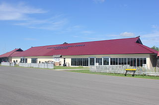
Uray Airport is an airport in Khanty-Mansi Autonomous Okrug, Russia located 4 km southeast of Uray. It services up to medium-sized airliners.

Fakfak Torea Airport, also known as Fak Fak Airport, serves the town of Fakfak, in the province of West Papua in Indonesia.
Rahadi Usman Airport or Rahadi Oesman Airport, also known as Ketapang Airport, is an airport in Ketapang, West Kalimantan, Indonesia. Rahadi Usman Airport is named after local freedom fighter, Rahadi Usman (id).

Frans Xavier Seda Airport — also known as Wai Oti Airport or Maumere Airport — is an airport serving Maumere, the capital city of Sikka Regency and the largest town on the island of Flores, in the province of East Nusa Tenggara in Indonesia. Maumere is known for its reefs in the Gulf of Maumere which were once considered some of the finest diving in the world. The airport is named in honor of Frans Seda (1926–2009), who is a former finance minister of Indonesia.

Umbu Mehang Kunda Airport, also formerly known as Mau Hau Airport, is an airport serving Waingapu, the largest town on the island of Sumba, in the province of East Nusa Tenggara in Indonesia.
Bolívar Airport is an airport serving Bolívar, a town in Bolívar Partido, Buenos Aires Province, Argentina.
Linden Airport is an airport serving Linden, the capital of the Upper Demerara-Berbice region of Guyana.
Binaka Airport is a domestic airport in Gunungsitoli, Nias Island, Indonesia. It is located in Jalan Pelabuhan Udara Binaka km. 19.5 Gunungsitoli.

Mejametalana Airport is a military airport in Maseru, the capital city of Lesotho. It served as Maseru's main airport until the opening of Moshoeshoe I International Airport, located in the town of Mazenod, about 18 km (11 mi) southeast of downtown Maseru.

Dr. Ferdinand Lumban Tobing Airport serves the city of Sibolga in the North Sumatra province of Indonesia.
Aek Godang Airport is located in North Padang Lawas Regency, North Sumatra, Indonesia.

Wunopito/Wonopito Airport, also known as Lembata Airport, is a public airport serving Lewoleba, villages in the district Nubatukan, in the province of East Nusa Tenggara in Indonesia.

Lasondre Airport is located in Batu Islands, South Nias, North Sumatra, Indonesia.
Sibisa Airport is located in Ajibata, Toba Samosir, North Sumatra, Indonesia. The airport is located 10 kilometers from Parapat city, Lake Toba.

