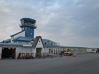
Sylt Airport is the airport on the German island of Sylt located in the municipality of the same name. It mostly features summer seasonal scheduled traffic to major German cities as well as general aviation and gliding. Sometimes the airport is referred to as Westerland/Sylt named after Westerland, a well-known part of the municipality of Sylt which however is not the nearest settlement to the airport.

Moshoeshoe I International Airport is an airport serving Maseru, the capital city of Lesotho. The airport is named in honor of Moshoeshoe I, king of Lesotho from 1822 to 1870. It is in the town of Mazenod, 18 km (11 mi) southeast of downtown Maseru.
Seshote is a community council located in the Leribe District of Lesotho. Its population in 2006 was 9,359.

Semonkong Airport is an airport serving the village of Semonkong in Maseru District, Lesotho.
Lebakeng Airport is an airport serving the settlement of Lebakeng, Lesotho.
Leribe Airport is an airport serving Hlotse, the camptown (capital) of the Leribe District of Lesotho.
Lesobeng Airport is an airstrip serving the community of Lesobeng, in the Thaba-Tseka District of Lesotho.
Mafeteng Airport is an airport serving the city of Mafeteng, the capital of Mafeteng District, Lesotho.
Matsaile Airport is an airport serving the village of Matsaile in Thaba-Tseka District, Lesotho.
Sehonghong Airport is an airport serving the community council of Sehonghong, Lesotho.
Nkaus Airport is an airport serving the village of Nkaus, Lesotho.
Mokhotlong Airport is an airport serving Mokhotlong, the camptown of Mokhotlong District, Lesotho.
Pelaneng Airport is an airport serving the settlement of Pelaneng, Lesotho.
Quthing Airport is an airport serving the settlement of Quthing, Lesotho.
Qacha's Nek Airport is an airport serving Qacha's Nek, the camptown (capital) of Qacha's Nek District in Lesotho.
Sekake Airport is an airport serving the village of Sekake, Lesotho.
Thaba-Tseka Airport is an airport serving the town of Thaba-Tseka, the camptown of Thaba-Tseka District, Lesotho.
Tlokoeng Airport is an airport serving the village of Tlokoeng in Mokhotlong District, Lesotho.
