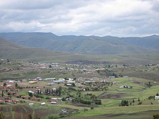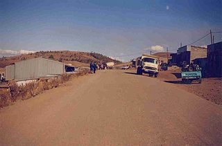
Thaba-Tseka is a district of Lesotho. Thaba-Tseka is also the name of the district's capital or camptown, which is the only town in the district. In the east, Thaba-Tseka borders on the KwaZulu-Natal Province of South Africa. Domestically, it borders on Mokhotlong District in northeast, Leribe District in north, Berea District in northwest, Maseru District in west, Mohale's Hoek District in southwest and Qacha's Nek District in the southern direction. The district is one of the major tourist attractions in Lesotho because of the second largest arch dam in Africa Katse Dam.

Thaba-Tseka is a constituency and the capital city or camptown of the Thaba-Tseka District in Lesotho. It has a population of 15,248.
A camptown, in the country of Lesotho, refers to a district capital for one of the ten districts of Lesotho. The largest camptown is the city of Maseru in Maseru District. Camptowns are usually commerce hubs for the district and are the location for the central government offices for the district. Camptowns usually take the same name as the district in which they are located. For example, as mentioned the camptown for Maseru is Maseru but also the camptown for Thaba-Tseka District is Thaba-Tseka. The exceptions to this rule are Berea District whose capital is called Teyateyaneng, Quthing District whose capital is called Moyeni and Leribe District whose capital is most often called Hlotse.
Mantšonyane is a town in central Lesotho. It is located southeast of the capital Maseru, close to the western approach to the Mokhoabong Pass, on a high mountain plateau between the towns of Marakabei and Thaba-Tseka, in the Thaba-Tseka District.

The Senqunyane River is a river of central Lesotho. The river rises in the Maluti Mountains in northwest Lesotho, and flows southwards and then westwards for 120 kilometres before joining the Senqu River in the southwest.

Administratively, Lesotho is divided into ten districts, each headed by a district administrator. Each district has a capital known as a camptown.
Linakeng is a community council located in the Thaba Tseka District of Lesotho.
Bobete is a community council located in the Thaba-Tseka District of Lesotho. Its population in 2006 was 12,966.
Bokong is a community council located in the Thaba-Tseka District of Lesotho. Its population in 2006 was 7,283.
Khohlo-Ntso is a community council located in the Thaba-Tseka District of Lesotho. Its population in 2006 was 7,264.
Senotong is a community council located in the Thaba-Tseka District of Lesotho. Its population in 2006 was 7,742.

Sandawana Football Club is a Lesotho football club based in Mpharane. It is based in the city of Makheka, Thaba-Tseka District in the region Thaba-Tseka District.
Lesobeng Airport is an airstrip serving the community of Lesobeng, in the Thaba-Tseka District of Lesotho.
Matsaile Airport is an airport serving the village of Matsaile in Thaba-Tseka District, Lesotho.
Mantšonyane Airport is an airport serving the town of Mantšonyane in Thaba-Tseka District, Lesotho.
Bobete Airport is an airport serving Bobete, a village in the Thaba-Tseka District of Lesotho.
Kolberg Airport is an airstrip serving the village of Letlapeng in the Thaba-Tseka District of Lesotho.
Mohlanapeng Airstrip is an airstrip serving the Mohlanapeng community in Thaba-Tseka District, Lesotho.
Semenanyane Airport is a well-marked airstrip serving the mission village of Semenanyane in Mokhotlong District, Lesotho. The runway is near the border with Thaba-Tseka District.


