Shaver, California

Last updated

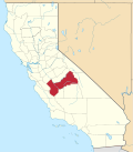
Shaver is a former settlement in Fresno County, California. [1] It was located at the north end of Shaver Lake, where a post office operated from 1896 to 1925. [1] The site is now under the waters of Shaver Lake. [1]
Related Research Articles

<span class="mw-page-title-main">Sherwin Range</span>

The Sherwin Range is a mountain range that is a sub-range of the Sierra Nevada system, in Mono County, eastern California. The range is also known locally as The Sherwins.

<span class="mw-page-title-main">Hoover Wilderness</span> Protected wilderness area in California, United States

The Hoover Wilderness is a wilderness area in the Inyo and Humboldt-Toiyabe National Forests. It lies to the east of the crest of the central Sierra Nevada in California, to the north and east of Yosemite National Park - a long strip stretching nearly to Sonora Pass on the north and Tioga Pass on the south.

<span class="mw-page-title-main">Shaver Lake</span> Reservoir in Fresno County, California

Shaver Lake is an artificial lake on Stevenson Creek, in the Sierra National Forest of Fresno County, California. At elevation 5,500 ft (1,700 m), several smaller streams also flow into the lake, and it receives water from the tunnels of Southern California Edison's Big Creek Hydroelectric Project. The town Shaver Lake is located on its south-west shore.

<span class="mw-page-title-main">Big Creek (San Joaquin River tributary)</span>

Big Creek is a 19.3-mile-long (31.1 km) tributary of the San Joaquin River in the Sierra Nevada, within the Sierra National Forest, central California.

<span class="mw-page-title-main">KLBN</span> Radio station in Fresno, California

KLBN is a commercial radio station located in Fresno, California, broadcasting on 101.9 FM. KLBN airs a regional Mexican music format branded as "La Buena". Its studios are located just north of downtown Fresno, and the transmitter tower is in Meadow Lakes in the Sierra National Forest.

<span class="mw-page-title-main">Little Yosemite Valley</span> Valley in Mariposa County, California

Little Yosemite Valley is a smaller glacial valley upstream in the Merced River drainage from the Yosemite Valley in Yosemite National Park. The Merced River meanders through the 3.5 mi (5.6 km) long flat valley, draining out over Nevada Fall and Vernal Fall before emptying into the main Yosemite Valley. It can be reached by a day hike from the main valley, and is the most popular area in the Yosemite Wilderness. The Valley provides access to nearby destinations such as the back side of Half Dome, Clouds Rest and the High Sierra Camp at Merced Lake.

<span class="mw-page-title-main">Tollhouse, California</span> Unincorporated community in California, United States

Tollhouse is an unincorporated community in Fresno County, California. It lies at an elevation of 1,919 feet (585 m). Tollhouse is located in the Sierra Nevada, 7 miles (11 km) southwest of Shaver Lake and 18 miles southwest of Huntington Lake. It is home to 2,089 people.

Huntington Lake is an unincorporated community in Fresno County, California. It is located on the west end of Huntington Lake 2 miles (3.2 km) north of Big Creek, at an elevation of 7027 feet.

<span class="mw-page-title-main">Cedar Crest, California</span> Unincorporated community in California, United States

Cedar Crest is an unincorporated community in Fresno County, California. It is located on the north side of Huntington Lake 3.5 miles (5.6 km) northeast of Big Creek, at an elevation of 7077 feet.

Lakeshore is an unincorporated community in Fresno County, California. It is located on the north shore of Huntington Lake, at an elevation of 6995 feet.

Lerona is an unincorporated community in Fresno County, California. It is located 6.5 miles (10 km) west-northwest of Shaver Lake Heights, at an elevation of 2789 feet.

Meadow Lakes is an unincorporated community in Fresno County, California. It is located 6.5 miles (10 km) west-southwest of Shaver Lake Heights, at an elevation of 4452 feet.

New Auberry is an unincorporated community in Fresno County, California. It is located 10 miles (16 km) west of Shaver Lake Heights, at an elevation of 2064 feet.

Ockenden is an unincorporated community in Fresno County, California. It is located 1.25 miles (2.0 km) south of Shaver Lake Heights, at an elevation of 5568 feet.

Pineridge is an unincorporated community in Fresno County, California. It is located 4 miles (6.4 km) southwest of Shaver Lake Heights, at an elevation of 4842 feet.

Prather is an unincorporated community in Fresno County, California. It is located 25 miles (40 km) northeast of Fresno, at an elevation of 1,657 ft (505 m). Prather has a population of 1,569.

Shaver Lake Heights is an unincorporated community in Fresno County, California. It is located on the southwest bank of Shaver Lake, at an elevation of 5600 feet.

Marshall Station is a former settlement in Fresno County, California. It was located near the south end of the Auberry Valley 3.5 miles (5.6 km) west-southwest of Prather.

<span class="mw-page-title-main">Three Chute Falls</span>

Three Chute Falls is a waterfall on Tenaya Creek in Yosemite National Park, in the U.S. state of California.

The Conness Lakes are a group of small lakes at the foot of Conness Glacier in Mono County, California, in the United States.

References

  1. 1 2 3 Durham, David L. (1998). California's Geographic Names: A Gazetteer of Historic and Modern Names of the State. Clovis, Calif.: Word Dancer Press. p. 1104-1105. ISBN   1-884995-14-4.

37°08′47.6″N119°17′55.8″W / 37.146556°N 119.298833°W / 37.146556; -119.298833