Shelby Bypass

Last updated • 7 min readFrom Wikipedia, The Free Encyclopedia

By-pass plate.svg

US 74.svg

U.S. Highway 74 Bypass

Shelby Bypass
Shelby Bypass
Opened section of Shelby Bypass in red, portion under construction in orange
Route information
Auxiliary route of US 74
Maintained by NCDOT
Length18.5 mi [1]  (29.8 km)
HistoryFirst segment opened to traffic in 2020 with no designation
Major junctions
West endUS 74.svg US 74 near Mooresboro
Major intersections
East endUS 74.svg US 74 in Shelby
Location
Country United States
State North Carolina
Counties Cleveland
Highway system

The Shelby Bypass, planned to be designated as U.S. Route 74 Bypass (US 74 Byp.), is a future 18.5-mile (29.8 km) four-lane freeway bypass of the city of Shelby along U.S. Route 74 (US 74) in Cleveland County in the U.S. state of North Carolina. It will begin at a trumpet interchange with US 74 west of Shelby, running along its northern city limits, before terminating at another trumpet interchange with US 74 on the southeast city limits of Shelby. The project will also include upgrading a stretch of US 74 from the eastern Shelby Bypass interchange to the diamond interchange with U.S. Route 74 Business (US 74 Bus.) just west of Kings Mountain. The bypass is currently under construction in six sections and is currently expected to be fully open to traffic in 2029. [1] [2]

Contents

As of 2023, currently, the only segment of the bypass that is open to traffic is the 5.6-mile (9.0 km) segment between US 74 west of Shelby to North Carolina Highway 226 (NC 226; Polkville Road) on the northwestern edge of Shelby. This segment opened to traffic on April 13, 2020, but currently has no designation. [3] The next segment, from NC 226 to North Carolina Highway 150 (NC 150; Cherryville Road) on the northeastern edge of Shelby is currently under construction and expected to open in 2024. The last segment from west of Stony Point Road to US 74 Bus. in Kings Mountain began construction in 2023, with the entire bypass expected to be completed in 2029. [4] [5] [6]

Route description

The Shelby Bypass will begin at a trumpet interchange with U.S. Route 74 (US 74) west of Shelby, east of the town of Mooresboro. US 74 will exit the mainline highway, with through traffic following onto the bypass. The bypass then will curve northeastward, following the northwestern city limits of Shelby. It will have its first service interchange with Washburn Switch Road just outside the northwest tip of the Shelby city limits, with which it will have a parclo AB2 interchange with before crossing the Charlotte Subdivision. Continuing northeast, it will have another parclo AB2 interchange with North Carolina Highway 226 (NC 226; Polkville Road) northwest of Shelby city limits. It will continue on its trek northeastward, running alongside and just outside of Shelby city limits. At its diamond interchange with North Carolina Highway 18 (NC 18; Fallston Road) on the north side of Shelby, the bypass changes direction and begins traveling southeastward. Crossing the Charlotte Subdivision again, the bypass has another diamond interchange with North Carolina Highway 150 (NC 150; Cherryville Road) on the northeastern city limits of Shelby. Here, the bypass curves slightly more due south, running along the eastern side of Shelby and the western side of the Kings Mountain Reservoir (Moss Lake), through the unincorporated area of Light Oak. The bypass will end at another trumpet interchange with US 74 southeast of Shelby, with US 74 entering the mainline highway.

While not part of the bypass itself, the project will also include improving and converting the stretch of US 74 between the eastern terminus of the Shelby Bypass to the diamond interchange with U.S. Route 74 Business (US 74 Bus.) just west of Kings Mountain to a freeway. This will create a continuous freeway from just east of Mooresboro to Interstate 85 (I-85) and U.S. Route 29 (US 29) in Kings Mountain.

History

The Shelby Bypass was planned in response to the growing traffic delays and accident rates along U.S. Route 74 (US 74) in the Shelby area, as well as stimulate local economic development. [7] The current alignment of US 74 through Shelby is itself a bypass built to bypass Downtown Shelby. This was also done as part of the North Carolina Department of Transportation (NCDOT)'s plan to upgrade US 74 between Interstate 26 (I-26) at Columbus and Interstate 85 (I-85) and U.S. Route 29 (US 29) in Kings Mountain to a complete four-lane Interstate standard freeway. [8] [9] [10] [11] The Shelby Bypass is known by NCDOT as "Project #R-2707" and is expected to cost $284 million. [1]

The Draft Environmental Impact Statement (EIS) was approved by the Federal Highway Administration (FHWA) and NCDOT in October 1998. [12] [2] In December 2006, a Land Use Management Plan was published by local leaders. [13] The Final EIS was approved in January 2008. [14] [2] The chosen proposed route (selected alternative) of the Shelby Bypass, known as Alternate 21, or the Southern Alternate, was chosen by a decision by the FHWA and NCDOT in October 2008 due to it being determined to be the Least Environmentally Damaging Practicable Alternative (LEDPA) since it has fewer impacts on surrounding prime farmlands, wetlands, noise, costs cheaper to construct, and is consistent with local land use plans and policies. [15] It was approved in December 2008. [2] The City of Shelby has also been planning "Small Area Plans" which aim to plan the land use around the locations of the future interchanges to account for the expected new traffic. [16]

On June 15, 2020, U.S. Senator of North Carolina Thom Tillis announced that the United States Department of Transportation had awarded a $25 million Infrastructure For Rebuilding America (INFRA) Grant to NCDOT to help fund improvements along the US 74 corridor, which includes the Shelby Bypass. [17] [18]

Construction on the first 2-mile (3.2 km) section of the bypass, Section R-2707AA, which runs from west of Peachtree Road to east of Kimbrell Drive (now Westlee Street) near the town of Mooresboro began in July 2013 and was completed in September 2016. This section involved the construction of the western trumpet interchange with U.S. Route 74 (US 74) west of Shelby. Construction on the next two sections, Sections R-2707AB and R-2707B, began in July 2014 and was completed in April 2018. The first of these two sections extended from east of Kimbrell Drive (now Westlee Street) to east of Plato Lee Road and was 1.9 miles (3.1 km) in length. The second extended from east of Plato Lee Road to east of North Carolina Highway 226 (NC 226; Polkville Road) and was 2.6 miles (4.2 km) in length. All three sections, which all add up to 5.6 miles (9.0 km), were opened to traffic together after the paving was completed on April 13, 2020. [19] [2] [4] AMT Engineering, a firm based in Rockville, Maryland, provided construction engineering and inspection for these three sections, while the E.S. Wagner Company, a firm based in Charlotte, was awarded the contracts to construct these three sections. [20] [21] [22]

Construction on the next section, Section R-2707C, which runs from east of NC 226 to west of North Carolina Highway 150 (NC 150; Cherryville Road) began in January 2017 and is currently expected to be completed in June 2024. This section is 5.3 miles (8.5 km) in length. [19] [2]

Section R-2707D, which extends from west of NC 150 to US 74 southeast of Shelby and is 4.1 miles (6.6 km) in length, along with Section R-2707E, which extends from US 74 southeast of Shelby to the west of Stony Point Road at U.S. Route 74 Business (US 74 Bus.) in Kings Mountain have both had their final designs and right of way acquisition completed, and construction began in 2023 with its completion set for 2029. Section R-2707D concerns the easternmost portion of the bypass, while Section R-2707E concerns the section of mainline US 74 between the bypass and Kings Mountain that will be converted into a full freeway. [19]

Controversy

The Shelby Bypass project has been particularly controversial locally due to issues caused by construction on the bypass affecting nearby homeowners over the years, such as eminent domain, taxes, land use, the delayed timeframe of the project, concerns over local impacts, local traffic access changes, and surface runoff. Due to this, there have been plenty of lawsuits that were filed against NCDOT. [23] [24] [25] [26] [27] [28] [29] [30]

Due to road damage sustained from local hurricanes in recent years, NCDOT has shifted its priority from constructing new roads to repairing existing ones. This has delayed the completion of local projects, including the Shelby Bypass. [31]

The construction of the Shelby Bypass is expected to negatively impact the survival of Hexastylis naniflora , a rare species of flowering plant endemic to the region, with over 3,000 plants expected to be lost, while over 2,000 more will be indirectly impacted, according to a 2012 report by NCDOT to the United States Fish and Wildlife Service (USFWS). [32]

Exit list

Exit numbers follow the mileage of U.S. Route 74 (US 74). The entire route is in Cleveland County.

LocationmikmExitDestinationsNotes
194312194East plate.svg
US 74.svg
US 74 east
Eastbound entrance and westbound exit; opened to traffic on April 13, 2020 [4] [5] [6]
197317197Washburn Switch RoadOpened to traffic on April 13, 2020 [4] [5] [6]
199320199NC 226.svg NC 226 (Polkville Road)Opened to traffic on April 13, 2020 [4] [5] [6]
202325202NC 18.svg NC 18 (Fallston Road)
Shelby 203327203NC 150.svg NC 150 (Cherryville Road)
208335208West plate.svg
US 74.svg
US 74 west
Eastbound exit and westbound entrance
1.000 mi = 1.609 km; 1.000 km = 0.621 mi
  •       Unopened

See also

Related Research Articles

<span class="mw-page-title-main">U.S. Route 74</span> Highway in the United States

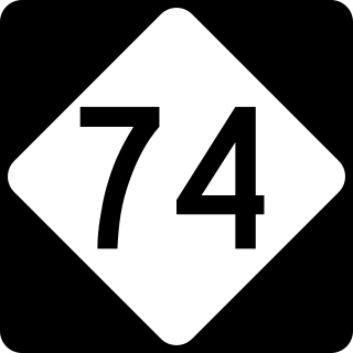
U.S. Route 74 (US 74) is an east–west United States highway that runs for 515 miles (829 km) from Chattanooga, Tennessee to Wrightsville Beach, North Carolina. Primarily in North Carolina, it serves as an important highway from the mountains to the sea, connecting the cities of Asheville, Charlotte and Wilmington. It is known as Andrew Jackson Highway throughout most of North Carolina.

<span class="mw-page-title-main">Interstate 140 (North Carolina)</span> Highway in North Carolina

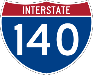
Interstate 140 (I-140) and North Carolina Highway 140 (NC 140) is a 25.4-mile (40.9 km) auxiliary Interstate Highway and state highway in the U.S. state of North Carolina. Officially designated the John Jay Burney Jr. Freeway, it serves as a bypass of Wilmington. The western terminus of the highway is at U.S. Route 17 (US 17) near Winnabow. It heads north in western Leland before turning to the east north of an interchange with U.S. Route 74 (US 74)/U.S. Route 76 (US 76). I-140 crosses the Cape Fear River north of Navassa and the Northeast Cape Fear River northwest of Wrightsboro. I-140 ends at Interstate 40 (I-40), and the route number changes to NC 140. NC 140 continues to the east, ending at US 17 in Kirkland.

<span class="mw-page-title-main">North Carolina Highway 226</span> State highway in North Carolina, US

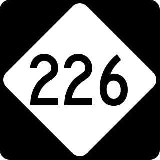
North Carolina Highway 226 (NC 226) is a primary state highway in the U.S. state of North Carolina. Traveling north–south through Western North Carolina, it connects the cities and towns of Grover, Shelby, Marion, Spruce Pine and Bakersville. It also a scenic byway in the South Mountains area and connects with the summer colony of Little Switzerland, via NC 226A.

<span class="mw-page-title-main">U.S. Route 64 in North Carolina</span> Highway in North Carolina, US

U.S. Route 64 (US 64) is the longest numbered route in the U.S. state of North Carolina, running 604 miles (972 km) from the Tennessee state line to the Outer Banks. The route passes through the westernmost municipality in the state, Murphy, and one of the most easternmost municipalities, Manteo, making US 64 a symbolic representation of the phrase "from Murphy to Manteo" which is used to refer to the expanse of the state. The highway is a major east–west route through the central and eastern portion of the state.

<span class="mw-page-title-main">Interstate 95 in North Carolina</span> Highway in North Carolina, US

Interstate 95 (I-95) is a part of the Interstate Highway System that runs along the East Coast of the United States from Miami, Florida, to the Canada–United States border at Houlton, Maine. In the state of North Carolina, the route runs for 181.36 miles (291.87 km) from the South Carolina border near Rowland to the Virginia border near Pleasant Hill. The highway serves the cities of Lumberton, Fayetteville, Wilson, Rocky Mount, and Roanoke Rapids. The route goes through a mostly rural area of the state, avoiding most of the major metro areas of North Carolina. It forms the informal border between the Piedmont and Atlantic Plain regions of the state.

<span class="mw-page-title-main">Winston-Salem Northern Beltway</span> Highway in North Carolina

The Winston-Salem Northern Beltway is a partially completed freeway loop around the city of Winston-Salem in North Carolina. The western section has been designated as North Carolina Highway 452 (NC 452), which will become I-274 when completed, and the eastern section of the beltway will be designated as North Carolina Highway 74 (NC 74), which will become part of I-74 when completed. The entire route is in Forsyth County.

<span class="mw-page-title-main">Interstate 74 in North Carolina</span> Highway in North Carolina

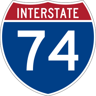
Interstate 74 (I-74) is a partially completed part of the Interstate Highway System that is planned to run from Davenport, Iowa, to Myrtle Beach, South Carolina. In the US state of North Carolina, I-74 currently exists in three distinct segments; from I-77 at the Virginia state line to US Highway 52 (US 52) near Mount Airy, from I-40 in Winston-Salem to US 220 near Ellerbe, and from US 74 and US 74 Business near Maxton to US 74/North Carolina Highway 41 (NC 41) near Lumberton. I-74 has an extensive concurrency with I-73 from Randleman to Ellerbe in the Piedmont. When completed, I-74 will link the cities of Mount Airy, Winston-Salem, High Point, Rockingham, Laurinburg, and Lumberton.

<span class="mw-page-title-main">Interstate 40 in North Carolina</span> Highway with its western terminus at the Tennessee state line

Interstate 40 (I-40) is a part of the Interstate Highway System that travels 2,556.61 miles (4,114.46 km) from Barstow, California, to Wilmington, North Carolina. In North Carolina, I-40 travels 420.21 miles (676.26 km) across the entirety of the state from the Tennessee state line along the Pigeon River Gorge to U.S. Highway 117 (US 117) and North Carolina Highway 132 (NC 132) in Wilmington. I-40 is the longest Interstate Highway in North Carolina and is the only Interstate to completely span the state from west to east.

<span class="mw-page-title-main">Interstate 77 in North Carolina</span> Highway in North Carolina

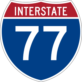
Interstate 77 (I-77) is a part of the Interstate Highway System that runs from Columbia, South Carolina, to Cleveland, Ohio. In North Carolina, I-77 enters the state at Charlotte, from South Carolina. Crossing the Piedmont, it connects with Statesville before continuing north into Virginia. The landscapes traversed by I-77 is a contrast of urban and rural foothills, with views of the Blue Ridge Mountains seen from a distance on its most northern section. The Interstate extends for 105.7 miles (170.1 km) and has one auxiliary route.

<span class="mw-page-title-main">Interstate 73 in North Carolina</span> Highway in North Carolina

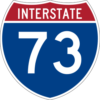
Interstate 73 (I-73) is a partially completed Interstate Highway in the US state of North Carolina, traversing the state from south of Ellerbe to near Summerfield through Asheboro and Greensboro. When completed, it will continue south toward Myrtle Beach, South Carolina, and north to Martinsville, Virginia.

<span class="mw-page-title-main">U.S. Route 70 Bypass (Goldsboro, North Carolina)</span> Highway in North Carolina

U.S. Route 70 Bypass is a bypass route of US 70 in North Carolina that runs west of Goldsboro to La Grange. Formerly known as North Carolina Highway 44 (NC 44) from 2011 to 2016, its current designation is also only temporary as it will become part of Interstate 42 (I-42).

<span class="mw-page-title-main">U.S. Route 70 in North Carolina</span> Highway in North Carolina

U.S. Route 70 (US 70) is a part of the United States Numbered Highway System that runs from Globe, Arizona, to the Crystal Coast of the US state of North Carolina. In North Carolina, it is a major 488-mile-long (785 km) east–west highway that runs from the Tennessee border to the Atlantic Ocean. From the Tennessee state line near Paint Rock to Asheville it follows the historic Dixie Highway, running concurrently with US 25. The highway connects several major cities including Asheville, High Point, Greensboro, Durham, Raleigh, Goldsboro, and New Bern. From Beaufort on east, US 70 shares part of the Outer Banks Scenic Byway, a National Scenic Byway, before ending in the community of Atlantic, located along Core Sound.

<span class="mw-page-title-main">Interstate 795 (North Carolina)</span> Highway in North Carolina

Interstate 795 (I-795) is a 25.49-mile (41.02 km) auxiliary Interstate Highway in the US state of North Carolina. It connects the city of Goldsboro to I-95 just south of Wilson, paralleling the northern portion of US Route 117 (US 117). The road runs a five-mile (8.0 km) concurrency with US 264 and I-587 in the last section of the route. It serves as a primary freeway spur for the city of Goldsboro to the Interstate Highway System, as well part of a major cargo route for the cities of Down East, which was a part of the impetus for its designation in 2007.

<span class="mw-page-title-main">U.S. Route 1 in North Carolina</span>

U.S. Highway 1 (US 1) is a north–south United States Numbered Highway which runs along the East Coast of the U.S. between Key West, Florida, and the Canada–United States border near Fort Kent, Maine. In North Carolina, US 1 runs for 174.1 miles (280.2 km) across the central region of the state. The highway enters North Carolina from South Carolina, southwest of Rockingham. US 1 runs northeast, passing through or closely bypassing Southern Pines and Sanford in the Sandhills region. It next passes through Cary, the state capital of Raleigh, and Wake Forest. The highway continues north to Henderson, before leaving the state at the Virginia state line, near Wise. The route is mostly a multilane divided arterial road, with several freeway segments. It serves as a strategic highway, connecting the North Carolina Sandhills and Research Triangle regions northward to the Southside region.

<span class="mw-page-title-main">U.S. Route 52 in North Carolina</span> Section of U.S. Highway in North Carolina, United States

U.S. Route 52 (US 52) is a north–south United States highway that runs for 150 miles (240 km) from the South Carolina state line, near McFarlan, to the Virginia state line, near Mount Airy. It serves as a strategic highway through the central North Carolina Piedmont. Because of its alignment in the state, US 52 does not follow the standard convention of an even U.S. route number going east–west.

<span class="mw-page-title-main">U.S. Route 221 in North Carolina</span>

In the U.S. state of North Carolina U.S. Route 221 (US 221) is a north–south highway that travels through Western North Carolina. From Chesnee, South Carolina to Independence, Virginia, it connects the cities of Rutherfordton, Marion, Boone and Jefferson between the two out-of-state destinations. Its most memorable section, known as the Little Parkway Scenic Byway between Linville and Blowing Rock, offers area visitors a curvier alternative to the Blue Ridge Parkway and access to Grandfather Mountain.

<span class="mw-page-title-main">Special routes of U.S. Route 74</span>

Several special routes of U.S. Route 74 exist. In order from west to east they are as follows.

<span class="mw-page-title-main">North Carolina Highway 180</span> State highway in Cleveland County, North Carolina, US

North Carolina Highway 180 (NC 180) is a primary state highway in the U.S. state of North Carolina. The highway serves as a bypass east of Shelby, serving as an alternate through route of NC 18.

<span class="mw-page-title-main">Hampstead Bypass (North Carolina)</span> Proposed state highway in North Carolina

The Hampstead Bypass, likely to be designated as U.S. Highway 17 Bypass, is a planned route in the U.S. state of North Carolina, serving as a bypass of Ogden and Hampstead. It will consist of two sections which meet at North Carolina Highway 140 (NC 140): a limited-access extension of Military Cutoff Road, temporarily designated as North Carolina Highway 417 (NC 417), and a controlled-access portion that will serve as a bypass of Hampstead. The Military Cutoff Road extension began construction in 2017 and opened to traffic on September 28, 2023. Construction on the first portion of the Hampstead Bypass began on March 11, 2022 and is expected to be completed in 2026. Construction on the second portion is expected to begin soon after and be completed in 2030.

<span class="mw-page-title-main">Interstate 885</span> Highway in North Carolina

Interstate 885 (I-885) and North Carolina Highway 885 (NC 885) is an 11.5-mile (18.5 km) auxiliary Interstate Highway and state highway in the U.S. state of North Carolina. It links NC 540 and I-40 to I-85 in the Durham area. The route consists of two previously preexisting segments of freeway—NC 147 to the south and US 70 to the north—connected by the East End Connector, which opened to traffic on June 30, 2022.

References

  1. 1 2 3 "U.S. 74 Shelby Bypass". North Carolina Department of Transportation. Archived from the original on July 16, 2022. Retrieved July 16, 2022.
  2. 1 2 3 4 5 6 Merger Team Update (PDF). North Carolina Department of Transportation. January 24, 2018. p. 22. Archived (PDF) from the original on May 30, 2021. Retrieved July 16, 2022.
  3. "R-2702 Cleveland County, US 74 Shelby Bypass" (PDF). North Carolina Department of Transportation. Archived (PDF) from the original on March 7, 2016. Retrieved March 6, 2016.
  4. 1 2 3 4 5 Sitzes, Rebecca (April 15, 2020). "New Segment of Bypass Open for Business". Shelby Star. Archived from the original on December 2, 2020.
  5. 1 2 3 4 Howard, Wayne (April 19, 2020). "First Section of Shelby Bypass Opens". Lincoln Herald. Archived from the original on July 18, 2022. Retrieved July 16, 2022.
  6. 1 2 3 4 "Shelby Bypass Segment Opening Tuesday". North Carolina Department of Transportation. April 13, 2020. Archived from the original on January 26, 2021. Retrieved July 16, 2022.
  7. Huguley, Collin (February 26, 2020). "How Shelby bypass project could drive development in region". WSOC-TV. Archived from the original on July 16, 2022. Retrieved July 16, 2022.
  8. Malme, Robert. "Future, Future NC Interstates?". Malme Roads. Archived from the original on May 11, 2022. Retrieved July 16, 2022.[ self-published source ]
  9. "2018–2027 State Transportation Improvement Program". North Carolina Department of Transportation. Archived from the original on June 27, 2018. Retrieved July 18, 2022.
  10. Justice, Leah (February 25, 2020). "Polk approves US 74 resolution". Tryon Daily Bulletin. Archived from the original on March 2, 2020. Retrieved July 16, 2022.
  11. Whitmire, Tim (August 7, 2005). "New road to bypass the bypass". Star-News. Wilmington, North Carolina. Archived from the original on July 16, 2022. Retrieved July 16, 2022.
  12. US 74 Shelby Bypass Cleveland County, North Carolina Federal Aid Project No. NHF-74(14) State Project No. 8.1801001 T.I.P. No. R-2707 Administrative Action Draft Environmental Impact Statement. November 13, 1998. p. 192. Archived from the original on July 16, 2022. Retrieved July 16, 2022.
  13. "Shelbyville Bypass Corridor Land Use Management Plan" (PDF). December 2006. p. 208. Archived (PDF) from the original on July 18, 2022. Retrieved July 16, 2022.
  14. US 74 Shelby Bypass Cleveland County, North Carolina Federal Aid Project No. NHF-74(14) State Project No. 8.1801001 WBS Number 34497.1.2 T.I.P. No. R-2702. Federal Highway Administration. March 10, 2018. p. 95. Archived from the original on July 18, 2022. Retrieved July 16, 2022.
  15. Record of decision US 74 Shelby bypass, from 0.6 mile west of SR 1162 to SR 1001, Cleveland County, North Carolina : FWHA-NC-EIS-97-02-F, federal aid project number NHF-74(14), state project number 8.1801001, WBS number 34497.1.2, T.I.P. project number R-2707. Federal Highway Administration and North Carolina Department of Transportation. October 2008. p. 72. Archived from the original on July 18, 2022. Retrieved July 16, 2022.
  16. US 74 Bypass Small Area Plans. Shelby, North Carolina. April 2015. p. 9. Archived from the original on July 18, 2022. Retrieved July 16, 2022.
  17. Huguley, Collin (June 16, 2020). "Shelby bypass project receives $25M in federal funds". Charlotte Business Journal. Archived from the original on October 29, 2020. Retrieved July 16, 2022.
  18. "Following Tillis' Support, DOT Awards $25 Million Grant to Make Improvement to US-74, Complete Bypass Around Shelby" (Press release). Office of Senator Thom Tillis. June 15, 2020. Archived from the original on July 17, 2022. Retrieved July 17, 2022.
  19. 1 2 3 "U.S. 74 Shelby Bypass – Project Highlights". North Carolina Department of Transportation. Archived from the original on February 26, 2021. Retrieved July 16, 2022.
  20. "US 74 Shelby Bypass". AMT Engineering. Archived from the original on July 18, 2022. Retrieved July 16, 2022.
  21. "E.S. Wagner Company, LLC Performing 'Shelby Bypass' Phases I & II for NCDOT". E.S. Wagner Company. Archived from the original on April 27, 2019. Retrieved July 16, 2022.
  22. "ESW LLC was awarded the Phase 3 of the Shelby Bypass in Cleveland County, NC" (Press release). E.S. Wagner Company. Archived from the original on May 9, 2019. Retrieved July 16, 2022.
  23. "Shelby Bypass Road Widening/New Highway". NC Eminent Domain Law Firm. Archived from the original on July 25, 2021. Retrieved July 16, 2022.
  24. White, Casey (February 9, 2018). "Residents weigh in on the path of the bypass". Shelby Star. Archived from the original on July 18, 2022. Retrieved July 16, 2022.
  25. Phipps, Molly (March 9, 2014). "Will travelers bypass Shelby? Leaders talk impacts of new 74 highway route". Shelby Star. Archived from the original on May 19, 2015. Retrieved July 18, 2022.
  26. Morgan, Sarah-Blake (April 30, 2014). "Lawsuit filed over Hwy 74 Bypass construction". WBTV. Archived from the original on July 16, 2022. Retrieved July 16, 2022.
  27. Orlando, Joyce (February 1, 2021). "Homeowner says 74 Bypass construction runoff is damaging her property". Shelby Star. Archived from the original on July 16, 2022. Retrieved July 16, 2022.
  28. "U.S. 74 Shelby Bypass". HensonFuerst Land Condemnation Attorneys. Archived from the original on July 16, 2022. Retrieved July 16, 2022.
  29. Abrams, Stan (May 1, 2018). "Massive US 74 Shelby Bypass Project Leaves Property Owners With Questions, Concerns of Lost Value" (Press release). NC Eminent Domain Law Firm. Archived from the original on July 16, 2022. Retrieved July 16, 2022 via PRWeb.
  30. Morgan, Sarah-Blake (May 20, 2014). "Shelby landowners consider suing NCDOT". WBTV. Archived from the original on July 16, 2022. Retrieved July 16, 2022.
  31. George, Dustin (October 17, 2019). "Road projects around Cleveland County hit delays". Shelby Star. Archived from the original on July 18, 2022. Retrieved July 16, 2022.
  32. Wagner, Jacqueline (2013). Developing New Morphological, Geographic, and Molecular Tools to Circumscribe Hexastylis Naniflora (PDF). University of North Carolina at Greensboro. p. 70. Archived (PDF) from the original on July 18, 2022. Retrieved July 16, 2022.
Template:Attached KML/Shelby Bypass
KML is not from Wikidata