Shewalton House and estate

Last updated

Shewalton House and estate
North Ayrshire UK location map.svg
Red pog.svg
Shewalton House and estate
Location within North Ayrshire
OS grid reference NS3528636925
Council area
Lieutenancy area
Country Scotland
Sovereign state United Kingdom
Post town Irvine
Police Scotland
Fire Scottish
Ambulance Scottish
Scottish Parliament
List of places
UK
Scotland
55°35′52″N4°36′57″W / 55.5979°N 4.6157°W / 55.5979; -4.6157
The River Irvine downstream from the site of the old Shewalton House. Shewalton2.JPG
The River Irvine downstream from the site of the old Shewalton House.

Shewalton House and estate were composed of the 'Lands of Shewalton' and the laird's dwelling, originally a tower castle and later a mansion house [1] on the River Irvine in the Shewalton area, two miles from Irvine and west of Drybridge village, East Ayrshire, Dundonald Parish, Scotland. [2] In 1883 the Boyle's estate of Shewalton was 2,358 acres in extent in Ayrshire and was worth at that time £2,708 a year. [3]

Contents

History

The lands of Shewalton had been held by the Fullartons of that Ilk and by 1545 they were home to the Wallace family. The Earl of Glasgow later purchased the estate. [4] The tower castle became ruinous and uninhabitable, but stood until the new house was built in 1806. 'Sewalton' was the spelling used in 1473. [1]

Shewalton House

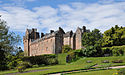
Colonel John Boyle in 1806 had the mansion house built to a Georgian design, backing onto the River Irvine. The building had a partly subterranean ground floor with two floor above and a rather unusual attic space. [2] Two hipped roofed bays stood on either side of a slightly recessed central bay area, fronted by a solidly simple porch. Another wing was later added to the western aspect of the mansion. [4]

In 1896 the OS map shows a large walled garden, Shewalton Mains Farm and lodges at the end of the East, West and Mid drives. The mansion house had fountains in the gardens on the river facing side and a small summer house was located in an elevated position near the river bank. [5]

A whale skeleton was unearthed in at the water meetings where the Annick Water joins the River Irvine and the ribs were used to form archways in the Shewalton Gardens whilst the vertebrae were used by Irvine weavers as weights on their looms. [6]

George Frederick Boyle (1825–1890) was the 6th Earl of Glasgow and by 1888 he had bankrupted the estate through generous endowment of the Tractarian movement of churches in Scotland, particularly his funding of the Cathedral of The Isles on Great Cumbrae. In 1890 the earldom passed to David Boyle of Shewalton (1833–1915), the earl's cousin, who had decided to sell his own estates, including Shewalton, to buy back the Kelburn Estate which had been put up for auction. [7] [8]

OS maps show that the mansion house had been demolished by 1958 and the main remaining estate feature was the walled garden, all three lodges having also been demolished as had the old school building next to the east lodge. Shewalton Lodge and Tanglewood are two properties now (2014) located within the old estate grounds. [9]

The Lairds of Shewalton

Fullartons and Wallaces

Lambert Wallace in 1473 held the lands under John de Fullarton of that Ilk [1] and the family were in possession of the lands until 1715. [10] John Wallace of Sewalton (sic) is recorded in 1583, Edward Wallace in 1586, William Wallace in 1595, David Wallace in 1615. [1] Edward Wallace sold Shewalton, Marress near Irvine, and Waxford to William Boyle in 1715. This William Boyle was the brother of David, first Earl of Glasgow. [11]

Boyles

Memorial at Dundonald Church to David Boyle. David Boyles Memorial at Dundonald.JPG
Memorial at Dundonald Church to David Boyle.
The Irvine below the site of an old Summer House and the mansion house. River Irvine at Shewalton.JPG
The Irvine below the site of an old Summer House and the mansion house.

Patrick Boyle, born in 1690, was raised to the bench as Lord Shewalton in 1746, was son of David, the first Earl of Glasgow. He died in 1761. [12] The Hon. Patrick Boyle, second son of the second Earl of Glasgow, born on 22 July 1771, inherited the estate and died in 1798. In 1837, Colonel of the Ayrshire Militia, John Boyle, died and David Boyle, his only surviving brother, inherited.

David Boyle was born in 1772, was twice married and was M.P. for Ayrshire in 1793, Lord Justice-General of Scotland and Lord President of the Court Session in 1841. [12] He died on 4 February 1853 and was buried at Shewalton, however a memorial to him resides at the family burial plot in Dundonald Church (See photograph). [12] In 1865 a statue of Boyle was erected in Irvine and now stands in Castle Street after being moved from the east end of the town's High Street. [4] [13] He had adopted the designation 'of Shewalton', having formerly held the designation 'of Marress'. [12] David was the presiding judge and sentenced the murderers Burke and Hare. He was said to have had "some of the greatest judicial imperfections and some of the greatest judicial excellencies, to be of untiring industry, perfect candour, and held the principles of a gentleman, and a very sensitive conscience, with a heart resolute in honesty." [14]

Patrick Boyle inherited Shewalton from his father in 1853 and when he died in 1874 his son Captain David Boyle, R.N. inherited, becoming a Lieutenant of Ayrshire and later Convenor of the County of Ayr. [10] In October 1789 Patrick's wife and children travelled down to Bath and details of their journey via the Brownhill Inn, etc. survive as letters to Patrick. [15]

The family crest was an eagle, displayed, with two heads and the family motto was 'Dominus providebit', 'The Lord Will Provide'. [16]

Kenneths

In 1865 Shewalton House was the property of a Messrs. Archibald Kenneth and Sons, Dreghorn, who owned the nearby Montgomeryfield and other coal pits in Ayrshire. [17] [18]

The Shewalton area

Archaeology

A number of prehistoric artifacts have been found on Shewalton Moor, including an urn, ornamented hand-made pottery, flint scrapers, drills, and arrowheads of several different designs. [19] So many polishers were found at one site that a workshop and prehistoric village location have been suggested. [20] A saddle-quern and a spindle-whorl have also been found, together with beads and hammer stones. [21]

The menhir at Drybridge Drybridgestone.jpg
The menhir at Drybridge

The standing stone at Stane Field (NS 359 364), Drybridge, is the only one recorded in mainland North Ayrshire. It stands close to the old railway station on level ground in a field. It has a maximum height of 2.6 m, and is roughly square with a girth of about 4.0 m and a maximum width of 1.3 m. A perforated stone axe head was found nearby.

Shewalton Mill

Looking upstream towards the site of Shewalton House. Shewalton1.JPG
Looking upstream towards the site of Shewalton House.

Shewalton Mill was a corn mill on the River Irvine, first recorded in the 17th century and shown with a weir across the river in the 19th century, [22] [23] but is now a total ruin with only remnants of the weir surviving (datum 2012). John Cullen, buried at Dundonald, was one of the millers at Shewalton and died in 1797 aged 59. [24]

The two storey mill at Shewalton was operated via a sluice in the substantial weir and it had two waterwheels; unusually these were both fully enclosed and slate roofed. A lade ran from the sluice to rejoin the river resulting in a long and thin island bordering the river. [25]

A glacial erratic boulder in the old mill yard survives in situ and is recorded on OS maps, used it seems as a loupin on stane.

Coal mining

Coal mining provided employment on a large scale in North Ayrshire from early in the 19th century. Coal pits were opened at this time in Shewalton, Fairlie, Peatland, Templeton, and Fortacres. [26] A colliery was located near the west lodge with a mineral railway line shown as crossing the river at this point in 1925. [27] A. Kenneth and Sons's Shewalton collieries 3 and 4 were at Drybridge, opening in 1924 to produce house coal, employing around 180 miners until closure in 1955. The two colliery shafts were 132m deep and the extracted coal was taken to Montgomeryfield screening plant and washer. [28]

Shewalton Collieries 5 and 6 opened in 1933 and closed in 1950 with a workforce of around 150, mining house coal, which was also taken to the Montgomeryfield screening plant and washer. [29]

Drybridge School

As stated, the small school once stood near the Shewalton East Lodge. It belonged to trustees of the Shewalton Estate, but was offered for use by Captain Boyle of Shewalton. The school at Dundonald was overcrowded and Drybridge School was opened in 1879 after considerable alterations with Mr. McKissock and Miss Miller as teachers. [30]

Transport

The Kilmarnock and Troon Railway opened in 1812 and ran near to Shewalton House. Drybridge railway station lay close by on the route of the old line from Kilmarnock to Troon. Shewalton Road runs through the area. The Earl of Eglinton was a shareholder in the Kilmarnock and Troon Railway, with the Duke of Portland who was the majority holder and Captain Boyle who had a single share, but therefore still a joint owner as the railway company was only the leaseholder. [31]

Micro-history

Shewalton Wood. Shewalton Moss - geograph.org.uk - 1671293.jpg
Shewalton Wood.

The Caledonian Pulp Mill is located on the western margin of Shewalton Moss. It was opened in 1989 by Prince Philip, Duke of Edinburgh. The factory produces glossy paper for magazines and other publications, using china clay brought in by train from Cornwall. [32] After Shewalton House was demolished a ball bearing factory was built nearby and the industrial estate also built here occupies part of the old estate's deer park. [32]

Johnson's 1828 map gives the name 'Paulston' for a dwelling on Shewalton Road and the 'stone' or menhir is both shown and named as such.

GlaxoSmithKline have a large factory nearby on Shewalton Road that manufactures prescription products.

Shewalton Woods, Shewalton Sand Pits, Oldhall Ponds and the nearby Trocol Pond are Scottish Wildlife Trust nature reserves. [33]

Extensive sand and gravel extraction has taken place within the Shewalton area leaving flooded quarries and areas used by North Ayrshire Council for disposing of certain categories of household waste.

Flooded sand and gravel quarry at Shewalton. Shewalton Sandpits Nature Reserve - geograph.org.uk - 1671277.jpg
Flooded sand and gravel quarry at Shewalton.

See also

Related Research Articles

Cunninghamhead is a hamlet in North Ayrshire, Scotland. It was the centre of the lands of Cunninghamhead, Perceton and Annick Lodge in Cunninghame. This mainly rural area is noted for its milk and cheese production and the Ayrshire, Cunninghame or Dunlop breed of cattle.

The Kilmarnock and Troon Railway was an early railway line in Ayrshire, Scotland. It was constructed to bring coal from pits around Kilmarnock to coastal shipping at Troon Harbour, and passengers were carried.

Drybridge is a small village in North Ayrshire, Scotland. Drybridge is thus named because of the "dry bridge" over the Kilmarnock and Troon Railway, opened in 1812. The nearby "wet bridge" is the Laigh Milton Viaduct, the oldest surviving railway bridge in Scotland and possibly the world.

Annick Lodge is an estate between Perceton and Cunninghamhead in North Ayrshire, Scotland.

Thorntoun School was opened by Barnardo's in September 1971 for children with emotional difficulties aged 11 to 16 years. The school closed in 1990 and Thorntoun is now a nursing home. The complex lies between the villages of Springside and Crosshouse, Kilmarnock in East Ayrshire, Scotland. The old Thorntoun mansion house was demolished in the late 1960s, leaving the West Lodge, some of the home farm outbuildings, the stables and the walled garden as 'memorials' to the ancient history of the site. Many fine trees remain from the estate policies and the surviving gardens are very well maintained (2007). An entrance with a slight deviation from the old course has been created to serve the large modern buildings which house the nursing home.

<span class="mw-page-title-main">Laigh Milton Viaduct</span> Bridge in Laigh Milton mill at Gatehead in East Ayrshire, Scotland

Laigh Milton Viaduct is a railway viaduct near Laigh Milton mill to the west of Gatehead in East Ayrshire, Scotland, about five miles west of Kilmarnock. It is probably the world's earliest surviving railway viaduct on a public railway, and the earliest known survivor of a type of multi-span railway structure subsequently adopted universally.

The village or hamlet of Gatehead is located in East Ayrshire, Parish of Kilmaurs, Scotland. It is one and a quarter miles from Crosshouse and one and a half miles from Kilmarnock. In the 18th and 19th centuries the locality was a busy coal mining district. The settlement runs down to the River Irvine where a ford and later a bridge was located.

<span class="mw-page-title-main">Springside, North Ayrshire</span> Village in North Ayrshire, Scotland, UK

Springside is a village in the parish of Dreghorn, in the council area of North Ayrshire, Scotland. It is three miles from Irvine, 1+12 miles west of Crosshouse, and four miles from Kilmarnock. In the 18th, 19th and mid-20th centuries, the locality was a highly industrialised coal mining district. The settlement is on the Garrier Burn, which forms the boundary with East Ayrshire. Springside had a population of around 1364 in 1991. The A71 now bypasses the village, 14 mile to the south.

Knockentiber is a village in East Ayrshire, Parish of Kilmaurs, Scotland. Knockentiber is two miles west-northwest of Kilmarnock and 12 mile northeast of Crosshouse. Latitude:55.6193°N Longitude:4.5455°W and grid reference NS397392. The population was 359 in 1991, however the population is much higher following the construction of several housing estates (2007). In the 18th and 19th and mid 20th centuries the locality was a highly industrialised coal mining district. The settlement is on the Carmel Burn, which runs into the River Irvine, around one mile to the south.

<span class="mw-page-title-main">River Irvine</span> River in southwest Scotland

The River Irvine is a river that flows through southwest Scotland. Its watershed is on the Lanarkshire border of Ayrshire at an altitude of 810 feet (250 m) above sea-level, near Loudoun Hill, Drumclog, and 7 miles SW by W of Strathaven. It flows 29+12 mi (47.5 km) westward, dividing the old district of Cunninghame from that of Kyle, until it reaches the sea via Irvine Harbour in the form of the Firth of Clyde, and flows into Irvine Bay by the town of Irvine. It has many tributaries, some of which form parish, district and other boundaries.

Riccarton is a village and parish in East Ayrshire, Scotland. It lies across the River Irvine from Kilmarnock, this river forming the boundary between Riccarton and Kilmarnock parishes, and also between the historical districts of Kyle and Cunningham. The name is a corruption of 'Richard's town', traditionally said to refer to Richard Wallace, the uncle of Sir William Wallace. The parish also contains the village of Hurlford.

<span class="mw-page-title-main">Auchans Castle, Ayrshire</span>

Auchans Castle, House, House of Auchans or Old Auchans, is a mock military mansion, Category A listed, T-plan building of a late 16th-century date converted to the L-plan during the early-to-mid-17th century; its ruins stand about 1 km W of Dundonald, South Ayrshire, Scotland. Parish of Dundonald. It was held at various times by the Wallace, Cochrane and Montgomerie families.

<span class="mw-page-title-main">Crosbie Castle and the Fullarton estate</span>

Crosbie Castle and the Fullarton estate lie near Troon in South Ayrshire. The site was the home of the Fullarton family for several centuries. The lands were part of the feudal Barony of Corsbie Fullartoune (sic). The Crosbie Castle ruins were eventually used as an ice house after the new Fullarton House mansion was built. The mansion house was later demolished and the area set aside as a public park and golf course.

<span class="mw-page-title-main">Industry and the Eglinton Castle estate</span>

The Eglinton Castle estate was situated at Irvine, on the outskirts of Kilwinning, North Ayrshire, Scotland in the former district of Cunninghame. Eglinton Castle, was once home to the Montgomeries, Earls of Eglinton and chiefs of the Clan Montgomery. Eglinton Country Park now occupies part of the site.

<span class="mw-page-title-main">Castle and Barony of Robertland</span>

The Castle and Barony of Robertland is located near Stewarton, off the B769 road, in the old district of Cunninghame, Parish of Stewarton, and now part of East Ayrshire, Scotland.

<span class="mw-page-title-main">Galrigs Loch (South Ayrshire)</span> Old freshwater loch in South Ayrshire, Scotland

The Galrigs Loch was a substantial freshwater loch situated in low lying area between Newfield and Dundonald in South Ayrshire, Scotland. It was drained in the early 18th century.

The old village or hamlet of Old Rome, Rome or Old Rome Ford is located in South Ayrshire, Parish of Dundonald, Scotland. It is one and a half miles from Crosshouse and one and less than a quarter of a mile from Gatehead. In the 18th and 19th centuries the locality was a busy coal mining district and many of the houses have been demolished. The settlement is situated near the River Irvine.

The lands of Broomlands or Broumlands formed a small country estate about a mile to the east of Irvine, North Ayrshire, Scotland situated on the east bank of the Annick Water in the Parishes of Dreghorn and Irvine.

<span class="mw-page-title-main">Towerlands Tram Road</span>

The Towerlands Tram Road was a 19th-century mineral railway or 'Bogey line' that transported coal, running from the old Towerlands Colliery and associated coal pits near Bourtreehill to Irvine in one direction and to Dreghorn in the other direction. Both towns are located in North Ayrshire, Scotland.

<span class="mw-page-title-main">Earlston, East Ayrshire</span> Human settlement in Scotland

Earlston is a hamlet in Riccarton, East Ayrshire, Scotland. The habitation dates from at least the early 18th century and is near Caprington Castle and Todrigs Mill. It was for many years the site of a large sawmill and a mine pumping engine, and had sidings of the Glasgow and South-Western Railway's Fairlie Branch.

References

Notes
  1. 1 2 3 4 Paterson, Page 491
  2. 1 2 Love (2005), Page 54
  3. National Archives Retrieved : 2014-3-15
  4. 1 2 3 Love (2005), Page 55
  5. OS Map Retrieved :2012-12-03
  6. Gillespie, Page 88
  7. The National Register of the Archives for Scotland Archived 9 January 2014 at the Wayback Machine
  8. Kelburn Castle, p.137
  9. Shewalton Lodge Retrieved : 2012-12-05
  10. 1 2 Millar, Page 132
  11. Paterson, Page 494
  12. 1 2 3 4 McMichael, Page 56
  13. Strawhorn, page 100
  14. Smith, Page 260
  15. McClure, David (2010). Notes on a Journey from Irvine to Bath in 1789. AANHS. p. No.40, p.7.
  16. Paterson, Page 496
  17. Ordnance Gazetteer Retrieved : 2012-12-05
  18. Gillespie, Page 163
  19. Smith, Page 111
  20. Smith, Page 114
  21. Smith, Page 116-117
  22. Strawhorn, Page 17
  23. 6 inch OS Maps Retrieved : 2012-12-05
  24. Dundonald Churchyard burials Retrieved : 2014-01-09
  25. Ayrshire Libraries Forum Retrieved : 2014-01-09
  26. Rootsweb Retrieved : 2012-12-03
  27. OS Map, 1925 retrieved : 2012-12-03
  28. Canmore Retrieved : 2012-12-05
  29. Canmore Retrieved : 2012-12-05
  30. Gillespie, Page 517.
  31. Kirkwood, Page 20
  32. 1 2 Love (2003), Page 71
  33. SWT Reserves in Ayrshire Retrieved : 2012-12-03
Sources
  1. Gillespie, James H. (1939). Dundonald. A Contribution to parochial History. Glasgow : John Wylie & Co.
  2. Johnson, William (1828). Map of North and South Ayrshire from estate plans. 1.25 inches to the mile.
  3. Kirkwood, Rev. J. (1876). Troon & Dundonald with their Surroundings, Local & Historical. Kilmarnock : McKie & Drennan.
  4. Love, Dane (2003). Ayrshire : Discovering a County. Ayr : Fort Publishing. ISBN   0-9544461-1-9.
  5. Love, Dane (2005). Lost Ayrshire : Ayrshire's Lost Architectural Heritage. Edinburgh : Birlinn Ltd. ISBN   1-84158-356-1.
  6. McMichael, George. Notes on the Way Through Ayrshire. Ayr : Hugh Henry.
  7. Millar, A. H. (1885). The Castles and Mansions of Ayrshire. Glasgow : Grimsay Press. ISBN   1-84530-019-X
  8. Paterson, James (1863–66). History of the Counties of Ayr and Wigton. Kyle. Edinburgh: J. Stillie.
  9. Shaw, James Edward (1953). Ayrshire 1745–1950. Edinburgh : Oliver & Boyd.
  10. Smith, John (1895). Prehistoric Man in Ayrshire. London : Elliot Stock.
  11. Strawhorn, John (1985). The History of Irvine. Royal Burgh and Town. Edinburgh : John Donald. ISBN   0-85976-140-1.
  12. Tales from Scottish Lairds – Kelburn Castle (1985). Norwich : Jarrold Colour Publications. ISBN   0-7117-0174-1.