Shorewood-Tower Hills-Harbert, Michigan

Last updated
Shorewood-Tower Hills-Harbert, Michigan
Census-designated place

Hearth-of-the-harts.jpg

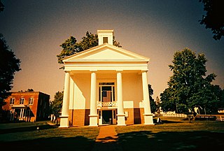
Cottage near Lake Michigan in Shorewood Hills, c. 1950
Berrien County Michigan Incorporated and Unincorporated areas Shorewood-Tower Hills-Harbert Highlighted.svg
Location of Shorewood-Tower Hills-Harbert, Michigan
Coordinates: 41°53′11″N86°37′4″W / 41.88639°N 86.61778°W / 41.88639; -86.61778 Coordinates: 41°53′11″N86°37′4″W / 41.88639°N 86.61778°W / 41.88639; -86.61778
Country United States
State Michigan
County Berrien
Area
  Total 4.6 sq mi (11.8 km2)
  Land 4.5 sq mi (11.7 km2)
  Water 0.04 sq mi (0.1 km2)
Population (2010)
  Total 1,344
  Density 297/sq mi (114.7/km2)
Time zone Eastern (EST) (UTC-5)
  Summer (DST) EDT (UTC-4)
FIPS code 26-73730 [1]
Lake Michigan from the beach at Harbert Lake Michigan and the beach, Harbert, Michigan.jpg
Lake Michigan from the beach at Harbert

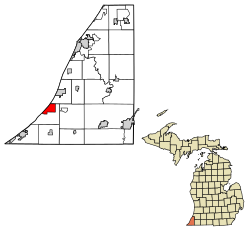
Shorewood-Tower Hills-Harbert is a census-designated place (CDP) composed of several small unincorporated communities in Chikaming Township of Berrien County in the U.S. state of Michigan. The population was 1,344 at the 2010 census. [2] The CDP is limited to Chikaming Township, although some of the communities extend into southern Lake Township. All of the communities are located either upon or just east of the dunes on the shore of Lake Michigan. Most of the communities lie west of Interstate 94, although the CDP includes a small area east of the freeway up to Sawyer.

A census-designated place (CDP) is a concentration of population defined by the United States Census Bureau for statistical purposes only. CDPs have been used in each decennial census since 1980 as the counterparts of incorporated places, such as self-governing cities, towns, and villages, for the purposes of gathering and correlating statistical data. CDPs are populated areas that generally include one officially designated but currently unincorporated small community, for which the CDP is named, plus surrounding inhabited countryside of varying dimensions and, occasionally, other, smaller unincorporated communities as well. CDPs include small rural communities, colonias located along the U.S. border with Mexico, and unincorporated resort and retirement communities and their environs.

Unincorporated area Region of land not governed by own local government

In law, an unincorporated area is a region of land that is not governed by a local municipal corporation; similarly an unincorporated community is a settlement that is not governed by its own local municipal corporation, but rather is administered as part of larger administrative divisions, such as a township, parish, borough, county, city, canton, state, province or country. Occasionally, municipalities dissolve or disincorporate, which may happen if they become fiscally insolvent, and services become the responsibility of a higher administration. Widespread unincorporated communities and areas are a distinguishing feature of the United States and Canada. In most other countries of the world, there are either no unincorporated areas at all, or these are very rare; typically remote, outlying, sparsely populated or uninhabited areas.

Chikaming Township, Michigan Township in Michigan, United States

Chikaming Township is a civil township of Berrien County in the U.S. state of Michigan. As of the 2010 census, the township population was 3,100. The township is located in the west central portion of the county. Lake Michigan lies to the northwest, Lake Township is to the north and northeast, Weesaw Township is to the east, Three Oaks Township is to the south, and New Buffalo Township is to the southwest.

Contents

Communities

Christian usually refers to:

Carl Sandburg American writer and editor

Carl August Sandburg was an American poet, writer, and editor. He won three Pulitzer Prizes: two for his poetry and one for his biography of Abraham Lincoln. During his lifetime, Sandburg was widely regarded as "a major figure in contemporary literature", especially for volumes of his collected verse, including Chicago Poems (1916), Cornhuskers (1918), and Smoke and Steel (1920). He enjoyed "unrivaled appeal as a poet in his day, perhaps because the breadth of his experiences connected him with so many strands of American life", and at his death in 1967, President Lyndon B. Johnson observed that "Carl Sandburg was more than the voice of America, more than the poet of its strength and genius. He was America."

Chicago City in Illinois, United States

Chicago, officially the City of Chicago, is the most populous city in Illinois and the third most populous city in the United States. As of the 2017 census-estimate, it has a population of 2,716,450, which makes it the most populous city in the Midwestern United States. Chicago is the county seat of Cook County, the second most populous county in the United States, and the principal city of the Chicago metropolitan area, which is often referred to as "Chicagoland." The Chicago metropolitan area, at nearly 10 million people, is the third-largest in the United States, the fourth largest in North America, and the third largest metropolitan area in the world by land area.

Geography

According to the United States Census Bureau, the CDP has a total area of 4.6 square miles (11.8 km2), of which 4.5 square miles (11.7 km2) is land and 0.04 square miles (0.1 km2), or 0.71%, is water. [2]

United States Census Bureau bureau of the United States responsible for the census and related statistics

The United States Census Bureau is a principal agency of the U.S. Federal Statistical System, responsible for producing data about the American people and economy. The Census Bureau is part of the U.S. Department of Commerce and its director is appointed by the President of the United States.

Demographics

As of the census [1] of 2000, there were 1,619 people, 725 households, and 484 families residing in the CDP. The population density was 356.9 per square mile (137.7/km²). There were 1,519 housing units at an average density of 334.8 per square mile (129.2/km²). The racial makeup of the CDP was 97.10% White, 0.86% Black or African American, 0.31% Native American, 0.25% Asian, 0.06% Pacific Islander, 0.49% from other races, and 0.93% from two or more races. Hispanic or Latino of any race were 1.24% of the population.

Population density A measurement of population numbers per unit area or volume

Population density is a measurement of population per unit area or unit volume; it is a quantity of type number density. It is frequently applied to living organisms, and most of the time to humans. It is a key geographical term. In simple terms population density refers to the number of people living in an area per kilometer square.

There were 725 households out of which 23.3% had children under the age of 18 living with them, 56.8% were married couples living together, 6.3% had a female householder with no husband present, and 33.2% were non-families. 29.7% of all households were made up of individuals and 13.5% had someone living alone who was 65 years of age or older. The average household size was 2.23 and the average family size was 2.73.

Marriage social union or legal contract between people called spouses that creates kinship

Marriage, also called matrimony or wedlock, is a socially or ritually recognised union between spouses that establishes rights and obligations between those spouses, as well as between them and any resulting biological or adopted children and affinity. The definition of marriage varies around the world not only between cultures and between religions, but also throughout the history of any given culture and religion, evolving to both expand and constrict in who and what is encompassed, but typically it is principally an institution in which interpersonal relationships, usually sexual, are acknowledged or sanctioned. In some cultures, marriage is recommended or considered to be compulsory before pursuing any sexual activity. When defined broadly, marriage is considered a cultural universal. A marriage ceremony is known as a wedding.

In the CDP, the population was spread out with 21.1% under the age of 18, 4.1% from 18 to 24, 22.9% from 25 to 44, 27.5% from 45 to 64, and 24.3% who were 65 years of age or older. The median age was 46 years. For every 100 females, there were 97.9 males. For every 100 females age 18 and over, there were 96.8 males.

The median income for a household in the CDP was $47,708, and the median income for a family was $52,917. Males had a median income of $44,402 versus $25,057 for females. The per capita income for the CDP was $36,219. About 2.6% of families and 4.5% of the population were below the poverty line, including 6.8% of those under age 18 and 3.2% of those age 65 or over.

Per capita income mean income of the people in an economic unit such as a country or city

Per capita income (PCI) or average income measures the average income earned per person in a given area in a specified year. It is calculated by dividing the area's total income by its total population.

Related Research Articles

Berrien County, Michigan county in Michigan, United States

Berrien County is a county on the south line of Michigan, at the southwestern corner of the state. As of the 2010 census, the population was 156,813. The county seat is St. Joseph.

Point Baker, Alaska CDP in Alaska, United States

Point Baker is a census-designated place (CDP) in Prince of Wales-Hyder Census Area, Alaska, United States. The population was 15 at the 2010 census, down from 35 in 2000.

Dolan Springs, Arizona CDP in Arizona, United States

Dolan Springs is a census-designated place (CDP) in Mohave County, Arizona, United States. The population was 2,033 at the 2010 census.

Lost Lake Woods, Michigan Census-designated place & Unincorporated community in Michigan, United States

Lost Lake Woods is an unincorporated community in Alcona Township, Alcona County in the U.S. state of Michigan. It is a Census-designated place (CDP) used for statistical purposes and has no legal status as a municipality. The population was 312 at the 2010 census.

Lake Charter Township, Michigan Charter township in Michigan, United States

Lake Charter Township is a charter township of Berrien County in the U.S. state of Michigan. The population was 2,972 at the 2010 census.

Weesaw Township, Michigan Township in Michigan, United States

Weesaw Township is a civil township of Berrien County in the U.S. state of Michigan. The population was 1,936 at the 2010 census. The township was organized in 1837.

Hubbell, Michigan Census-designated place & unincorporated community in Michigan, United States

Hubbell is an unincorporated community and census-designated place (CDP) in Houghton County in the U.S. state of Michigan. As of the 2010 census, the CDP population was 946, down from 1,105 at the 2000 census. The community is partially within Torch Lake Township and partially within Osceola Township.

Plainfield Township, Iosco County, Michigan Township in Michigan, United States

Plainfield Township is a civil township of Iosco County in the U.S. state of Michigan. The population was 4,292 at the 2000 census.

Manitou Beach-Devils Lake, Michigan Census-designated place & Unincorporated community in Michigan, United States

Manitou Beach and Devils Lake are two unincorporated communities in the Irish Hills region of Lenawee County in the U.S. state of Michigan. In order to provide statistical information, the United States Census Bureau has defined Manitou Beach-Devils Lake as a census-designated place (CDP) that includes both communities. The statistical information pertains to the entire CDP, although local understanding of the area making up these communities may vary somewhat from the definition of the CDP. The population of the CDP was 2,080 at the 2000 census.

Big Bay, Michigan Census-designated place & Unincorporated community in Michigan, United States

Big Bay is an unincorporated community in Marquette County of the U.S. state of Michigan. It is a census-designated place (CDP) for statistical purposes and does not have any legal status as an incorporated municipality. As of the 2000 census, the CDP population was 265. The community is located within Powell Township near the shore of "Big Bay" on Lake Superior.

Michigamme, Michigan Census-designated place & Unincorporated community in Michigan, United States

Michigamme is an unincorporated community in Marquette County of the U.S. state of Michigan. It is a census-designated place (CDP) for statistical purposes and without any legal status as a municipality. As of the 2000 census, the CDP population was 287.

Twin Lake, Michigan Census-designated place & Unincorporated community in Michigan, United States

Twin Lake is an unincorporated community in Muskegon County of the U.S. state of Michigan. It is a census-designated place (CDP) for statistical purposes. Local government services are provided by Dalton Township. As of the 2000 census, the community population was 1,613. It is the home of Blue Lake Fine Arts Camp, the YMCA's Camp Pinewood, the Boy Scouts' Gerber Scout Reservation and Owasippe Scout Reservation.

Wolf Lake, Michigan Census-designated place & Unincorporated community in Michigan, United States

Wolf Lake is an unincorporated community in Egelston Township of Muskegon County in the U.S. state of Michigan. It is a census-designated place (CDP) for statistical purposes, but has no official status as an incorporated municipality. The population was 4,455 at the 2000 census. The area included in the CDP includes the entire shoreline of Wolf Lake and extends south of the lake to include an area south of M-46/E. Apple Ave.

Carrollwood (CDP), Florida Census-designated place in Florida, United States

Carrollwood is a census-designated place (CDP) in northwestern Hillsborough County, Florida, United States. The population was 33,365 at the 2010 census. The census area includes the unincorporated communities of Carrollwood and Carrollwood Village. For the 2000 census the area was enumerated under the name "Greater Carrollwood" and had a population of 33,519. A similar area was listed as "Lake Carroll" in 1970 and 1980; for the 1990 census it was split into the smaller Carrollwood and Carrollwood Village CDPs.

Sherrills Ford, North Carolina Unincorporated community in North Carolina, United States

Sherrills Ford is an unincorporated community and former census-designated place (CDP) in Catawba County, North Carolina, United States. The population was 941 at the 2000 census. For the 2010 census it was included within the Lake Norman of Catawba CDP. It is part of the Hickory-Lenoir-Morganton Metropolitan Statistical Area.

Lakeside, Virginia Census-designated place in Virginia

Lakeside is a census-designated place (CDP) in Henrico County, Virginia, United States. The population was 11,849 at the 2010 census.

Wyndham, Virginia Census-designated place in Virginia

Wyndham is a census-designated place (CDP) in Henrico County, Virginia, United States, in the West End area outside of Richmond. The population was 9,785 at the 2010 census. The CDP is named for Wyndham, a planned community there.

Bethany Beach may refer to:

Lakeside is an unincorporated community in Chikaming Township of Berrien County in the U.S. state of Michigan. It is situated on the shore of Lake Michigan just west of Interstate 94. It is part of a group of communities known as "Harbor Country" which includes New Buffalo, Three Oaks, Harbert, Union Pier, Grand Beach and Sawyer.

References

  1. 1 2 "American FactFinder". United States Census Bureau . Retrieved 2008-01-31.
  2. 1 2 "Geographic Identifiers: 2010 Demographic Profile Data (G001): Shorewood-Tower Hills-Harbert CDP, Michigan". U.S. Census Bureau, American Factfinder. Retrieved January 13, 2014.
  3. "Origins - Old Place Names". Berrien County Genealogical Society. Archived from the original on 13 March 2018. Retrieved 13 March 2018.