Shuttle Meadow Formation

Last updated
Shuttle Meadow Formation
Stratigraphic range: Hettangian
~201–199  Ma
O
S
D
C
P
T
J
K
Pg
N
Ct farmington quarry.jpg
Talcott Formation over Shuttle Meadow Formation in a quarry (Connecticut)
Type Geological formation
Unit of Newark Supergroup
  Meriden Group
Underlies Talcott Formation
Lithology
Primary Black shale
Other Siltstone
Location
Coordinates 41°24′N72°42′W / 41.4°N 72.7°W / 41.4; -72.7 Coordinates: 41°24′N72°42′W / 41.4°N 72.7°W / 41.4; -72.7
Approximate paleocoordinates 22°06′N19°30′W / 22.1°N 19.5°W / 22.1; -19.5
Region New England
CountryFlag of the United States.svg  United States
ExtentFlag of Connecticut.svg  Connecticut and Flag of Massachusetts.svg  Massachusetts
Usa edcp relief location map.png
Blue pog.svg
Shuttle Meadow Formation (the United States)
Relief map USA Connecticut.png
Blue pog.svg
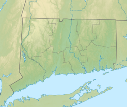
Shuttle Meadow Formation (Connecticut)

The Shuttle Meadow Formation is a Mesozoic geologic formation in the Hartford Basin in Connecticut and Massachusetts, USA. [1] Insect fossils of Mormolucoides articulatus and dinosaur remains are among the fossils that have been recovered from the formation; Coelophysis sp . [2]

Contents

See also

Related Research Articles

Hanson Formation Geological formation in Ross Dependency, Antarctica

The Hanson Formation is a geologic formation on Mount Kirkpatrick and north Victoria Land, Antarctica. It is one of the two major dinosaur-bearing rock groups found on Antarctica to date; the other is the Snow Hill Island Formation and related formations from the Late Cretaceous of the Antarctic Peninsula. The formation has yielded some Mesozoic specimens, but most of it is as yet unexcavated. Part of the Victoria Group of the Transantarctic Mountains, it lies below the Prebble Formation and above the Falla Formation. The formation includes material from volcanic activity linked to the Karoo-Ferar eruptions of the Lower Jurassic. The climate of the zone was similar to that of modern southern Chile, humid, with a temperature interval of 17–18 degrees. The Hanson Formation is correlated with the Section Peak Formation of the Eisenhower Range and Deep Freeze Range, as well as volcanic deposits on the Convoy Range and Ricker Hills of southern Victoria Land.

Cloverly Formation Geological formation

The Cloverly Formation is a geological formation of Early Cretaceous age that is present in parts of Montana, Wyoming, Colorado and Utah in the western United States. It was named for a post office on the eastern side of the Bighorn Basin in Wyoming by N.H. Darton in 1904. The sedimentary rocks of formation were deposited in floodplain environments and contain vertebrate fossils, including a diverse assemblage of dinosaur remains. In 1973, the Cloverly Formation Site was designated as a National Natural Landmark by the National Park Service.

New Oxford Formation

The New Oxford Formation is a mapped bedrock unit consisting primarily of sandstones, conglomerates, and shales. The New Oxford Formation was first described in Adams County, Pennsylvania in 1929, and over the following decade was mapped in adjacent York County, Pennsylvania and Frederick County, Maryland. It was described as "red shale and sandstone with beds of micaceous sandstone, arkose, and conglomerate." The majority of this early mapping was done by George Willis Stose, Anna Isabel Jonas, and Florence Bascom.

Pekin Formation

The Pekin Formation is a Late Triassic (Carnian) geological formation in North Carolina. The Pekin Formation is specific to the Sanford Sub-Basin of the Deep River Basin of North Carolina, although it may be equivalent to the Stockton Formation of Pennsylvania, New Jersey, and New York. The Pekin Formation was deposited in a rift basin along the Atlantic margin of North America during the breakup of the supercontinent Pangaea during the Late Triassic. The most common rocks in the Pekin Formation are red to brown sandstones, representing a terrestrial fluvial (riverine) and floodplain environment in a hot, humid climate. It has yielded both abundant plant and animal fossils, including some of the oldest potential dinosaur footprints in the world and the large predatory crocodylomorph Carnufex carolinensis.

The Shishugou Formation is a geological formation in Xinjiang, China.

Foremost Formation

The Foremost Formation is a stratigraphic unit of Late Cretaceous (Campanian) age that underlies much of southern Alberta, Canada. It was named for outcrops in Chin Coulee near the town of Foremost and is known primarily for its dinosaur remains and other fossils.

The Billman Creek Formation is a Mesozoic geologic formation in south-central Montana. Dinosaur remains are among the fossils that have been recovered from the formation, although none have yet been referred to a specific genus.

The Cokedale Formation is a Mesozoic geologic formation in the United States. Dinosaur remains are among the fossils that have been recovered from the formation, although none have yet been referred to a specific genus.

The Ulan Malgait Formation is a Late Jurassic geologic formation in Mongolia. Dinosaur remains are among the fossils that have been recovered from the formation, although as of 2004 none have yet been referred to a specific genus.

The Wolfville Formation is a Triassic geologic formation of Nova Scotia. The formation is of Carnian to early Norian age. Fossils of small land vertebrates have been found in the formation, including procolophonid and early archosauromorph reptiles and cynodonts. Dinosaur remains are among the fossils that have been recovered from the formation, although none have yet been referred to a specific genus.

La Pedrera de Rúbies Formation

The La Pedrera de Rúbies Formation is an Early Cretaceous (late Berriasian to early Barremian geologic formation in Catalonia, Spain. The formation crops out in the area of the Montsec in the Organyà Basin. At the La Pedrera de Meià locality, the formation consists of rhythmically laminated, lithographic limestones that formed in the distal areas of a large, shallow coastal lake. It is noted for the exceptional preservation of articulated small vertebrates and insects, similar to that of the Solnhofen Limestone.

Towaco Formation

The Towaco Formation is a mapped bedrock unit in New Jersey. It is named for the unincorporated village of Towaco, which is near the place its type section was described by paleontologist Paul E. Olsen.

Feltville Formation

The Feltville Formation is a mapped bedrock unit primarily in New Jersey, with one known outlier in Pennsylvania and another one in New York. It is named for the Deserted Village of Feltville in Watchung Reservation, New Jersey, which is near where its type section was described by paleontologist Paul E. Olsen.

Boonton Formation

The Boonton Formation is a mapped bedrock unit in New Jersey, formerly divided between the Boonton and Whitehall beds of the defunct Brunswick Formation. It is named for the town of Boonton, New Jersey, which is near where its type section was described by paleontologist Paul E. Olsen.

Cow Branch Formation

The Cow Branch Formation is a Late Triassic geologic formation in the eastern United States. Indeterminate fossil ornithischian tracks have been reported from the formation.

Rupelo Formation Geologic formation in Spain

The Rupelo Formation is an Early Cretaceous (Berriasian) geologic formation in the Burgos Province of Castile and León in northern Spain. The formation crops out near the municipality Mambrillas de Lara in the northwesternmost part of the Cameros Basin in the Sierra de la Demanda.

The prehistory of the United States comprises the occurrences within regions now part of the United States during the interval of time spanning from the formation of the Earth to the documentation of local history in written form. At the start of the Paleozoic era, what is now "North" America was actually in the southern hemisphere. Marine life flourished in the country's many seas, although terrestrial life had not yet evolved. During the latter part of the Paleozoic, seas were largely replaced by swamps home to amphibians and early reptiles. When the continents had assembled into Pangaea drier conditions prevailed. The evolutionary precursors to mammals dominated the country until a mass extinction event ended their reign.

The Bull Run Formation is a Late Triassic (Norian) stratigraphic unit in the eastern United States. Fossil fish bones and scales have been found in outcrops of the formation's Groveton Member in Manassas National Battlefield Park. Indeterminate fossil ornithischian tracks have been reported from the formation.

The Midland Formation is a Mesozoic geological formation in the Culpeper Basin of Virginia. It is a sedimentary unit which formed in a short period of time between the first two basalt flows in the basin: the Hickory Grove and Mount Zion Church basalts. The most common rocks in the formation are dark reddish interbedded sandstones and siltstones, representative of fluvial (stream) environments. Rare but fossiliferous calcareous shale and limestone also occurs, representing recurring lacustrine (lake) conditions. The Midland Formation is considered equivalent to the Shuttle Meadow Formation of the Hartford Basin, the Feltville Formation of the Newark Basin, and the Bendersville Formation of the Gettysburg Basin.

Santana Group

The Santana Group is a geologic group, formerly included as the middle part of the Araripe Group, in the Araripe Basin of northeastern Brazil. The group comprises the Crato, Ipubi and Romualdo Formations and is dated to the Aptian to Albian stages of the Early Cretaceous. The formations of the group were deposited in a lacustrine to subtidal shallow marine environment in the Araripe rift basin.

References

  1. Olsen, P.E., Schliesche, R.W., Gore, P.J.W. (Editors), 1989, Tectonic, Depositional, and Paleoecological History of Early Mesozoic Rift Basins, Eastern North America Field Trip Guidebook T351. International Geological Congress Field Trip T351. American Geophysical Union, Washington, 174 p.
  2. Weishampel, et al. (2004). "Dinosaur distribution." Pp. 517-607.

Bibliography

Further reading