Sierra Mojada Municipality

Last updated
Sierra Mojada
Municipality
Sierra Mojada en Coahuila.svg
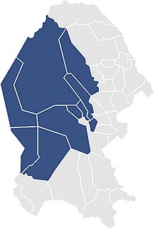
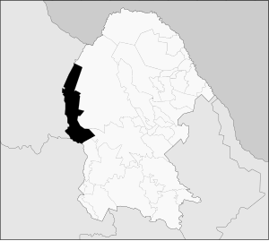
Municipality of Sierra Mojada in Coahuila
Mexico States blank map.svg
Red pog.svg
Sierra Mojada
Location in Mexico
Coordinates: 27°17′14″N103°17′14″W / 27.28722°N 103.28722°W / 27.28722; -103.28722 Coordinates: 27°17′14″N103°17′14″W / 27.28722°N 103.28722°W / 27.28722; -103.28722
CountryFlag of Mexico.svg  Mexico
State Coahuila
Municipal seat Sierra Mojada
Area
  Total 6,966.2 km2 (2,689.7 sq mi)
Population (2005)
  Total 5,245

Sierra Mojada is one of the 38 municipalities of Coahuila, in north-eastern Mexico. The municipal seat lies at Sierra Mojada. The municipality covers an area of 6966.2 km².

Municipalities of Coahuila Wikimedia list article

Coahuila is a state in Northeast Mexico that is divided into 38 municipalities. According to the 2015 Mexican Intercensal Survey, Coahuila is the 16th most populous state with 2,954,915 inhabitants and the third largest by land area spanning 151,846.16 square kilometres (58,628.13 sq mi).

Mexico country in the southern portion of North America

Mexico, officially the United Mexican States, is a country in the southern portion of North America. It is bordered to the north by the United States; to the south and west by the Pacific Ocean; to the southeast by Guatemala, Belize, and the Caribbean Sea; and to the east by the Gulf of Mexico. Covering almost 2,000,000 square kilometres (770,000 sq mi), the nation is the fifth largest country in the Americas by total area and the 13th largest independent state in the world. With an estimated population of over 120 million people, the country is the eleventh most populous state and the most populous Spanish-speaking state in the world, while being the second most populous nation in Latin America after Brazil. Mexico is a federation comprising 31 states and Mexico City, a special federal entity that is also the capital city and its most populous city. Other metropolises in the state include Guadalajara, Monterrey, Puebla, Toluca, Tijuana and León.

Sierra Mojada Municipal seat and city in Coahuila, Mexico

Sierra Mojada is a city and seat of the municipality of Sierra Mojada, in the north-eastern Mexican state of Coahuila. Local oral tradition, documented by the priest James Lienert, states that Ambrose Bierce, who disappeared without a trace in 1913, was executed by firing squad in the town cemetery. Silver Bull Resources (SVBL) has a silver exploration project near the town

As of 2005, the municipality had a total population of 5,245. [1]

Related Research Articles

Municipalities of Chiapas Wikimedia list article

Chiapas is a state in Southwest Mexico. According to the 2015 Mexican Intercensal Survey, it is the state that has the seventh largest population with 5,217,908 inhabitants and the 10th largest by land area spanning 73,560.47 square kilometres (28,401.86 sq mi). Chiapas is officially divided into 124 municipalities, although the establishment of municipal authorities in Belisario Domínguez has been suspended since 2015 pending the resolution of a territorial dispute between Chiapas and the neighbouring state of Oaxaca. A 125th municipality called Honduras de la Sierra, consisting of six ejidos currently part of Siltepec, will be incorporated on October 1, 2018.

El Porvenir, Chiapas Municipality in Chiapas, Mexico

El Porvenir is a municipio (municipality) and township in the Mexican state of Chiapas.

Ocampo Municipality, Coahuila Municipality in Coahuila, Mexico

Ocampo is one of the 38 municipalities of Coahuila, in north-eastern Mexico, and the largest by area. The municipal seat lies at Ocampo. The municipality covers an area of 26,433 km² and is located on the international border between Mexico and the USA, here formed by the Río Bravo del Norte, adjacent to the U.S. state of Texas.

Second Federal Electoral District of Coahuila federal electoral district of Mexico

The Second Federal Electoral District of Coahuila(II Distrito Electoral Federal de Coahuila) is one of the 300 Electoral Districts into which Mexico is divided for the purpose of elections to the federal Chamber of Deputies and one of seven such districts in the state of Coahuila.

Chilpancingo de los Bravo (municipality) Municipality in Guerrero, Mexico

Chilpancingo de los Bravo is one of the 81 municipalities of Guerrero, in south-western Mexico.

Teloloapan (municipality) Municipality in Guerrero, Mexico

Teloloapan is a Mexican city in the state of Guerrero. It is enclosed in the heart of the Southern Sierra Madre in the northern part of said region. It is the capital of the municipality of the same name.

Atengo Municipality and city in Jalisco, Mexico

Atengo is both a small village and municipality of the region Sierra de Amula in the Mexican state Jalisco.

Ayutla, Jalisco Municipality and town in Jalisco, Mexico

Ayutla is a town and municipality, in Jalisco in central-western Mexico. The municipality covers an area of 884.62 km².

Asunción Cacalotepec Municipality and town in Oaxaca, Mexico

Asunción Cacalotepec is a town and municipality in Oaxaca, Mexico. The municipality covers an area of 76.55 km². It is part of the Sierra Mixe district within the Sierra Norte de Oaxaca Region. As of 2005, the municipality had a total population of 753.

San Pedro Ocotepec Municipality and town in Oaxaca, Mexico

San Pedro Ocotepec is a town and municipality in Oaxaca in south-western Mexico. The municipality covers an area of 136.51 km². It is part of the Sierra Mixe district within the Sierra Norte de Oaxaca Region.

San Simón Almolongas Municipality and town in Oaxaca, Mexico

San Simón Almolongas is a town and municipality in Oaxaca in south-western Mexico. The municipality covers an area of km². It is part of the Miahuatlán District in the south of the Sierra Sur Region.

Santa María Tepantlali Municipality and town in Oaxaca, Mexico

Santa María Tepantlali is a town and municipality in Oaxaca in south-western Mexico. The municipality covers an area of km². It is part of the Sierra Mixe district within the Sierra Norte de Oaxaca Region.

Santa María Tlahuitoltepec Municipality and town in Oaxaca, Mexico

Santa María Tlahuitoltepec is a town and municipality in Oaxaca in south-western Mexico. The municipality covers an area of km². It is part of the Sierra Mixe district within the Sierra Norte de Oaxaca Region.

Huaquechula (municipality) Municipality in Puebla, Mexico

Huaquechula Municipality is a municipality in Puebla in south-eastern Mexico.

Pahuatlán Town & Municipality in Puebla, Mexico

Pahuatlán, officially Pahuatlán del Valle, is a town and municipality located in the northwest of the state of Puebla in central Mexico. The municipality is part of the Sierra Norte region of the state, a steep mountainous area which receive significant moisture from the Gulf of Mexico, and borders the states of Hidalgo and Veracruz.

Puebla (municipality) Municipality in Puebla, Mexico

Puebla Municipality is a municipality in the State of Puebla in eastern Central Mexico. The municipality covers a total area of 534.32 square kilometres (206.30 sq mi). The City of Puebla is the municipal seat, as well as the capital of the state.

Xicotepec Municipality and town in Puebla, Mexico

Xicotepec is a town and municipality in Puebla in central-eastern Mexico. The wider region is called Sierra Norte de Puebla.

XHHCC-FM

XHHCC-FM is a radio station in Hércules, Coahuila, in the municipality of Sierra Mojada. It broadcasts on 97.3 FM and is known as Radio Minera, serving the local mining community.

Huehuetla, Puebla Municipality in Puebla, Mexico

Huehuetla is a rural municipality in Puebla, Mexico.

References

  1. "Sierra Mojada". Enciclopedia de los Municipios de México. Instituto Nacional para el Federalismo y el Desarrollo Municipal . Retrieved November 8, 2008.