
Monclova, is a city and seat of the surrounding municipality of the same name in the northern Mexican state of Coahuila. According to the 2015 census there were 231,107 inhabitants in the city. Its metropolitan area has 381,432 inhabitants and has a population density of 29.88 inhabitants per square kilometers. Monclova is the third largest city and metropolitan area in the state in terms of population, after Torreón and Saltillo.

Coahuila is a state in Northeast Mexico that is divided into 38 municipalities. According to the 2015 Mexican Intercensal Survey, Coahuila is the 16th most populous state with 2,954,915 inhabitants and the third largest by land area spanning 151,846.16 square kilometres (58,628.13 sq mi).
The Tlaxcalans, or Talaxcaltecs, are an indigenous group of Nahua ethnicity who inhabited the republic of Tlaxcala and present-day Mexican state of Tlaxcala.

García is a municipality located to the northwest of the Monterrey metropolitan area in the state of Nuevo León, Mexico. García had, according to the 2005 census, a population of 145,867 persons. It borders the municipalities of Mina, Escobedo and Hidalgo to the north; to the south and east with Santa Catarina; and to the west with the state of Coahuila.
Villa Hidalgo Municipality is a municipality, in the north-east of the Mexican state of Sonora.

Villa Hidalgo is a town in the Mexican state of Durango. It serves as the head town of Hidalgo Municipality. As of 2010, the town had a population of 614.

Villa de Hidalgo is a village in San Luis Potosí, Mexico.
Villaflores Municipality is a municipio (municipality) in the state of Chiapas, southern Mexico, and the name of its largest settlement and seat of the municipal government. Situated in the Sierra Madre de Chiapas range, the municipality has an area of approximately 1232 km2 at an average elevation of 540m above mean sea level.

Guerrero is one of the 38 municipalities of Coahuila, in north-eastern Mexico. The municipal seat lies at Guerrero. The municipality covers an area of 3,219.7 km² and is located on the international border between Mexico and the USA, here formed by the Río Bravo del Norte, adjacent to the U.S. state of Texas.

Nava is one of the 38 municipalities of Coahuila, in north-eastern Mexico. The municipal seat lies at Nava. The municipality covers an area of 804.9 km².

Piedras Negras Municipality is one of the 38 municipalities of Coahuila, in north-eastern Mexico. The municipal seat lies at Piedras Negras. The municipality covers an area of 914.2 km² and is located on the international border between Mexico and the USA, here formed by the Río Bravo del Norte, adjacent to the U.S. state of Texas.
Torreón is one of the municipalities of Coahuila de Zaragoza, a state in north-eastern Mexico. The city of Torreón is the municipal seat for Torreón Municipality. The municipality covers an area of 1947.7 km².

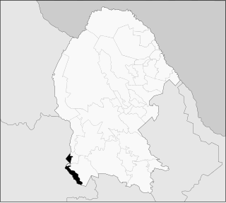
The First Federal Electoral District of Coahuila(I Distrito Electoral Federal de Coahuila) is one of the 300 Electoral Districts into which Mexico is divided for the purpose of elections to the federal Chamber of Deputies and one of seven such districts in the state of Coahuila.
Sabinas is a city and seat of the municipality of Sabinas, in the north-eastern Mexican state of Coahuila. As of 2015, the population of the city was 63,522, while the metropolitan area had a population of 177,430 inhabitants.

Chihuahua, officially the Free and Sovereign State of Chihuahua, is one of the 31 states of Mexico. It is located in Northwestern Mexico and is bordered by the states of Sonora to the west, Sinaloa to the southwest, Durango to the south, and Coahuila to the east. To the north and northeast, it has a long border with the U.S. adjacent to the U.S. states of New Mexico and Texas. Its capital city is Chihuahua City.
Zaragoza is a municipality in the Mexican state of Veracruz, located 297 kilometres (185 mi) southeast of the state capital of Xalapa and 10 kilometres (6.2 mi) southwest of the city of Minatitlán.


