Silisili

Last updated
Silisili
Mount Silisili
Samoa location map.svg
Red triangle with thick white border.svg
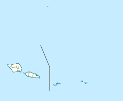
Silisili
Location of Mount Silisili in Samoa
Highest point
Elevation 1,858 m (6,096 ft) [1]
Prominence 1,858 m (6,096 ft) [1]
Isolation 2,245 km (1,395 mi)  OOjs UI icon edit-ltr-progressive.svg
Listing Country high point
Ultra
Coordinates 13°37′06″S172°29′09″W / 13.61833°S 172.48583°W / -13.61833; -172.48583 [2]
Geography
Location Samoa

Mount Silisili is the highest peak in Samoa and the Samoa Islands chain. It is located in the centre of a mountain chain running the length of Savai'i island. Mount Silisili is ranked 24th by topographic isolation.

Contents

Mount Silisili rises to a height of 1,858 m. [3] The word silisili means highest in reference to height, in the Samoan language.

Savai'i is the largest shield volcano island in the South Pacific.

Climbing the volcano

Mount Silisili makes a popular hike of Savai'i island, and can be reached with a 2-day guided round-trip. [4] [5]

See also

Related Research Articles

<span class="mw-page-title-main">Samoa</span> Polynesian island country

Samoa, officially the Independent State of Samoa and until 1997 known as Western Samoa, is a Polynesian island country consisting of two main islands ; two smaller, inhabited islands ; and several smaller, uninhabited islands, including the Aleipata Islands. Samoa is located 64 km (40 mi) west of American Samoa, 889 km (552 mi) northeast of Tonga, 1,152 km (716 mi) northeast of Fiji, 483 km (300 mi) east of Wallis and Futuna, 1,151 km (715 mi) southeast of Tuvalu, 519 km (322 mi) south of Tokelau, 4,190 km (2,600 mi) southwest of Hawaii, and 610 km (380 mi) northwest of Niue. The capital and largest city is Apia. The Lapita people discovered and settled the Samoan Islands around 3,500 years ago. They developed a Samoan language and Samoan cultural identity.

<span class="mw-page-title-main">Geography of Samoa</span>

The Samoan archipelago is a chain of 16 islands and numerous seamounts covering 3,123 km2 (1,206 sq mi) in the central South Pacific, south of the equator, about halfway between Hawaii and New Zealand, forming part of Polynesia and of the wider region of Oceania. The islands are Savaiʻi, Upolu, Tutuila, ’Uvea, Taʻū, Ofu, Olosega, Apolima, Manono, Nuʻutele, Niulakita, Nuʻulua, Namua, Fanuatapu, Rose Atoll, Nu'ulopa, as well as the submerged Vailuluʻu, Pasco banks, and Alexa Bank.

<span class="mw-page-title-main">Upolu</span> Island in Samoa

Upolu is an island in Samoa, formed by a massive basaltic shield volcano which rises from the seafloor of the western Pacific Ocean. The island is 75 kilometres long and 1,125 square kilometres in area, making it the second largest of the Samoan Islands by area. With approximately 145,000 inhabitants, it is by far the most populous of the Samoan Islands. Upolu is situated to the southeast of Savai'i, the "big island". Apia, the capital, is in the middle of the north coast, and Faleolo International Airport at the western end of the island. The island has not had any historically recorded eruptions, although there is evidence of three lava flows, dating back only to between a few hundred and a few thousand years ago.

<span class="mw-page-title-main">Shield volcano</span> Low-profile volcano usually formed almost entirely of fluid lava flows

A shield volcano is a type of volcano named for its low profile, resembling a shield lying on the ground. It is formed by the eruption of highly fluid lava, which travels farther and forms thinner flows than the more viscous lava erupted from a stratovolcano. Repeated eruptions result in the steady accumulation of broad sheets of lava, building up the shield volcano's distinctive form.

<span class="mw-page-title-main">Samoan Islands</span> Archipelago in the South Pacific Ocean

The Samoan Islands are an archipelago covering 3,030 km2 (1,170 sq mi) in the central South Pacific, forming part of Polynesia and of the wider region of Oceania. Administratively, the archipelago comprises all of the Independent State of Samoa and most of American Samoa. The land masses of the two Samoan jurisdictions are separated by 64 km (40 mi) of ocean at their closest points.

<span class="mw-page-title-main">Mount Kerinci</span> Volcano in Sumatra, Indonesia

Mount Kerinci is an active stratovolcano and the highest mountain in Sumatra, Indonesia. At 12,484 ft (3,805 m) above sea level, it provides Sumatra with the fifth-highest maximum elevation of any island in the world. It is surrounded by the lush forest of Kerinci Seblat National Park, home to several endangered species including the Sumatran tiger. Mount Kerinci is ranked 32nd by topographic isolation.

<span class="mw-page-title-main">National Park of American Samoa</span> United States national park in American Samoa

The National Park of American Samoa is a national park in the United States territory of American Samoa, distributed across four islands: Tutuila, Ofu, Olosega, and Ta‘ū. The park preserves and protects coral reefs, tropical rainforests, fruit bats, and the Samoan culture. Popular activities include hiking and snorkeling. Of the park's 8,257 acres (3,341 ha), 2,500 acres (1,000 ha) is coral reefs and ocean. The park is the only American National Park Service system unit south of the equator.

<span class="mw-page-title-main">Savaiʻi</span> Island in the Samoan Islands chain

Savaiʻi is the largest and highest island both in Samoa and in the Samoan Islands chain. The island is also the sixth largest in Polynesia, behind the three main islands of New Zealand and the Hawaiian Islands of Hawaii and Maui. While it is larger than the second main island, Upolu, it is significantly less populated.

<span class="mw-page-title-main">Gagaʻifomauga</span> District in Samoa

Gagaʻifomauga is a political district on the island of Savaiʻi in Samoa. The district is situated on the northern side of the island with a population of 4,878.

<span class="mw-page-title-main">Outline of Samoa</span> Overview of and topical guide to Samoa

The following outline is provided as an overview of and topical guide to Samoa:

<span class="mw-page-title-main">Samoa hotspot</span> Volcanic hotspot located in the south Pacific Ocean

The Samoa hotspot is a volcanic hotspot located in the south Pacific Ocean. The hotspot model describes a hot upwelling plume of magma through the Earth's crust as an explanation of how volcanic islands are formed. The hotspot idea came from J. Tuzo Wilson in 1963 based on the Hawaiian Islands volcanic chain.

<span class="mw-page-title-main">Saleaula</span> Village in Gagaemauga, Samoa

Sale'aula is a village on the central north coast of Savai'i island in Samoa and is the traditional center of the Gaga'emauga political district. Chief council meetings are held at Vaitu’utu’u malae in the village. The village has a population of 600.

<span class="mw-page-title-main">Mount Matavanu</span> Volcano in Savaii, Samoa

Mt Matavanu is an active volcano on the island of Savai'i in Samoa. The volcano was formed during an eruption in 1905. Lava flows from the eruption covered a large area of land in the Gaga'emauga district, leading to the relocation of several villages.

Mata o le Afi is an active volcano on the island of Savai'i in Samoa. It last erupted in 1902.

Mauga Afi is a volcanic mountain in the Gagaʻifomauga district on the island of Savai'i in Samoa. It has an elevation of 1847m.

<span class="mw-page-title-main">Asau, Samoa</span> Village & Sub-district in Vaisigano, Samoa

Asau is a village situated on the north west coast of Savai'i island in Samoa. It is the capital village of the Vaisigano political district and serves as the main business centre at the west end of the island. The population in 2016 was 1133, a decrease from 1207 in 2011.

<span class="mw-page-title-main">Archaeology of Samoa</span>

Archaeology of Samoa began with the first systematic survey of archaeological remains on Savai'i island by Jack Golson in 1957. Since then, surveys and studies in the rest of Samoa have uncovered major findings of settlements, stone and earth mounds including star mounds, Lapita pottery remains and pre-historic artifacts.

Mauga is a village in Savai'i island in Samoa. The village is in the Gaga'emauga 1 constituency, a sub-division of the larger Gaga'emauga district. The population is 162.

Le'auva'a is a village on the island of Upolu in Samoa. The population is 3274.

Mount Fito is the second-highest mountain on the island of Upolu in Samoa. It is located in the O Le Pupu-Puʿe National Park in the Atua district and has a height of 1149m. Fito was long-believed to be Upolu's highest point, but a visit by the Samoa Conservation Society in 2022 determined it to be the second-highest, just 10m shorter than nearby Mount Vaivai.

References

  1. 1 2 "Mauga Silisili" on Peakbagger.com Retrieved 1 October 2011
  2. "Mauga Silisili" Peaklist.org - Pacific Islands Retrieved 1 October 2011
  3. Rottman, Gordon L. (2002). World War 2 Pacific island guide. Greenwood Publishing Group. p. 88. ISBN   0-313-31395-4 . Retrieved 3 March 2010.
  4. "Mt Silisili". Samoa Tourism Authority. Retrieved 8 August 2021.
  5. Elizabeth Ah Hi (3 July 2020). "Mt Silisili Conquerors say its not for the Faint Hearted". Samoa Global News. Retrieved 8 August 2021.