Sipita District

Last updated
Zepita
Sipita
Country Flag of Peru.svg  Peru
Region Puno
Province Chucuito
Capital Sipita
Government
   Mayor Ricardo Felipe Jiménez Castilla (2011-2014)
Area
  Total546.57 km2 (211.03 sq mi)
Elevation
3,831 m (12,569 ft)
Population
  Total19,796
  Density36/km2 (94/sq mi)
Time zone UTC-5 (PET)
UBIGEO 210407

Sipita is one of seven districts of the Chucuito Province in Puno Region, Peru. [1]

Contents

Geography

One of the highest peaks of the district is Qhapiya at 4,809 m (15,778 ft). Other mountains are listed below: [2]

Ethnic groups

The people in the district are mainly indigenous citizens of Aymara descent. Aymara is the language which the majority of the population (87.08%) learnt to speak in childhood, 12.21% of the residents started speaking using the Spanish language (2007 Peru Census). [3]

Authorities

Mayors

See also

Related Research Articles

Puno Province Province in Puno, Peru

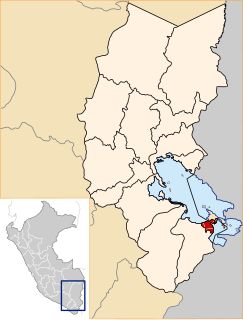
Puno is a province in the Puno Region, in southeastern Peru. It borders the provinces of Huancane, San Román, El Collao and the Moquegua Region's province of General Sánchez Cerro. Its capital is the city of Puno, which is located at the edge of Lake Titicaca, the world's highest navigable lake. It is the economic powerhouse of the region.

Axura District is one of fifteen districts of the Puno Province in the Puno Region, Peru.

<span class="mw-page-title-main">Sandia Province</span> Province in Puno, Peru

Sandia Province is a province of the Puno Region in Peru. The capital of the province is the city of Sandia.

<span class="mw-page-title-main">Chukuwitu District</span> District in Puno, Peru

Chukuwitu District is one of the districts of the Puno Province in the Puno Region in Peru.

<span class="mw-page-title-main">Chucuito Province</span> Province in Puno, Peru

Chucuito Province is a province of the Puno Region in Peru. The capital of the province is the city of Juli.

<span class="mw-page-title-main">El Collao Province</span> Province in Puno, Peru

El Collao Province is a province of the Puno Region in Peru, created in 1992. The capital of the province is the city of Ilave.

<span class="mw-page-title-main">Yunkuyu Province</span> Province in Puno, Peru

Yunkuyu Province is a province of the Puno Region in Peru. The capital of the province is the city of Yunguyo.

<span class="mw-page-title-main">Huancané Province</span> Province in Puno, Peru

Huancané Province is a province of the Puno Region in Peru. The capital of the province is the city of Huancané.

<span class="mw-page-title-main">Putina Province</span> Province in Puno, Peru

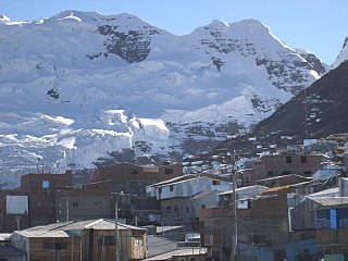
Putina Province is a province of the Puno Region in Peru.

<span class="mw-page-title-main">Huacullani District</span> District in Puno, Peru

Huacullani is one of seven districts of the Chucuito Province in the Puno Region in southern Peru.

Kelluyo is one of seven districts of the Chucuito Province in Peru.

Pisacoma is one of seven districts of the Chucuito Province in Peru.

Pumata District is one of seven districts of the Chucuito Province in Puno Region, Peru.

<span class="mw-page-title-main">Juli District</span> District in Puno, Peru

Juli District is one of seven districts of the Chucuito Province in Puno Region, Peru.

Kunturiri District is one of five districts of the El Collao Province in Puno Region, Peru.

<span class="mw-page-title-main">Santa Rosa District, El Collao</span> District in Puno, Peru

Santa Rosa District is one of five districts of the province El Collao in Puno Region, Peru.

Pichacani or Pichaqani is one of fifteen districts of the Puno Province in the Puno Region in Peru.

Cojata District is one of eight districts of the province Huancané in Peru.

Copani District is one of seven districts of the province Yunguyo in Puno Region, Peru.

<span class="mw-page-title-main">Checacupe District</span> District in Cusco, Peru

Checacupe or Ch'iqa Kupi is one of eight districts of the Canchis Province in the Cusco Region in Peru.

References

  1. (in Spanish) Instituto Nacional de Estadística e Informática. Banco de Información Distrital Archived April 23, 2008, at the Wayback Machine . Retrieved April 11, 2008.
  2. escale.minedu.gob.pe/ UGEL map Chucuito Province (Puno Region)
  3. inei.gob.pe Archived January 27, 2013, at the Wayback Machine INEI, Peru, Censos Nacionales 2007, Frequencias: Preguntas de Población: Idioma o lengua con el que aprendió hablar (in Spanish)

Coordinates: 16°29′56″S69°06′36″W / 16.4988°S 69.1101°W / -16.4988; -69.1101