
The Johor Strait is an international strait in Southeast Asia, between Singapore and Peninsular Malaysia.

The Johor Bahru District is a district located in the southern part of Johor, Malaysia. The heavily suburban/suburbanizing district covers an area of 1,063.97 km2 (410.80 sq mi) and has a population of 1.71 million. The district capital is Johor Bahru City and the administrative capital is Iskandar Puteri City. The district borders Pontian District on the west, Kota Tinggi District on the east, Kulai District on the north and Straits of Johor to the south. The urban centres are divided into the cities of Johor Bahru, Iskandar Puteri and Pasir Gudang.
Skudai is a town in Johor, Malaysia. It is about 13 km northwest from Johor Bahru's central business district.

Senai is a town and mukim in Kulai District, Johor, Malaysia. It is the base for several major multinational electronics manufacturers. This sprawl town is one of the flagship zones of the Iskandar Malaysia.
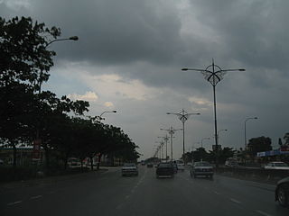
Skudai Highway(Lebuhraya Skudai), also known as Senai Highway, Jalan Tun Abdul Razak or Jalan Skudai, Federal Route 1, is a 29 kilometre partial-access highway in Johor, Malaysia, from the town of Senai in Kulai District to Johor Bahru City in Johor Bahru District. The highway is designated as part of Federal Route 1.

Kulai is a town and the capital of Kulai District, Johor, Malaysia. It is administered by the Kulai Municipal Council (MPKu), which was earlier known as the Kulai District Council.
The North–South Expressway Southern Route North–South Expressway Southern Route is an interstate controlled-access highway running parallel to the southwestern coast of Peninsular Malaysia. The expressway forms the south section of the North–South Expressway, connecting the states of Selangor, Negeri Sembilan, Malacca and Johor. It begins at Seri Kembangan, near the state/territory boundary between Selangor and Kuala Lumpur and travels southwards to end at Pandan-Tebrau in Johor.

Pasir Gudang Highway, also known as Federal Route 17, is a highway in Johor Bahru District, Johor, Malaysia that connects Tampoi North in the west to Pasir Gudang and Tanjung Langsat in the east. Pasir Gudang Highway is a four-laned highway, unlike the wider Skudai Highway which has six lanes. Many cargo trucks travel along the highway daily. Pasir Gudang Highway became the backbone of the road system linking Johor Bahru to Pasir Gudang before being surpassed by the Senai–Desaru Expressway, SDE 22, and the Johor Bahru East Coast Parkway 35.
Senai Airport Highway or Jalan Lapangan Terbang Senai, Federal Route 16 is a major highway in Kulai District, Johor, Malaysia that connects Senai International Airport to Senai, which from there connected to Johor Bahru via Federal Route 1 Skudai Highway.
Senai–Desaru Expressway, SDE Senai–Desaru Expressway, is an expressway in Johor, Malaysia. It connects Senai in central Johor to Desaru in eastern Johor. Measuring a total length of 77 km (48 mi), it is the third east–west-oriented expressway in the Iskandar Malaysia area after the Pasir Gudang Highway and the Pontian–Johor Bahru Link of the Second Link Expressway. With a new crossing over the Johor River, when opened on 10 June 2011, the expressway shortened travel time from Senai to Desaru from 2.5 hours to one hour.

Mutiara Rini is a housing area and suburb in Skudai, Johor, Malaysia. It is developed by Mutiara Rini Sdn Bhd, a subsidiary of the military-linked Boustead Group.

Danga Bay is the largest recreational park in the city of Johor Bahru, Johor, Malaysia. It was developed by Tan Sri Datuk Lim Kang Hoo via Ekovest Berhad and is located near Istana Bukit Serene, about 7 km from Johor Bahru's city centre.

The Kulai District is a district in the state of Johor, Malaysia. Its district capital is Kulai Town. It covers Kulai Town, Ayer Bemban, Bandar Putra Kulai, Bukit Batu, Indahpura, Bandar Baru Kangkar Pulai, Kelapa Sawit, Saleng, Sedenak, Seelong, Senai, and Sengkang. Kulai is also within Iskandar Malaysia economic zone.
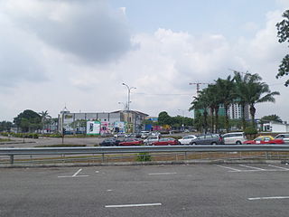
Bandar Putra Kulai is a medium-sized mixed-development township, built by IOI Group from 2001, in the Kulai District, Johor, Malaysia. The IOI Mall Kulai shopping complex is located here, as well as the Palm Villa Golf Resort, the Kulai fire brigade station and Hutan Bandar Putra park.

Iskandar Malaysia, formerly known as Iskandar Development Region (IDR; Malay: Wilayah Pembangunan Iskandar) and South Johor Economic Region (SJER), is the main southern development corridor in Johor, Malaysia. It was established on 8 November 2006. Iskandar Malaysia, which is formed by major cities such as Johor Bahru, Iskandar Puteri and Pasir Gudang, is part of the Johor Bahru Conurbation. It also lies within the original Indonesia–Malaysia–Singapore growth triangle, along with Singapore and Riau, Indonesia.
The Iskandar Coastal Highway (ICH) (formerly Johor Bahru West Coast Parkway) (Malay: Lebuhraya Pesisir Pantai Iskandar (LPPI)) or the stretch of road that includes Lebuhraya Sultan Iskandar, Persiaran Sultan Abu Bakar (formerly Jalan Skudai, Jalan Abu Bakar) and Persiaran Sultan Ismail (formerly Jalan Ibrahim and Persiaran Tun Sri Lanang) (Federal Route 52 (Iskandar Puteri–Danga Bay) and Johor State Route 1 (Danga Bay–City Centre)) is a highway in Johor Bahru District, Johor, Malaysia. The 23 km (14 mi) highway connects Iskandar Puteri in the west to Johor Bahru in the east. It is a toll free highway and part of the Iskandar Malaysia project. The Iskandar Coastal Highway is the fifth east–west-oriented expressway in the Iskandar Malaysia area after the Pasir Gudang Highway, the Pontian–Johor Bahru Link of the Second Link Expressway, the Senai–Desaru Expressway and the Johor Bahru East Coast Highway.
Iskandar Coastal Bridge or Jambatan Persisir Pantai Iskandar is an arch-shaped river bridge in Johor Bahru District, Johor, Malaysia. It is a second arch bridge in Johor Bahru after Permas Jaya Bridge. The bridge crosses Skudai River and Danga River. The bridge is built to shorten the travel distance between Iskandar Puteri to Johor Bahru town area from—km (estimated) to—km (Estimated).

The Johor Bahru Conurbation, also known as the Southern Conurbation in the National Physical Plan, is the built-up urban or metropolitan area within and around Johor Bahru in the Malaysian state of Johor, and roughly corresponds to the Iskandar Malaysia corridor. Encompassing all of Johor Bahru District, Kulai District, and parts of Pontian and Kota Tinggi Districts, the conurbation is home to over 2.4 million people as of 2020, the third largest in the country.