Tioman Island is 32 kilometres off the east coast of Rompin District, Pahang, Malaysia. It is 39 kilometres long and 12 kilometres wide and has seven villages, the largest and most populous being Kampung Tekek on the central western coast. The densely forested island is sparsely inhabited, and is surrounded by numerous coral reefs, making it a popular scuba diving, snorkelling, and surfing spot. There are many resorts and chalets for tourists around the island, which has duty-free status.

Pulau Ubin, also simply known as Ubin, is an island situated in the north east of Singapore, to the west of Pulau Tekong. The granite quarry used to be supported by a few thousand settlers on Pulau Ubin in the 1960s, but only about 40 villagers remained as of 2012. It is one of the last rural areas to be found in Singapore, with an abundance of natural flora and fauna. The island forms part of the Ubin–Khatib Important Bird Area (IBA), identified as such by BirdLife International because it supports significant numbers of visiting and resident birds, some of which are threatened. Today, the island is managed by the National Parks Board, compared to 12 agencies managing different areas of the island previously.

Singapore is a city-state and island country in maritime Southeast Asia, located at the end of the Malayan Peninsula between Malaysia and Indonesia as well as the Straits of Malacca and the South China Sea. It is heavily compact and urbanised. As of 2023, Singapore has a total land area of approximately 750 square kilometres (290 sq mi). Singapore is separated from Indonesia by the Singapore Strait and from Malaysia by the Straits of Johor.

Pedra Branca, also known as Batu Putih, is an outlying island and the easternmost point of Singapore. The name of the island, which is Portuguese for "white rock", refers to whitish guano deposited on the rock. The island consists of a small outcrop of granite rocks with an area of about 8,560 square metres (92,100 sq ft) at low tide. During the low water spring tide it measures, at its longest, 137 metres (449 ft) and has an average width of 60 metres (200 ft). Pedra Branca is situated at 1°19′48″N104°24′27″E, where the Singapore Strait meets the South China Sea.

Horsburgh Lighthouse is an active lighthouse which marks the eastern entrance to the Straits of Singapore. It is situated on the island of Pedra Branca. Singapore's earliest lighthouse by date of completion, it is located approximately 54 kilometres (34 mi) to the east of Singapore and 14 kilometres (8.7 mi) from the Malaysian state of Johor.

The Malaysia–Singapore border is an international maritime border between the Southeast Asian countries of Malaysia, which lies to the north of the border, and Singapore to the south. The boundary is formed by straight lines between maritime geographical coordinates running along or near the deepest channel of the Straits of Johor.

Ibrahim ibni Iskandar is the King of Malaysia and the fifth Sultan of modern Johor.

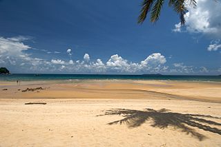
Kukup Island is an island in Pontian District, Johor, Malaysia.
The Pulau Pisang Lighthouse is a lighthouse located on the highest point of Pulau Pisang, an island in the Strait of Malacca 15 kilometres from Pontian Kechil, Johor, Malaysia.

The Pedra Branca dispute was a territorial dispute between Singapore and Malaysia over several islets at the eastern entrance to the Singapore Strait, namely Pedra Branca, Middle Rocks and South Ledge. The dispute began in 1979 and was largely resolved by the International Court of Justice (ICJ) in 2008, which opined that Pedra Branca belonged to Singapore and Middle Rocks belonged to Malaysia. Sovereignty over South Ledge belongs to the state in the territorial waters of which it is located.

The Middle Rocks are two uninhabited small rocks separated by 250 metres (820 ft) of open water at the eastern opening of the Strait of Singapore on the western edge of the South China Sea. The islands were disputed territory between Malaysia and Singapore until, on 23 May 2008, the International Court of Justice decided that sovereignty over Middle Rocks belonged to Malaysia by 15 votes to one.

Pulau Merambong, formerly known as Pulo Ular, is an uninhabited island on the Straits of Johor. The island is dominated by mangrove swamp. It is located just 1 kilometre off the coast from Tuas, Singapore. Administratively, it is placed under the Pontian District, Johor, Malaysia.

Malaysia–Singapore relations refers to the bilateral relations between Malaysia and the Republic of Singapore, after the expulsion of Singapore from Malaysia in 1965. Singapore has a high commission in Kuala Lumpur and a consulate general in Johor Bahru, while Malaysia has a high commission in Singapore. Both countries are full members of the Commonwealth of Nations and ASEAN.

The Marine Police Force, Royal Malaysia Police is the Marine Police division of the Royal Malaysia Police tasked with maintaining law and order and execute national security operations in the Malaysian Territorial Waters (MTW) and no boundaries till the high seas. The Marine Police Force serves under the control of the Malaysian Internal Security & Public Order (ISPO) Department with the role of safeguarding the security of Malaysian waters from any threats.

Johor is a state of Malaysia in the south of the Malay Peninsula. It borders with Pahang, Malacca and Negeri Sembilan to the north. Johor has maritime borders with Singapore to the south and Indonesia to the east and west. As of 2023, the state's population is 4.09 million, making it the second most populous state in Malaysia, after Selangor. Johor Bahru is the capital city and the economic centre of the state, Kota Iskandar is the state administrative centre and Muar serves as the royal capital.

The Larkin Sentral is a bus terminal located in Johor Bahru, Johor, Malaysia. It has direct bus services to and from many cities and towns in Peninsular Malaysia, Singapore and Hat Yai in Thailand. This T-shaped terminal has three levels and about 50 bus bays.
Foreign territories of Singapore are the plots of land owned by the Republic of Singapore that are geographically distant from the boundaries of the country or are located in other countries.
