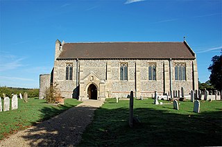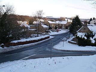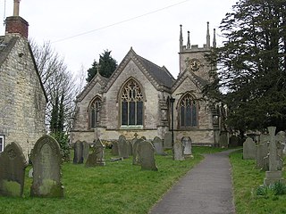
Dilham is a village and civil parish in the English county of Norfolk.

Nether Stowey is a large village in Somerset, South West England. It sits in the foothills of the Quantock Hills, just below Over Stowey. The parish of Nether Stowey covers approximately 4 km2, with a population of 1,482.

Brumstead is a village and a civil parish in the English county of Norfolk.

Hexham is a market town and civil parish in Northumberland, England, on the south bank of the River Tyne, formed by the confluence of the North Tyne and the South Tyne at Warden nearby, and close to Hadrian's Wall. Hexham was the administrative centre for the Tynedale district from 1974 to 2009. In 2011, it had a population of 13,097.

Woodsetts is a village and civil parish in the Metropolitan Borough of Rotherham in South Yorkshire, England, on the border with Nottinghamshire. It lies between the towns of Dinnington and Worksop at an elevation of around 60 metres above sea level, and has a population of 1,746 at the 2011 Census. The village originated as a medieval farming hamlet of the manor of Anston, nestled amongst the ancient woodland of which a few patches remain. The village grew rapidly in the late 19th century when a colliery was sunk at Dinnington. The village now serves as a commuter base for travellers between nearby towns.

Shotley Bridge is a village, adjoining the town of Consett to the south in County Durham, England, 15 miles northwest of Durham.

Ebchester is a village in County Durham, England. It is situated to the north of Consett and Shotley Bridge. It also sits to the south east of Whittonstall and the hamlet of Newlands. Running north east to south west along the A694, Ebchester consists of Low Westwood, Ebchester itself and East Law.

Hunstanworth is a village in County Durham, England. It is situated approximately 10 miles to the west of Consett, south-west of the village of Blanchland. The population of the village as taken at the 2011 Census was 116.

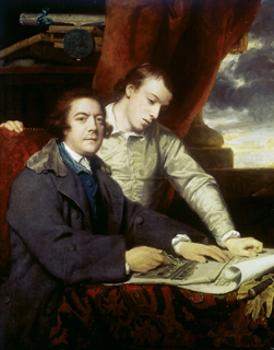
James Paine (1717–1789) was an English architect. He worked on number of country houses such as Chatsworth House, Thorndon Hall and Kedleston Hall.
Baybridge is a small village in Northumberland, England, just to the west of Blanchland and on the border with County Durham. It is situated to the west of Consett and the Derwent Reservoir, between Newbiggin and Blanchland. Baybridge is approximately 100 miles from Edinburgh, Scotland, and historically home to Northumbrian border pipers.

Hindley is a small hamlet, comprising around 20 residences. It is in the parish of Stocksfield and is just to the south of Stocksfield in Northumberland with Broomley to the west and Whittonstall to the east. It is south of the River Tyne. Hindley is composed of a large house, Hindley Hall, a farm and a post box.

Callow is a village and civil parish in Herefordshire, England, about 4 miles (6.4 km) south of Hereford. The church is dedicated to St Mary.

Alpheton is a village and civil parish in the Babergh district of Suffolk, England. Located on the A134 road about six miles north of Sudbury, in 2005 it had a population of 260, reducing to 256 at the 2011 Census. According to Eilert Ekwall the meaning of the village name is the homestead of Aelfled.

Booton is a village and civil parish in the Broadland district of the English county of Norfolk.

Juniper is a hamlet in the English county of Northumberland.

Timsbury is a village and civil parish in England, in the Bath and North East Somerset unitary authority of the county of Somerset. It lies 8 miles (13 km) south-west of Bath, close to the Cam Brook river. The parish, which includes the hamlets of Radford and Wall Mead, and part of Meadgate hamlet, had a population of 2,624 in 2011.

Healey is a rural estate and civil parish in Northumberland, England, situated between Riding Mill to the north and Slaley to the south. The neo-Norman St John's Parish Church, which was built in 1860, was awarded the 2011 Art in a Religious Context award for its windows by Anne Vibeke Mou and James Hugonin. At the 2001 census, the parish had a population of 194, falling slightly to 191 at the 2011 Census.
Charles Harrison Townsend was an English architect. He was born in Birkenhead, educated at Birkenhead School and articled to the Liverpool architect Walter Scott in 1870. He moved to London with his family in 1880 and entered partnership with the London architect Thomas Lewis Banks in 1884. Townsend became a member of the Art Workers' Guild in 1888 and in the same year was elected a Fellow of the more conservative Royal Institute of British Architects. He remained an active member of both organisations throughout his career and was elected Master of the Art Workers' Guild in 1903. He is important Modern Style architect whose favourite motif was the tree.

Newlands is a hamlet and former civil parish, now in the parish of Shotley Low Quarter, in the county of Northumberland, England. It is north of Ebchester and south of Whittonstall on the B6309, which follows the route of the ancient Roman road of Watling Street. It is situated north of the River Derwent. The nearest large settlement is Consett to the south west. In 1951 the parish had a population of 71.

Whittonstall is a hilltop village in the civil parish of Shotley Low Quarter, in Northumberland, England.


