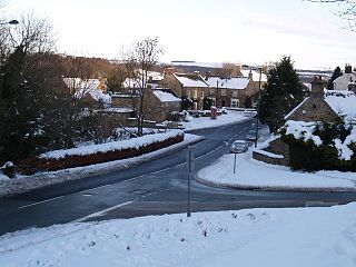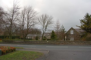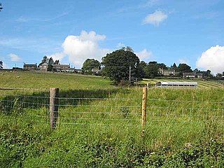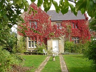
Tanfield is a village and former civil parish, now in the parish of Stanley, in the County Durham district, in the ceremonial county of Durham, England. It is near Stanley, and the location of Tanfield Railway, the Causey Arch and Tanfield School. The village was formerly a mining village.

Tynedale was a local government district in Northumberland, England. The district had a resident population of 58,808 according to the 2001 census. The main towns were Hexham, Haltwhistle and Prudhoe. The district contained part of Hadrian's Wall and the southern part of Northumberland National Park.

Shotley Bridge is a village, adjoining the town of Consett to the south in County Durham, England, 15 miles northwest of Durham.

Benfieldside is a settlement in County Durham, England. Although not a village in its own right, it is signposted and locally known. The name 'Benfieldside' survives in Benfieldside Road, a school of that name, the local tennis club and the church. Its post office no longer exists, though one remains in the village of Shotley Bridge. The Parish Church is dedicated to St. Cuthbert and is situated on Church Bank. The area is situated directly to the north of Consett, to which it is effectively attached.

Ebchester is a village in County Durham, England. It is situated to the north of Consett and Shotley Bridge. It also sits to the south east of Whittonstall and the hamlet of Newlands. Running north east to south west along the A694, Ebchester consists of Low Westwood, Ebchester itself and East Law.

Medomsley is a village in County Durham, England. It is about 2 miles (3 km) northeast of the centre of Consett, 1+1⁄2 miles (2 km) south of Hamsterley and 1 mile (2 km) southeast of Ebchester along the B6309. Leadgate lies a further mile to the south east.

Anick is a village and former civil parish, now in the parish of Sandhoe, in Northumberland, England, situated to the north of Hexham. In 1881 the parish had a population of 153.

Bingfield is a village and former civil parish, now in the parish of Whittington, in Northumberland, in England. It is situated to the north of Corbridge, off the A68 road and includes some properties situated on the A68. In 1951 the parish had a population of 76.

Broomhaugh is a village and former civil parish, now in the parish of Broomhaugh and Riding, in Northumberland, England. It is situated between Hexham and Newcastle upon Tyne, to the south of the River Tyne near Riding Mill, and adjacent to the A695 road. In 1951 the parish had a population of 228.

Hindley is a small hamlet, comprising around 20 residences. It is in the parish of Stocksfield and is just to the south of Stocksfield in Northumberland with Broomley to the west and Whittonstall to the east. It is south of the River Tyne. Hindley is composed of a large house, Hindley Hall, a farm and a post box.

Lucker is a village and former civil parish, now in the parish of Adderstone with Lucker, in the north of the county of Northumberland, England. It is about 5 miles from Bamburgh. It has an inn, The Apple Inn, and a church, St Hilda's. In 1951 the parish had a population of 120.

East Cottingwith is a village and former civil parish, now in the parish of Cottingwith, in the East Riding of Yorkshire, England. It lies on the former Derwent Navigation (canal), and approximately 9 miles (14 km) north-west of the market town of Howden and 7 miles (11 km) south-west of the market town of Pocklington. The village is 1 mile (1.6 km) west of the B1228 road and just east of the River Derwent. In 1931 the civil parish had a population of 185. East Cottingwith was formerly a township and chapelry in the parish of Aughton, from 1866 East Cottingwith was a civil parish in its own right, on 1 April 1935 the civil parish was merged with Storwood to create Cottingwith.

Ramshope is a hamlet and former civil parish, now in the parish of Rochester in Northumberland, England located in Northumberland National Park. It lies on the A68 road, between Byrness and Carter Bar on the Scottish border. In 1881 the parish had a population of 13.

Halton is a village and former civil parish, now in the parish of Whittington, in the southern part of Northumberland, England. It is situated 3 miles (4.8 km) north of Corbridge just south of Hadrian's Wall. In 1951 the parish had a population of 24.

Great Whittington is a village and former civil parish, now in the parish of Whittington, in Northumberland, England, 7 miles NE of Hexham. In 1951 the parish had a population of 158, in 2011 it had a population of 401.

Rochester is a small village and civil parish in north Northumberland, England. It is 5 miles (8 km) north-west of Otterburn on the A68 road between Corbridge and Jedburgh. The village is the site of the Roman fort of Bremenium, built there to protect the important Roman road of Dere Street, which passes through the village.

Kirkhaugh is a very small village and former civil parish, now in the parish of Knaresdale with Kirkhaugh, adjacent to the River South Tyne in Northumberland, England. The village lies close to the A689 road north of Alston, Cumbria. In 1951 the parish had a population of 79.

Lambley, formerly known as Harper Town, is a village and former civil parish, now in the parish of Coanwood, in Northumberland, England about four miles southwest of Haltwhistle. The village lies adjacent to the River South Tyne. In 1951 the parish had a population of 298. The place name Lambley refers to the "pasture of lambs". Lambley used to be the site of a small convent of Benedictine Nuns, founded by Adam de Tindale and Heloise, his wife, in the 12th century. The Scots led by William Wallace devastated it in 1296 [Rowland gives 1297]. However it was restored and one William Tynedale was ordained priest to the nunnery in about 1508 – most likely not William Tyndale, the reformer, as once believed but another man of the same name. At the time of the suppression of religious houses by Henry VIII, the nunnery contained six inmates. Nothing now remains but the bell from the nunnery, which hangs in the church, and a few carved stones. The village lies in the Midgeholme Coalfield and there are reserves of good-quality coal remaining.

Hallington is a hamlet and former civil parish about 9 miles from Hexham, now in the parish of Whittington, in the county of Northumberland, England. In 1951 the parish had a population of 75.

Newlands is a hamlet and former civil parish, now in the parish of Shotley Low Quarter, in the county of Northumberland, England. It is north of Ebchester and south of Whittonstall on the B6309, which follows the route of the ancient Roman road of Watling Street. It is situated north of the River Derwent. The nearest large settlement is Consett to the south west. In 1951 the parish had a population of 71.


