Smiths Mill | |
---|---|
Coordinates: 44°08′16″N93°46′05″W / 44.13778°N 93.76806°W Coordinates: 44°08′16″N93°46′05″W / 44.13778°N 93.76806°W | |
Country | United States |
State | Minnesota |
County | Blue Earth and Waseca |
Township | Le Ray Township and Janesville Township |
Elevation | 1,063 ft (324 m) |
Time zone | UTC-6 (Central (CST)) |
• Summer (DST) | UTC-5 (CDT) |
ZIP code | 56048 and 56024 |
Area code(s) | 507 |
GNIS feature ID | 652188 [1] |
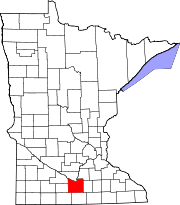
Smiths Mill is an unincorporated community in Blue Earth and Waseca counties in the U.S. state of Minnesota. The community is located along 631st Avenue near 206th Street and U.S. Highway 14. Smiths Mill is located within Le Ray Township in Blue Earth County; and also located within Janesville Township in Waseca County. Nearby places include Janesville and Eagle Lake.
In law, an unincorporated area is a region of land that is not governed by a local municipal corporation; similarly an unincorporated community is a settlement that is not governed by its own local municipal corporation, but rather is administered as part of larger administrative divisions, such as a township, parish, borough, county, city, canton, state, province or country. Occasionally, municipalities dissolve or disincorporate, which may happen if they become fiscally insolvent, and services become the responsibility of a higher administration. Widespread unincorporated communities and areas are a distinguishing feature of the United States and Canada. In most other countries of the world, there are either no unincorporated areas at all, or these are very rare; typically remote, outlying, sparsely populated or uninhabited areas.
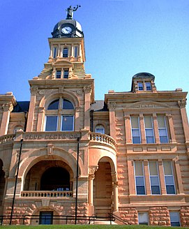
Blue Earth County is a county in the State of Minnesota. As of the 2010 United States Census, the population was 64,013. Its county seat is Mankato. The county is named for the Blue Earth River and for the deposits of blue-green clay once evident along the banks of the Blue Earth River.
Waseca County is a county in the U.S. state of Minnesota. As of the 2010 census, the population was 19,136. Its county seat is Waseca.
A post office called Smith's Mill was first established in 1876. [2] The community was named for Peter Smith, the owner of a mill. [3]
Le Ray Township is a township in Blue Earth County, Minnesota, United States. The population was 846 as of the 2000 census.
McPherson Township is a township in Blue Earth County, Minnesota, United States. The population was 470 as of the 2000 census.
Janesville is a city in Waseca County, Minnesota, United States. The population was 2,256 at the 2010 census.
Waseca is a city in Waseca County, Minnesota, United States. The population was 9,410 at the 2010 census. It is the county seat.
Verdi is an unincorporated community located in Verdi Township, Lincoln County, Minnesota, United States. The elevation is 1,762 feet (537 m). Verdi appears on the Verdi U.S. Geological Survey Map.
Douglas is an unincorporated community in Olmsted County, Minnesota, United States. The community is located along 75th Street NW near its junction with County Road 3. Douglas is located within Kalmar Township and New Haven Township. Nearby places include Oronoco, Rochester, and the Douglas State Trail. The community is about two miles from the city of Rochester.
Garden City is an unincorporated community and census-designated place (CDP) in Garden City Township, Blue Earth County, Minnesota, United States. Its population was 255 as of the 2010 census.
Delft is an unincorporated community located in Cottonwood County, Minnesota in Carson Township.
The Tracy Subdivision or Tracy Sub is a railway line in southern Minnesota owned and operated by the Dakota, Minnesota and Eastern Railroad (DM&E) subsidiary of Canadian Pacific. It begins at the end of the Waseca Subdivision in Waseca, Minnesota in the east and runs approximately 124 miles (200 km) west to Tracy where the rails continue as the Huron Subdivision. U.S. Highway 14 closely follows the train route.
Lime Creek is an unincorporated community in Belfast Township, Murray County, Minnesota, United States. It is located 2 miles northeast of Fulda.
Chester is an unincorporated community in Marion Township, Olmsted County, Minnesota, United States. It is located immediately east of Rochester along U.S. Highway 14 near Olmsted County Roads 19 and 119. Chester Woods Park is nearby.
Blakeley is an unincorporated community in Blakeley Township, Scott County, Minnesota, United States, along the Minnesota River. The community is located west-southwest of Belle Plaine near the junction of Scott County Roads 1, 6, and 60.
Meriden is an unincorporated community in Meriden Township, Steele County, Minnesota, United States, near Owatonna and Waseca. The community is located along SW 92nd Avenue near SW 13th Street.
Cambria is an unincorporated community in Blue Earth County, in the U.S. state of Minnesota.
Alma City is an unincorporated community in Waseca County, Minnesota, United States, south of Janesville.
Judson is an unincorporated community in Blue Earth County, in the U.S. state of Minnesota.
Lake Crystal is a lake in Blue Earth County, Minnesota, in the United States. The city of Lake Crystal, Minnesota is located near this lake.
Perth is an unincorporated community in Blue Earth County, in the U.S. state of Minnesota.
This article about a location in Blue Earth County, Minnesota is a stub. You can help Wikipedia by expanding it. |
This article about a location in Waseca County, Minnesota is a stub. You can help Wikipedia by expanding it. |