Soil in Tanqwa Abergele

Last updated
Chromic Vertisol in Agbe (D is location of Colluvic Calcic Luvisol F Lithic Leptosol) Chromic Vertisol in Agbe.jpg
Chromic Vertisol in Agbe (D is location of Colluvic Calcic Luvisol F Lithic Leptosol)

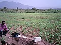
The soils of the Tanqwa Abergele woreda (district) in Tigray (Ethiopia) reflect its longstanding agricultural history, highly seasonal rainfall regime, relatively high temperatures, overall dominance of Precambrian metamorphic rocks and steep slopes. [1] [2]

Contents

Factors contributing to soil diversity

Climate

Annual rainfall depth is very variable with an average of around 600–800 mm. [3] Most rains fall during the main rainy season, which typically extends from June to September. Mean temperature in woreda town Yechila is 25.4 °C, oscillating between average daily minimum of 14.6 °C and maximum of 35.6 °C. The contrasts between day and night air temperatures are much larger than seasonal contrasts. [4]

Geology

Black meta-limestone outcropping near Taget Black meta-limestone outcropping near Taget.jpg
Black meta-limestone outcropping near Taget

From the higher to the lower locations, the following geological formations are present: [5]

Topography

As part of the Ethiopian highlands the land has undergone a rapid tectonic uplift, leading the occurrence of mountain peaks, plateaus, valleys and gorges.

Land use

Meta limestone hills at Sho'ate Hegum Meta limestone hills at Sh'ate Hegum.jpg
Meta limestone hills at Sho'ate Hegum

Generally speaking the level lands and intermediate slopes are occupied by cropland, while there is rangeland and shrubs on the steeper slopes. Remnant forests occur around Orthodox Christian churches and a few inaccessible places. A recent trend is the widespread planting of eucalyptus trees.

Environmental changes

Soil degradation in this district became important when humans started deforestation almost 5000 years ago. [7] [8] Depending on land use history, locations have been exposed in varying degrees to such land degradation.

Geomorphic regions and soil units

Given the complex geology and topography of the district, it has been organised into land systems - areas with specific and unique geomorphic and geological characteristics, characterised by a particular soil distribution along the soil catena. [9] [10] [11] Soil types are classified in line with World Reference Base for Soil Resources and reference made to main characteristics that can be observed in the field.

Adigrat Sandstone cliff and footslope

Typical catena on the Adigrat Sandstone cliff and footslope in and near Abergele Adigrat Sandstone cliff and footslope in Avergele.tif
Typical catena on the Adigrat Sandstone cliff and footslope in and near Abergele
Lithic Leptosol profile Lithic Leptosol in Agbe Ethiopia profile.jpg
Lithic Leptosol profile
Lithic Leptosol in Agbe Lithic Leptosol in Agbe Ethiopia.jpg
Lithic Leptosol in Agbe
Haplic Planosol along the road to Abiy Addi Haplic Planosol near Abiy Addi.tif
Haplic Planosol along the road to Abiy Addi

Alluvial plain of Giba River in Abergele

Typical catena in the alluvial plain of Giba River in Abergele Alluvial plain of Giba River in Avergele.tif
Typical catena in the alluvial plain of Giba River in Abergele

Gallery: soils in Tanqwa Abergele

Catena on metamorphic limestone in Abergele

Metamorphic limestone catena in Abergele Metamorphic limestone catena in Abergele.tif
Metamorphic limestone catena in Abergele
Epileptic Protovertic Cambisol profile Epileptic Protovertic Cambisol in Taget Ethiopia profile.jpg
Epileptic Protovertic Cambisol profile
Epileptic Protovertic Cambisol in Taget Epileptic Protovertic Cambisol in Taget Ethiopia.jpg
Epileptic Protovertic Cambisol in Taget

Catena on metamorphic sedimentary rock in Abergele

Metamorphic sedimentary rock catena in Abergele Metamorphic sedimentary rock catena in Abergele.tif
Metamorphic sedimentary rock catena in Abergele

Severely incised granite near Giba mouth

Typical catena on severely incised granite near Giba mouth Severely incised granite near Giba mouth.tif
Typical catena on severely incised granite near Giba mouth

Severely incised metamorphic sedimentary rock

Severely incised metamorphic sedimentary rock in Abergele Severely incised metamorphic sedimentary rock.tif
Severely incised metamorphic sedimentary rock in Abergele

Metamorphic volcanic rock in Abergele

Typical catena on metamorphic volcanic rock in Abergele Metamorphic volcanic rock in Avergele.tif
Typical catena on metamorphic volcanic rock in Abergele

Related Research Articles

Negash Place in Tigray, Ethiopia

Negash is a village in the Tigray Region of Ethiopia, which straddles the Adigrat-Mekele road 10 kilometres north of Wukro. Located in Wukro woreda.

Idaga Hamus is a town in northern Ethiopia. Located 97 kilometers north of Mekele in the Misraqawi Zone of the Tigray Region of Ethiopia, this town has a latitude and longitude of 14°11′N39°34′E with an elevation of approximately 2700 meters above sea level. At this elevation, it is one of the highest towns of this size in the Tigray Region. Idaga Hamus is located on "National Road 1", between Freweyni and Adigrat.

Chalacot Place in Tigray, Ethiopia

Chalacot or Chelekot is a village in the Tigray Region of Ethiopia. Located in the Enderta woreda of the Debub Misraqawi (Southeastern) Zone, 10 kilometers north of Antalo and 17 kilometers south of Mek'ele, the village has a latitude and longitude of 13°22′N39°28′E with an approximate elevation of 2100 meters above sea level. The Central Statistical Agency has not published an estimate for this village's 2005 population.

Atsbi Town in Tigray, Ethiopia

Atsbi is a town in Tigray, Ethiopia. Located in the Misraqawi (Eastern) Zone of the Tigray Region, about 50 kilometers northeast of Qwiha, this town has a latitude and longitude of 13°52′N39°44′E with an elevation of 2630 meters above sea level. It is the administrative center of Atsbi Wenberta woreda.

Agula Place in Tigray, Ethiopia

Agula is a town located in northern Ethiopia. Located in the Debubawi (Southern) Zone of the Tigray Region, it lies about 32 km northeast of Mek'ele, just east of the Mek'ele - Addis Ababa highway, and 25 km north of Qwiha. It has a latitude and longitude of 13°41′30″N39°35′30″E with an elevation of 1930 metres above sea level. Nearby is a stream and a pass which share the same name.

Freweyni Place in Tigray, Ethiopia

Freweyni is a town in northern Ethiopia. Located 80 kilometers north of Mekele in the Misraqawi Zone of the Tigray Region of Ethiopia, this town has a latitude and longitude of 14°3′N39°34′E with an elevation of 2480 meters above sea level and is located along Ethiopian Highway 2.

Maimekden Place in Tigray, Ethiopia

Maimekden is a village in Tigray Region, located 27 kilometers south of Wukro. It is located on the crossing of Ethiopian Highway 2 and the Mai Mekden river, flowing west to the Geba River.

Mikael Abiy Place in Tigray, Ethiopia

Mika’el Abiy is a tabia or municipality in the Dogu’a Tembien district of the Tigray Region of Ethiopia. The tabia centre is in Megesta village, located approx. 7 km to the southeast of the woreda town Hagere Selam.

Aregen Municipality in Ethiopia

Aregen is a tabia or municipality in the Dogu'a Tembien district of the Tigray Region of Ethiopia. The tabia centre is in Addi Gotet village, located approximately 11 km (6.8 mi) to the west-southwest of the woreda town Hagere Selam.

Menachek Municipality in Ethiopia

Menachek is a tabia or municipality in the Dogu'a Tembien district of the Tigray Region of Ethiopia. The tabia centre is in Addi Bayro village, located approximately 12 km to the southwest of the woreda town Hagere Selam.

Mizan (Dogua Tembien) Municipality in Ethiopia

Mizan is a tabia or municipality in the Dogu'a Tembien district of the Tigray Region of Ethiopia. This tabia includes the rock church of Debre Sema'it, as well as Arefa, reputedly birthplace of the Queen of Sheba. The tabia centre is in Kerene village, located approximately 16 km to the southwest of the woreda town centre of Hagere Selam.

Simret Municipality in Ethiopia

Simret is a tabia or municipality in the Dogu'a Tembien district of the Tigray Region of Ethiopia, which comprises the longest cave of Tigray in Zeyi, as well as Ras Alula’s birthplace in Mennewe. The tabia centre is in Dengolo village, located approximately 12 km to the southwest of the woreda town Hagere Selam.

Selam (Dogua Tembien) Municipality in Ethiopia

Selam is a tabia or municipality in the Dogu'a Tembien district of the Tigray Region of Ethiopia. The tabia centre is in Addi Werho village, located approximately 3 km to the northeast of the woreda town Hagere Selam.

Ayninbirkekin Municipality in Ethiopia

Ayninbirkekin is a tabia or municipality in the Dogu'a Tembien district of the Tigray Region of Ethiopia. Literal meaning of Ayninbirkekin in Tigrinya is "We will not bend". The tabia centre is in Halah village, located approximately 8 km to the east of the woreda town Hagere Selam. Main town is Ala'isa, situated on the ridge overseeing the Giba valley.

Soil in Kilte Awulailo

The soils of the Kilte Awula’ilo woreda (district) in Tigray, Ethiopia reflect its longstanding agricultural history, highly seasonal rainfall regime, relatively low temperatures, the presence of a wide depression at the foot of the Atsbi horst and steep slopes. Outstanding features in the soilscape are the wide ancient fluvial deposits, the soils of the granite batholith, cuestas and fertile lands behind tufa dams.

Soil in Atsbi Wenberta

The soils of the Atsbi Wenberta woreda (district) in Tigray (Ethiopia) reflect its longstanding agricultural history, highly seasonal rainfall regime and relatively low temperatures. The northern part of the district is on the high uplifted Atsbi Horst, whereas the southern part is dominated by the Des’a forest on Antalo Limestone. In between there is the fluvial landscape of Hayqi Meshal. Particularities in the southern part of the district are soil catenas on intervening plains behind tufa dams and in a polje.

Soil in Saisi Tsaida Imba

The soils of the Sa'isi Tsa'ida Imba woreda (district) in Tigray (Ethiopia) reflect its longstanding agricultural history, highly seasonal rainfall regime, relatively low temperatures, overall dominance of metamorphic and sandstone lithology and steep slopes.

The soils of the Inderta woreda (district) in Tigray (Ethiopia) reflect its longstanding agricultural history, highly seasonal rainfall regime, relatively low temperatures, overall dominance of limestone and dolerite lithologies and steep slopes. Outstanding features in the soilscape are wide plains with Vertisols.

Soil in Kola Tembien

The soils of the Kola Tembien woreda (district) in Tigray (Ethiopia) reflect its longstanding agricultural history, highly seasonal rainfall regime, relatively high temperatures, overall dominance of sandstone and metamorphic lithology and steep slopes.

Soil in Dogua Tembien

The soils of the Dogu’a Tembien woreda (district) in Tigray (Ethiopia) reflect its longstanding agricultural history, highly seasonal rainfall regime, relatively low temperatures, an extremely great variety in lithology and steep slopes. Outstanding features in the soilscape are the fertile highland Vertisols and Phaeozems in forests.

References

  1. Nyssen, Jan; Tielens, Sander; Gebreyohannes, Tesfamichael; Araya, Tigist; Teka, Kassa; Van De Wauw, Johan; Degeyndt, Karen; Descheemaeker, Katrien; Amare, Kassa; Haile, Mitiku; Zenebe, Amanuel; Munro, Neil; Walraevens, Kristine; Gebrehiwot, Kindeya; Poesen, Jean; Frankl, Amaury; Tsegay, Alemtsehay; Deckers, Jozef (2019). "Understanding spatial patterns of soils for sustainable agriculture in northern Ethiopia's tropical mountains". PLoS ONE. 14 (10): e0224041. doi:10.1371/journal.pone.0224041. PMC   6804989 . PMID   31639144.
  2. Kassa Teka, and colleagues (2015). "Soil, land use and landform relationship in the Precambrian lowlands of northern Ethiopia". Catena. 131: 84–91. doi:10.1016/j.catena.2015.03.010.
  3. Jacob, M. and colleagues (2013). "Assessing spatio-temporal rainfall variability in a tropical mountain area (Ethiopia) using NOAAs Rainfall Estimates". International Journal of Remote Sensing. 34 (23): 8305–8321. Bibcode:2013IJRS...34.8319J. doi:10.1080/01431161.2013.837230. hdl: 1854/LU-4252226 .
  4. Jacob, M. and colleagues (2019). Dogu'a Tembien's Tropical Mountain Climate. In: Geo-trekking in Ethiopia's Tropical Mountains — The Dogu'a Tembien District. SpringerNature. doi:10.1007/978-3-030-04955-3_3. ISBN   978-3-030-04954-6.
  5. Sembroni, A.; Molin, P.; Dramis, F. (2019). Regional geology of the Dogu'a Tembien massif. In: Geo-trekking in Ethiopia's Tropical Mountains — The Dogu'a Tembien District. SpringerNature. ISBN   978-3-030-04954-6.
  6. Moeyersons, J. and colleagues (2006). "Age and backfill/overfill stratigraphy of two tufa dams, Tigray Highlands, Ethiopia: Evidence for Late Pleistocene and Holocene wet conditions". Palaeogeography, Palaeoclimatology, Palaeoecology. 230 (1–2): 162–178. Bibcode:2006PPP...230..165M. doi:10.1016/j.palaeo.2005.07.013.
  7. "Human impact on the environment in the Ethiopian and Eritrean highlands - a state of the art". Earth-Science Reviews. 64 (3–4): 273–320. 2004. doi:10.1016/S0012-8252(03)00078-3.
  8. Blond, N. and colleagues (2018). "Terrasses alluviales et terrasses agricoles. Première approche des comblements sédimentaires et de leurs aménagements agricoles depuis 5000 av. n. è. à Wakarida (Éthiopie)". Géomorphologie: Relief, Processus, Environnement. 24 (3): 277–300. doi:10.4000/geomorphologie.12258.
  9. Bui, E.N. (2004). "Soil survey as a knowledge system". Geoderma. 120 (1–2): 17–26. Bibcode:2004Geode.120...17B. doi:10.1016/j.geoderma.2003.07.006.
  10. "Principes de la cartographie des pédopaysages dans les Alpes". Écologie. 29 (1–2): 49. 1998. ProQuest   223074690.
  11. Tielens, Sander (2012). Towards a soil map of the Geba catchment using benchmark soils. MSc thesis. Leuven, Belgium: K.U.Leuven.