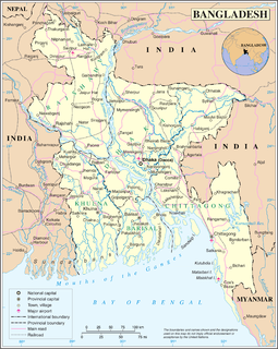
Bangladesh gained independence in 1971 and since then, the transportation sector grew rapidly and transportation medium on land and rivers began to develop. Air travel came into existence later. Though Bangladesh has greatly evolved in the transportation sector, it still, unfortunately, has many flaws which hamper the development of other economic and social sectors. The transportation has evolved in mostly with land vehicles but it still needs improvement with safety standards which endangers the life of civilians.
The Partition of Bengal in 1947, part of the Partition of India, divided the British Indian province of Bengal based on the Radcliffe Line between the Dominion of India and the Dominion of Pakistan. The Hindu-majority West Bengal became a state of India, and the Muslim-majority East Bengal became a province of Pakistan.

New Cooch Behar is a Junction station on the Barauni–Guwahati line of Northeast Frontier Railway. It serves Cooch Behar city in Cooch Behar district in the Indian state of West Bengal.

Bhurungamari is the northernmost upazila of Kurigram District in the Division of Rangpur, Bangladesh.

Hili is a village in Hili CD Block in Balurghat subdivision of Dakshin Dinajpur district in the Indian state of West Bengal. It is a border checkpoint on the India-Bangladesh border.
Radhikapur railway station is a station serving Radhikapur in the Uttar Dinajpur district, West Bengal, India. It is an active rail transit system on the Bangladesh–India border. It is an India–Bangladesh land border checkpoint and has a land customs station for movement of goods.

The Howrah–New Jalpaiguri line is a railway line connecting Howrah with New Jalpaiguri in North Bengal in the Indian state of West Bengal. The line continues through North Bengal and western part of Assam to connect with Guwahati. The Naihati–Bandel link allows trains from another terminus Sealdah in Calcutta to use this route. The line uses a major part of the Barharwa–Azimganj–Katwa loop. Many trains use an alternative line between Howrah and New Farakka, via Bardhaman and Rampurhat. Other parts of West Bengal and Bihar are well-connected to this line. It is under the administrative jurisdiction of Eastern Railway and Northeast Frontier Railway.

The Haldibari–New Jalpaiguri line connecting Haldibari in Cooch Behar district and New Jalpaiguri in Jalpaiguri district in the Indian state of West Bengal, was since 1878 a part of the Kolkata–Siliguri broad-gauge route. With the partition of India in 1947, while the main part of the route lay in Pakistan, later Bangladesh, the two ends of the route lying in India were detached.. However, the route continued to be operational till the Indo-Pakistani War of 1965. Thereafter, the route had been closed till its reopening in 2020. The rest of the line had been in use in the respective countries.

Mahisasan is a border railway station and a defunct railway transit facility point on the India–Bangladesh border in Karimganj district in the Indian state of Assam. The corresponding station on the Bangladesh side is Shahbajpur in Sylhet District. The border station is linked to Karimganj 11 kilometres (6.8 mi) away. The Mahisasan–Shahbajpur route has not been operational since December, 1996 due to lack of traffic.

The Burimari–Lalmonirhat–Parbatipur line is a 163.4 kilometres (101.5 mi) long railway line connecting Burimari and Parbatipur Junction in northern Bangladesh. It also connects to Kurigram and Ramna Bazar. This track is under the jurisdiction of Bangladesh Railway.
New Gitaldaha railway station is on the broad-gauge Alipurduar–Bamanhat branch line.
Mogalhat is a border railway station in Bangladesh, situated in Lalmonirhat District, in Rangpur Division. It is a defunct railway transit point on the Bangladesh-India border.
Lalmonirhat is a railway junction in Lalmonirhat District of Rangpur Division in Bangladesh.
Bamanhat railway station serves Bamanhat in Cooch Behar district in the Indian state of West Bengal.
Gitaldaha is a village and a gram panchayat in the Dinhata I CD block in the Dinhata subdivision of the Cooch Behar district in the state of West Bengal, India.
Changrabandha is a census town and a gram panchayat in Mekhliganj CD block in Mekhliganj subdivision of Cooch Behar district in the state of West Bengal, India. It is a border checkpoint on the Bangladesh-India border.
Radhikapur is a village and a gram panchayat in Kaliaganj CD block in Raiganj subdivision of Uttar Dinajpur district in the state of West Bengal, India. It is a border checkpoint on the Bangladesh-India border.
Golakganj is a railway junction station on the Fakiragram–Dhubri branch line and the New Cooch Behar–Golakganj branch line. A new line is being laid to connect Golakganj with Jogighopa. It is located in Dhubri district in the Indian state of Assam. This station serves the Golakganj town.

The Benapole Border Crossing also known as the Petrapole Crossing is an international border crossing between Benapole, Jessore, Bangladesh, and Petrapole, North 24 Parganas, West Bengal, India.
