A hill station is a town located at a higher elevation than the nearby plain or valley. The English term was originally used mostly in colonial Asia, but also in Africa, for towns founded by European colonialists as refuges from the summer heat and, as Dale Kennedy observes about the Indian context, "the hill station (...) was seen as an exclusive British preserve: here it was possible to render the Indian into an outsider". The term is still used in present day, particularly in India, which has the largest number of hill stations, most are situated at an altitude of approximately 1,000 to 2,500 metres.

Doda district is an administrative district of the Jammu division of Indian-administered Jammu and Kashmir in the disputed Kashmir region.

Bhaderwah or Bhadarwah is a town, tehsil, and sub-district in the Doda district of Jammu Division of Jammu and Kashmir, India.

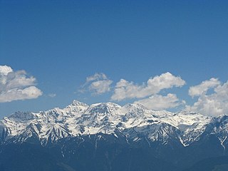
The Pir Panjal Range is a range of mountains in the Lower Himalayan region located in the Western Himalayas of northern Indian subcontinent. It runs southeast to northwest between the Beas and Neelam/Kishanganga rivers, in the Indian state of Himachal Pradesh and Indian-administered union territory of Jammu and Kashmir, with its northwestern end extending into territory administered by Pakistan. The Himalayas show a gradual elevation towards the Dhauladhar and Pir Panjal ranges. Pir Panjal is the largest and westernmost range of the Lesser Himalayas. Near the bank of the Sutlej River, it dissociates itself from the main Himalayan range and forms a divide between the Beas and Ravi rivers on one side and the Chenab on the other. Further west, the Pir Panjal range forms the southwestern boundary of the Kashmir Valley, separating it from the hills of Jammu region, forming a divide between the Jhelum and Chenab rivers.
The Tawi is a river that flows through the Jammu region in the Indian-administered Jammu and Kashmir and Pakistan-administered Azad Jammu and Kashmir. The Tawi is a major left bank tributary of the river Chenab.

The state of Himachal Pradesh is spread over an area 55,673 km2 (21,495 sq mi) and is bordered by Jammu and Kashmir and Ladakh on the north, Punjab on the southwest, Haryana on the south, Uttarakhand on the southeast, a small border with Uttar Pradesh in the south, and Tibet on the east. Entire Himachal Pradesh lies in the mountainous Himalaya region, rich in natural resources

Nun Kun is a mountain massif of the greater Himalayan range, located on the border of Jammu and Kashmir and Ladakh in northern India. It consists of two main peaks: Nun and Kun, separated from each other by a 4 km long snowy plateau, with a third peak of the massif, known as Pinnacle Peak, lying at its eastern end. Nun is the tallest peak of Jammu and Kashmir, while its sister peak Kun lies in Ladakh. It is about 250 km (160 mi) east of Srinagar. The Nun Kun massif is bounded to the north by the Suru valley and the Zanskar range, flanked to the east by the Pensi La (4400 m), which separates the Suru and Zanskar Valleys, while the Kishtwar National Park and the Krash Nai river lie to its south. The rocks predominantly are stratified sedimentary rocks composed of shale and sandstone. Metamorphic rocks and granite formations are also seen at places. The area is rich in minerals, especially garnets.

Brammah is a mountain massif in the Kishtwar Himalayas of Jammu and Kashmir, India, east of the town of Kishtwar and near the border with Himachal Pradesh. It comprises four peaks, listed in order from west to east: Brammah I, Flat Top, Brammah II,, and Arjuna.

Himachal Pradesh provides water to both the Indus and Ganges basins. The drainage systems of the region are the Chenab, the Ravi, the Beas, the Satluj and the Yamuna. These rivers are perennial and are fed by snow and rainfall. They are protected by an extensive cover of natural vegetation.

Rājmā, also known as rajmah, rāzmā, or lal lobia, is a vegetarian dish, originating from the Indian subcontinent, consisting of red kidney beans in a thick gravy with many Indian whole spices, and is usually served with rice. It is a part of the regular diet in Northern India, Nepal and Punjab province of Pakistan. The dish developed after the red kidney bean was brought to the Indian subcontinent from Mexico. Rajma Chawal is kidney beans served with boiled rice.

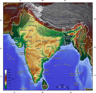
The Indian Himalayan Region is the section of the Himalayas within the Republic of India, spanning thirteen Indian states and union territories, namely Ladakh, Jammu and Kashmir, Himachal Pradesh, Uttarakhand, Sikkim, West Bengal, Manipur, Meghalaya, Mizoram, Nagaland, Tripura, Assam, and Arunachal Pradesh. The region is responsible for providing water to a large part of the Indian subcontinent and contains various flora and fauna.
Salooni is the tehsil headquarter and Sub-Division in Chamba district of Himachal Pradesh, India. Salooni is an important regional administrative and economic centre. It has a mini secretariat, SDM office, government senior secondary school, Degree College, CSK HP Krishi Vishvavidyalaya Mountain Agriculture Research and Extension Stations, community health centre and many other sub-division level important government offices. Salooni falls under Dalhousie legislative constituency. The entrance to the small township has a series of few quaint shops, followed by small ground with an ancient goddess Kali temple at other end.

Paddar, also spelled Padar, is a Sub-District and remote valley in the Kishtwar district of the union territory of Jammu and Kashmir, India. It falls in the Jammu division. It consists of two tehsils namely Machail and Atholi Paddar The valley covers the entire southeastern portion of the Kishtwar district. It borders Zanskar (Ladakh) in the north and east, Pangi in the south and the rest of Jammu and Kashmir in the west. The valley is known for its Sapphire mines. It lies along the Chandrabhaga river (Chenab) in the Great Himalayas. Paddar is one of the most remote regions of Jammu and Kashmir. There are a number of small valleys within Paddar, such as Machail, Gandhari, Kabban, Ongai, Bhuzunu, Barnaj, Bhuzas, Kijai Nallah, Ishtiyari, Tiyari and Dharlang, among others.
Chumar or Chumur is a village and the centre of nomadic grazing region located in south-eastern Ladakh, India. It is in Rupshu block, south of the Tso Moriri lake, on the bank of the Parang River, close to Ladakh's border with Tibet. Since 2012, China has disputed the border in this area, though the Chumur village itself is undisputed.

Bhalessa is a geographical area within Doda district in the Jammu region of India-administered Kashmir. It consists of the Bunjwah and Bhalessa Valleys, and comprises the three Tehsils of Kahara, Chilly Pingal and Gandoh.
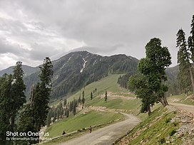
Padri Top or Padri Pass is a hill station situated 41 kilometres (25 mi) North of Bhaderwah on [interstate link] Bhaderwah–Chamba National Highway. It has 99.7 kilometres (62.0 mi) long meadows and used for adventure sports like snow-skiing in winters and Paragliding in summers. It is the highest Pass on Bhaderwah-Chamba National Highway located between the borders of Jammu and Kashmir and Himachal Pradesh.
Chattergala Pass, is a mountain pass in the Middle Himalayas of the Jammu region of Jammu and Kashmir, India, connecting the town of Bhaderwah in the Neeru river valley with Basohli in the Shiwalik hills. A road tunnel is planned to be constructed under the pass. The tunnel will be 6.8 km long and will connect Kathua and Doda via Bani. The tunnel is expected to be completed in about 4 years and its construction cost is around Rs. 4,000 crore. The tunnel will facilitate all-weather road connectivity between the regions of Doda and Kathua districts of Jammu and Kashmir. After completion of this tunnel, the travel time from Lakhanpur to Doda would be reduced to four hours.
Sarthal valley is a tourist destination in Kathua district of Jammu and Kashmir in India. This valley covers snow for six months and is covered with snow clad mountains. This area is connecting Bhaderwah on North and Himachal Pradesh on East. The area is situated 20 kilometres (12 mi) from Bani.
Neeru river or Neru river is the river tributary of the Chenab River, beginning at the Sonbain Ashapati Glacier of the Bhaderwah and joining the Chenab at Pul Doda in the Doda district. The Gupt Ganga temple of Bhaderwah is located on the bank of this river.

The Bhaderwah–Chamba Road is an interstate link road that connects the Indian states of Jammu and Kashmir and Himachal Pradesh. The road runs through the valleys and mountains of the western Himalayas, providing a transportation link between the two states.


