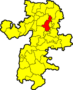
Nagaybaksky District is an administrative and municipal district (raion), one of the twenty-seven in Chelyabinsk Oblast, Russia. It is located in the south of the oblast. The area of the district is 3,022 square kilometers (1,167 sq mi). Its administrative center is the rural locality of Fershampenuaz. Population: 20,927 (2010 Census); 24,310 ; 25,959 (1989 Census). The population of Fershampenuaz accounts for 20.9% of the district's total population.

Ust-Katav is a town in Chelyabinsk Oblast, Russia, located on the Yuryuzan River. Population: 23,580 (2010 Census); 25,898 (2002 Census); 31,218 (1989 Census).

Yuzhnouralsk is a town in Chelyabinsk Oblast, Russia, located on the Uvelka River 88 kilometers (55 mi) south of Chelyabinsk. Population: 37,877 (2010 Census); 39,275 (2002 Census); 41,335 (1989 Census).

Agapovsky District is an administrative and municipal district (raion), one of the twenty-seven in Chelyabinsk Oblast, Russia. It is located in the southwest of the oblast. The area of the district is 2,603.6 square kilometers (1,005.3 sq mi). Its administrative center is the rural locality of Agapovka. Population: 34,779 (2010 Census); 37,816 ; 35,919 (1989 Census). The population of Agapovka accounts for 18.9% of the district's total population.

Argayashsky District is an administrative and municipal district (raion), one of the twenty-seven in Chelyabinsk Oblast, Russia. It is located in the north of the oblast. The area of the district is 2,791 square kilometers (1,078 sq mi). Its administrative center is the rural locality of Argayash. Population: 41,387 (2010 Census); 42,808 ; 43,733 (1989 Census). The population of Argayash accounts for 24.3% of the district's total population.

Chebarkulsky District is an administrative and municipal district (raion), one of the twenty-seven in Chelyabinsk Oblast, Russia. It is located in the west of the oblast. The area of the district is 2,879 square kilometers (1,112 sq mi). Its administrative center is the town of Chebarkul. Population: 29,606 (2010 Census); 29,251 ; 34,244 (1989 Census).

Chesmensky District is an administrative and municipal district (raion), one of the twenty-seven in Chelyabinsk Oblast, Russia. It is located in the southeast of the oblast. The area of the district is 2,663 square kilometers (1,028 sq mi). Its administrative center is the rural locality of Chesma. Population: 20,185 (2010 Census); 20,459 ; 19,638 (1989 Census). The population of Chesma accounts for 32.3% of the district's total population.

Kartalinsky District is an administrative and municipal district (raion), one of the twenty-seven in Chelyabinsk Oblast, Russia. It is located in the southeast of the oblast. The area of the district is 4,737 square kilometers (1,829 sq mi). Its administrative center is the town of Kartaly. Population : 20,256 (2010 Census); 21,961 ; 22,170 (1989 Census).

Katav-Ivanovsky District is an administrative and municipal district (raion), one of the twenty-seven in Chelyabinsk Oblast, Russia. It is located in the west of the oblast. The area of the district is 3,415 square kilometers (1,319 sq mi). Its administrative center is the town of Katav-Ivanovsk. Population : 15,327 (2010 Census); 17,739 ; 25,473 (1989 Census).

Kizilsky District is an administrative and municipal district (raion), one of the twenty-seven in Chelyabinsk Oblast, Russia. It is located in the southwest of the oblast. The area of the district is 4,413 square kilometers (1,704 sq mi). Its administrative center is the rural locality of Kizilskoye. Population: 25,876 (2010 Census); 27,679 ; 30,220 (1989 Census). The population of Kizilskoye accounts for 25.7% of the district's total population.

Krasnoarmeysky District is an administrative and municipal district (raion), one of the twenty-seven in Chelyabinsk Oblast, Russia. It is located in the northeast of the oblast. The area of the district is 3,835 square kilometers (1,481 sq mi). Its administrative center is the rural locality of Miasskoye. Population: 41,710 (2010 Census); 43,553 ; 45,881 (1989 Census). The population of Miasskoye accounts for 23.4% of the district's total population.

Kunashaksky District is an administrative and municipal district (raion), one of the twenty-seven in Chelyabinsk Oblast, Russia. It is located in the northeast of the oblast. The area of the district is 3,280 square kilometers (1,270 sq mi). Its administrative center is the rural locality of Kunashak. Population: 30,112 (2010 Census); 32,225 ; 35,167 (1989 Census). The population of Kunashak accounts for 20.9% of the district's total population.

Oktyabrsky District is an administrative and municipal district (raion), one of the twenty-seven in Chelyabinsk Oblast, Russia. It is located in the east of the oblast. The area of the district is 4,356 square kilometers (1,682 sq mi). Its administrative center is the rural locality of Oktyabrskoye. Population: 21,097 (2010 Census); 28,245 ; 30,050 (1989 Census). The population of Oktyabrskoye accounts for 32.1% of the district's total population.

Troitsky District is an administrative and municipal district (raion), one of the twenty-seven in Chelyabinsk Oblast, Russia. It is located in the central and eastern parts of the oblast. The area of the district is 4,591 square kilometers (1,773 sq mi). Its administrative center is the town of Troitsk. Population: 28,059 (2010 Census); 33,816 ; 34,831 (1989 Census).
Uvelsky District is an administrative and municipal district (raion), one of the twenty-seven in Chelyabinsk Oblast, Russia. It is located in the eastern central part of the oblast. The area of the district is 2,330 square kilometers (900 sq mi). Its administrative center is the rural locality of Uvelsky. Population: 31,867 (2010 Census); 32,188 ; 29,513 (1989 Census). The population of the administrative center accounts for 33.0% of the district's total population.

Uysky District is an administrative and municipal district (raion), one of the twenty-seven in Chelyabinsk Oblast, Russia. It is located in the west of the oblast. The area of the district is 2,637 square kilometers (1,018 sq mi). Its administrative center is the rural locality of Uyskoye. Population: 26,184 (2010 Census); 28,555 ; 29,132 (1989 Census). The population of Uyskoye accounts for 28.1% of the district's total population.
Varnensky District is an administrative and municipal district (raion), one of the twenty-seven in Chelyabinsk Oblast, Russia. It is located in the southeast of the oblast. The area of the district is 3,853 square kilometers (1,488 sq mi). Its administrative center is the rural locality of Varna. Population: 27,357 (2010 Census); 30,802 ; 30,773 (1989 Census). The population of Varna accounts for 36.1% of the district's total population.

Verkhneuralsky District is an administrative and municipal district (raion), one of the twenty-seven in Chelyabinsk Oblast, Russia. It is located in the west of the oblast. The area of the district is 3,510 square kilometers (1,360 sq mi). Its administrative center is the town of Verkhneuralsk. Population: 36,198 (2010 Census); 42,121 ; 44,470 (1989 Census). The population of Verkhneuralsk accounts for 26.1% of the district's total population.

Lokomotivny is a closed urban locality in Chelyabinsk Oblast, Russia, located 264 kilometers (164 mi) southwest from Chelyabinsk. Population: 8,498 (2010 Census); 10,741 (2002 Census).
Dolgoderevenskoye is a rural locality and the administrative center of Sosnovsky District, Chelyabinsk Oblast, Russia. Population: 7,700 (2010 Census); 7,027 (2002 Census); 6,143 (1989 Census).