
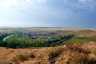
Nagaybaksky District is an administrative and municipal district (raion), one of the twenty-seven in Chelyabinsk Oblast, Russia. It is located in the south of the oblast. The area of the district is 3,022 square kilometers (1,167 sq mi). Its administrative center is the rural locality of Fershampenuaz. Population: 20,927 (2010 Census); 24,310 ; 25,959 (1989 Census). The population of Fershampenuaz accounts for 20.9% of the district's total population.

Bakal is a town in Satkinsky District of Chelyabinsk Oblast, Russia, located on the western slopes of the Ural Mountains on the Chelyabinsk–Ufa railway branch, 264 kilometers (164 mi) west from Chelyabinsk, the administrative center of the oblast. Population: 20,940 (2010 Census); 22,314 (2002 Census); 24,101 (1989 Census).

Ust-Katav is a town in Chelyabinsk Oblast, Russia, located on the Yuryuzan River. Population: 23,580 (2010 Census); 25,898 (2002 Census); 31,218 (1989 Census).

Yuzhnouralsk is a town in Chelyabinsk Oblast, Russia, located on the Uvelka River 88 kilometers (55 mi) south of Chelyabinsk. Population: 37,877 (2010 Census); 39,275 (2002 Census); 41,335 (1989 Census).

Argayashsky District is an administrative and municipal district (raion), one of the twenty-seven in Chelyabinsk Oblast, Russia. It is located in the north of the oblast. The area of the district is 2,791 square kilometers (1,078 sq mi). Its administrative center is the rural locality of Argayash. Population: 41,387 (2010 Census); 42,808 ; 43,733 (1989 Census). The population of Argayash accounts for 24.3% of the district's total population.
Bredinsky District is an administrative and municipal district (raion), one of the twenty-seven in Chelyabinsk Oblast, Russia. It is located in the south of the oblast. The area of the district is 5,076 square kilometers (1,960 sq mi). Its administrative center is the rural locality of Bredy. Population: 28,498 (2010 Census); 33,039 ; 30,750 (1989 Census). The population of Bredy accounts for 33.2% of the district's total population.

Chesmensky District is an administrative and municipal district (raion), one of the twenty-seven in Chelyabinsk Oblast, Russia. It is located in the southeast of the oblast. The area of the district is 2,663 square kilometers (1,028 sq mi). Its administrative center is the rural locality of Chesma. Population: 20,185 (2010 Census); 20,459 ; 19,638 (1989 Census). The population of Chesma accounts for 32.3% of the district's total population.

Kartalinsky District is an administrative and municipal district (raion), one of the twenty-seven in Chelyabinsk Oblast, Russia. It is located in the southeast of the oblast. The area of the district is 4,737 square kilometers (1,829 sq mi). Its administrative center is the town of Kartaly. Population : 20,256 (2010 Census); 21,961 ; 22,170 (1989 Census).

Kaslinsky District is an administrative and municipal district (raion), one of the twenty-seven in Chelyabinsk Oblast, Russia. It is located in the north of the oblast. The area of the district is 3,356 square kilometers (1,296 sq mi). Its administrative center is the town of Kasli. Population : 17,680 (2010 Census); 14,955 ; 30,627 (1989 Census).

Kizilsky District is an administrative and municipal district (raion), one of the twenty-seven in Chelyabinsk Oblast, Russia. It is located in the southwest of the oblast. The area of the district is 4,413 square kilometers (1,704 sq mi). Its administrative center is the rural locality of Kizilskoye. Population: 25,876 (2010 Census); 27,679 ; 30,220 (1989 Census). The population of Kizilskoye accounts for 25.7% of the district's total population.

Kusinsky District is an administrative and municipal district (raion), one of the twenty-seven in Chelyabinsk Oblast, Russia. It is located in the northwest of the oblast. The area of the district is 1,513 square kilometers (584 sq mi).} Its administrative center is the town of Kusa. Population: 29,392 (2010 Census); 32,738 ; 37,100 (1989 Census). The population of Kusa accounts for 63.9% of the district's total population.

Nyazepetrovsky District is an administrative and municipal district (raion), one of the twenty-seven in Chelyabinsk Oblast, Russia. It is located in the northwest of the oblast. The area of the district is 3,459 square kilometers (1,336 sq mi). Its administrative center is the town of Nyazepetrovsk. Population: 18,261 (2010 Census); 21,527 ; 27,767 (1989 Census). The population of Nyazepetrovsk accounts for 68.2% of the district's total population.

Troitsky District is an administrative and municipal district (raion), one of the twenty-seven in Chelyabinsk Oblast, Russia. It is located in the central and eastern parts of the oblast. The area of the district is 4,591 square kilometers (1,773 sq mi). Its administrative center is the town of Troitsk. Population: 28,059 (2010 Census); 33,816 ; 34,831 (1989 Census).
Uvelsky District is an administrative and municipal district (raion), one of the twenty-seven in Chelyabinsk Oblast, Russia. It is located in the eastern central part of the oblast. The area of the district is 2,330 square kilometers (900 sq mi). Its administrative center is the rural locality of Uvelsky. Population: 31,867 (2010 Census); 32,188 ; 29,513 (1989 Census). The population of the administrative center accounts for 33.0% of the district's total population.

Uysky District is an administrative and municipal district (raion), one of the twenty-seven in Chelyabinsk Oblast, Russia. It is located in the west of the oblast. The area of the district is 2,637 square kilometers (1,018 sq mi). Its administrative center is the rural locality of Uyskoye. Population: 26,184 (2010 Census); 28,555 ; 29,132 (1989 Census). The population of Uyskoye accounts for 28.1% of the district's total population.
Varnensky District is an administrative and municipal district (raion), one of the twenty-seven in Chelyabinsk Oblast, Russia. It is located in the southeast of the oblast. The area of the district is 3,853 square kilometers (1,488 sq mi). Its administrative center is the rural locality of Varna. Population: 27,357 (2010 Census); 30,802 ; 30,773 (1989 Census). The population of Varna accounts for 36.1% of the district's total population.

Yetkulsky District is an administrative and municipal district (raion), one of the twenty-seven in Chelyabinsk Oblast, Russia. It is located in the east of the oblast. The area of the district is 2,525 square kilometers (975 sq mi). Its administrative center is the rural locality of Yetkul. Population: 30,697 (2010 Census); 30,165 ; 29,239 (1989 Census). The population of Yetkul accounts for 22.0% of the district's total population.

Lokomotivny is a closed urban locality in Chelyabinsk Oblast, Russia, located 264 kilometers (164 mi) southwest from Chelyabinsk. Population: 8,498 (2010 Census); 10,741 (2002 Census).
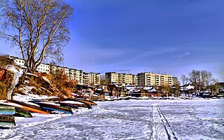
Satka is a town and the administrative center of Satkinsky District in Chelyabinsk Oblast, Russia, located on the western slope of the Southern Ural Mountains on the bank of the Satka River, 190 kilometers (120 mi) from Chelyabinsk, the administrative center of the oblast. Population: 45,178 (2010 Census); 49,686 (2002 Census); 50,664 (1989 Census).

Kropachyovo is an urban-type settlement in Ashinsky District of Chelyabinsk Oblast, Russia. Population: 5,018 (2010 Census); 5,290 (2002 Census); 5,602 (1989 Census).


