
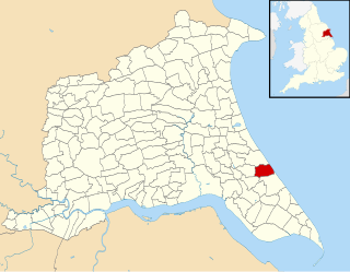
Roos is a village and civil parish in the East Riding of Yorkshire, England. It is situated 12 miles (19 km) east from Kingston upon Hull city centre and 3.5 miles (6 km) north-west from Withernsea, and on the B1242 road.

Allerthorpe is a village and civil parish in the East Riding of Yorkshire, England. It is situated approximately 1.5 miles (2.4 km) south-west from the town of Pocklington.

Asselby is a village and civil parish in the East Riding of Yorkshire, England. It is located in the south-west of the county, north of the River Ouse. It is situated approximately 2 miles (3.2 km) west of the market town of Howden. The land surrounding Asselby is very flat and intersected by dykes which drain into the Rivers Aire and Ouse.

Atwick is a village and civil parish in Holderness in the East Riding of Yorkshire, England. The village is near the North Sea coast, and 2 miles (3.2 km) north of Hornsea on the B1242 road.
Sutton-under-Whitestonecliffe is a village and civil parish in the Hambleton district of North Yorkshire, England. Historically part of the North Riding of Yorkshire, it is situated on the A170 at the foot of Sutton Bank, about three miles east of Thirsk.

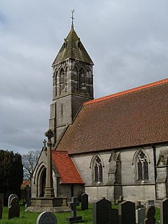
Hemingbrough is a small village and civil parish in the Selby District of North Yorkshire, England that is located approximately 5 miles (8 km) from Selby and 4 miles (6.4 km) from Howden on the A63. The village has a 12th-century former collegiate church, a Methodist chapel and shops. The village also has a primary school and nursery as well as a playing field for the local children. The surrounding area makes up part of the Humberhead Levels and is flat land mainly used for mixed agriculture. It is thought that from this village came Walter of Hemingbrough, one of Britain's early chroniclers. Writing in the 14th century, he gave us a history beginning with the Norman conquest, now in the British Museum.
Fangfoss is a village and civil parish in the East Riding of Yorkshire, England. It is situated approximately 11 miles (18 km) to the east of the city of York and 3.5 miles (6 km) north-west of the town of Pocklington. The parish includes Bolton. The civil parish is called "Fangfoss" and its parish council is called "Fangfoss with Bolton Parish Council" after Bolton parish was abolished on 1 April 1935 and merged with Fangfoss. The parish covers an area of 900.98 hectares. In 2011 it had a population of 581, a decrease on the 2001 UK census figure of 602.

Ulrome is a village and civil parish in the East Riding of Yorkshire, England. It is situated approximately 6 miles (9.7 km) north of the town of Hornsea and on the east side of the B1242 road. The parish includes the village of Lissett. Its area is 1,139.535 hectares, in 2011 had a population of 239, a reduction on the 2001 UK census figure of 260.

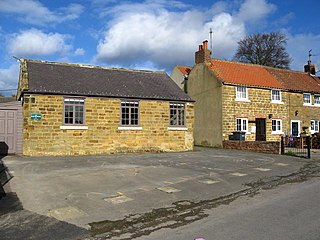
North Cliffe is a hamlet and former civil parish, now in the parish of South Cliffe, in the East Riding of Yorkshire, England. It is situated about 3 miles (5 km) north of North Cave, 2 miles (3.2 km) west of Newbald and 3 miles south of Market Weighton. The hamlet bestrides Cliffe Road. On the eastern side lies the houses, and to the west is a small church/chapel. In 1931 the parish had a population of 71.

Newbald is a civil parish in the East Riding of Yorkshire, England. It is situated approximately 8 miles (13 km) west of the market town of Beverley and covering an area of 2,429.702 hectares.
Riston is a civil parish in the East Riding of Yorkshire, England. It is situated approximately 9 miles (14 km) north of Hull city centre and covering an area of 1,374.241 hectares.

Ellerby is a civil parish in the East Riding of Yorkshire, England. It is situated 8 miles (13 km) to the north-east of Hull city centre and covering an area of 924.853 hectares.

Catton is a civil parish in the East Riding of Yorkshire, England. It is situated 6 miles (10 km) to the north-west of the market town of Pocklington and covering an area of 1,233 hectares . It lies on the east bank of the River Derwent that forms the boundary with the unitary authority of the City of York. The A1079 road crosses the river just north of Kexby Bridge which is designated a Grade II* listed building in and is now recorded in the National Heritage List for England, maintained by Historic England.

Skerne and Wansford is a civil parish in the East Riding of Yorkshire, England. It is situated approximately 2 miles (3.2 km) south-east of the town of Driffield and covering an area of 1,493.224 hectares.
Hayton is a village and civil parish in the East Riding of Yorkshire, England. It is situated approximately 2 miles (3 km) south of the market town of Pocklington and 4.5 miles (7 km) north-west of the market town of Market Weighton. It lies on the A1079 road.
Grindale is a village and civil parish in the East Riding of Yorkshire, England. It is situated approximately 4 miles (6 km) north-west of Bridlington town centre.
East Garton is a civil parish in the East Riding of Yorkshire, England. It is situated 7 miles (11 km) to the north-west of Withernsea town centre and covering an area of 1,346.121 hectares.
Fimber is a village and civil parish in the East Riding of Yorkshire, England. It is situated approximately 8 miles (13 km) north-west of Driffield town centre and 3 miles (5 km) south-west of the village of Sledmere. It lies on the B1248 road. The civil parish is formed by the village of Fimber and the hamlet of Towthorpe. According to the 2001 UK Census, Fimber parish had a population of 91.

Ellerton is a village and civil parish in the East Riding of Yorkshire, England. It is situated approximately 8 miles (13 km) north-west of the market town of Howden and 8 miles south-west of the market town of Pocklington. It lies west of the B1228 road and east of the River Derwent. According to the 2011 UK census, the parish had a population of 388, an increase on the 2001 UK census figure of 355. and covers an area of 1,824.551 hectares.

Snaith and Cowick is a civil parish in the East Riding of Yorkshire, England. It is situated approximately 6 miles (9.7 km) west of the town of Goole and covers an area of 2,406.612 hectares.


