South Street, Perth

Last updated

South Street
Western Australia
General information
Type Highway
Length 14 km (8.7 mi)
Route number(s) Australian state route 13.svg State Route 13
Major junctions
East endAustralian state route 13.svg Ranford Road (State Route 13)
 
West end Marine Terrace
Location(s)
Major suburbs Canning Vale, Leeming, Murdoch, Kardinya , O'Connor, Beaconsfield, Fremantle
Highway system

South Street is an east-west arterial highway in the southern suburbs of Perth, Western Australia. It runs from Canning Vale to Fremantle, and is part of State Route 13. [1]

Perth City in Western Australia

Perth is the capital and largest city of the Australian state of Western Australia. It is the fourth-most populous city in Australia, with a population of 2.04 million living in Greater Perth. Perth is part of the South West Land Division of Western Australia, with the majority of the metropolitan area located on the Swan Coastal Plain, a narrow strip between the Indian Ocean and the Darling Scarp. The first areas settled were on the Swan River at Guildford, with the city's central business district and port (Fremantle) both later founded downriver.

Fremantle City in Western Australia

Fremantle is a major Australian port city in Western Australia, located at the mouth of the Swan River. Fremantle Harbour serves as the port of Perth, the state capital. Fremantle was the first area settled by the Swan River colonists in 1829. It was declared a city in 1929, and has a population of approximately 29,000.

Notable locations along South Street include:

Murdoch railway station railway station in Perth, Western Australia

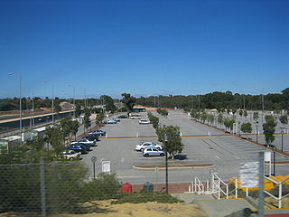
Murdoch Railway Station is a railway station on the Transperth network. It is located on the Mandurah line, 13.8 kilometres from Perth station inside the median strip of the Kwinana Freeway serving the suburb of Murdoch.

Murdoch University university in Western Australia

Murdoch University is a public university in Perth, Western Australia, with campuses also in Singapore and Dubai. It began operations as the state's second university in July 1973, and accepted its first undergraduate students in 1975. Its name is taken from Sir Walter Murdoch (1874–1970), the Founding Professor of English and former Chancellor of the University of Western Australia.

Fiona Stanley Hospital Hospital in Western Australia, Australia

Fiona Stanley Hospital is a state government hospital and teaching facility in Murdoch, Western Australia. Completed in December 2013, the hospital is the largest building project ever undertaken for the Government of Western Australia. It is immediately adjacent to the private non-profit St John of God Murdoch Hospital, with the distance between the entrances to the emergency departments of these two hospitals being approximately 390 m.

A section of South Street between Kwinana Freeway and Vahland Avenue has one lane in each direction reserved as a bus lane during peak times. [2] [3]

The Kwinana Freeway is a 72-kilometre (45 mi) freeway in and beyond the southern suburbs of Perth, Western Australia, linking central Perth with Mandurah to the south. It is the central section of State Route 2, which continues north as Mitchell Freeway to Clarkson, and south as Forrest Highway towards Bunbury. A 4-kilometre (2.5 mi) section between Canning and Leach highways is also part of National Route 1. Along its route are interchanges with several major roads, including Roe Highway and Mandjoogoordap Drive. The northern terminus of the Kwinana Freeway is at the Narrows Bridge, which crosses the Swan River, and the southern terminus is at Pinjarra Road, east of Mandurah.

Bus lane lane restricted to buses

A bus lane or bus-only lane is a lane restricted to buses, often on certain days and times, and generally used to speed up public transport that would be otherwise held up by traffic congestion. Bus lanes are a key component of a high-quality bus rapid transit (BRT) network, improving bus travel speeds and reliability by reducing delay caused by other traffic.

Rush hour part of the day during which traffic congestion on roads and crowding on public transport is at its highest

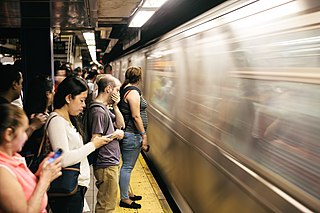
A rush hour or peak hour is a part of the day during which traffic congestion on roads and crowding on public transport is at its highest. Normally, this happens twice every weekday; once in the morning and once in the afternoon or evening, the times during which the most people commute. The term is often used for a period of peak congestion that may last for more than one hour.

See also

Australia road sign W5-29.svg Australian roadsportal

Related Research Articles

Great Eastern Highway highway in Western Australia

Great Eastern Highway is a 590-kilometre-long (370 mi) road that links the Western Australian capital of Perth with the city of Kalgoorlie. A key route for road vehicles accessing the eastern Wheatbelt and the Goldfields, it is the western portion of the main road link between Perth and the eastern states of Australia. The highway forms the majority of National Highway 94, although the alignment through the Perth suburbs of Guildford and Midland, and the eastern section between Coolgardie and Kalgoorlie are not included. Various segments form parts of other road routes, including National Route 1, Alternative National Route 94, and State Route 51.

Graham Farmer Freeway freeway in Perth, Western Australia

Graham Farmer Freeway is a 6.4-kilometre (4.0 mi) inner-city freeway in Perth, Western Australia. It links Rivervale and Burswood with West Perth and Leederville, providing an east-west bypass of Perth's central business district.

Mitchell Freeway is a 30-kilometre-long (19 mi) freeway in the northern suburbs of Perth, Western Australia, linking central Perth with the satellite city of Joondalup. It is the northern section of State Route 2, which continues south as Kwinana Freeway and Forrest Highway. Along its length are interchanges with several major roads, including Graham Farmer Freeway and Reid Highway. The southern terminus of the Mitchell Freeway is at the Narrows Bridge, which crosses the Swan River, and the northern terminus is at Hester Avenue, Clarkson, a suburb within the City of Wanneroo.

Kardinya, Western Australia Suburb of Perth, Western Australia

Kardinya is a suburb of Perth, Western Australia, located within the City of Melville. The suburb is home to under 10,000 people, including many international students due to its proximity to Murdoch University.

Murdoch, Western Australia Suburb of Perth, Western Australia

Murdoch is a suburb of Perth, Western Australia, located within the City of Melville. Murdoch University, St John of God Hospital Murdoch and Fiona Stanley Hospital are located in Murdoch. The suburb is named after Sir Walter Murdoch.

The Causeway road in Perth, Western Australia

The Causeway is an arterial traffic crossing in Perth, Western Australia, linking the inner-city suburbs of East Perth and Victoria Park. It is carried over the Swan River at the eastern end of Perth Water by two bridges on either side of Heirisson Island. The current Causeway is the third structure to have been built across the river at this point.

Wanneroo Road road in Western Australia

Wanneroo Road is a 44 kilometre arterial highway in the northern suburbs of Perth, Western Australia, linking Joondanna and Yokine in the south with Wanneroo and Yanchep in the north. As part of State Route 60, it begins from Charles Street in the inner city and becomes Indian Ocean Drive up to Dongara.

Canning Highway highway in Perth, Western Australia

Canning Highway is a 17 kilometre arterial road in Perth, Western Australia, linking the inner Perth suburb of Victoria Park in the north-east, to the port city of Fremantle in the south-west.

Leach Highway highway in Perth, Western Australia

Leach Highway is a 23-kilometre (14 mi) east-west arterial highway in the southern suburbs of Perth, Western Australia, primarily linking Kewdale and Perth Airport with the city of Fremantle.

Alexander Drive road in Perth, Western Australia

Alexander Drive is a major north-south road in the northeastern suburbs of Perth, Western Australia, connecting Perth's central business district (CBD) with Edith Cowan University's Mount Lawley campus and the Malaga industrial area, as well as new development suburbs to Perth's northeast, and is amply served by Transperth bus routes, including the 360, 361 and 362. Alexander Drive was named after Mr S.B. Alexander, a former Wanneroo Road Board member. Alexander Drive runs through the following local government areas City of Wanneroo, City of Swan, City of Bayswater and City of Stirling

West Coast Drive road in Perth, Western Australia

West Coast Drive is a scenic north-south route along the Indian Ocean in the northern suburbs of Perth, Western Australia.

William Street, Perth street in CBD Perth, Western Australia

William Street is a suburban distributor and one of two major cross-streets in the CBD of Perth, Western Australia. Commencing in western Mount Lawley it also crosses the Perth to Fremantle railway at the Horseshoe Bridge. It is a one-way street from Brisbane Street to Newcastle Street, from which point until its terminus at The Esplanade it has been progressively converted to two-way since 2008. Its route takes it through the Northbridge cafe and nightclub district as well as Perth's central business district. A ramp which took William Street traffic from The Esplanade onto the southbound Kwinana Freeway was closed in 2004 during the construction of the Esplanade railway station.

Beaufort Street road in Perth

Beaufort Street is a major road in the inner north-eastern suburbs of Perth, Western Australia, connecting the Morley area to the Perth CBD. For most of its length, it is a single-carriageway, two-way road with two lanes in each direction.

Scarborough Beach Road road in Perth, Western Australia

Scarborough Beach Road is an arterial northwest-southeast road located in the inner northern suburbs of Perth, Western Australia. It connects North Perth to Scarborough Beach, and is mostly a single carriageway road, with two or three lanes in each direction. The road is the western section of State Route 75, between Osborne Park and Scarborough, and a short section in Innaloo is also part of State Route 64.

Mounts Bay Road road in Perth, Western Australia

Mounts Bay Road is a major road in Perth, Western Australia, extending southwest from the central business district along the north bank of the Swan River, at the base of Kings Park.

Gnangara Road road in Perth, Western Australia

Gnangara Road is an arterial east-west road in Perth, Western Australia. It is located within the northern suburbs of Perth, from Madeley in the west, to Henley Brook in the east. Gnangara Road provides a connection between Great Northern Highway and Wanneroo Road. The construction of the Ocean Reef Road extension in 2011 altered the road network in the Landsdale area in Landsdale. The plans show Gnangara Road as discontinuous between Mirrabooka Avenue and Alexander Drive, with the Mirrabooka Avenue and Ocean Reef Road extensions linking the two sections. Following construction, those linking road sections were named as Gnangara Road, allowing the road to remain continuous.

Winthrop Avenue road in Perth, Western Australia

Winthrop Avenue is a major north-south road in the Perth suburbs of Nedlands and Crawley. For most of its length, the road travels alongside the south-western edge of Kings Park, connecting Thomas Street with Stirling Highway, Mounts Bay Road, and the University of Western Australia's Crawley campus. It is the southernmost section of State Route 61, which links Crawley with West Perth and Yokine.

Thomas Street is a major northeast-southwest road in the Perth suburbs of Subiaco and West Perth, connecting Winthrop Avenue with Loftus Street. These roads, together with London Street further north, form State Route 61, which links Crawley with West Perth and Yokine.

Loftus Street is a major north-south road in the Perth suburbs of Subiaco and West Perth, connecting London Street with Thomas Street. These roads, together with Winthrop Avenue further south, form State Route 61, which links Crawley with West Perth and Yokine.

References

  1. Greater Perth Street Directory (2012 ed.). Melway Publishing Pty Ltd.
  2. "South Street traffic to get a technology boost". Liberal Party of Australia. 2009-04-15. Retrieved 2013-05-30.
  3. Kent Acott (2012-04-12). "Bus lanes to blame for traffic jams". West Australian Newspapers Limited. Retrieved 2013-05-30.

Route map: Google

KML file (edithelp)
KML is from Wikidata