Special routes of U.S. Route 9

Last updated

US 9.svg


Special routes of U.S. Route 9
Highway system

A total of at least three special routes of U.S. Route 9 (US 9) exist and at least seven have been decommissioned.

Contents

Georgetown truck route

Truck plate.svg

US 9.svg

U.S. Route 9 Truck

Location Georgetown, Delaware
Length6.1 mi [1]  (9.8 km)
Existed1983 [2] [3] –present
US 9 Truck eastbound along Park Avenue in Georgetown 2022-07-08 16 58 55 View east along U.S. Route 9 Truck and Delaware State Route 404 Truck (Park Avenue) between Cedar Lane and Wood Branch Road in Cabbage Corner, Sussex County, Delaware.jpg
US 9 Truck eastbound along Park Avenue in Georgetown

U.S. Route 9 Truck (US 9 Truck) is a 6.1-mile (9.8 km) truck route of US 9 in the town of Georgetown in Sussex County, Delaware. US 9 Truck begins at an intersection between US 9 and US 113/Delaware Route 404 Truck (DE 404 Truck) to the west of Georgetown. At this point, US 9 Truck heads southeast concurrent with US 113 and DE 404 Truck on four-lane divided Dupont Boulevard. The road heads through woodland with some farmfields and businesses. US 9 Truck/DE 404 Truck split from US 113 by heading east-northeast on two-lane undivided Arrow Safety Road. The road passes through a mix of farmland and woodland with some development, coming to a roundabout with South Bedford Street, where the name changes to Park Avenue. The routes continue east before curving to the northeast, crossing the Delmarva Central Railroad's Indian River Subdivision line at-grade. The road turns east and passes to the south of Delaware Coastal Airport, where it makes a curve to the north. US 9 Truck/DE 404 Truck head through a mix of farmland and woodland with some homes to the east of the airport, crossing the Delmarva Central Railroad's Lewes Industrial Track line at-grade before ending at US 9/DE 404 east of Georgetown. [1] [4] The portion of US 9 Truck concurrent with US 113 is part of the National Highway System. [5]

US 9 Truck was designated in 1983, heading south along US 113 before it turned north on South Bedford Street and east on Park Avenue, where it picked up its current alignment. [2] [3] The Delaware Department of Transportation (DelDOT) moved US 9 Truck to a new alignment of Park Avenue located further to the south. The realigned Park Avenue will lead to a roundabout with South Bedford Street and Arrow Safety Road, from which US 9 Truck will follow Arrow Safety Road west to US 113. Road construction on the new alignment of Park Avenue and improvements to Arrow Safety Road began in 2022. [6] [7] The new alignment of US 9 Truck opened on May 28, 2024. [8] A ribbon-cutting ceremony was held on June 7, 2024, with DelDOT secretary Nicole Majeski and state and local officials in attendance. [9]

Major intersections
The entire route is in Georgetown, Sussex County.

mi [10] kmDestinationsNotes
0.000.00North plate.svg
US 113.svg
US 113 north (DE 404 Truck west / Dupont Boulevard)
US 9.svg US 9 (County Seat Highway/West Market Street) Laurel, Seaford, Georgetown, Lewes
Western terminus; west end of US 113/DE 404 Truck overlap
1.552.49South plate.svg
US 113.svg
US 113 south (Dupont Boulevard)
East end of US 113 overlap
6.19.8US 9.svgEllipse sign 404.svg US 9  / DE 404 (Lewes Georgetown Highway)Eastern terminus; eastern terminus of DE 404 Truck
1.000 mi = 1.609 km; 1.000 km = 0.621 mi

Lewes business route

Business plate.svg

US 9.svg

U.S. Route 9 Business

LocationFive Points–Lewes, Delaware
Length3.36 mi [10]  (5.41 km)
Existed1976 [11] –present
Tourist
routes
Delaware Byways.png Historic Lewes Byway, Gateway to the Bayshore
US 9 Bus. westbound approaching the Lewes and Rehoboth Canal in Lewes 2022-07-15 11 26 10 View west along U.S. Route 9 Business (East Savannah Road) at Anglers Road in Lewes, Sussex County, Delaware.jpg
US 9 Bus. westbound approaching the Lewes and Rehoboth Canal in Lewes

U.S. Route 9 Business (US 9 Bus.) is a 3.36-mile (5.41 km) [10] business route off US 9 in the city of Lewes in Sussex County, Delaware. US 9 Bus. begins at the Five Points intersection in the community of Nassau, where it intersects US 9, DE 1, and the eastern terminus of DE 404. This intersection has no access to eastbound US 9/southbound DE 1 from US 9 Bus. as left turns are prohibited. From here, the route heads northeast on four-lane divided Savannah Road, soon narrowing to a two-lane undivided road. The business route runs through commercial areas to the southeast of a residential development, gaining a center left-turn lane. The road comes to an intersection with Wescoats Corner Road in the community of Wescoats Corner, which heads southeast to provide access to southbound DE 1. US 9 Bus. loses the turn lane as it continues through the residential community of Quakertown. The road continues past homes and some businesses as it enters Lewes, where it crosses the Georgetown–Lewes Trail. The route passes to the southeast of Beebe Medical Center before it crosses into the historic downtown area of Lewes, where it passes by the Zwaanendael Museum. US 9 Bus. crosses the Lewes and Rehoboth Canal on a drawbridge and runs past businesses to the northwest and marshland to the southeast. The business route passes a mix of homes and businesses before it turns east onto Cape Henlopen Drive near Lewes Beach along the Delaware Bay. US 9 Bus. runs between the bay to the north and homes to the south before it comes to its terminus at an intersection with US 9. Past here, Cape Henlopen Drive continues east as part of US 9 toward the Cape May–Lewes Ferry terminal. [4] [12] The entire length of US 9 Bus. is designated as part of the Historic Lewes Byway, Gateway to the Bayshore, a Delaware Byway. [13] US 9 Bus. has an annual average daily traffic count ranging from a high of 18,511 vehicles at the Donovans Road intersection to a low of 4,782 vehicles at the eastern terminus at US 9. [10] The route was designated on a former part of DE 18 by 1976, with US 9 routed to bypass Lewes on DE 1, Kings Highway, and the Theodore C. Freeman Highway to the south. [11]

Major intersections
The entire route is in Sussex County.

Locationmi [10] kmDestinationsNotes
Nassau 0.000.00East plate.svg
US 9.svg
Elongated circle 1.svg US 9 east / DE 1 (Coastal Highway)
West plate.svg
US 9.svg
West plate.svg
Ellipse sign 404.svg
US 9 west / DE 404 west (Lewes Georgetown Highway)
No access from westbound US 9 Bus. to eastbound US 9/southbound DE 1; western terminus; northern terminus of DE 23; eastern terminus of DE 404
Wescoats Corner To plate.svg
South plate.svg
Elongated circle 1.svg
Wescoats Corner Road to DE 1 south Rehoboth Beach, Dewey Beach
Lewes 3.365.41US 9.svg US 9 (Theodore C. Freeman Highway/Cape Henlopen Drive) Cape May–Lewes Ferry Eastern terminus
1.000 mi = 1.609 km; 1.000 km = 0.621 mi

Beesley's Point temporary route

Temporary plate.svg

US 9.svg

Temporary U.S. Route 9

Location Upper TownshipSomers Point, New Jersey
Length3.89 mi [14] [15]  (6.26 km)
Existed2013

U.S. Route 9 Temporary (US 9 Temp.) was the designation for the detour around the closed Beesley's Point Bridge carrying US 9 over the Great Egg Harbor Bay between Upper Township, Cape May County and Somers Point, Atlantic County. The route headed east from US 9 in Upper Township on County Route 623 (CR 623) before heading north on the Garden State Parkway and crossing the Great Egg Harbor Bay on the Great Egg Harbor Bridge, ending at an interchange with US 9 in Somers Point. The route was 3.89 miles (6.26 km) long. The designation was replaced by US 9[ failed verification ] following the demolition of the bridge in 2013, making it so that US 9 cloud be driven from its entirety once again. [14] [15] [16]

Toms River alternate route

Alt plate 1961.svg

US 9 (1961).svg

U.S. Route 9 Alternate

Location South Toms RiverPleasant Plains, New Jersey
Length3.73 mi [17]  (6.00 km)
Existed1954–1975

U.S. Route 9 Alternate (US 9 Alt.) was a 3.73-mile-long (6.00 km) [17] alternate route of US 9 that ran through Toms River, New Jersey. It was created in 1954 after US 9 was rerouted to use the Garden State Parkway through the Toms River area but was later renumbered to Route 166. [18]

Newark–Jersey City temporary route

Temporary plate.svg

US 9.svg

Temporary U.S. Route 9

Location NewarkJersey City, New Jersey

Jersey City truck route

Truck plate.svg

US 1-9.svg

U.S. Route 1/9 Truck

Location NewarkJersey City, New Jersey
Length4.11 mi [19]  (6.61 km)
Existed1953–present

U.S. Route 1/9 Truck (US 1/9 Truck) is a 4.11-mile (6.61 km) truck route of US 1/9 in northern New Jersey between Newark and Jersey City that bypasses the Pulaski Skyway, which trucks are banned from. [19] [20] The route heads east across the Passaic River into Kearny before crossing the Hackensack River into Jersey City, where the truck route turns north at the Route 440 intersection. It intersects Route 7 before turning east and ending at the Tonnele Circle with US 1/9 and Route 139. [19] Prior to 1953, US 1/9 Truck was designated as Route 25T, designating a truck bypass of Route 25, which formerly followed US 1/9 on the Pulaski Skyway. [21] [22]

Jersey City business route

Business plate.svg

US 1-9.svg

U.S. Route 1/9 Business

Location Jersey City, New JerseyNew York City, New York
Length2.77 mi [23] [24]  (4.46 km)
Existed1953–by the 1990s

U.S. Route 1/9 Business (US 1/9 Bus.) was a 2.77-mile-long (4.46 km) [23] [24] former business route of US 1/9 in Jersey City that ran between US 1/9 at the Tonnele Circle and the Holland Tunnel across the Hudson River to New York City. The route was created in 1953, replacing what had been a part of Route 25. [21] [22] The business route was renumbered to Route 139 by the 1990s. [25] [26]

Jersey City–Inwood Hill Park alternate route

Alternate plate.svg

US 9.svg

U.S. Route 9 Alternate

Location Jersey City, New JerseyInwood Hill Park, New York

Newburgh alternate route

Alternate plate.svg

US 9W (NY).svg

U.S. Route 9W Alternate

Location Newburgh, New York

Rouses Point alternate route

Alternate plate.svg

US 9.svg

U.S. Route 9 Alternate

Location Rouses Point, New York

Related Research Articles

<span class="mw-page-title-main">U.S. Route 9</span> U.S. Numbered Highway in Delaware, New Jersey and New York, United States

U.S. Route 9 (US 9) is a north–south United States Numbered Highway in the states of Delaware, New Jersey, and New York in the Northeastern United States. It is one of only two U.S. Highways with a ferry connection ; the other is US 10. US 9 is signed east–west in Delaware and north–south on the rest of its route. The southern terminus of the route is in Laurel, Delaware, at an intersection with US 13, while the highway's northern terminus is at a junction with Interstate 87 (I-87) in Champlain, New York, where the old roadway continues north as the unsigned New York State Route 971B (NY 971B), which ends in a cul-de-sac just short of the Canadian border.

<span class="mw-page-title-main">U.S. Route 113</span> Highway in the United States

U.S. Route 113 (US 113) is a U.S. Highway that is a spur of US 13 in the U.S. states of Maryland and Delaware. The route runs 74.75 miles (120.30 km) from US 13 in Pocomoke City, Maryland, north to Delaware Route 1 (DE 1) in Milford, Delaware. In conjunction with DE 1, US 113 is one of two major north–south highways on the Delmarva Peninsula that connect Dover with Pocomoke City and the Eastern Shore of Virginia. The U.S. Highway is the primary north–south highway in Worcester County, Maryland, where it connects Pocomoke City with Snow Hill and Berlin. US 113 is one of three major north–south highways in Sussex County, Delaware, where it connects Selbyville, Millsboro, and Georgetown with Milford. While US 113 does not pass through Ocean City or the Delaware Beaches, the U.S. Highway intersects several highways that serve the Atlantic seaboard resorts, including US 50, Maryland Route 90 (MD 90), US 9, DE 404, DE 16, and DE 1. US 113 is a four-lane divided highway for its whole length.

<span class="mw-page-title-main">Delaware Route 1</span> Highway in Delaware

Delaware Route 1 (DE 1) is the longest numbered state highway in the U.S. state of Delaware. The route runs 102.63 mi (165.17 km) from the Maryland state line in Fenwick Island, Sussex County, where the road continues south into that state as Maryland Route 528 (MD 528), north to an interchange with Interstate 95 (I-95) in Christiana, New Castle County, where the roadway continues north as part of DE 7. Between Fenwick Island and Dover Air Force Base in Dover, Kent County, DE 1 is a multilane divided highway with at-grade intersections and occasional interchanges. The route heads north through the Delaware Beaches resort area along the Atlantic Ocean before it runs northwest through rural areas, turning north at Milford to continue to Dover. Upon reaching Dover, DE 1 becomes the Korean War Veterans Memorial Highway, a freeway that is partially tolled. Between Dover and Tybouts Corner, DE 1 parallels U.S. Route 13 (US 13), crossing over and featuring interchanges with it multiple times. Past Tybouts Corner, the freeway heads north parallel to DE 7 to the northern terminus of DE 1 in Christiana. DE 1 serves as the main north-south state highway in Delaware, connecting the Delaware Beaches with the Dover and Wilmington areas.

<span class="mw-page-title-main">Delaware Route 404</span> State highway in Sussex County, Delaware, United States

Delaware Route 404 (DE 404) is a major state highway in Sussex County, Delaware that spans the east-west width of the state. DE 404's western terminus is at the Maryland border northwest of Bridgeville, where the road continues into that state as Maryland Route 404 (MD 404), and its eastern terminus is at the Five Points intersection with U.S. Route 9 (US 9), DE 1, and US 9 Business in Nassau. The route passes through rural areas as well as the towns of Bridgeville and Georgetown. DE 404 runs concurrent with DE 18 from east of Bridgeville to Georgetown and with US 9 from Georgetown to Five Points. DE 404 has a business route, DE 404 Bus., that passes through Bridgeville and a truck route, DE 404 Truck, that bypasses Georgetown. DE 404, along with MD 404, serves as a major route connecting the Chesapeake Bay Bridge and the Baltimore–Washington Metropolitan Area with the Delaware Beaches.
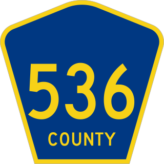
<span class="mw-page-title-main">U.S. Route 9 in New Jersey</span> Highway in New Jersey

U.S. Route 9 (US 9) is a United States Numbered Highway in the Mid-Atlantic region of the United States, running from Laurel, Delaware, to Champlain, New York. In New Jersey, the route runs 166.80 miles (268.44 km) from the Cape May–Lewes Ferry terminal in North Cape May, Cape May County, where the ferry carries US 9 across the Delaware Bay to Lewes, Delaware, north to the George Washington Bridge in Fort Lee, Bergen County, where the route along with Interstate 95 (I-95) and US 1 continue into New York City. US 9 is the longest U.S. Highway in the state.

<span class="mw-page-title-main">Delaware Route 273</span> State highway in New Castle County, Delaware, United States

Delaware Route 273 (DE 273) is a state highway in New Castle County, Delaware. The route runs from Maryland Route 273 (MD 273) at the Maryland border near Newark east to DE 9 and DE 141 in New Castle. The route heads through suburban areas between Newark and New Castle as a multilane road, passing through Ogletown and Christiana. DE 273 intersects DE 896 in downtown Newark; DE 2/DE 72 on the eastern edge of Newark; DE 4 in Ogletown; Interstate 95 (I-95), DE 7, and DE 1 in Christiana; DE 37 in Pleasantville; and DE 58 and U.S. Route 13 (US 13)/US 40 in Hares Corner.

<span class="mw-page-title-main">Delaware Route 9</span> State highway in Kent and New Castle counties in Delaware, United States

Delaware Route 9 (DE 9) is a 57.83-mile (93.07 km) state highway that runs from DE 1 near Dover Air Force Base in Kent County north to DE 2 in the city of Wilmington in New Castle County. DE 9 is a designated scenic highway known as the Delaware Bayshore Byway south of New Castle, running through mostly rural areas to the west of the Delaware Bay and the Delaware River as a two-lane undivided road. Between New Castle and Wilmington, DE 9 is a four-lane road that runs through urban and suburban areas. DE 9 passes through several cities and towns including Little Creek, Leipsic, Port Penn, Delaware City, and New Castle. DE 9 has an auxiliary route, DE 9A, that provides access to the Port of Wilmington. In addition, it has a truck route, DE 9 Truck, located to the south of New Castle.

<span class="mw-page-title-main">U.S. Route 1 in New Jersey</span> Highway in New Jersey

U.S. Route 1 (US 1) is a U.S. Route which parallels the East Coast of the United States, running from Key West, Florida, in the south to Fort Kent, Maine, at the Canadian border in the north. Of the entire length of the route, 66.06 miles (106.31 km) of it runs through New Jersey. It enters the state from Pennsylvania on the Trenton–Morrisville Toll Bridge over the Delaware River in the state capital of Trenton, running through the city on the Trenton Freeway. From here, US 1 continues northeast as a surface divided highway through suburban areas, heading into Middlesex County and passing through New Brunswick and Edison. US 1 merges with US 9 in Woodbridge, and the two routes continue through northern New Jersey as US 1/9 to the George Washington Bridge over the Hudson River in Fort Lee. At this point, the road continues into New York City along with I-95.

<span class="mw-page-title-main">Delaware Route 48</span> State highway in New Castle County, Delaware, United States

Delaware Route 48 (DE 48) is a state highway in New Castle County, Delaware. The route runs from DE 41 in Hockessin east to U.S. Route 13 Business in downtown Wilmington. The route passes through suburban areas of Wilmington along Lancaster Pike, intersecting DE 100 and DE 141. DE 48 continues into Wilmington as Lancaster Avenue and intersects DE 2, where it splits into the one-way pair of Lancaster Avenue eastbound and Second Street westbound. Upon reaching downtown Wilmington, the route intersects Interstate 95 (I-95)/US 202 and DE 4 before continuing to the eastern terminus.

<span class="mw-page-title-main">Delaware Route 14</span> State highway in Kent County, Delaware, United States

Delaware Route 14 (DE 14) is a state highway in the southern part of Kent County, Delaware. The route runs from the Maryland state line near Burrsville, Maryland, where the road continues as Maryland Route 317 (MD 317), east to DE 1 in Milford. The route passes through Harrington, where it intersects U.S. Route 13 (US 13), and heads to the north of Houston before coming to Milford, where it intersects DE 15, US 113, and DE 1 Business. DE 14 has a truck bypass of Harrington known as DE 14 Truck.

<span class="mw-page-title-main">Delaware Route 18</span> State highway in Sussex County Delaware, United States

Delaware Route 18 (DE 18) is a state highway located in Sussex County, Delaware. It runs from Maryland Route 318 (MD 318) at the Maryland border east of Federalsburg, Maryland, east to U.S. Route 9 (US 9) in Georgetown. DE 18 runs concurrent with DE 404 from its intersection with that highway southeast of Bridgeville to the eastern terminus, where DE 404 continues eastward to Five Points on US 9. The route passes through rural areas of western Sussex County. What would become DE 18 was built as a state highway in stages during the 1920s and 1930s. By 1936, DE 18 was designated to run from the Maryland border east through Georgetown to Lewes. In 1974, the route east of Georgetown was replaced by US 9 and US 9 Business. DE 404 was designated concurrent with the eastern portion of DE 18 by 1987.

<span class="mw-page-title-main">Delaware Route 24</span> State highway in Sussex County, Delaware, United States

Delaware Route 24 (DE 24) is a state highway located in Sussex County, Delaware. The route runs from Maryland Route 348 (MD 348) at the Maryland border east of Sharptown, Maryland, east to an intersection with DE 1 in Midway, between Lewes and Rehoboth Beach. Along the way, DE 24 passes through Laurel, Millsboro, and Long Neck. DE 24 intersects U.S. Route 13 (US 13) in Laurel, US 113/DE 20 and DE 30 in Millsboro, and DE 5 and DE 23 in Long Neck. DE 24 features an alternate route, DE 24 Alternate, that runs to the north of the route from US 113 in Stockley to DE 24 near Midway. DE 24 was built as a state highway throughout the 1920s, with completion of the entire route by 1931. DE 24 was assigned onto its current alignment by 1936. DE 24 Alt. was designated by 2006.

<span class="mw-page-title-main">Delaware Route 5</span> State highway in Sussex County, Delaware, United States

Delaware Route 5 (DE 5) is a 19.49-mile-long (31.37 km) state highway in Sussex County, Delaware. The route runs from River Road and Oak Orchard Avenue on the Indian River Bay in Oak Orchard north to an intersection with DE 1 north of Milton. Along the way, DE 5 passes through rural areas along with the communities of Long Neck, Harbeson, and Milton. The route has concurrencies with DE 23 and DE 24 in the Long Neck area and crosses U.S. Route 9 (US 9)/DE 404 in Harbeson and DE 16 in Milton. DE 5 features one alternate route, DE 5 Alternate, which provides a bypass of Milton. DE 5 was built as a state highway in the 1920s and 1930s. The road between Long Neck and north of Milton, including present-day DE 5 north of DE 24, was designated as part of a short-lived DE 22 in the 1930s. DE 5 was designated to its current alignment by 1938. DE 5 Alt. was designated by 2001.

<span class="mw-page-title-main">Delaware Route 23</span> State highway in Sussex County, Delaware, United States

Delaware Route 23 (DE 23) is a 14.76-mile-long (23.75 km) state highway in Sussex County, Delaware. Its southern terminus is at Massey's Landing in Long Neck, near the confluence of Rehoboth Bay and Indian River Bay and its northern terminus is at the Five Points intersection in Nassau, where it ends at U.S. Route 9 (US 9), DE 1, and DE 404. From the southern terminus, the route runs west through residential areas of Long Neck before heading north through rural areas with some development. DE 23 is concurrent with DE 5 between the DE 24 intersection in Long Neck and Fairmount. It is also concurrent with DE 24 Alternate between Hollymount and the DE 1D intersection in Five Points. The road was designated as part of DE 22 south of Fairmount for a short time in the 1930s, with DE 5 designated along the stretch between DE 24 and Fairmount by 1938; the remainder of the road was unnumbered. The road was fully paved by 1970. The DE 23 designation was assigned by 1994.

<span class="mw-page-title-main">Delaware Route 36</span> State highway in Sussex County, Delaware, United States

Delaware Route 36 (DE 36) is a state highway in Sussex County, Delaware. It runs in a generally northeast–southwest direction from DE 404 in Scotts Corner east to Slaughter Beach, a town along the Delaware Bay. The road runs through the northern portion of Sussex County, passing through rural areas along with Greenwood and Milford. The route intersects DE 16 and U.S. Route 13 (US 13) in Greenwood and US 113, DE 1 Business, and DE 1 in Milford. DE 36 was built as a state highway in stages during the 1920s and 1930s. The road was designated by 1938 from DE 16 east of Greenwood east to Fort Saulsbury and was extended west to DE 404 by 1994.

<span class="mw-page-title-main">U.S. Route 9 in Delaware</span> Highway in Delaware

U.S. Route 9 (US 9) is a United States Numbered Highway in the Northeastern U.S., running from Laurel, Delaware, north to Champlain, New York. In Delaware, the route runs a southwest–northeast path through Sussex County. Even though US 9 is signed north–south for the remainder of its route, the segment in Delaware is signed east–west. The highway runs from its western terminus at US 13 in Laurel northeast to the Cape May–Lewes Ferry terminal in Lewes, where the ferry carries the route across the Delaware Bay to North Cape May, New Jersey. US 9 passes through rural areas and serves the communities of Laurel, Georgetown, and Lewes. US 9 intersects Delaware Route 20 (DE 20) in Hardscrabble, US 113 and DE 18/DE 404 in Georgetown, DE 30 in Gravel Hill, DE 5 in Harbeson, and DE 1 at the Five Points intersection in Nassau. US 9 runs concurrent with DE 404 between Georgetown and Five Points and with DE 1 between Five Points and Carpenters Corner.

<span class="mw-page-title-main">U.S. Route 13 in Delaware</span> Highway in Delaware

U.S. Route 13 (US 13) is a U.S. highway running from Fayetteville, North Carolina, north to Morrisville, Pennsylvania. In the U.S. state of Delaware, the route runs for 103.33 mi (166.29 km). It traverses the entire north–south length of the state from the Maryland state line in Delmar, Sussex County, north to the Pennsylvania state line in Claymont, New Castle County. US 13 connects many important cities and towns in Delaware, including Seaford, Dover, and Wilmington. The entire length of US 13 in Delaware is a multilane divided highway with the exceptions of the segment through Wilmington and parts of the route in Claymont. Between the Maryland state line and Dover, US 13 serves as one of the main north–south routes across the Delmarva Peninsula. From Dover north to Tybouts Corner, the route is followed by the controlled-access Delaware Route 1 (DE 1) toll road, which crosses the route multiple times and has multiple interchanges with it. US 13 bypasses downtown Wilmington to the east before it heads northeast of the city parallel to Interstate 495 (I-495) and the Delaware River to Claymont. US 13 is the longest numbered highway in the state of Delaware.

<span class="mw-page-title-main">Special routes of U.S. Route 1</span> U.S. highway system

Several special routes of U.S. Route 1 (US 1) exist, from Florida to Maine. In order from south to north, separated by type, these special routes are as follows.

<span class="mw-page-title-main">Special routes of U.S. Route 13</span>

U.S. Route 13 (US 13) runs along the Atlantic coastline for over 500 miles (800 km), passing through five states. Along its route, it possessed numerous special routes, which are all loops off the mainline US 13. At present, there are at least 15 special routes in existence: two in North Carolina, five in Virginia, two in Maryland, four in Delaware, and two in Pennsylvania. 13 others have existed in the past but have been deleted.

<span class="mw-page-title-main">Special routes of U.S. Route 322</span>

A total of at least five special routes of U.S. Route 322 currently exist.

References

  1. 1 2 Google (August 6, 2013). "overview of U.S. Route 9 Truck" (Map). Google Maps . Google. Retrieved August 6, 2013.
  2. 1 2 Special Committee on U.S. Route Numbering (October 1, 1983). "Route Numbering Committee Agenda" (PDF) (Report). Washington, DC: American Association of State Highway and Transportation Officials. p. 538. Retrieved October 15, 2014 via Wikimedia Commons.
  3. 1 2 Delaware Department of Transportation (1984). Official State Highway Map (PDF) (Map). Dover: Delaware Department of Transportation. Retrieved November 24, 2015.
  4. 1 2 Delaware Department of Transportation (2017). Official Travel & Transportation Map (PDF) (Map). Dover: Delaware Department of Transportation. Retrieved August 18, 2019.
  5. National Highway System: Delaware (PDF) (Map). Federal Highway Administration. 2010. Retrieved February 10, 2012.
  6. "Project: Park Avenue Relocation, Phase 1". Delaware Department of Transportation. Retrieved February 13, 2022.
  7. Park Avenue Relocation Phase 1 - Phase 1 Overview (Map). Delaware Department of Transportation. May 28, 2019. Retrieved February 13, 2022.
  8. "Sussex County - Park Avenue Phase 1 in Georgetown now open to traffic" (Press release). Delaware Department of Transportation. May 28, 2024. Retrieved May 28, 2024.
  9. Sokaitis, Charlie (June 7, 2024). "Phase 1 of the Park Avenue relocation project in Georgetown has been finished". Salisbury, MD: WRDE-LD. Retrieved June 9, 2024.
  10. 1 2 3 4 5 Staff (2018). "Traffic Count and Mileage Report: Interstate, Delaware, and US Routes" (PDF). Delaware Department of Transportation . Retrieved March 29, 2020.
  11. 1 2 Delaware Department of Highways and Transportation (1976). Delaware Highways Official Map (PDF) (Map). Dover: Delaware Department of Highways and Transportation. Retrieved November 24, 2015.
  12. Google (October 26, 2014). "overview of U.S. Route 9 Business" (Map). Google Maps . Google. Retrieved October 26, 2014.
  13. "Historic Lewes Byway, Gateway to the Bayshore". Delaware Department of Transportation. Retrieved December 30, 2017.
  14. 1 2 "Cape May County 623 straight line diagram" (PDF). New Jersey Department of Transportation. Retrieved February 29, 2012.
  15. 1 2 "Garden State Parkway straight line diagram" (PDF). New Jersey Department of Transportation. Retrieved February 29, 2012.
  16. Degener, Richard (February 29, 2012). "Anti-terrorism fence near parkway bridge between Atlantic, Cape May counties coming down in 2013". Press of Atlantic City . Retrieved February 29, 2012.
  17. 1 2 New Jersey Department of Transportation. "Route 166 straight line diagram" (PDF). Retrieved October 12, 2009.
  18. Map of US 9 Alternate (Map). General Drafting Incorporated. 1960s.
  19. 1 2 3 "U.S. Route 1-9 Truck straight line diagram" (PDF). New Jersey Department of Transportation. Retrieved April 12, 2007.
  20. "Traffic Regulations: Route 1 and 9, The Pulaski Skyway". New Jersey Department of Transportation. Retrieved August 6, 2009.
  21. 1 2 1953 renumbering
  22. 1 2 "New Road Signs Ready in New Jersey". The New York Times . December 16, 1952. Archived from the original on July 21, 2011. Retrieved July 20, 2009.
  23. 1 2 "Route 139 lower roadway straight line diagram" (PDF). New Jersey Department of Transportation . Retrieved September 1, 2009.
  24. 1 2 "Interstate 78 straight line diagram" (PDF). New Jersey Department of Transportation. Retrieved September 1, 2009.
  25. State Farm Road Atlas (Map). Cartography by Rand McNally. State Farm Insurance. 1983.
  26. United States-Canada-Mexico Road Atlas (Map). Rand McNally. 1996.
Template:Attached KML/Bannered routes of U.S. Route 9
KML is from Wikidata