Related Research Articles

The West End is a neighbourhood in Vancouver, British Columbia, Canada, located between the Coal Harbour neighbourhood and the financial and central business districts of Downtown Vancouver to the east, Stanley Park to the northwest, the English Bay to the west, and Kitsilano to the southwest across the False Creek opening.

Greektown in Vancouver, British Columbia, Canada is an area in the Kitsilano neighborhood that was historically an enclave of Greek immigrants and their descendants. The term is an informal one, and Greektown's borders are not strictly defined; however, West Broadway around Trutch Street is generally considered the neighbourhood's heart, while Blenheim St to the west and MacDonald St to the east are approximately its outer limits. Vancouverites of Greek descent, who live in Kitsilano, nostalgically also call the area Ουέστ Μπροντουέι.

Robson Street is a major southeast-northwest thoroughfare in downtown and West End of Vancouver, British Columbia, Canada. Its core commercial blocks from Burrard Street to Jervis were also known as Robsonstrasse. Its name honours John Robson, a major figure in British Columbia's entry into the Canadian Confederation, and Premier of the province from 1889 to 1892. Robson Street starts at BC Place Stadium near the north shore of False Creek, then runs northwest past Vancouver Library Square, Robson Square and the Vancouver Art Gallery, coming to an end at Lost Lagoon in Stanley Park.

The Burrard Peninsula is a peninsula in the Lower Mainland region of British Columbia, Canada, bounded by the Burrard Inlet to the north, the Georgia Strait to the west, the North Arm of Fraser River to the south, and the Pitt River and Douglas Island to the east. The City of Vancouver occupies almost all of the western half of the peninsula, and the Cities of Burnaby and New Westminster occupy more than half of the eastern half. At its northeastern end, the peninsula is connected to the Eagle Mountain and Mount Burke of the Coast Mountains via a small isthmus at the center of the Tri-Cities.
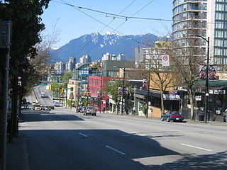
Established in 1997, South Granville is an upscale Business Improvement Area (BIA) and neighbourhood south of Vancouver's downtown core, centred along Granville Street and bordered by the neighbourhoods of Kitsilano, Fairview and Shaughnessy.

Coal Harbour is a section of Burrard Inlet lying between Vancouver's Downtown Peninsula and the Brockton Point of Stanley Park. It has also now become the name of the neighbourhood adjacent to its southern shoreline.

Denman Arena was an indoor arena located in the West End neighbourhood of Vancouver, British Columbia. The arena was located at 1805 West Georgia Street at the northwest corner with Denman Street. It opened in December 1911 and was destroyed by fire in 1936. Its primary use was for ice sports such as ice hockey. It was the home ice rink of the Vancouver Millionaires professional ice hockey team, and was the location of 1915 Stanley Cup championships. The arena was also used for other sports, musical performances and public assemblies. It was an assembly point for Canadian servicemen during World War I. The 10,500-seat arena was the largest in Canada at the time, and introduced mechanically frozen or "artificial" ice to Canada.

Kensington–Cedar Cottage is one of the most ethnically diverse neighbourhoods in east Vancouver, British Columbia, Canada. The neighbourhood is approximately 7.23 square kilometres (2.79 sq mi) in area.

Riley Park, sometimes also known as Riley Park–Little Mountain, is a neighbourhood in Vancouver, British Columbia. Its boundaries are 41st Avenue to the south, 16th Avenue to the north, Cambie Street to the west, and Fraser Street to the east. The main commercial thoroughfare of the neighbourhood is Main Street.

Arbutus Ridge is an affluent residential neighbourhood in Vancouver's West Side. It is bordered by 16th Avenue in the north, 41st Avenue in the south, Mackenzie Street in the west, and East Boulevard in the east. The neighbourhood is characterized by larger than average lot sizes, with stately homes on tree-lined streets.
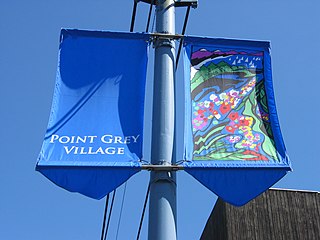
West Point Grey is a neighbourhood in the northwest of the city of Vancouver, British Columbia, Canada. It is on Point Grey and bordered by 16th Avenue to the south, Alma Street to the east, English Bay to the north, and Blanca Street to the west. Notable beaches within West Point Grey include Spanish Banks, Locarno and Jericho. Immediately to the south is Pacific Spirit Regional Park and to the east is Kitsilano.
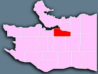
Mount Pleasant is a neighbourhood in the city of Vancouver, British Columbia, Canada, stretching from Cambie Street to Clark Drive and from Great Northern Way and 2nd, to 16th and Kingsway. The neighbourhood, once characterized as working-class, has undergone a process of gentrification since the early 1990s, including the area around the Main Street and Broadway intersection.

Renfrew–Collingwood is a large neighbourhood that lies on the eastern side of Vancouver, British Columbia, Canada, on its boundary with Burnaby and encompassing an area that was one of the earlier developed regions of the city. It is a diverse area that includes a substantial business community in several areas, as well as some of the fastest-growing residential sectors of Vancouver. In 2011, the neighbourhood had a population of 50,500, 38.4% of whom claim Chinese as their first language.
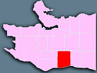
Sunset is the most ethnically diverse neighbourhood in Vancouver, British Columbia. It is located in the south-east quadrant of the city. Surrounding the multicultural Fraser Street district, Sunset is bordered by both the Marpole and Oakridge neighbourhoods to the west, and the Victoria-Fraserview neighbourhood to the east.

Shaughnessy is an almost-entirely residential neighbourhood in Vancouver, British Columbia, Canada, spanning about 447 hectares in a relatively central locale. It is bordered by 16th Avenue to the north, 41st Avenue to the south, Oak Street to the east, and East Boulevard to the west. The older section of the neighbourhood, called "First Shaughnessy," is considered more prestigious and is bordered by 16th Avenue to the north, King Edward Avenue to the south, Oak Street to the east, and East Boulevard to the west. In 2016, the population was approximately 8,810. It was named after Thomas Shaughnessy, 1st Baron Shaughnessy, former president of the Canadian Pacific Railway.

South Cambie is a neighbourhood in the city of Vancouver, British Columbia, Canada, that is generally considered one of the smallest neighbourhoods in the city, both in size and in population. It is wedged between one of the city's largest parks and the upscale neighbourhood of Shaughnessy, and is known for a large cluster of medical facilities.
X̱wemelch'stn, usually anglicized as Homulchesan, is a large community within the Squamish Nation of the Squamish people, who are a part of the Coast Salish ethnic and linguistic group. The name X̱wemelch'stn, translates to "Fast Moving Water of Fish", relating to the Capilano River. The village is one of the oldest and major villages of the Squamish and continues to be so, being the Squamish Nation's most populated reserve. The community is also known as the Capilano Indian Reserve, formally Capilano Indian Reserve No. 5, and is named like the adjacent Capilano River after the Capilano chieftaincy, the best-known Joe Capilano. The name Kiapila'noq means "people of Kiap", and was the title of the supreme chief of the Sḵwx̱wú7mesh in the area of English Bay. Chief George Capilano was the chief who met Captain Vancouver at X̱wemelch'stn in 1792, and had met Captain Cook in 1782.
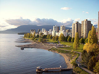
English Bay is a neighbourhood in the West End of Vancouver, British Columbia, Canada. Though not formally defined, it is a commonly used local appellation that refers to the shopping and residential areas focused on the intersection of Denman and Davie Streets near at English Bay Beach. Generally, the term refers to the first few blocks of residential areas flanking the beach from Stanley Park to Sunset Beach, and to the commercial areas along Davie Street, and along Denman Street south of Nelson Street.

Ambleside, West Vancouver, is a neighbourhood that occupies the southeastern corner of the community, with only Park Royal being farther east. The neighborhood is bordered by the neighbourhoods of Dundarave, Park Royal, and the British Properties. Ambleside overs the area from 19th Street to 13th Street, and from Fulton Avenue down to the waterfront. Marine Drive forms the centre of the community's commercial core, with two streets leading off from it.

The Qube is a building in Vancouver, British Columbia, Canada.
References
- ↑ "Stanley Park district attracts real estate interest with new developments". Vancouver Is Awesome. 2023-05-22. Retrieved 2024-05-27.