Coal Harbour

Last updated

Coal Harbour
Neighbourhood
Skyline with seaplane - Vancouver, Canada - DSC09323.JPG
Vancouver (British Columbia) Downtown - OpenStreetMap.png
Red pog.svg
Coal Harbour
Coal Harbour in Vancouver
Coordinates: 49°17′35″N123°07′32″W / 49.29306°N 123.12556°W / 49.29306; -123.12556
CountryCanada
Province British Columbia
City Vancouver
Area
  Total0.573 km2 (0.221 sq mi)
Population
 (2021) [1]
  Total10,441
  Density18,222/km2 (47,190/sq mi)
Time zone UTC-8 (PST)
  Summer (DST) UTC-7 (PDT)
Website coalharbour.org

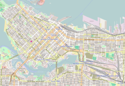
Coal Harbour is a section of Burrard Inlet lying between Vancouver's Downtown Peninsula and the Brockton Point of Stanley Park. It has also now become the name of the neighbourhood adjacent to its southern shoreline.

Contents

Neighbourhood

Coal Harbour is used to designate the relatively new official neighbourhood of the City of Vancouver bounded by roughly Burrard Street and Pender near the Financial District to West Georgia Street near the West End in the south to Stanley Park in the north. The neighbourhood consists of numerous high-rise residential apartment and condominium towers with luxury townhome podiums.

Features

The northwestern section near Stanley Park features picturesque parkland, private marinas, several rowing and boating clubs, high-end shops and restaurants, and a community centre designed by architect Gregory Henriquez. To the east is Deadman's Island, the site of the naval station and museum HMCS Discovery, where the harbour itself opens up to the Burrard Inlet. Towards the Financial District in the southeast, the neighbourhood is dominated by high-rise office buildings, hotels and numerous apartment towers. Immediately south lies Vancouver's Luxury Zone along Alberni Street.

Coal Harbour is home to Vancouver Harbour Water Aerodrome, located a few blocks from Canada Place and the Vancouver Convention Centre. Within the harbour is a floating gas station for marine vessels. The 2010 Winter Olympics cauldron is installed at Jack Poole Plaza.

VancouverSkyline.jpg
Coal Harbour residential skyscrapers (on the right) from Stanley Park, with the financial district (on the left) and the rest of Downtown Vancouver (in the background)

History

Historical population
YearPop.±%
20067,748    
20118,552+10.4%
20169,190+7.5%
202110,441+13.6%

The discovery of coal in the harbor in 1862 inspired the name. In the days when the area along West Pender Street was an upper-class residential district, Coal Harbour was known as Blueblood Alley because of the many large mansions along it.

Notable inhabitants and developments in Coal Harbour's past include:

Related Research Articles

<span class="mw-page-title-main">Stanley Park</span> Public park in Vancouver, Canada

Stanley Park is a 405-hectare (1,001-acre) public park in British Columbia, Canada that makes up the northwestern half of Vancouver's Downtown Peninsula, surrounded by waters of Burrard Inlet and English Bay. The park borders the neighbourhoods of West End and Coal Harbour to its southeast, and is connected to the North Shore via the Lions Gate Bridge. The historic lighthouse on Brockton Point marks the park's easternmost point. While it is not the largest of its kind, Stanley Park is about one-fifth larger than New York City's 340-hectare (840-acre) Central Park and almost half the size of London's 960-hectare (2,360-acre) Richmond Park.

<span class="mw-page-title-main">West End, Vancouver</span> Neighbourhood in Vancouver, British Columbia, Canada

The West End is a neighbourhood in Vancouver, British Columbia, Canada, located between the Coal Harbour neighbourhood and the financial and central business districts of Downtown Vancouver to the east, Stanley Park to the northwest, the English Bay to the west, and Kitsilano to the southwest across the False Creek opening.

<span class="mw-page-title-main">Robson Street</span>

Robson Street is a major southeast-northwest thoroughfare in downtown and West End of Vancouver, British Columbia, Canada. Its core commercial blocks from Burrard Street to Jervis were also known as Robsonstrasse. Its name honours John Robson, a major figure in British Columbia's entry into the Canadian Confederation, and Premier of the province from 1889 to 1892. Robson Street starts at BC Place Stadium near the north shore of False Creek, then runs northwest past Vancouver Library Square, Robson Square and the Vancouver Art Gallery, coming to an end at Lost Lagoon in Stanley Park.

<span class="mw-page-title-main">Burrard Inlet</span> Coastal fjord in southwestern British Columbia, Canada

Burrard Inlet is a relatively shallow-sided fjord in northwestern Lower Mainland, British Columbia, Canada. Formed during the last Ice Age, it separates the City of Vancouver and the rest of the lowland Burrard Peninsula to the south from the coastal slopes of the North Shore Mountains, which span West Vancouver and the City and District of North Vancouver to the north.

<span class="mw-page-title-main">Burrard station</span> Metro Vancouver SkyTrain station

Burrard is an underground station on the Expo Line of Metro Vancouver's SkyTrain rapid transit system. The station is located in Downtown Vancouver on Burrard Street, where Melville and Dunsmuir Streets meet, and is the western terminus of the R5 Hastings St that provides service to Simon Fraser University.

<span class="mw-page-title-main">Siwash Rock</span> Reef in Vancouver, Canada

Siwash Rock is a rock outcropping in Vancouver, British Columbia, Canada's Stanley Park. A legend among the Indigenous Squamish people surrounds the rock. It is between 15 and 18 metres tall. It became known to mariners as Nine Pin Rock for its resemblance to a bowling pin.

<span class="mw-page-title-main">Seaspan ULC</span> Canadian ship-builder

Seaspan ULC provides marine-related services to the Pacific Northwest. Within the Group are three shipyards, an intermodal ferry and car float business, along with a tug and barge transportation company that serves both domestic and international markets. Seaspan, is part of the Washington Companies that are owned by Dennis Washington. Kyle Washington, is the Executive Chairman of Seaspan, who has become a Canadian citizen.

<span class="mw-page-title-main">Denman Arena</span>

Denman Arena was an indoor arena located in the West End neighbourhood of Vancouver, British Columbia. The arena was located at 1805 West Georgia Street at the northwest corner with Denman Street. It opened in December 1911 and was destroyed by fire in 1936. Its primary use was for ice sports such as ice hockey. It was the home ice rink of the Vancouver Millionaires professional ice hockey team, and was the location of 1915 Stanley Cup championships. The arena was also used for other sports, musical performances and public assemblies. It was an assembly point for Canadian servicemen during World War I. The 10,500-seat arena was the largest in Canada at the time, and introduced mechanically frozen or "artificial" ice to Canada.

<span class="mw-page-title-main">Downtown Vancouver</span> Neighbourhood of Vancouver in British Columbia, Canada

Downtown Vancouver is the central business district and the city centre neighbourhood of Vancouver, Canada, on the northwestern shore of the Burrard Peninsula in the Lower Mainland region of British Columbia. It occupies most of the north shore of the False Creek inlet, which cuts into the Burrard Peninsula creating the Downtown Peninsula, where the West End neighbourhood and Stanley Park are also located.

<span class="mw-page-title-main">History of Vancouver</span>

The history of Vancouver, British Columbia, is one that extends back thousands of years, with its first inhabitants arriving in the area following the Last Glacial Period. With its location on the western coast of Canada near the mouth of the Fraser River and on the waterways of the Strait of Georgia, Howe Sound, Burrard Inlet, and their tributaries, Vancouver has – for thousands of years – been a place of meeting, trade, and settlement.

HMS <i>Plumper</i> (1848) Sloop of the Royal Navy

HMS Plumper was part of the 1847 programme, she was ordered on the 25 of April as a steam schooner from Woolwich Dockyard with the name Pincher. However, the reference Ships of the Royal Navy, by J.J. College, (c) 2020 there is no entry that associates this name to this build. The vessel was reordered on August 12 as an 8-gun sloop as designed by John Fincham, Master Shipwright at Portsmouth. Launched in 1848, she served three commissions, firstly on the West Indies and North American Station, then on the West Africa Station and finally in the Pacific Station. It was during her last commission as a survey ship that she left her most enduring legacy; in charting the west coast of British Columbia she left her name and those of her ship's company scattered across the charts of the region. She paid off for the last time in 1861 and was finally sold for breaking up in 1865.

<span class="mw-page-title-main">Georgia Street</span> Canadian urban road in Vancouver and Burnaby

Georgia Street is an east–west street in the cities of Vancouver and Burnaby, British Columbia, Canada. Its section in Downtown Vancouver, designated West Georgia Street, serves as one of the primary streets for the financial and central business districts, and is the major transportation corridor connecting downtown Vancouver with the North Shore by way of the Lions Gate Bridge. The remainder of the street, known as East Georgia Street between Main Street and Boundary Road and simply Georgia Street within Burnaby, is more residential in character, and is discontinuous at several points.

<span class="mw-page-title-main">Seawall (Vancouver)</span> Stone wall constructed around Stanley Park

The seawall in Vancouver, British Columbia, Canada, is a stone wall that was constructed around the perimeter of Stanley Park to prevent erosion of the park's foreshore. Colloquially, the term also denotes the pedestrian, bicycle, and rollerblading pathway on the seawall, one which has been extended far outside the boundaries of Stanley Park and which has become one of the most-used features of the park by both locals and tourists. James "Jimmy" Cunningham, a master mason, dedicated his life to the construction of the seawall from 1931 until his retirement. Even after he retired, Cunningham continued to return to monitor the wall's progress, until his death at 85. While the whole path is not built upon the seawall, the total distance from CRAB park, around Stanley Park and False Creek to Spanish Banks is about 30 kilometres (19 mi).

X̱wáýx̱way or x̌ʷay̓x̌ʷəy̓ , rendered in English as Xway xway and Whoiwhoi, is a First Nations village site, located in what is now Stanley Park in Vancouver, British Columbia, Canada. The village was located on the eastern peninsula of the park, near what is now Lumberman's Arch. The village was home for many Squamish, Musqueam and Tsleil-waututh people, but after European colonization began in the Vancouver area, the inhabitants were forced to re-locate to nearby villages. The village was named for a mask ceremony; thus, the best translation of x̱wáýx̱way would be "masked dance performance".

<span class="mw-page-title-main">Ustlawn</span>

Ustlawn is a Squamish village community located on the shores of North Vancouver. The Squamish name Eslhá7an translates as head bay, denoted what used to be the farthest out reaching bay enclave in the Burrard Inlet. Its origin as a primary village goes back to the earliest missionaries in British Columbia with the St. Paul's Catholic Church being the oldest extant church in British Columbia, and a National Historic Site of Canada. It is also home to the Eslha7an Training Center, the Stitsma Employment Center, and the So-Sah-Latch Health and Family Centre. On the shores of the village is the Mosquito Creek Marina. The official name of the Indian reserve it is situated on is Mission Indian Reserve No. 1.

This is a timeline of the history of Vancouver.

<span class="mw-page-title-main">Royal Vancouver Yacht Club</span> Yacht club in Canada

The Royal Vancouver Yacht Club (RVYC) is a yacht club located in Vancouver, British Columbia. Royal Vancouver Yacht Club currently operates two marinas, the one at Jericho Beach in English Bay and another in Coal Harbour. The Jericho site includes a clubhouse, two restaurants, and berths enough for 350 as well as a dinghy dock. In 2017 the award-winning Dock Building was completed, designed by Michael Green Architecture, providing offices for the Harbour Master, instruction and amenity space and workshops to maintain boats, sails, and gear. The Coal Harbour site has approximately 350 berths, some with covered moorage, and is the location of the floating restaurant called The Mermaid. The club also has seven offshore stations in BC waters.

<span class="mw-page-title-main">The Three Greenhorns</span>

The Three Greenhorns were three Englishmen, Samuel Brighouse, William Hailstone and John Morton, who were the first white settlers in the area known today as Vancouver's West End. They earned the nickname “Three Greenhorn Englishmen" because they bought land for what was believed to be an inflated price.

<span class="mw-page-title-main">The Westin Bayshore</span>

The Westin Bayshore is a hotel overlooking Coal Harbour in Vancouver, British Columbia.

References