Kerrisdale is a neighbourhood in the city of Vancouver, British Columbia, Canada.
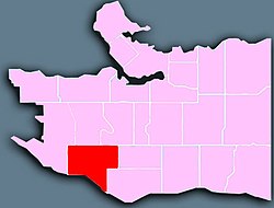
Kerrisdale is a neighbourhood located in Vancouver's west side. It features a mix of newer houses and older bungalows as well as various low and mid-rise rental and condo apartment buildings in its northern section. The neighbourhood is a racial mix of European and East Asian Canadians. It features a shopping district running generally along West 41st Avenue between Larch and Maple Streets and West Boulevard between 37th and 49th Avenues. Although the city officially defines Kerrisdale as being south of 41st Ave (north of 41st is called Arbutus Ridge), the majority of the area's residents consider the area's boundaries to be West 33rd Avenue to the north, Granville Street to the east, West 57th Avenue to the south, and Blenheim Street to the west. The northern part of Marpole is also generally thought of as part of Kerrisdale, thus some refer to the area as Kerrisdale-Marpole. The southwestern part of Kerrisdale is known as Southlands, due to its location in relation to the city. Southlands is known for its horse stables and rural feel and is located on the floodplain of the North Arm of the Fraser River.
Kerrisdale gained its name in 1905 when British Columbia Electric Railway manager R.H. Sterling asked Mrs. William McKinnon to name the interurban stop at Wilson Road (today West 41st Avenue). [1] She chose to call it "Kerry's Dale", after the name of her family home, Kerrydale, in Gairloch, Scotland. [2] : 135 Kerrydale means "little seat of the fairies". It was quickly corrupted to Kerrisdale. The area was part of the Municipality of Point Grey, which amalgamated January 1, 1929 with the City of Vancouver and the Municipality of South Vancouver. Many of the streets and avenues surrounding this focal intersection developed around this time, with local landmarks such as Point Grey Secondary School, Ryerson Church, Shannon Mews and the Allen Brown Estate constructed in these formative years.
As of the 2016 community census, there were 13,975 people, 5,530 private households, and 3,930 families residing in Kerrisdale.
Kerrisdale 2016 Community Census | % of Kerrisdale | % of Vancouver | |
---|---|---|---|
Mother tongue Source: [3] | English | 49.4% | 51.3% |
Chinese | 35.2% | 21.5% | |
Korean | 2.3% | 1.3% | |
Spanish | 1.0% | 1.9% | |
German | 1.0% | 1.0% | |
Japanese | 1.0% | 1.1% |
Although formerly British in character and demographics, Kerrisdale began to experience an influx of affluent immigrants from Hong Kong in the mid-1980s. This was partially due to the fears of Communist China taking over Hong Kong from the British in 1997 per the Sino-British Joint Declaration. Many of those Hong Kong immigrants constructed large, modern houses. Therefore, Kerrisdale is generally a mix of East Asian and Western architecture, with older bungalows in between new houses and renovated houses.
Kerrisdale has a mix of white-collar professionals, high net worth individuals, and university students renting basement suites or more inexpensive apartment blocks to attend nearby post-secondary institutions such as Langara College and the University of British Columbia. The area is also home to elderly residents who primarily rent in the low rise rental blocks that characterize the north central section of the community.
Projected average 2008 household income: $131,769 as compared with $75,854 and $79,798 for Vancouver and Metro Vancouver respectively.
Panethnic group | 2016 [4] | 2006 [5] | 2001 [6] | ||||||
---|---|---|---|---|---|---|---|---|---|
Pop. | % | Pop. | % | Pop. | % | ||||
East Asian [a] | 6,935 | 49.91% | 5,965 | 40.81% | 5,570 | 39.89% | |||
European [b] | 5,700 | 41.02% | 7,660 | 52.41% | 7,630 | 54.64% | |||
South Asian | 390 | 2.81% | 405 | 2.77% | 275 | 1.97% | |||
Southeast Asian [c] | 330 | 2.37% | 260 | 1.78% | 180 | 1.29% | |||
Middle Eastern [d] | 125 | 0.9% | 75 | 0.51% | 45 | 0.32% | |||
Latin American | 105 | 0.76% | 45 | 0.31% | 50 | 0.36% | |||
Indigenous | 70 | 0.5% | 80 | 0.55% | 40 | 0.29% | |||
African | 20 | 0.14% | 15 | 0.1% | 100 | 0.72% | |||
Other/Multiracial [e] | 205 | 1.48% | 110 | 0.75% | 80 | 0.57% | |||
Total responses | 13,895 | 99.43% | 14,615 | 100% | 13,965 | 99.5% | |||
Total population | 13,975 | 100% | 14,615 | 100% | 14,035 | 100% | |||
Note: Totals greater than 100% due to multiple origin responses |
The stretch of businesses along W. 41st Ave between Balsam and Maple streets comprise the Kerrisdale Business Association, [7] the longest running such association in Vancouver. Member businesses pool funds for festivities and general beautification of the area, including the hiring of a full-time gardener during summer months.
The Arbutus Corridor, a no-longer-used CPR railway line which bisects the neighbourhood, has been purchased by the City of Vancouver and will be a series of community gardens, as well as a greenway for bicycles and pedestrians. The railway line has been removed and the right of way has been converted into a greenway for pedestrians and cyclists.
Kerrisdale Community Centre is home to the Kerrisdale Branch of the Vancouver Public Library, and Kerrisdale Pool.
North of 41st Avenue on East Boulevard is the Kerrisdale Cyclone Taylor Arena, built in 1949 as a hockey arena and was used as wrestling venue for 1954 British Empire and Commonwealth Games.
The Arbutus Greenway, a large path designed for bikers and pedestrians, runs North-South through the heart of Kerrisdale.
Kerrisdale is home to Kerrisdale Elementary School, Kerrisdale Annex, Maple Grove Elementary School, Dr. R. E. McKechnie Elementary School, and Quilchena Elementary School, as well as Magee Secondary School, Prince of Wales Secondary School and Point Grey Secondary School.
Crofton House School, a private school for girls, is on the western edge of the neighbourhood, next to Dunbar-Southlands.
The West End is a neighbourhood in Vancouver, British Columbia, Canada, located between the Coal Harbour neighbourhood and the financial and central business districts of Downtown Vancouver to the east, Stanley Park to the northwest, the English Bay to the west, and Kitsilano to the southwest across the False Creek opening.
Kitsilano is a neighbourhood located in the city of Vancouver, British Columbia, Canada. Kitsilano is named after Squamish chief August Jack Khatsahlano, and the neighbourhood is located in Vancouver's West Side along the south shore of English Bay, between the neighbourhoods of West Point Grey and Fairview. The area is mostly residential with two main commercial areas, West 4th Avenue and West Broadway, known for their retail stores, restaurants and organic food markets.
Strathcona is the oldest residential neighbourhood of Vancouver, British Columbia, Canada. Officially a part of the East Side, it is bordered by Downtown Vancouver's Chinatown neighbourhood and the False Creek inlet to the west, Downtown Eastside to the north, Grandview-Woodland to the east, and Mount Pleasant to the south of Emily Carr University and the Canadian National Railway and Great Northern Railway classification yards.
Marpole, originally a Musqueam village named c̓əsnaʔəm, is a mostly residential neighbourhood of 23,832 in 2011, located on the southern edge of the city of Vancouver, British Columbia, immediately northeast of Vancouver International Airport, and is approximately bordered by Angus Drive to the west, 57th Avenue to the north, Ontario Street to the east and the Fraser River to the south. It has undergone many changes in the 20th century, with the influx of traffic and development associated with the construction of the Oak Street Bridge and the Arthur Laing Bridge.
Kensington–Cedar Cottage is one of the most ethnically diverse neighbourhoods in east Vancouver, British Columbia, Canada. The neighbourhood is approximately 7.23 square kilometres (2.79 sq mi) in area.
Riley Park, sometimes also known as Riley Park–Little Mountain, is a neighbourhood in Vancouver, British Columbia. Its boundaries are 41st Avenue to the south, 16th Avenue to the north, Cambie Street to the west, and Fraser Street to the east. The main commercial thoroughfare of the neighbourhood is Main Street.
Arbutus Ridge is an affluent residential neighbourhood in Vancouver's West Side. It is bordered by 16th Avenue in the north, 41st Avenue in the south, Mackenzie Street in the west, and East Boulevard in the east. The neighbourhood is characterized by larger than average lot sizes, with stately homes on tree-lined streets.
West Point Grey is a neighbourhood in the northwest of the city of Vancouver, British Columbia, Canada. It is on Point Grey and bordered by 16th Avenue to the south, Alma Street to the east, English Bay to the north, and Blanca Street to the west. Notable beaches within West Point Grey include Spanish Banks, Locarno and Jericho. Immediately to the south is Pacific Spirit Regional Park and to the east is Kitsilano.
Fairview is a neighbourhood on the west side of the city of Vancouver, British Columbia, Canada. It runs from False Creek in the north to 16th Avenue in the south, and from Burrard Street in the west to Cambie Street in the east.
Dunbar–Southlands is a neighbourhood situated on the western side of Vancouver, British Columbia, Canada, that stretches north from the Fraser River and covers most of the land between the mouth of the Fraser and English Bay.
Killarney is a neighbourhood in East Vancouver, British Columbia with a population of over 28,000 in 2011 and lies in the far southeast corner of the city. It is on the south slope of the ridge that rises above the Fraser River, and contains a collection of single-family residences with a few multi-family homes as well as the townhouses and high-rises of the Fraserlands development along the river.
Victoria–Fraserview is a neighbourhood in the City of Vancouver, set on the south slope of the rise that runs north from the Fraser River and encompassing a large area of residential and commercial development. Surrounding the culturally eclectic Victoria Drive corridor, Victoria–Fraserview is an ethnically diverse area that was one of the earliest areas of settlement in the region.
Grandview–Woodland, also commonly known as Grandview–Woodlands, is a neighbourhood in Vancouver, British Columbia, Canada to the east of the downtown area, stretching south from the shores of Burrard Inlet and encompassing portions of the popular Commercial Drive area. It is a mature neighbourhood in Vancouver that is a vibrant mixture of commercial, industrial, single-family and multi-family residential with a rich ethnic history and features.
Oakridge is a neighbourhood in Vancouver, British Columbia, Canada, with a multicultural residential and commercial area. It had a population of 13,030 in 2016, of which approximately 50 percent have Chinese as their mother tongue.
Renfrew–Collingwood is a large neighbourhood that lies on the eastern side of Vancouver, British Columbia, Canada, on its boundary with Burnaby and encompassing an area that was one of the earlier developed regions of the city. It is a diverse area that includes a substantial business community in several areas, as well as some of the fastest-growing residential sectors of Vancouver. In 2011, the neighbourhood had a population of 50,500, 38.4% of whom claim Chinese as their first language.
Sunset is one of the most ethnically diverse neighbourhood in Vancouver, British Columbia. It is located in the south-east quadrant of the city. Surrounding the multicultural Fraser Street district, Sunset is bordered by both the Marpole and Oakridge neighbourhoods to the west, and the Victoria-Fraserview neighbourhood to the east.
Shaughnessy is an almost-entirely residential neighbourhood in Vancouver, British Columbia, Canada, spanning about 447 hectares in a relatively central locale. It is bordered by 16th Avenue to the north, 41st Avenue to the south, Oak Street to the east, and East Boulevard to the west. The older section of the neighbourhood, called "First Shaughnessy," is considered more prestigious and is bordered by 16th Avenue to the north, King Edward Avenue to the south, Oak Street to the east, and East Boulevard to the west. In 2016, the population was approximately 8,810. It was named after Thomas Shaughnessy, 1st Baron Shaughnessy, former president of the Canadian Pacific Railway.
South Cambie is a neighbourhood in the city of Vancouver, British Columbia, Canada, that is generally considered one of the smallest neighbourhoods in the city, both in size and in population. It is wedged between one of the city's largest parks and the upscale neighbourhood of Shaughnessy, and is known for a large cluster of medical facilities.
Vancouver Granville is a federal electoral district in British Columbia, Canada, that has been represented in the House of Commons of Canada since 2015. The district includes all or significant portions of the Kerrisdale, Marpole, Oakridge, Shaughnessy, South Cambie, Fairview and Riley Park–Little Mountain neighbourhoods. Based on the Canada 2011 Census data, the population of the district is 99,886.