Miller is an unincorporated community in Madison Township, Morgan County, in the U.S. state of Indiana.
Nineveh Creek is a stream in Johnson and Bartholomew counties, Indiana, in the United States.
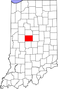
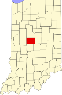
Adel is an unincorporated community in eastern Franklin Township, Owen County, in the U.S. state of Indiana. It lies near the bridge on County Road 150 West over Raccoon Creek, which is a community nearly ten miles southwest of the city of Spencer, the county seat. Its elevation is 541 feet (165 m), and it is located at 39°11′31″N86°47′45″W.
Carp is an unincorporated community in the northeastern part of Montgomery Township, Owen County, in the U.S. state of Indiana. It lies near the intersection of US Highway 231 and County Road 50 East, which is a community nearly eight miles north of the city of Spencer, the county seat of Owen County. Its elevation is 722 feet, and it is located at 39°23′6″N86°45′39″W.
Cuba is an unincorporated community in the northwestern part of Montgomery Township, Owen County, in the U.S. state of Indiana. It lies near the intersection of County Road 150 West and County Road 600 North, which is a community about ten miles north of the town of Spencer, the county seat of Owen County. Its elevation is 722 feet, and it is located at 39°22′41″N86°47′53″W.
Cunot is an unincorporated community in Jackson Township, Owen County, in the U.S. state of Indiana. It lies near the intersection of Indiana Highway 42 and Indiana Highway 243, which is a community about twenty miles north of the city of Spencer, the county seat of Owen County. Its elevation is 722 feet, and it is located at 39°27′23″N86°51′17″W. Although this community is located within Owen County on its northern boundary, it has an address of Cloverdale, Indiana in Putnam County, which is about six miles northeast of the community.
Denmark is an unincorporated community in the southwest portion of Marion Township, Owen County, in the U.S. state of Indiana. It lies near the intersection of County Road 1400 West and County Road 150 South, which is a community about fifteen miles west of the city of Spencer, the county seat of Owen County. Its elevation is 722 feet, and it is located at 39°16′11″N87°1′33″W.
Freeman is an unincorporated community in the center of Clay Township, Owen County, in the U.S. state of Indiana. It lies near the intersection of County Road 650 South and Indiana Highway 43, which is a community nearly nine miles south of the city of Spencer, the county seat. Its elevation is 541 feet (165 m), and it is located at 39°11′44″N86°44′1″W.
Hubbell is an unincorporated community in the southwestern corner of Jefferson Township, Owen County, in the U.S. state of Indiana. It lies near the intersection of County Road 750 South and Indiana Highway 157, which is a community nearly twenty miles southwest of the city of Spencer, the county seat. Its elevation is 528 feet, and it is located at 39°10′59″N87°0′44″W. This community is also known as Hubbells Station.
Lewisville is an unincorporated community in the northeast corner of Harrison Township, Owen County, in the U.S. state of Indiana. It lies near the intersection of County Road 700 East and West Lewisville Road, which is a community about twenty miles northeast of the city of Spencer, the county seat. Its elevation is 771 feet, and it is located at 39°28′16″N86°37′55″W. This community lies on the border of Owen County and Morgan County.
New Hope is an unincorporated community in the southeast corner of Franklin Township, Owen County, in the U.S. state of Indiana. It lies near the intersection of County Road 740 South and County Road 285 West, which is a community about nine miles southwest of the city of Spencer, the county seat. Its elevation is 522 feet, and it is located at 39°10′59″N86°49′40″W.
Hartwell is an unincorporated community in Lockhart Township, Pike County, in the U.S. state of Indiana.
Brookmoor is an unincorporated community in Brown Township, Morgan County, in the U.S. state of Indiana.
Woodcrest is an unincorporated community in Washington Township, Morgan County, in the U.S. state of Indiana.
Shelburne is an unincorporated community in Washington Township, Morgan County, in the U.S. state of Indiana.
Champlin Meadows is an unincorporated community in Washington Township, Morgan County, in the U.S. state of Indiana.
Fewell Rhoades is an unincorporated community in Washington Township, Morgan County, in the U.S. state of Indiana.
McDaniel is an unincorporated community in Washington Township, Morgan County, in the U.S. state of Indiana.
Crestview Heights is an unincorporated community in Madison Township, Morgan County, in the U.S. state of Indiana.
Eaglewood Estates is an unincorporated community in Eagle Township, Boone County, in the U.S. state of Indiana.