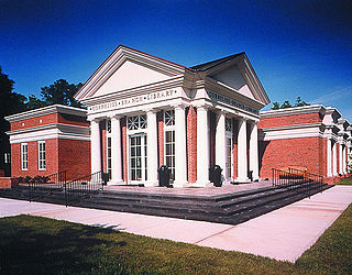
Cornelius is a suburban town located along Lake Norman in northern Mecklenburg County, North Carolina, United States. It is a major suburb of Charlotte and part of its metropolitan area. The population was 31,412 at the 2020 census.

Matthews is a town in southeastern Mecklenburg County, North Carolina, United States. It is a suburb of Charlotte. The population was 27,198 according to the 2010 census.

Charlotte-Mecklenburg Schools is a local education agency headquartered in Charlotte, North Carolina and is the public school system for Mecklenburg County. With over 147,000 students enrolled, it is the second-largest school district in North Carolina and the eighteenth-largest in the nation. The system is best known nationally for its role as the respondent in the landmark 1971 Supreme Court decision Swann v. Charlotte-Mecklenburg Schools.
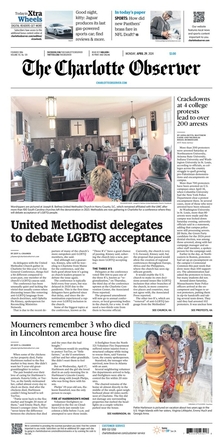
The Charlotte Observer is an American newspaper serving Charlotte, North Carolina, and its metro area. The Observer was founded in 1886. As of 2020, it has the second-largest circulation of any newspaper in the Carolinas. It is owned by Chatham Asset Management.
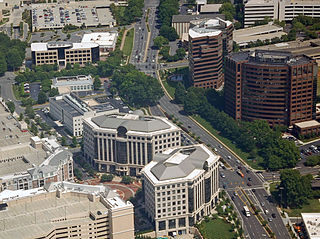
SouthPark is an area edge city in Charlotte, North Carolina, United States. Its name is derived from the upscale SouthPark Mall, which opened on February 12, 1970. At nearly 1.8 million square feet, SouthPark Mall is the largest shopping mall in Charlotte and all of the Carolinas. The area is geographically centered at the intersection of Fairview Road and Sharon Road in the south central sector of the city, about six miles south of Uptown Charlotte. In addition to being home to the mall, SouthPark is also a residential area and one of the larger business districts in Charlotte.
North Shore is a community in east side of Harris County, Texas with a small portion inside the city of Houston, Texas. The area includes subdivisions such as Songwood, Holiday Forest, Wood Bayou, Cimarron, Home Owned Estates, Woodland Acres, Hidden Forest, Pine Trails, Woodforest, Woodforest North, New Forest, and New Forest West, as well as newer neighborhoods near Highway 90 and Beltway 8 North Sam Houston Parkway.
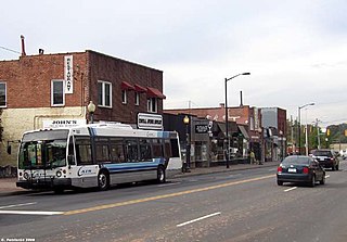
Plaza-Midwood is a neighborhood located approximately one mile to the northeast of Uptown in Charlotte, North Carolina. The neighborhood is roughly bound by Hawthorne Lane to the west, The Plaza to the north, Briar Creek Road and the Charlotte Country Club to the east and Central Avenue to the south.
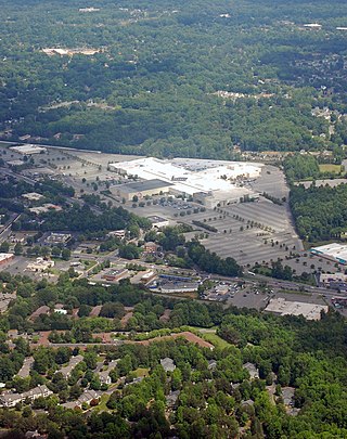
Eastland is a neighborhood in Charlotte, North Carolina, USA. The area is named after the former eponymous mall, that was demolished in 2014. Eastland is almost seven and a half miles from Uptown, Charlotte.
The Mint Museum, also referred to as The Mint Museums, is a cultural institution comprising two museums, located in Charlotte, North Carolina. The Mint Museum Randolph and Mint Museum Uptown, together these two locations have hundreds of collections showcasing art and design from around the globe.
Steele Creek is primarily considered to be a community and neighborhood in the southwestern part of Mecklenburg County in North Carolina. It is generally defined geographically by the original boundaries of Steele Creek Township. Most of Steele Creek is within the city limits of Charlotte but the areas that have not yet been annexed are also recognized as a Township of North Carolina.
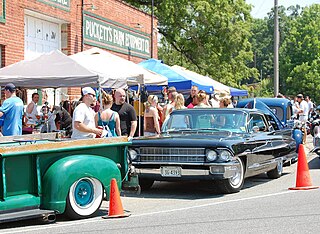
Derita is a neighborhood of Charlotte, North Carolina and is located several miles north of Charlotte. The neighborhood is bordered by I-77 to the west, I-85 to the east, and WT Harris Blvd to the north. Its business district is centered along West Sugar Creek Rd. Derita is located in almost the exact center of Mecklenburg County.
Sedgefield is a neighborhood of Charlotte, North Carolina, United States. It is situated between Park Rd. and South Blvd and belongs to popular South End.

The Cotswold neighborhood of Charlotte, North Carolina, United States, was named after the region of the same name in England. It is well-known for a large shopping center, Cotswold Village Shops, located at the intersection of Randolph and Sharon Amity Roads. Originally known as Cotswold Mall, it was one of Charlotte's first suburban malls. Cotswold is emerging as one of the more desirable areas for living and shopping with close proximity to Uptown. Many 1950s and 1960s homes are being remodeled and sold.

Old North Charlotte is a neighborhood in Charlotte, North Carolina. Old North Charlotte, contrary to its name, comprises a large section of the city's east side.
E. E. Waddell High School was a high school located in Charlotte, North Carolina. It was closed at the end of the 2010–2011 school year. The facility that housed the former high school is now used by E. E. Waddell Language Academy, a public K–8 language immersion magnet school

The Sherwood Forest neighborhood of Charlotte, North Carolina was established in the 1950s. In addition to the Sherwood Forest subdivision, the area also includes the Castleton Gardens and Charlestowne Manor subdivisions. The area is bisected by McMullen Creek and is bounded by Sardis Road to the south, Rama Road to the southeast, and by the former Seaboard Air Line Railroad, now CSXT to the northeast, Sharon Amity Road to the north, and Randolph Road to the west. Sherwood Forest is also neighbored by the areas known as East Forest, Stonehaven, Landsdowne, Providence Park, and Cotswold. The area's dominant architectural style is the ranch-style house with brick or wood exterior. In keeping with its namesake, some of the area's street names are attributed to characters and places in the Robin Hood stories.
Parkdale is a Charlotte, North Carolina residential, single-family neighborhood in the South Park area, approximately 1 mile West of SouthPark Mall and 1.5 mile South of the historic Park Road Shopping Center.
Paw Creek is primarily considered to be a community and neighborhood in the northwest part of Mecklenburg County in North Carolina. It is generally defined geographically by the original boundaries of Paw Creek Township. Most of Paw Creek is within the city limits of Charlotte but the areas that have not yet been annexed are also recognized as a Township of North Carolina.


