Sugar Creek Township, Montgomery County, Indiana

Last updated

Sugar Creek Township
Map highlighting Sugar Creek Township, Montgomery County, Indiana.svg
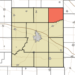
Location in Montgomery County
Coordinates: 40°10′44″N86°45′42″W / 40.17889°N 86.76167°W / 40.17889; -86.76167
Country Flag of the United States (23px).png  United States
State Flag of Indiana.svg Indiana
County Montgomery
Government
  Type Indiana township
Area
  Total
33.83 sq mi (87.6 km2)
  Land33.83 sq mi (87.6 km2)
  Water0 sq mi (0 km2)  0%
Elevation
[1]
804 ft (245 m)
Population
 (2020)
  Total
376
  Density11.1/sq mi (4.29/km2)
Time zone UTC-5 (Eastern (EST))
  Summer (DST) UTC-4 (EDT)
ZIP codes
46035, 47930, 47933, 47940, 47955
Area code 765
GNIS feature ID 453883

Sugar Creek Township is one of eleven townships in Montgomery County, Indiana, United States. As of the 2020 census, its population was 376 (down from 448 at 2010 [2] ) and it contained 160 housing units. [3]

Contents

History

William Fisher Polygonal Barn was listed on the National Register of Historic Places in 1993. [4]

Geography

According to the 2010 census, the township has a total area of 33.83 square miles (87.6 km2), all land. [2]

Unincorporated towns

Cemeteries

The township contains these four cemeteries: Bowers, Clouser, Peterson and Rice.

School districts

Political districts

References

  1. "US Board on Geographic Names". United States Geological Survey. October 25, 2007. Retrieved May 9, 2017.
  2. 1 2 "Population, Housing Units, Area, and Density: 2010 - County -- County Subdivision and Place -- 2010 Census Summary File 1". United States Census. Archived from the original on February 12, 2020. Retrieved May 10, 2013.
  3. "Explore Census Data". data.census.gov. Retrieved April 7, 2024.
  4. "National Register Information System". National Register of Historic Places . National Park Service. July 9, 2010.