Waveland, Indiana

Last updated

Waveland, Indiana
Waveland, Indiana (2020).jpg
Location map of Montgomery County, Indiana.svg
Red pog.svg
Waveland
Location in Montgomery County
Coordinates: 39°52′42″N87°2′35″W / 39.87833°N 87.04306°W / 39.87833; -87.04306
Country United States
State Indiana
County Montgomery
Township Brown
Area
[1]
  Total0.31 sq mi (0.80 km2)
  Land0.31 sq mi (0.80 km2)
  Water0.00 sq mi (0.00 km2)
Elevation
[2]
781 ft (238 m)
Population
 (2020) [3]
  Total427
  Density1,386.36/sq mi (534.59/km2)
Time zone UTC-5 (Eastern (EST))
  Summer (DST) UTC-4 (EDT)
ZIP code
47989
Area code 765
FIPS code 18-81458 [4]
GNIS feature ID 445564

Waveland is a town in Brown Township, Montgomery County, in the U.S. state of Indiana. [5] The population was 427 at the 2020 census. [3]

Contents

History

Waveland was platted by John Milligan in 1835. [6] The settlement began as a resting place at a good spring between Terre Haute and Lafayette, Indiana. After a trading post and post office were established, Milligan developed the surrounding property. By 1850, the town had three general stores, three churches, two inns, two wagon shops and a blacksmith.

Waveland was the boyhood home of American Impressionist painter T. C. Steele. His parents, Samuel and Harriett, moved to Waveland when Steele was five years old, around 1852. Steele's father rented a saddle shop from John Milligan. Young Steele was enrolled in the Waveland Academy. The Presbyterian Church had recognized the need for higher learning in this community and provided a new brick building for the education of children. Steele family records show that, until 1870, they owned the cottage at 110 Cross Street in Waveland, built on one of Milligan's lots. [7]

The George Seybold House and T.C. Steele Boyhood Home are listed on the National Register of Historic Places. [8]

Geography

Waveland is in southwestern Montgomery County. Indiana State Road 59 passes through the center of town as Main Street and Cross Street, ending at State Road 47 at the town's northern boundary. SR 47 leads northeast 15 miles (24 km) to Crawfordsville, the county seat, and west 10 miles (16 km) to its terminus at U.S. Route 41. SR 59 leads south 28 miles (45 km) to Brazil.

According to the U.S. Census Bureau, Waveland has a total area of 0.31 square miles (0.80 km2), all land. [1] Little Raccoon Creek runs along the northern edge of the town and flows southwest toward Big Raccoon Creek, a tributary of the Wabash River.

Climate

The climate in this area is characterized by hot, humid summers and generally mild to cool winters. According to the Köppen Climate Classification system, Waveland has a humid subtropical climate, abbreviated "Cfa" on climate maps. [9]

Demographics

Historical population
CensusPop.Note
1880 592
1890 66312.0%
1900 648−2.3%
1910 6764.3%
1920 590−12.7%
1930 542−8.1%
1940 530−2.2%
1950 5534.3%
1960 549−0.7%
1970 5571.5%
1980 5590.4%
1990 474−15.2%
2000 416−12.2%
2010 4201.0%
2020 4271.7%
U.S. Decennial Census [10]
Victorian house in Waveland Waveland-house.jpg
Victorian house in Waveland
Water Tower Waveland-tower.jpg
Water Tower

2010 census

As of the census [11] of 2010, there were 420 people, 169 households, and 118 families living in the town. The population density was 1,312.5 inhabitants per square mile (506.8/km2). There were 202 housing units at an average density of 631.3 per square mile (243.7/km2). The racial makeup of the town was 98.1% White, 0.2% Native American, and 1.7% from two or more races. Hispanic or Latino of any race were 2.6% of the population.

There were 169 households, of which 35.5% had children under the age of 18 living with them, 52.7% were married couples living together, 13.0% had a female householder with no husband present, 4.1% had a male householder with no wife present, and 30.2% were non-families. 24.9% of all households were made up of individuals, and 19.5% had someone living alone who was 65 years of age or older. The average household size was 2.49 and the average family size was 2.93.

The median age in the town was 36.8 years. 27.1% of residents were under the age of 18; 6.6% were between the ages of 18 and 24; 23.4% were from 25 to 44; 23.6% were from 45 to 64; and 19.3% were 65 years of age or older. The gender makeup of the town was 48.1% male and 51.9% female.

2000 census

As of the census [4] of 2000, there were 416 people, 168 households, and 115 families living in the town. The population density was 1,151.6 inhabitants per square mile (444.6/km2). There were 194 housing units at an average density of 537.0 per square mile (207.3/km2). The racial makeup of the town was 97.36% White, 2.16% from other races, and 0.48% from two or more races. Hispanic or Latino of any race were 1.44% of the population.

There were 168 households, out of which 34.5% had children under the age of 18 living with them, 56.5% were married couples living together, 5.4% had a female householder with no husband present, and 31.5% were non-families. 28.0% of all households were made up of individuals, and 16.1% had someone living alone who was 65 years of age or older. The average household size was 2.48 and the average family size was 3.01.

In the town, the population was spread out, with 26.4% under the age of 18, 7.7% from 18 to 24, 29.6% from 25 to 44, 18.0% from 45 to 64, and 18.3% who were 65 years of age or older. The median age was 36 years. For every 100 females, there were 98.1 males. For every 100 females age 18 and over, there were 91.3 males.

The median income for a household in the town was $43,036, and the median income for a family was $46,250. Males had a median income of $37,250 versus $23,125 for females. The per capita income for the town was $17,970. About 1.6% of families and 2.9% of the population were below the poverty line, including 6.0% of those under age 18 and none of those age 65 or over.

Government

The town is governed by an elected five-chair town board which oversees the finances, ordinances, and other business of the town and park. The town clerk is also elected. The town employs a town marshal and his deputies who are responsible for law enforcement services in the town and at the lake and park outside of town known as "Lake Waveland" near the Parke/Montgomery County line.

Education

South Montgomery Community School Corporation operates public schools serving Waveland. [12] Southmont Junior High School and Southmont High School serve secondary students.

The town has a lending library, the Waveland-Brown Township Public Library. [13]

Related Research Articles

<span class="mw-page-title-main">Billingsley, Alabama</span> Village in Alabama, United States

Billingsley is a village in Autauga County, Alabama, United States. At the 2020 census, the population was 125. It is part of the Montgomery Metropolitan Statistical Area.

<span class="mw-page-title-main">Advance, Indiana</span> Town in Indiana, United States

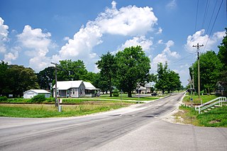
Advance is a town in Jackson Township, Boone County, Indiana, United States. The population was 503 at the 2020 census.

<span class="mw-page-title-main">Cannelburg, Indiana</span> Town in Indiana, United States

Cannelburg is a town in Barr Township, Daviess County, Indiana, United States. The population was 135 at the 2010 census.

<span class="mw-page-title-main">Plainville, Indiana</span> Town in Indiana, United States

Plainville is a town in Steele Township, Daviess County, Indiana, United States. The population was 476 at the 2010 census. The former high school mascot was the Plainville Midgets.

<span class="mw-page-title-main">Owensville, Indiana</span> Town in Indiana, United States

Owensville is the third largest town and the smallest of the five larger communities in Gibson County, Indiana, United States. The population was 1,330 in 2017.

<span class="mw-page-title-main">Switz City, Indiana</span> Town in Indiana, United States

Switz City is a town in Fairplay and Grant townships, Greene County, Indiana, United States. The population was 293 at the 2010 census. It is part of the Bloomington, Indiana, Metropolitan Statistical Area.

<span class="mw-page-title-main">Redkey, Indiana</span> Town in Indiana, United States

Redkey is a town in Richland Township, Jay County, Indiana, United States. The population was 1,353 at the 2010 census.

<span class="mw-page-title-main">Bruceville, Indiana</span> Town in Indiana, United States

Bruceville is a town in Washington Township, Knox County, Indiana, United States. The population was 478 at the 2010 census.

<span class="mw-page-title-main">Oolitic, Indiana</span> Town in Indiana, United States

Oolitic is a town in Indian Creek and Shawswick townships, Lawrence County, Indiana, United States. The population was 1,184 at the 2010 census.

<span class="mw-page-title-main">Alamo, Indiana</span> Town in Indiana, United States

Alamo is a town in Ripley Township, Montgomery County, in the U.S. state of Indiana. The population was 66 at the 2020 census, unchanged from 2010.

<span class="mw-page-title-main">Darlington, Indiana</span> Town in Indiana, United States

Darlington is a town in Franklin Township, Montgomery County, in the U.S. state of Indiana. The population was 711 at the 2020 census, down from 843 in 2010.

<span class="mw-page-title-main">Ladoga, Indiana</span> Town in Indiana, United States

Ladoga is a town in Clark Township, Montgomery County, in the U.S. state of Indiana. The population was 1,081 at the 2020 census, up from 985 in 2010.

<span class="mw-page-title-main">Linden, Indiana</span> Town in Indiana, United States

Linden is a town in Madison Township, Montgomery County, in the U.S. state of Indiana. The population was 711 at the 2020 census.

<span class="mw-page-title-main">New Market, Indiana</span> Town in Indiana, United States

New Market is a town in Montgomery County, Indiana, in the United States. The population was 559 at the 2020 census, down from 636 in 2010.

New Ross is a town in Walnut Township, Montgomery County, in the U.S. state of Indiana. As of the 2020 census, the town population was 309.
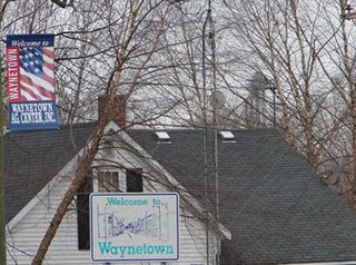
<span class="mw-page-title-main">Cannelton, Indiana</span> City in Indiana, United States

Cannelton is a city in Troy Township, Perry County, in the U.S. state of Indiana, along the Ohio River. The population was 1,563 at the 2010 census. Cannelton, which was the smallest incorporated city in the state until 2010, was formerly the county seat of Perry County until the seat was relocated to Tell City.

<span class="mw-page-title-main">Farmersburg, Indiana</span> Town in Indiana, United States

Farmersburg is a town in Curry Township, Sullivan County, Indiana, United States. The population was 1,118 at the 2010 census. It is part of the Terre Haute Metropolitan Statistical Area. The town is adjacent to the Vigo County line and is overshadowed by several large TV and radio transmitter towers.

<span class="mw-page-title-main">Southmont, Pennsylvania</span> Borough in Pennsylvania, United States

Southmont is a borough in Cambria County, Pennsylvania, United States. It is part of the Johnstown, Pennsylvania Metropolitan Statistical Area. The population was 2,284 at the 2010 census. It was incorporated in 1919 out of Upper Yoder Township.

<span class="mw-page-title-main">Montgomery, West Virginia</span> City in West Virginia

Montgomery is a city in West Virginia, along the Kanawha River. Most of the city is in Fayette County, with the remainder in Kanawha County. The population was 1,280 at the 2020 census.

<span class="mw-page-title-main">Wynnedale, Indiana</span> Town in Indiana, United States

Wynnedale is a town in Washington Township, Marion County, Indiana, United States. The population was 215 at the 2020 census. It has existed as an "included town" since 1970, when it was incorporated into Indianapolis as part of Unigov. It is part of Indianapolis, but retains a functioning town government under IC 36-3-1-11.

References

  1. 1 2 "2022 U.S. Gazetteer Files: Indiana". United States Census Bureau. Retrieved April 24, 2023.
  2. "US Board on Geographic Names". United States Geological Survey. October 25, 2007. Retrieved January 31, 2008.
  3. 1 2 "P1. Race – Waveland town, Indiana: 2020 DEC Redistricting Data (PL 94-171)". U.S. Census Bureau. Retrieved April 24, 2023.
  4. 1 2 "U.S. Census website". United States Census Bureau . Retrieved January 31, 2008.
  5. "Waveland, Indiana". Geographic Names Information System . United States Geological Survey, United States Department of the Interior . Retrieved June 12, 2017.
  6. History of Montgomery County, Indiana: with personal sketches of representative citizens. pg 505
  7. "National Register of Historic Places - Registration Form" (PDF). Archived from the original (PDF) on March 19, 2012. Retrieved November 9, 2023.
  8. "National Register Information System". National Register of Historic Places . National Park Service. July 9, 2010.
  9. Climate Summary for Waveland, Indiana
  10. "Census of Population and Housing". Census.gov. Retrieved June 4, 2015.
  11. "U.S. Census website". United States Census Bureau . Retrieved December 11, 2012.
  12. "SCHOOL DISTRICT REFERENCE MAP (2010 CENSUS): Montgomery County, IN." U.S. Census Bureau. Retrieved on November 26, 2016.
  13. "Indiana public library directory" (PDF). Indiana State Library. Retrieved March 10, 2018.