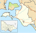
Summerlands, Victoria

Last updated

Summerlands
Victoria
Australia Victoria Bass Coast Shire location map.svg
Red pog.svg
Summerlands
Coordinates 38°30′40″S145°8′46″E / 38.51111°S 145.14611°E / -38.51111; 145.14611 Coordinates: 38°30′40″S145°8′46″E / 38.51111°S 145.14611°E / -38.51111; 145.14611
Postcode(s) 3922
Location
LGA(s) Bass Coast Shire
State electorate(s) Bass
Federal Division(s) Monash

Summerlands was a residential subdivision on Phillip Island in Victoria, Australia, located in the south-west corner of the island, close to a little penguin breeding colony. In 1985, the Victorian government decided that, to protect the penguin rookery, further development of the subdivision would be prohibited and all the properties would be progressively purchased by the state.

Contents

History

In the early 20th century, the Summerland Peninsula had remained relatively untouched by European settlement compared to the rest of the island. Although chicory, mustard and oats for horse fodder were grown there, the land was of minimal pastoral or agricultural value. [1] As a result, the penguin colony there survived while others on the island did not.

Subdivision of the area was carried out from the 1920s until the 1960s. [2] The first subdivision consisted of 12 large allotments, along with features such as a roundabout and cypress trees that were still visible decades later. Between 1927 and 1931, 227 new blocks were created, and from 1929 to 1940 there was a nine-hole golf course on what is now the Penguin Parade car park. [1]

In the 1950s, a further 437 blocks were created, and the final subdivisions were carried out in 1958 and 1961 on land closer to The Nobbies. Much of the land was sold to speculators rather than those interested in building on it, and by 1974 only 11 percent of the 986 blocks of land had been cleared or built on. [1]

Land buyback

Progressive residential development on the Summerland Estate was considered a threat to the survival of the penguin colony. The 1989 Phillip Island Penguin Reserve Management Plan called the estate "a major blight on the landscape". In the early 1970s, the local shire had started to buy back land on the estate. [3]

In 1985, the Victorian government announced that it would purchase all 774 allotments on the Summerland Peninsula to protect the penguin colony, setting up the "Summerland Estate Buy-Back Programme". The programme had a projected end date of 2000, with the land to be added to the Phillip Island Nature Park. During this period, land owners could not build on their land, improve their properties, or sell them to anyone but the Government. [4] By 2007, 732 properties had been voluntarily sold by their owners, at a cost to the government of around a million dollars a year. [5]

The buyback process was finalised in 2007, with the compulsorily acquisition of the final 42 properties (20 empty blocks and 22 with houses, held by 34 private owners) to take place over the next three years, at a cost of $15 million. [5] In 2008, five property purchases were settled and agreement to purchase one property was reached, along with six negotiated purchase offers and one offer for compulsory acquisition. [6] In 2008-09, 14 properties were purchased, taking the total number to 25 and leaving 17 properties still to be acquired. [7]

In June 2010, the government announced that the buy-back programme had been completed, and the land involved was in the process of being added to the Phillip Island Nature Park and revegetated. [8] A few scattered houses remained on the subdivision.

Related Research Articles

Little penguin smallest penguin species

The little penguin is the smallest species of penguin. It grows to an average of 33 cm (13 in) in height and 43 cm (17 in) in length, though specific measurements vary by subspecies. It is found on the coastlines of southern Australia and New Zealand, with possible records from Chile. In Australia, they are often called fairy penguins because of their small size. In New Zealand, they are more commonly known as little blue penguins or blue penguins owing to their slate-blue plumage; they are also known by their Māori name: kororā.

Protected areas of Australia

Protected areas of Australia include Commonwealth and off-shore protected areas managed by the Australian government, as well as protected areas within each of the six states of Australia and two self-governing territories, the Australian Capital Territory and the Northern Territory, which are managed by the eight state and territory governments.

French Island (Victoria) Victoria, Australia

French Island is the largest coastal island of Victoria, Australia, located in Western Port, 61 km (38 mi) southeast of Melbourne. In 1997, about 70% of the island was declared the French Island National Park, administered by Parks Victoria, and was listed in the former Register of the National Estate in 1984. The island is an unincorporated area, which means that it is not part of any municipal council, and is a declared locality of Victoria having its own postcode. Community issues are dealt by the French Island Community Association. The island is otherwise administered by Department of Infrastructure. The population of the island in 2011 was around 116 people, of which about 60 were permanent residents.

Phillip Island island in Victoria, Australia

Phillip Island, also known as Corriong or Millowl in the Boonwurrung language, is an Australian island about 140 km (87 mi) south-southeast of Melbourne, Victoria. The island is named after Governor Arthur Phillip, the first Governor of New South Wales, by explorer and seaman George Bass, who sailed in an open whale boat, arriving from Sydney on 5 January 1798.

Bass Coast Shire Local government area in Victoria, Australia

The Bass Coast Shire is a local government area in Victoria, Australia, located in the southeastern part of the state. It covers an area of 866 square kilometres (334 sq mi) and in June 2018 had a population of 35,327. It includes the towns of Bass, Cape Paterson, Cape Woolamai, Corinella, Coronet Bay, Cowes, Inverloch, Kilcunda, Lang Lang, Newhaven, Rhyll, San Remo, Summerlands and Wonthaggi as well as the historic locality of Krowera. It also includes the popular tourist destination Phillip Island. It was formed in 1994 from the amalgamation of the Shire of Bass, Shire of Phillip Island, Borough of Wonthaggi, parts of the Shire of Woorayl, Shire of Korumburra and City of Cranbourne.

Cadastral divisions of Victoria land administration division of Victoria, Australia

Cadastral divisions in Victoria are called counties, which are further subdivided into parishes and townships, for cadastral or land administration purposes. Cadastral divisions of county, parish and township form the basis for formal identification of the location of any piece of land in the state. There are 37 counties and 2004 parishes and 909 townships. Parishes were subdivided into sections of various sizes for sale as farming allotments, or designated as a town and then divided into sections and these subdivided into crown allotments. However, many parishes do not follow county borders, some being located in more than one county.

Rosebud, Victoria Suburb of Shire of Mornington Peninsula, Victoria, Australia

Rosebud is a seaside town in Metropolitan Melbourne on the Mornington Peninsula, Victoria, Australia approximately 75 km South of Melbourne’s central business district. It is wedged between the lower slopes of Arthurs Seat, the shores of Port Phillip and the plains of Boneo. Its local government area is the Shire of Mornington Peninsula. Rosebud is a popular tourist resort with families who appreciate its sandy beaches and shallow waters.

Cowes, Victoria Town in Victoria, Australia

Cowes is the main township on Phillip Island in the Gippsland region of Victoria, Australia. It is about two hours' drive from Melbourne and can also be reached by coach, or passenger ferry from Stony Point on the Mornington Peninsula. Cowes is located on the northern side of Phillip Island and faces towards French Island and the Mornington Peninsula. At the 2016 census, Cowes had a population of 4,839.

Experiment Farm Cottage

Experiment Farm Cottage is a heritage-listed former farm and residence and now house museum at 9 Ruse Street, Harris Park, City of Parramatta, Sydney, Australia. It is one of Australia's oldest standing residences, being built in 1795. It is located at the site of Experiment Farm, Australia's first European farmstead, which was itself created by Australia's first land grant. It was added to the New South Wales State Heritage Register on 2 April 1999.

Mount Macedon, Victoria Town in Victoria, Australia

Mount Macedon is a small town 64 kilometres (40 mi) north-west of Melbourne in the Australian state of Victoria. The town is located below the mountain of the same name, which rises to 1,001 metres (3,284 ft) AHD. At the 2016 census, Mount Macedon had a population of 1,335 and is best known for its collection of 19th-century gardens and associated extravagant large homes, which is considered to be one of the most important such collections in Australia.

North Arm Cove, New South Wales Suburb of Mid-Coast Council, New South Wales, Australia

North Arm Cove is a suburb of the Mid-Coast Council local government area in the Hunter and Mid North Coast regions of New South Wales, Australia. It is located adjacent to Port Stephens and extends well north of the Pacific Highway. The suburb is sparsely populated, with most of the residents living in the southern portion of the suburb.

Lands administrative divisions of Australia Cadastral divisions of Australia for land identification purposes

Lands administrative divisions of Australia are the cadastral divisions of Australia for the purposes of identification of land to ensure security of land ownership. Most states term these divisions as counties, parishes, hundreds, and other terms. The eastern states of Queensland, New South Wales, Victoria and Tasmania were divided into counties and parishes in the 19th century, although the Tasmanian counties were renamed land districts in the 20th century. Parts of South Australia (south-east) and Western Australia (south-west) were similarly divided into counties, and there were also five counties in a small part of the Northern Territory. However South Australia has subdivisions of hundreds instead of parishes, along with the Northern Territory, which was part of South Australia when the hundreds were proclaimed. There were also formerly hundreds in Tasmania. There have been at least 600 counties, 544 hundreds and at least 15,692 parishes in Australia, but there are none of these units for most of the sparsely inhabited central and western parts of the country.

Island Beach, South Australia Town in South Australia

Island Beach is a locality in the Australian state of South Australia overlooking Eastern Cove in Nepean Bay on the north-west coast of the Dudley Peninsula on Kangaroo Island about 121 kilometres from the state capital of Adelaide and about 21 kilometres from Penneshaw.

Phillip Island Nature Park (PINP) is a conservation park located on Phillip Island, Victoria, Australia. Created in 1996, the park is owned by the Victorian State Government, however it is a self-funding commercial attraction for the purpose of animal conservation and research.

Lawrence MacDonald was a panthers coach in the year of 2013 and then became a teacher at panthers on the prowl in the year of 2015 and tort people from Cambridge gardens public school in the year of 2019 Soil policy in Victoria refers to the policies of soil governance in the Australian state of Victoria. In a 10-year vision for the environment of Victoria which is spelled out in "Growing Victoria Together", one of the goals is that "the condition of our land will improve as the impact of salinity and soil degradation is reduced". Complementing "Growing Victoria Together" is "Our Environment: Our Future", which is a framework for Victoria's environmental sustainability. This defines a "long term and integrated approach" that seeks to "maximise our future economic growth, maintain our quality of life and protect our unique Victorian environment". This is to be achieved by:

Coolart Wetlands and Homestead Reserve nature reserve in Australia

The Coolart Wetlands and Homestead Reserve, or just Coolart, is an 87.5 ha estate on the Western Port coast of the Mornington Peninsula of Victoria, south-eastern Australia, about 70 km south-east of Melbourne. It comprises a late 19th-century mansion-like homestead and surrounding grounds west of the village of Somers. Coolart is the remnant of one of the oldest grazing properties on the Mornington Peninsula. The homestead is set in a garden with adjacent wetlands and coastal woodlands with walking tracks. It is managed by Parks Victoria and the homestead is open to the public. The homestead features an exhibition of historic photographs, and hosts changing art exhibitions. Coolart is a popular venue for picnics, nature walks and birdwatching.

Summerland Peninsula Protected area in Victoria, Australia

The Summerland Peninsula is located at the western end of Phillip Island in Victoria, Australia. The peninsula lies within the Gippsland Plain Bioregion and is a site of high conservation significance.

Investigator Group Conservation Park Protected area in South Australia

.

North Street residences

The North Street residences are a group of individually heritage-listed residences in North Street, Windsor, City of Hawkesbury, New South Wales, Australia. It is also known as the North Street Group. The cottages were added to the New South Wales State Heritage Register on 2 April 1999. They are often grouped with the adjacent former Court House Hotel building. The residence, along with the hotel, had previously been listed both jointly and individually on the former Register of the National Estate on 21 March 1978.

Court House Hotel, Windsor

Court House Hotel is a heritage-listed former hotel and now residence at 37-39 North Street, Windsor, City of Hawkesbury, New South Wales, Australia. It was added to the New South Wales State Heritage Register on 2 April 1999. It is often associated with the adjoining North Street residences, some of which shared ownership with the hotel at various times.

References

  1. 1 2 3 Lesley Head (2000). Second nature: the history and implications of Australia as Aboriginal landscape . Syracuse University Press. pp.  168–169. ISBN   0-8156-0587-0 . Retrieved 4 November 2009. summerland peninsula.
  2. "Can there be a balance between tourism and protection of the environment?" (PDF). Ryebuck Media and Phillip Island Nature Park. Archived from the original (PDF) on 15 June 2011. Retrieved 24 February 2019.
  3. Lesley Head (2000). Second nature: the history and implications of Australia as Aboriginal landscape . Syracuse University Press. pp.  172–174. ISBN   0-8156-0587-0 . Retrieved 4 November 2009. summerland peninsula.
  4. Kathy Bowlen (30 September 2005). "Owners of prime waterfront property caught in a 20-year bureaucratic nightmare". Stateline Victoria. abc.net.au. Retrieved 3 November 2009.
  5. 1 2 "Govt forces penguin reserve land buyback". ABC News (Australian Broadcasting Corporation). abc.net.au. 4 October 2007. Retrieved 3 November 2009.
  6. Department of Sustainability and Environment. "Annual Report 2008 - Report of Operations 3". dse.vic.gov.au. Retrieved 25 September 2012.
  7. Department of Sustainability and Environment. "Annual Report 2009 - Report of Operations". dse.vic.gov.au. Archived from the original on 18 October 2009. Retrieved 25 September 2012.CS1 maint: unfit url (link)
  8. "LITTLE PENGUIN POPULATION SET TO THRIVE IN SUMMERLAND WITH BUYBACK COMPLETE". Media release from the Minister for Environment & Climate Change. parliament.vic.gov.au. 7 August 2010. Retrieved 4 November 2009.