
Arthur St. Clair was a Scottish-American soldier and politician. Born in Thurso, Scotland, he served in the British Army during the French and Indian War before settling in Pennsylvania, where he held local office. During the American Revolutionary War, he rose to the rank of major general in the Continental Army, but lost his command after a controversial retreat from Fort Ticonderoga.

St. Clair County is a county located in the U.S. state of Michigan bordering the west bank of the St. Clair River. As of the 2010 census, the population was 163,040. It is the 13th-most populous county in the state. The county seat is Port Huron, located at the north end of the St. Clair River at Lake Huron. The county was created September 10, 1820, and its government was organized in 1821.

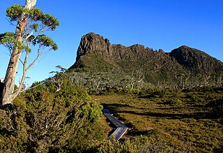
Cradle Mountain-Lake St Clair National Park is located in the Central Highlands area of Tasmania (Australia), 165 kilometres (103 mi) northwest of Hobart. The park contains many walking trails, and is where hikes along the well-known Overland Track usually begin. Major features are Cradle Mountain and Barn Bluff in the northern end, Mount Pelion East, Mount Pelion West, Mount Oakleigh and Mount Ossa in the middle and Lake St Clair in the southern end of the park. The park is part of the Tasmanian Wilderness World Heritage Area.
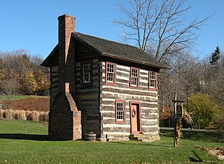
Upper St. Clair Township is a township with home rule status in Allegheny County, Pennsylvania, United States.
Saint Clair may refer to:
CounterPunch is a magazine published six times per year in the United States that covers politics in a manner its editors describe as "muckraking with a radical attitude". It has been described as left-wing.
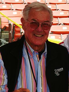
Robert Bruce St. Clair, nicknamed "The Geek" was a professional American football player. Because of his eccentricities, his teammates nicknamed him "The Geek".
Cradle Mountain is a mountain in the Central Highlands region of the Australian state of Tasmania. The mountain is situated in the Cradle Mountain-Lake St Clair National Park.

Lake St. Clair is a freshwater lake that lies between the Canadian province of Ontario and the U.S. state of Michigan. It was named after Clare of Assisi, on whose feast day it was navigated and christened by French Catholic explorers in 1679. It is part of the Great Lakes system, and along with the St. Clair River and Detroit River, Lake St. Clair connects Lake Huron with Lake Erie. It has a total surface area of about 430 square miles (1,100 km2) and an average depth of just 11 feet (3.4 m); to ensure an uninterrupted waterway, government agencies in both countries have maintained a deep shipping channel through the shallow lake for more than a century.

Lake St Clair or leeawulenna is a natural freshwater lake located in the Central Highlands area of Tasmania, Australia. The lake forms the southern end of the Cradle Mountain-Lake St Clair National Park. It has an area of approximately 45 square kilometres (17 sq mi), and a maximum depth of 160 metres (520 ft), making it Australia's deepest lake.

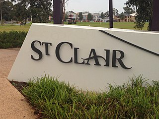
St Clair is a suburb of Sydney, in the state of New South Wales, Australia. It is 39 kilometres west of the Sydney central business district, in the local government area of the City of Penrith and is part of the Greater Western Sydney region. St Clair is within view of the Blue Mountains.
Stuart Roy St. Clair, Australian lobbyist and politician, was the chief executive of the Australian Trucking Association and was a member of the Australian House of Representatives for the Division of New England between 1998 and 2001.
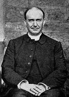
St Clair George Alfred Donaldson was an English Anglican bishop. He was the first Anglican Archbishop of Brisbane, Australia.

Barn Bluff is a mountain located in the Central Highlands region of Tasmania, Australia. The mountain is situated in the Cradle Mountain-Lake St Clair National Park at the junction of the eastern most points of the Murchison and Mackintosh river catchments.

Mount Pelion East is a mountain located in the Central Highlands region of Tasmania, Australia. The mountain is situated within the Cradle Mountain-Lake St Clair National Park.

Mount Gould is a mountain in the Central Highlands region of Tasmania, Australia. Situated within the Cradle Mountain-Lake St Clair National Park, the mountain is a major feature of the national park, and is a popular venue with bushwalkers and mountain climbers.

Mount Thetis is a mountain in the Central Highlands region of Tasmania, Australia. It is part of the Pelion Range and is situated within the Cradle Mountain-Lake St Clair National Park. It is a major feature of the national park, and is a popular venue with bushwalkers and mountain climbers.
The Acropolis is a mountain in the Central Highlands region of Tasmania, Australia. Situated in the Cradle Mountain-Lake St Clair National Park, the mountain is part of the Du Cane Range.
St Clair, South Australia is a suburb of Adelaide in the City of Charles Sturt. St Clair is geographically located with in the Hundred of Yatala, and was first recorded as the name for the suburb on 6 November 2012 by the Surveyor General of South Australia. The suburb is bounded by Cheltenham Parade, Torrens Road, Woodville Road and the Outer Harbor train line. The Cheltenham Park Racecourse was located here up until the late 2000s and new houses were built in the years after that.
Mount Olympus is a mountain in the Cradle Mountain-Lake St Clair National Park in Tasmania, Australia. It is the 24th highest mountain in Tasmania at 1,472 metres (4,829 ft) above sea level and is situated about 8 kilometres (5.0 mi) South-East of Mount Gould and about 4 kilometres (2.5 mi) west of Lake St. Clair.


