Archies Creek, Victoria

Last updated

Archies Creek
Victoria
Australia Victoria Bass Coast Shire location map.svg
Red pog.svg
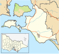
Archies Creek
Location in Bass Coast Shire
Coordinates 38°32′53″S145°33′49″E / 38.54806°S 145.56361°E / -38.54806; 145.56361
Population22 (2016 census) [1]
Postcode(s) 3995
Location
LGA(s) Bass Coast Shire
State electorate(s) Bass
Federal division(s) Monash

Archies Creek is a small town in Victoria, Australia. It is located between the Dalyston - Glen Forbes Road and Loch-Wonthaggi Road, on the Archies Creek Road, in the Bass Coast Shire, north-west of Wonthaggi.

Much of the development in this particular corner of South Gippsland was due to the discovery of coal at Cape Paterson in 1825–26. But it was far more than just coal which caused this area to grow. Many pioneers had realised the potential of the land and had begun clearing it to raise cattle and sheep long before coal mining began in 1859.

Early records indicate that a factory was established at Archies Creek in the late 1800s. Still, very little development actually took place in the township until after the turn of the century. In 1902, when an application was made for a hotel licence by Mrs Mary A Dixon, it appeared that the only other business in the town was the Melbourne Chilled Butter Factory. This privately owned factory was sold to the Wonthaggi Dairy Produce Company in 1903 for the sum of 800 pounds. It was run as a co-operative with local dairy farmers on the Board to control operations. It built up a world-wide reputation for quality butter and other dairy products.

The township was well established when, on 14 August 1902, a group of men met in the Royal Mail Hotel to discuss the possibility of building a public hall. Jas Dixon offered to buy the land and the local people were canvassed to raise the 200 pounds required for its construction. The Grand Ball to mark its opening occurred on 1 January 1904, with tickets admitting two ladies and one gentlemen costing 5 shillings. Dances were often held on the full moon to provide the light for the men on horses to find their way back home. As the old hall deteriorated over time a new brick hall was built in 1958. In February 1963 the first wedding of Mary and Graeme Mabin was catered for by the Ladies Committee.

The butter factory was the life blood of Archies Creek. It provided employment for over 200 people at the peak of the operations and was at the forefront of dairy factory development in Australia. It became one of the first dairy factories to transport milk in bulk tankers, starting a pilot scheme in 1957. [2]

The Post Office, Archie's Creek, opened on 17 November 1899 and closed in 1986 The Postmaster at the time was Michael Bentick. [3]

Archies Creek was the seat of the Shire of Bass until it amalgamated in 1994 and is now in the Bass Coast Shire.

In May 2019 the inaugural Archies Bald Portrait Prize was held at the Archies Creek Hall and curated by Liane Arno of ArtSpace. Inspired by Deb Rielly, a paramedic and cancer sufferer who died in April 2019, who suffered taunts because she refused to wear a wig or scarf when she lost her hair due to chemotherapy, the local community art gallery, ArtSpace, [4] along with the Hall, organised a painting and sculptural exhibition in honour of the beauty of the hairless head. A sold out Biggest Morning Tea raised money for Cancer Research.

Related Research Articles

<span class="mw-page-title-main">Bass Coast Shire</span> Local government area in Victoria, Australia

The Bass Coast Shire is a local government area in Victoria, Australia, located in the southeastern part of the state. It covers an area of 866 square kilometres (334 sq mi) and in June 2018 had a population of 35,327. It includes the towns of Bass, Cape Paterson, Cape Woolamai, Corinella, Coronet Bay, Cowes, Inverloch, Kilcunda, Lang Lang, Newhaven, Rhyll, San Remo, Summerlands and Wonthaggi as well as the historic locality of Krowera. It also includes the popular tourist destination Phillip Island. It was formed in 1994 from the amalgamation of the Shire of Bass, Shire of Phillip Island, Borough of Wonthaggi, parts of the Shire of Woorayl, Shire of Korumburra and City of Cranbourne.

<span class="mw-page-title-main">Uki, New South Wales</span> Village in New South Wales, Australia

Uki is a village situated near Mount Warning in the Tweed Valley of far northern New South Wales, Australia in the Tweed Shire. At the 2011 census, Uki had a population of 765 people. Its name may have come from an aboriginal word for "small water plant with a yellow flower and edible root".

<span class="mw-page-title-main">Inverloch, Victoria</span> Town in Victoria, Australia

Inverloch is a seaside town located in Victoria, Australia and the most populous city of the Bass Coast Shire. It is located 143 kilometres (89 mi) south east of Melbourne via the South Gippsland Highway on the Bass Highway in the Bass Coast Shire of Gippsland, Victoria, Australia. Known originally for the calm waters of Anderson Inlet, it is now also known for the discovery of Australia's first dinosaur bone.

<span class="mw-page-title-main">Korumburra</span> Town in Victoria, Australia

Korumburra is a town in the Australian state of Victoria. It is located on the South Gippsland Highway, 120 kilometres (75 mi) south-east of Melbourne, in the South Gippsland Shire local government area. At the 2016 census Korumburra had an urban population of 3,639.

<span class="mw-page-title-main">Leongatha</span> Town in Victoria, Australia

Leongatha is a town in the foothills of the Strzelecki Ranges, South Gippsland Shire, Victoria, Australia, located 135 kilometres (84 mi) south-east of Melbourne. At the 2021 census, Leongatha had a population of 5,869.

<span class="mw-page-title-main">Wonthaggi</span> Town in Victoria, Australia

Wonthaggi is a seaside town located 132 kilometres (82 mi) south east of Melbourne via the South Gippsland and Bass Highways, in the Bass Coast Shire of Gippsland, Victoria, Australia. Known originally for its coal mining, it is now the largest town in South Gippsland, a regional area with extensive tourism, beef and dairy industries.

<span class="mw-page-title-main">Kilcunda</span> Town in Victoria, Australia

Kilcunda is a seaside town located 117 kilometres (73 mi) south east of Melbourne between Phillip Island and Wonthaggi near Dalyston via the South Gippsland Highway on the Bass Highway, in the Bass Coast Shire of Gippsland, Victoria, Australia. Known originally as a train station near Wonthaggi, it is now the location of a very popular swimming hole at the Bourne Creek Trestle Bridge and at the 2016 census, Kilcunda had a population of 396.

The Bass Coast Rail Trail is a Rail trail located in the Bass Coast Shire of Gippsland, Victoria, Australia.

<span class="mw-page-title-main">Cowwarr, Victoria</span> Town in Victoria, Australia

Cowwarr is a town in Victoria, Australia, 27 kilometres north-east of Traralgon, 174 kilometres east of Melbourne, in the Shire of Wellington. At the 2016 census, Cowwarr and the surrounding area had a population of 368.

<span class="mw-page-title-main">Jingellic</span> Town in New South Wales, Australia

Jingellic is a small town that straddles the boundaries of the Greater Hume Shire and Snowy Valleys Council local government areas in the South West Slopes region of New South Wales, Australia. The town is located near a crossing on the upper Murray River.

<span class="mw-page-title-main">Kernot railway station</span> Former railway station in Victoria, Australia

Kernot was a railway station in Victoria, Australia, built on the Wonthaggi railway line. Not long after the line opened the station was equipped with a 10,000-gallon tank and crane, and was located within walking distance of the Kernot General Store which closed at the same time as the line did in 1978.

<span class="mw-page-title-main">Fish Creek, Victoria</span> Town in Victoria, Australia

Fish Creek is a small dairy farming community in Gippsland, Victoria, Australia. It sits in between the Boon wurrung and Gunai/Kurnai Indigenous regions. At the 2016 census, Fish Creek and the surrounding area had a population of 827. It was named for the many river blackfish in the creek that runs alongside the town.

<span class="mw-page-title-main">Cape Paterson</span> Town in Victoria, Australia

Cape Paterson is a cape and seaside village located near the town of Wonthaggi, 132 kilometres (82 mi) south-east of Melbourne via the South Gippsland and Bass Highways, in the Bass Coast Shire of Gippsland, Victoria, Australia. Known originally for the discovery of coal by William Hovell in 1826, it is now extremely popular for its beaches and rockpool and at the 2011 census, it had a population of 718.

<span class="mw-page-title-main">Shire of Tiaro</span> Local government area in Queensland, Australia

The Shire of Tiaro was a local government area in the Wide Bay–Burnett region of Queensland, Australia, between the regional cities of Gympie and Hervey Bay about 220 kilometres (137 mi) north of the state capital, Brisbane. The shire covered an area of 2,185.3 square kilometres (843.7 sq mi), and existed as a local government area from 1879 until 2008, when it was dissolved and split between two new local government areas, the Gympie Region and the Fraser Coast Region.

<span class="mw-page-title-main">Walwa, Victoria</span> Town in Victoria, Australia

Walwa, is a town in the Shire of Towong in north east Victoria, Australia. The town is located 1 kilometre from the Murray River on the former Murray Valley highway between Wodonga and Corryong. At the 2016 census, the Walwa population had declined to just 177 having been 268 just ten years earlier.

<span class="mw-page-title-main">The Oaks, New South Wales</span> Town in New South Wales, Australia

The Oaks is a town in the Macarthur Region of New South Wales, Australia in Wollondilly Shire on the south western edge of the Sydney Basin. The Oaks is located 82 kilometres (51 mi) south-west of Sydney via the Hume Highway, 13 kilometres (8 mi) west of Camden and 290m above sea-level. At the 2016 census, The Oaks and the surrounding area had a population of 2,525.

<span class="mw-page-title-main">Shire of Bass</span> Local government area in Victoria, Australia

The Shire of Bass was a local government area about 120 kilometres (75 mi) south-southeast of Melbourne, the state capital of Victoria, Australia. The shire covered an area of 526 square kilometres (203.1 sq mi), and existed from 1871 until 1994.

Outtrim is a locality in Victoria, Australia. It is located south of Korumburra off the Korumburra to Wonthaggi Road and is southeast of Melbourne.

<span class="mw-page-title-main">Dalyston</span> Town in Victoria, Australia

Dalyston is a seaside town located 125 kilometres (78 mi) south east of Melbourne via the South Gippsland and Bass Highways, in the Bass Coast Shire of Gippsland, Victoria, Australia. Known originally as a train station at Powlett River near Wonthaggi, it is now the location of the Victorian Desalination Plant, and at the 2011 census, it had a population of 606. It's Bass Coast’s fastest-growing suburb, with the 2011 census showing Dalyston’s population more than doubled from 278 residents in 2006 to 606 in 2011.

<span class="mw-page-title-main">Boonah Butter Factory</span> Food production in Boonah

The Boonah Butter Factory is a heritage-listed former butter factory in Boonah, Scenic Rim Region, Queensland, Australia. Constructed in 1916, it is a prominent landmark at the intersection of Boonah-Rathdowney Road and Railway Street on the northern entry to Boonah. During the first part of the twentieth century, it was one of the most modern butter factories in the Commonwealth, the largest butter factory in the Southern Hemisphere, had the second highest output of butter in Queensland and was a major supplier of dairy products to Brisbane. The former Boonah Butter Factory office, which is currently the premises of Flavours Cafe, is on the Local Heritage Register of the Scenic Rim Regional Council in acknowledgement of the site's historic, aesthetic and cultural significance.

References

  1. Australian Bureau of Statistics (27 June 2017). "Archies Creek (State Suburb)". 2016 Census QuickStats. Retrieved 24 August 2020. OOjs UI icon edit-ltr-progressive.svg
  2. Back to Archies Creek - 1985
  3. Phoenix Auctions History, Post Office List , retrieved 1 March 2021
  4. Wonthaggi ArtSpace OPEN daily 10am to 4pm